I’ve decided to get into the newsletter game! It will serve as another outlet to explore and report on my curiosities in Toronto history and fill the space in between posts. I’ll have what’s interested me, what I’m up to, and sharing some favourite research resources. The articles on this site won’t stop, of course. In fact, I have a few coming down the pipeline in 2026!
Windfields Park is an 83-acre park in the former city of North York in Toronto. Its history includes being part-golf course and part-equestrian estate, and it is an important chapter in suburban Toronto.
A short distance from the southeast corner of Bayview Avenue and York Mills Road, the park begins by following the course of Wilket Creek. The narrow and shallow watercourse was historically known as Milne Creek, named after the Milne family, who built a mill on the creek further south and east near Lawrence Avenue. The creek seems to have later taken on the current and lasting name Wilket Creek, which itself comes after the Wilcotts of Willowdale where the waterway’s headwaters stood.
To the centre of the park, the topography opens up into rolling hills to the east and the Canadian Film Centre (CFC) grounds to the west. This is where the land’s history and geography get interesting.
Historically, the park is made of parts of Lots 8 to 10, Second Concession East of Yonge — the majority being the Bell property on Lot 9. By 1930, parts of Lots 8 and 9 were part of the Glen Mawr Golf Club with an address on Bayview Avenue.
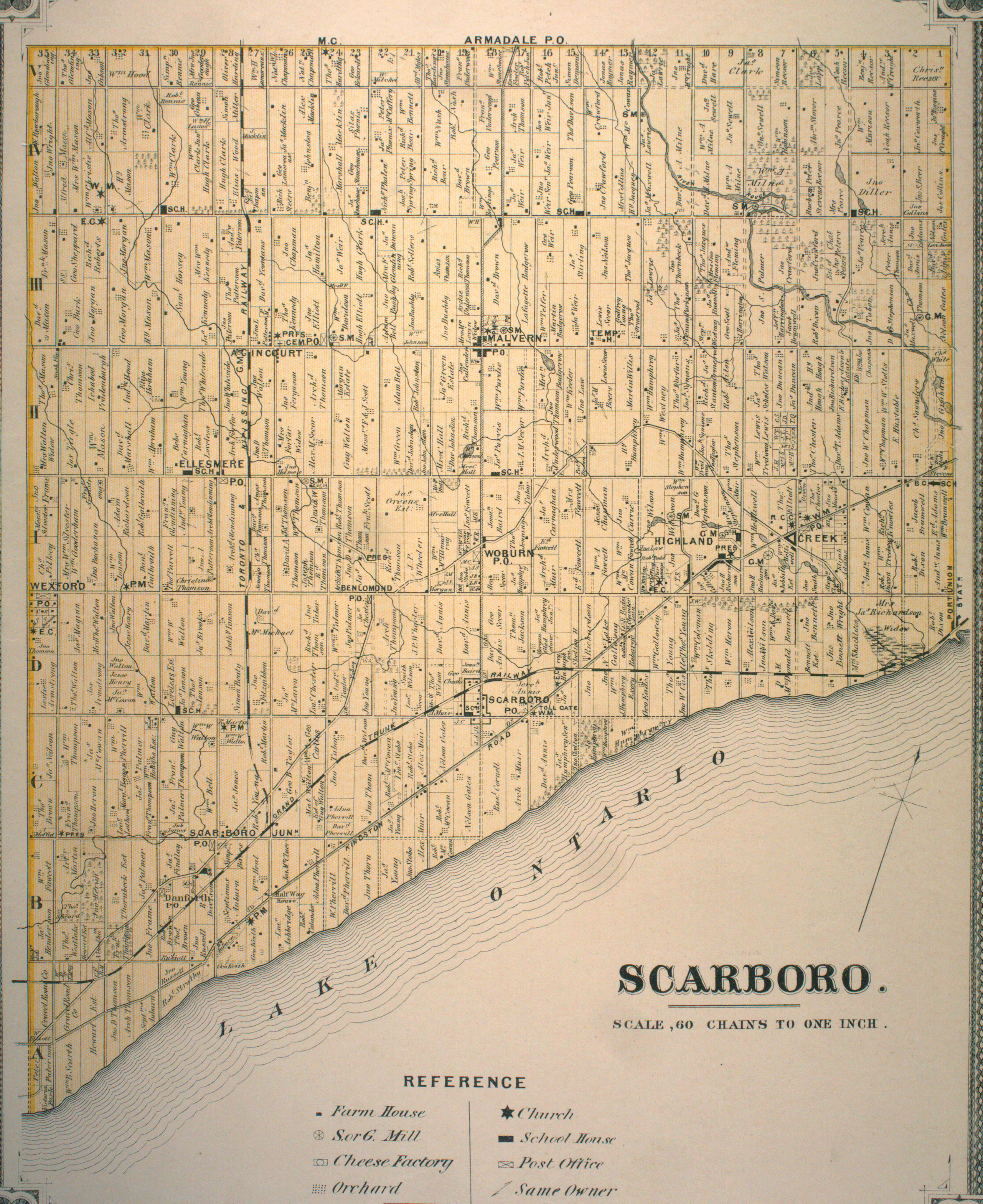
Map of the Townships, York, Scarboro, and Etobicoke, 1916 Credit: University of Toronto Map & Data Library
The Globe, May 6, 1932
Street Map of Toronto, 1946 Credit: University of Toronto Map & Data Library
In the 1940s, the International Business Machines (IBM) Ltd bought the course for exclusive use of its employees. Its address was on Leslie Street and extended to Wilket Creek. The company had their headquarters nearby at Don Mills Road and Eglinton Avenue.
Metropolitan Toronto, 1957 Credit: University of Toronto Map & Data Library
In 1932, industrialist and financier Edward Plunket (E.P.) Taylor bought twenty acres of land on Bayview Avenue, also on lots 8 and 9. An estate house was commissioned and built in the colonial revival style. A gatehouse, stables, workers’ cottages, and gardens were added in the Fourties.
In addition to his business pursuits, in the Fifties, Taylor became big-time stock-breeder – a connoisseur for racing horses and cows. He amassed hundreds of acres of real estate as part of his Windfields Farm — a name conceived of by his wife Winnifred while feeling the breezy air while walking through the open land — and turned it into “a top centre for thoroughbred houses and cattle.” In 1959, The Globe profiled Windfields as “the type of farm that doesn’t really exist.” The farm consisted of parcels of land on Bayview Avenue and on both sides of York Mills Road west of Leslie Street. In 1964, the Taylors’ Northern Dancer won the Kentucky Derby, the first Canadian-bred horse to achieve the accolade.
The Globe & Mail, October 23, 1959
In the Sixties, several transformative events impacted the two landholdings. With surrounding farmlands beginning to be redeveloped in the decade prior, IBM sold its 103-acre club to Morenish Land Developments. The last year for golf was 1967. By the mid-1970s, new streets and houses replaced the greens. The rolling topography of the western part of the property near the creek seems to have remained as parkland.
The Globe & Mail, June 6, 1968
In 1968, Taylor agreed to sell 330 acres of its 390-acre Windfields Farm to Morenish Land Developments as well. The new subdivisions near York Mills and Leslie went up by the end of the Seventies. The neighbourhood now bears the Windfields name.
Windfield Farm & IBM Golf Course, 1965 & 1978 City of Toronto Archives,
Taylor set aside 50-acres to North York of his equestrian estate for parkland. It was named appropriately named Windfields Park. The family immediately retained 20 acres, including the house, to live on. These lands were to be deeded to North York upon the family’s wishes or deaths. In 1987, Charles Taylor officially transferred the remaining property to the city. The Canadian Centre for Advanced Film Studies, now the Canadian Film Centre, was founded in the building by Norman Jewison in the following year.
Today, Windfields Park and CFC grounds mark a picturesque landscape in North York, one with interesting historical layers.
The only picture taken at “Wandering Wishing Well Acres”. Discussing Wishing Well Plaza and its future.
The grand story of Wishing Well, like many communities of Toronto, is contained in its historical evolution. Not surprisingly, the layer of suburbia is probably most central to this area. And that’s where my own fascination began.
The millionth house built after World War II in Canada is located in Wishing Well Acres — a little white corner bungalow originally purchased for $16,200. Of course, this bungalow could have been built anywhere — that is to say, there was nothing really special about Wishing Well that ‘bred’ the millionth house (other than perhaps the timing of the subdivision’s construction in 1956).
The genesis of Wandering Wishing Well Acres came from the discovery of Canada’s Millionth Post-War on an Interactive Heritage Property Registry Map. Source: City of Toronto.
But the fact that the millionth house was here gives a bit of insight about the area in the 1950s — why people were moving to Toronto’s new suburbs. The owners of the watershed home were Mr. and Mrs Camisso and their two daughters (nuclear family, much?). The story goes that they were not even looking for a home but Mrs. Camisso was attracted to the green roof. Other selling points: its proximity to the Toronto ByPass (now the 401) and its automatic heating (no more shovelling coal into furnace!).
“1,000,000th House Built in Canada Since War is Sold to Young Family of Four”, Globe & Mail, Sept 15, 1956. Source: Globe & Mail Archives.
1956 is a funny year. In the grand timeline of history, it really isn’t that long ago. But at the same time, it is hard to find a reference point to that period. Newspapers help; first-hand accounts are better. My goal for the walk was to retell the ‘History’ of the area (via research), and elicit other ‘histories’ (i.e. personal anecdotes) from fellow walkers. Together, those make up a complete picture. I think that was achieved.
Wandering Wishing Well Acres had the wonderful benefit of two original residents and their takes on the neighbourhood some fifty and sixty years ago – one that still lives in the subdivision and one that returned for the first time in decades for the Jane’s Walk! Some of those insights: neighbours really did all know each other, children rode their bikes together, and people would gather in Wishing Well Park’s flooded ice pond. It was a great place to grow up. I get a similar vibe whenever I walk through it today.
Back to the layers: It’s no secret Scarborough was mostly rural fields prior to WWII. The farms are gone, but their geographic legacies remain. Subdivisions were developed 100 acres at a time — the size of patented farm lots that were gradually swooped up in the 1800s. Sheppard Avenue, the main street of sorts, provided access to the three farms that compose Wishing Well Acres as Concession Road III. It was later made a highway between Pickering and Yonge Street (because apparently Kingston Road was too congested in 1931?).
There’s the enduring power of names in local storytelling, too: Wishing Well was the name of Christopher Thompson’s farm; Vradenburg/Vradenberg, of which the street and school is named, was another pioneering family (albeit, with a more European spelling: Vradenburgh).
Wishing Well area via 1860 Tremaine’s Map of the County of York, Canada West. Source: Old Toronto Maps.
Of course, there’s a story before the Vradenburghs, Thompsons, and Masons. Was there Aboriginal presence here? Unfortunately, there’s no proof, but I’d still say possibly. Other sites in Scarborough — the Alexandra Site, Tabor Hill & Birkdale Ravine — point to indigenous settlement as late as around 800 years ago. Those areas all had a waterway in common — and Wishing Well once sported a free-flowing creek through it.
So then, what’s the future of Wishing Well Acres? I’d say it’s similar to its past: redevelopment. Sheppard Avenue is changing to accommodate more density: walkable, mixed use and mid-rise buildings. It’s like a retrofit to the blantantly, car-designed suburb. Of most interest to Wishing Well is the proposed development at Pharmacy and Sheppard. If it gets the green light, it would replace Wishing Well Plaza, which was at one time the commercial nexus of the early community and today home to a few eateries and shops that are largely and perhaps erroneously overlooked.
And what would a talk of the future be without public transit? Regardless of what transit on Sheppard Avenue ends up looking (or if it ends up looking like anything!), demand for (improved) public transit isn’t new! In 1956, the Town and Country Ratepayers and Community Association were calling for more than just a rush hour bus on Victoria Park. They wanted service on Sheppard! Plus ca change, eh? (That bus didn’t come until the mid-1960s, by the way.)
“A Bungalow in Scarboro”, Globe & Mail, Aug 6, 1956. Source: Globe & Mail Archives.
There are other aspects to the story too: the burying of Taylor-Massey Creek, the gem of Wishing Well Woods (another rural remnant), the lost O’Sullivan’s Corners village at Victoria Park and Sheppard (of which the Johnny’s Hamburgers building is a leftover), and the Northwest Drive-in once located in Consumers Business Park (which is also getting a makeover.) It’s fitting that “Wandering Wishing Well Acres” ran overtime — there was too much to say!
Northwest Drive-In & Consumers Business Park, 1975. Source: City of Toronto Archives.
Being located in Scarborough, the Wandering Wishing Well Acres Jane’s Walk was likely not destined for popularity. It’s admittedly not a “sexy” topic nor located in a “sexy” area. But I tried not to let that deter me.
Wishing Well Acres has a story. It’s a good one. And it should be told and celebrated.
If one wants to learn about the roots of Scarborough, Thomson Memorial Park in Bendale is a pretty good place to start. After all, it is located on the historic property of the Thomson family – the first European settlers in Scarboro Township. Thomson Park also houses Scarborough Museum, which serves to tell the history of the Thomsons and the borough. More than that though, Bendale embodies and showcases the great layers of Scarborough: from its pre-contact period to rural pioneers to post-WWII multicultural suburbia.
Scarborough Museum, which offers pay-what-you-can admission, is a collection of structures: Cornell House, McCowan Log House, Hough Carriage Works, and the Kennedy Gallery. Together, they form a sort of scaled back version of Black Creek Pioneer Village.
After arriving in the township in the late 1700s, Scottish immigrants David and Mary (née Glendinning) Thomson followed an old aboriginal trail to a thickly wooded bush on the banks of the Highland Creek. Their task was tall: clear the property and make it inhabitable. In 1802, they patented 200 acres on lot 24 concession 1 (today’s the east side of Brimley at Lawrence). David’s brother, Andrew Thomson, patented 200 acres on the adjacent lot 23 to the east.
Although none of the museum buildings themselves were part of the Thomson property, they originate from different areas of Scarborough and belonged to noteworthy families in the township. The artefacts within the museum also mostly originate within Scarborough, including a few items belonging to the Thomsons.
Cornell House fronts Scarborough Museum, and was the museum’s first structure in 1962. Originally located at Markham and Ellesmere, it was built for Matilda and Charles Cornell in the 185os. The Cornell family sold the property in the 20th century to the Lye family. It was saved from demolition in 1961 and transported to Thomson Park. (One can imagine a building on wheels, meandering through Scarborough.)
A highlight of Cornell House is the wood and coal burning oven. A large part of Scarborough Museum’s programming is food preparation, and the oven plays a central role in that. (I enjoyed a delicious chocolate cookie during my visit.) For the Cornells, it also ingeniously heated the bedrooms above with wood during the day and coal at night.
The parlour room has an amazing collection of musical instruments. Unknown to me was Scarborough has very musical roots, apparently. It also speaks to the detail and amount of artefacts within the museum. There is something in every room that catches the eye and has a story.
If Cornell House represents a second generation house (that is, the kind of house the children of pioneers would aspire to build), McCowan Log House might be a first-gen home. It dates from the 1830s to a William Porteous McCowan of Malvern – the same McCowan for which the street is named. Much like Cornell House, it was rescued by the Scarborough Historical Society in the 1970s and added to the museum.
McCowan Log House is built primarily of wood and consists of a main cooking/living room (with a very hearty fireplace used for more historic cooking programs) and two bedrooms. McCowan lived in the home with his mother and sister, thus the two rooms. In terms of cabins, the house is actually spacious with additions McCowan undertook on the structure.
The crib in the foreground belonged to the Thomsons.
The Thomsons built their own log house out of pine and oak, too. When he wasn’t working his land, David was a mason in Scarboro and the Town of York. Mary’s tasks were concentrated in the house, but when David was absent, Scarborough historian Robert Bonis writes she was left “to face the dangers of the forest alone with her children”. He recounts how wolves would jump on the roof of their cabin and gnaw at the door. My favourite anecdote of his, though, is Mary boldly wielding an axe to scare off a bear trying to make off with a pig! A plaque honouring Rhoda Skinner and other pioneering women stands behind the main building. Skinner was the wife of William Cornell, father of Charles Cornell.
Hough Carriage Works is a recreation of the original Hough Carriage Works which stood at Birchmount and Eglinton. This establishment was responsible for building and repairing wagons and more. Interestingly, it also functioned as a gathering point because it served an entire community, so it allowed residents to conduct business with each other.
A penny-farthing, also known as a boneshaker for the toll it takes on a rider’s body.
Finally, the Kennedy Gallery is adaptive reuse at work. Formerly a 1920s garage from the Lyman Kennedy farm in Agincourt, it is now rotating exhibition space. On until March 2016 is a neat exhibit about Frances Tweedie Milne and her writings in the context of rights and the Magna Carta.
Facebook in the 19th century: “Killed 10 pigs today. Men cut them up, Margaret and I salted them. Tired now.”
Exiting Scarborough Museum, Thomson Park is very expansive. The Thomsons used the area as a gathering point before they gifted it to become a public park in 1962, so it enjoys that continuity. It hosts an exercise circuit and a number of seating pavilions, which come in great use at the annual Scarborough Ribfest. The west branch of Highland Creek also winds through the park.
Somewhat hidden within the history of Thomson Park is the former Canadian Northern Ontario Railway. I first encountered this now defunct railway at Taylor Creek Hydro Corridor. From East York, it passed northeast through Scarborough and the western edge of this park. By 1926 however, it was abandoned and the tracks were removed.
The Canadian Northern Ontario Railway roughly followed this path. An embankment is also still visible where it crossed Highland Creek.
Thomson Memorial Park area, 1956. The Canadian Northern Ontario Railway right of way is still visible. Source: City of Toronto Archives.
St. Andrews Road sits atop a ridge as it slinks from Brimley down to McCowan, echoing the route of Highland Creek to its south. It’s definitely a throwback road. For the Thomsons, the road network in the 19th and early 20th centuries mostly consisted of the main roads that essentially formed property boundaries – except for St. Andrews which curiously shows up in early maps.
In 1818, David Thomson donated part of his land to a congregation started by his brother Andrew and others. The result was a 30 by 40 foot frame church that would become St. Andrew’s Presbyterian – the first church in Scarborough. The street serving the church was appropriately named “Church Lane”, now St. Andrews Road. What stands today is the second St. Andrew’s Church, built in 1849.
Historic St. Andrews Road also houses a number of other early landmarks such the 1896 Scarborough Centennial Library, and St. Andrews Cemetery, which is the resting spot for a who’s who of Scarborough pioneers. The oldest brick building in Scarborough, Springfield, the 1840 home of James A. Thomson is also found here.
Following the Gatineau Hydro Corridor back down through the park, I cut through Scarborough General Hospital to Lawrence Avenue. The hospital dates from 1952 with its distinctive circular tower coming in 1968. It’s the major landmark at McCowan and Lawrence today, but historically the honour might have gone to Bendale’s post office.
1878 Map of Scarboro Township. The 1878 community of Benlomond was renamed Bendale in 1881 to avoid confusion with a nearby town that already had the moniker. Source: Old Toronto Maps.
I don’t realize it at the time passing by it, but the subdivision north of Lawrence between McCowan and Bellamy features streets that all begin with “Ben”. Quirky? You bet.
The Ben Jungle subdivision dates from 1956.
Finally, Tabor/Taber Hill Park on Bellamy was the site of a 13th century Huron-Wendat ossuary. It was discovered in 1956 after the hill was set to be leveled to accommodate a new subdivision. Construction immediately stopped, excavations began, and at the end of it, the hill was preserved with a monument to the ancient burial mound. An excavated village on the north banks of Birkdale Ravine also connects to Tabor Hill. As I ascend the hill, there’s a family and their dog who had the same idea. They ask me to snap a portrait of them. I oblige.
The view from Tabor Hill is provocative. All around is suburbia. The faint outline of CN Tower is even visible from this perspective. But none of it was here 700 years ago. The next people to see Scarborough as the Wendats saw it were the Thomsons. But the Scarborough David and Mary left was different than the Wendats’ Scarborough and different still than 2016’s Scarborough. And yet, all three realities seem to converge in this one spot.
The White Shield Plaza hugs the northwest corner of Kennedy Road and Lawrence Avenue. Without any disrespect to the mall (which hosts Flipper’s and other tenants) though, my eye goes to two restaurants just off the strip mall.
On first look, Harry’s Drive-In looks of another era. And that’s because it is. Immediately I think of Johnny’s Hamburgers at Victoria Park and Sheppard. It’s a small shack of a burger joint that slightly compensates for its lack of space inside with a tiny patio outside. Even the name is to the point. No gimmicks. My observation is pretty bang on, too: it’s been here since the 1960s.
Beside Harry’s, there’s Nova Ristorante – a sitdown Pizza Nova restaurant. The first Pizza Nova. Sam Prumicci and his brothers opened the shop here in Scarborough in 1963. One thinks of the pizza chain as a takeout/delivery place, but restaurants have been part of its past and present.
The Hellenic Home for the Aged sits on the southeast corner of the intersection. Before the home however, there was a hydro station here.
Kennedy & Lawrence Hydro Station, 1960. Source: City of Toronto Archives.
Mike Myers Drive, which was (re)named for the Scarborough comedian in 2002, slinks behind the seniors home. I believe a few power stations still remain.
Kennedy Road looking north to Lawrence Avenue, 1960. Source: City of Toronto Archives.
Kennedy Lawrence Hydro Station aerial, 1965. Note the spur off the Canadian National Railway. Source: City of Toronto Archives.
The houses on this stretch of Kennedy Road south of Lawrence date from the 1950s.
Down in the hydro field, there is (or was, rather) some planting a’happenin’. This is Givendale Allotment Garden, and its concept is new to me. My sense is it’s an unknown idea in general – “secret gardens”, as I’ve read. It’s certainly a neat use for a hydro fiend – much more advisable than model airplane or kite-flying.
If my understanding is right, one can apply for a permit to use a garden plot in one of 13 designated allotment gardens in the city. Applications are accepted the first day of February and permits are issued the first day of May.
Finally, Jack Goodlad Park is a nicely sized park with basketball courts, a recreation centre, playground, and a couple of baseball fields. Jack Goodlad, its namesake, was a Scarborough alderman.
The Pan Am Path also passes through Jack Goodlad Park in its meandering route through Toronto. It’s one of the legacies of the 2015 Pan Am & Parapan Am Games.
Before it was a park and trail though, Jack Goodlad Park was the Scarboro Drive-In. The theatre opened in 1952 and closed around the late 1970s when drive-in movies in Toronto declined in popularity. It’s fascinating to learn about because it tells us a bit about what Toronto suburbia used to look and be like.
Scarborough Council purchased the Scarboro Drive-In property and redeveloped it into a municipal park beginning in 1980. Goodlad himself had a big hand in the end of the movie theatre, objecting to the seedier movies that were playing in the supposedly family-friendly venue.
Scarboro Drive-In, 1960. Source: City of Toronto Archives.
Scarboro Drive-In aerial, 1965. Source: City of Toronto Archives.
Kennedy Road between Finch and Linwood Avenues is, at first glance, an inconsequential stretch of street. 1km of nothing. A bit of digging, however, and there’s a story. There’s always a story.
Beginning at the top, there’s the Hugh Clark House. A rural leftover nestled in behind a gas station. The Clark family once lined the north side of Finch with their farms. The first of the Clarks to plant his roots was Hugh‘s father, William, who settled two lots over at Birchmount Road in 1838. I wrote a little bit about the elder Clark while exploring his property at today’s L’Amoreaux Park.
Crossing the street, one comes to an innocent looking parkette. Today’s park, however, is yesterday’s street jog. Kennedy at one time jogged left at Finch, forcing a northbound traveler to turn left and then right before continuing north. At some point Kennedy was reconfigured to run seamlessly through the intersection. An orphaned section of the old route remained south of Finch, however. The old Kennedy bus used to turn around at the loop when the bus route terminated at Finch. The triangular jog was eliminated for good in 1979, leaving us Kennedy Road Parkette.
Next, Lynnwood Heights on Southlawn Drive has been around since 1956. The school’s TDSB webpage notes an original population of 400, a staggering far cry from the current enrollment of 160 pupils. The surrounding subdivision also dates from around 1956, making it one of the older post-war developments in northern Scarborough. One can imagine as the area continued to grow, more schools opened to relieve Lynnwood.
Huntingwood Drive is an east-west alternative to Sheppard and Finch (at least, between Victoria Park and McCowan), but its existence is a relatively recent thing – around 1967, more specifically. It’s odd in the way it snakes close to Sheppard in some parts and close in Finch in others.
Kennedy Road & Area, 1965. Source: City of Toronto Archives. The future Huntingwood Drive is pencilled in bottom left. Finch jog at top.
Bookending the kilometre stretch is another farmhouse, Elmridge. This was the Pat(t)erson family homestead. Or, at least, one of them. Like the Clarks, the Patersons were a pioneering Scarboro family who toiled the land on the east side of the street between Sheppard and Finch. Robert Bonis writes in A History of Scarboroughthat a Thomas Paterson arrived here in 1820 from Scotland, clearing the land with his son. His descendants continued his work at Elmridge, eventually making the Paterson name synonymous with Agincourt. This excellently researched WikiTree entry breaks down the life of Thomas Archibald Paterson, the great-grandson of the original Thomas Paterson.
Consider this a sequel. Or, maybe a prequel. Whatever the case, if Wishing Well Acres is the Sullivan in Tam O’Shanter-Sullivan, here’s the Tam O’Shanter part.
We begin at Agincourt Mall. The shopping centre dates back to 1966, likely making it the third enclosed mall in Scarborough after 1954’s Eglinton Square and Golden Mile (Cedarbrae Mall predates Agincourt by four years but didn’t get its ceiling until 1972). The mall’s anchors are Wal-Mart and No Frills, but I can recall a time – in 1994, specifically – when they were Woolco and Loblaws, respectively. Walmart bought Woolco that year. No Frills came in the 2000s.
As much as malls like Agincourt are seen as shabby and sad (Agincourt Mall as of 2016 has a number of empty tenants), I’ve found that they are still appreciated locales. A lot of nostalgia fills their walls. The comments in this BlogTO article about Agincourt Mall by Robyn Urback prove that. Everyone has a story, or a store they enjoyed frequently, or an odd memory about something that isn’t there anymore. Mine is the RadioShack that was there in 1990s and 00s, reminding me of lost Canadian retailers. There is a Source in the mall now, but not in the same space as its predecessor.
Agincourt Mall was built on the Kennedy farm, with the farmhouse once located just north of the mall and south of the West Highland Creek. A walk down the street named for the family leads to a trail that lines the creek.
The path is sandwiched between an apartment and townhouse complex on one side and the creek and Tam O’Shanter Golf Club on the other. A look down at the shallow waterway produces a shiny sheet of ice over the surface and the occasional group of ducks in the non-frozen bits. But there’s also something that doesn’t quite belong.
Several pillars jut out on either side of the creek – two on one side and two opposite them. I count three sets of these abutments along the way. Their meaning isn’t hard to figure out: 3 sets of abutments, 3 phantom bridges. There is one question, though: what’s the story?
The answer: In the 1930s to the 1970s, this was the site of the Tam O’Shanter Golf and Country Club, the precursor to Tam O’Shanter Golf Course.
In addition to golf, the Tam O’Shanter Country Club complex had swimming, ice hockey, and curling. In 1971, the club erupted in flames, destroying some of the complex. In researching the fire, I’ve read many stories about people seeing the flames from afar. Like Agincourt Mall, the country club meant something to many people.
In 1973, the Province of Ontario, Metro Toronto, and Scarborough jointly acquired Tam O’Shanter and converted it into a municipal golf course. In the coming years, the complex would be gradually demolished and a new clubhouse would be built around 1980. Today, a couple of apartment towers on Bonis Avenue stand in the club’s former location.
Tam O’Shanter & West Highland Creek, 1967, Source: City of Toronto Archives.
Back to the abandoned abutments, the creek was located just behind the clubhouse and its bridges led to and from the golf course. Shortly after the course’s acquisition, the bridges were removed, presumably because the course layout would be reorganized.
But the creek hasn’t always run the same course.
Tam O’Shanter & West Highland Creek, 1956, Source: City of Toronto Archives.
The West Highland at one time swung north up into the golf course before dropping back down and resuming in a northwest direction. Around 1967, the creek was straightened and bridges were installed. The orphan bend remained as a sort of oxbox for some time, but since has been mostly filled in. One can still see the imprint of the bend today, though, notably through the pond and the ‘etched’ curved outline north of it.
Tam O’Shanter & West Highland Creek, 2015. Source: Toronto Historic Maps.
There is one remaining bridge, however – a wider, sturdier construction. There is a gate in the fence on the other side, so one can guess that at least it might have been a vehicular corridor. As of 2015, though, both ends have been barricaded to prevent any sort of use.
As the West Highland continues into the golf course and beyond, the trail comes to Ron Watson Park, renamed from Tam O’Shanter Park in 2005 in recognition of the long-time Scarborough resident, trustee, and councillor. Watson was honoured with a star on Scarborough’s Walk of Fame in 2011. The park forms the field of Tam O’Shanter School, featuring a nice playground…and a stone turret.
This viney tower became an instant curiosity to me. It looked old and misplaced. No doors (although, perhaps a sealed opening), a couple of ‘windows’ near the top. What was/is it?
I had to do some digging. Google presented nothing, so I consulted some aerial photos to try and date it. It’s been around since at least 1947, the first year on record for aerials in the Toronto Archives.
Charles Watson Farm, 1965. Source: City of Toronto Archives.
Ron Watson Park, 2015. Source: Toronto Historic Maps.
So, Horsey sold his farm to Watson, who likely built the silo. When Watson’s farm was subdivided, the tower was never torn down with it. My guess is the task proved too difficult. It doesn’t fully answer the ‘when?’ part, but mystery solved!
Leaving the park and silo, the two-in-one Stephen Leacock Collegiate/John Buchan Senior Public School has had a place on Birchmount Road since 1970. It is built in the Brutalist (or, Heroic) style that was indicative of Toronto architecture in the 1950s to 1970s. The schools’ namesakes were a Canadian author and humourist and Scottish author and historian, respectively.
And while I’m profiling, Tam O’Shanter is a Robbie Burns poem. Another Scottish connection. The Anglo-Saxon roots and references of the Tam O’Shanter community is interesting though, considering what it became. Today, it is one of the more diverse areas in the city of Toronto.
Next, a derelict structure stands across the school. I don’t know its full context, but it’s most definitely another rural leftover.
On Bonis Avenue, there’s Agincourt Library and another great turret. Although the building opened in 1991, the library itself dates back to 1918. Within that time it has moved locales a few times, including a stay in Agincourt Mall. The branh carries three copies of A History of Scaborough. Its editor is a Mr. Robert Bonis, who lends his name to the street.
Down at Birchmount and Sheppard, a strip mall has gone through a makeover in the last few years. It’s about to get a new tenant, too: Starbucks. The sight is initial shock for me, if only because it’s strange to see one in this neighbourhood. My mind shoots to the old idea that a Starbucks is tell tale sign of gentrification, but I question whether it applies here. We’ll have to see.
Foregoing a stroll down Sheppard, I backtrack to Bay Mills Boulevard. The curved street offers a sort of ‘backstage’ view of Tam O’Shanter, showing off the apartments, church, school, field, playground that all front Sheppard. The intersection of Bay Mills and Sheppard is the start of the Sheppard Avenue East Avenue Study zone. On one side there’s another strip mall; on the other, a car dealership. They’ll surely be part of the plans.
Warden Avenue is further down the way, but that adventure lies in the mentioned Wish Well exploration. For now, that’s a wrap on this one.
If you have memories of Agincourt Mall, Tam O’Shanter Country Club, Stephen Leacock School, or Tam-O’Shanter-Sullivan in general, I would like to hear about it. Leave a comment below or tweet me!
The area between Highway 401 and Sheppard Avenue East, Warden and Victoria Park Avenues has got a bit going on. A strip-mall and apartment lined main street, a winding neighbourhood of bungalows to its south — it’s unmistakably suburbia. The rise of its subdivisions following World War II, the effects on the natural and built environment, and its pending evolution make it an area of interest.
First, from its beginnings as the narrow, dirt covered Concession Road III to its wide, strip mall-lined incarnation after WWII, Sheppard is about to get another layer.
Sheppard East is an avenue, but it’s also an Avenue – at least, if you ask Toronto city planners.
Avenues are corridors which have been identified to help accommodate Toronto’s growth. Avenues like Sheppard have to be rezoned to handle more density and this is done through midrise construction. The result are livable, walkable, transit accessible, mixed use communities outside the downtown core. A Sheppard Avenue East Avenue Study sets out the upcoming changes.
As suburban arterials transform to become people-oriented places, cycling, walking and transit become real options. pic.twitter.com/x2rZCBy1PI
The centre of this transformation is the Sheppard and Warden intersection. On one corner, a car dealership sits empty – and has for a while, as far as I can remember – and awaits development. A muralled box by Katherine Laco colours the corner as well.
On another corner, the aptly named Warden-Sheppard Plaza looks like it might be razed as well. I remember this mall for its longtime archor, the Galati Brothers supermarket, now Food Depot Supermarket.
South of the Sheppard to the 401, the residential neighbourhood also sports some layers. It’s a bit of a name game to identify this neighbourhood. Tam O’Shanter-Sullivan (or simply Sullivan) marks the larger area in the Scarborough-Agincourt federal and provincial ridings. Just to narrow it down, though, I’ll elect to use the Wishing Well Acres moniker after one of the subdivisions.
This area between Warden and Victoria Park Avenue historically consisted of three 19th century farms: one by Ichabod Vradenburgh at Concession II Lot 33, another by Christopher Thomson at Lot 34, and finally one by Thomas Mason at Lot 35.
Source: 1878 Illustrated Historical Atlas of the County of York.
Ichabod Vradenburgh was born in 1815, and emigrated from New York some time after. He married Jane Thompson, a Scarborough native, and had six children. The Vradenburgh name is pretty well represented in the new neighbourhood – sort of.
Vradenburgh development, 1965. Source: City of Toronto Archives. The northern half of the plot, consisting of Palmdale Drive (above picture) and Warden-Sheppard Plaza, is constructed by 1975.
Vradenburg Junior Public School was built in 1957, which was approximately year the community starts to take shape. By the looks of its large windows, it follows the Modernist design of John B. Parkin’s 1942 Sunnylea Junior Public School. Vradenberg Drive and Park also bear the family name, although with an inexplicably vowel swap and consonant removal.
Today’s Castleford Drive roughly marks the border between Vradenburgh’s property and Christopher Thomson’s Wishing Well Farm. Thomson was named after his Scottish father, who was one of the first settlers in Scarboro Township and who rose to a respected position locally. Christopher’s mother, Mary, was a native of York, Upper Canada. According to the Scarborough Historical Society, Thomson settled here in 1827 and the name of his farm derived from his hope to plant a well on his land. When he finally hit water, he called it Wishing Well Farm.
Wishing Well Acres, 1956. Source: City of Toronto Archives. North of Sheppard is Harry C. Hatch’s indoor racetrack. On the south side of Sheppard is Wishing Well Woods.
I always feel like I’m taking a secret passageway anytime I encounter paths like this.
Wishing Well Acres, the subdivision that rose out of the farm in 1956, is notable for housing Canada’s Millionth Post-War House, a bungalow on Beacham Crescent also built in 1956, needless to say, marked a watershed moment in suburbia.
Hidden behind a strip mall at Pharmacy and Sheppard is Wishing Well Woods. Like Brimley Woods and Passmore Forest, this woodlot is what I like to call a colonial remnant or a rural leftover – a patch of 100 to 200 year old forest on a farming parcel which survived redevelopment after WWII. Of course, these remnants never seem to prevail fully in tact, especially in the case of Wishing Well Woods. Compared to Brimley and Passmore Woods, though, this collection of trees isn’t much of a woodlot. That said, green space is green space and losing it would be a loss.
The mentioned strip mall at Pharmacy and Sheppard looks like it has development in its future. Hopefully that doesn’t affect Wishing Well Woods.
The Pharmacy and Sheppard intersection is no stranger to redevelopment. North of Sheppard is the Bridlewood neighbourhood, which gets its name from the indoor racetrack once located at the northeast corner. It was built for Harry H. Hatch, a distiller with a hand in the Gooderham & Worts empire and a championship horse breeder. The racetrack was torn down in 1958 and the Bridlewood development was subsequently constructed.
South of Sheppard, Pharmacy Avenue takes on a narrower, sparser form than north of it. Historically, it ran through the area now occupied by Highway 401, but since the highway’s construction in the early t0 mid-1950s, it dead ends just north and south of the expressway. One supposes with its proximity to Victoria Park, a bridge at Pharmacy wasn’t needed.
Wishing Well Park occupies the foot of Pharmacy. Anyone traveling westbound on the 401 near Victoria Park is at least familiar with Wishing Well and its baseball diamonds.
But today’s baseball fields is yesterday’s farmfield, specifically Thomas Mason’s barns. The post-Mason farm development to the north, constructed around 1955, is named Town & Country. Information about Mason himself and the root of this naming is scarce, but if I had to guess, it might be because of the duality of (sub)urban and rural at the time.
Further to the story, Wishing Well Park also once contained the headwaters to Taylor-Massey Creek, a slinking waterway that shows up in Warden Woods Park and the former Massey property in today’s Crescent Town. Today’s headwaters are located south of the highway after the original were buried and diverted to Highland Creek.
Town and Country, 1956. Source: City of Toronto Archives. Taylor Massey Creek cuts diagonally through Wishing Well Park, then still a farm.
As signs of its one time existence, one can pick out Taylor Massey Creek’s topographical imprint on the park. Moreover, streets like Meadowacres Drive pay tribute to it.
Up on Victoria Park, Consumers Road and area is home to a large employment district in Toronto and a few company headquarters, including Universal Music and the street’s namesake company, Consumers Enbridge Gas.
Like Sheppard East, the area is set for redevelopment with the ConsumersNext project. As a huge locale for jobs, Consumers Road Business Park is currently zoned as an employment area, but the environment isn’t very navigable sans an automobile. Among its goals, ConsumersNext will make the Business Park pedestrian- and transit-friendly.
Consumers Next Map. Source: City of Toronto City Planning.
Within the ConsumersNext lands is the recently named Ann O’Reilly Road. The new street contains an interesting bit of local, hidden history. O’Reilly was an innkeeper who, in 1860, along with husband, Patrick O’Sullivan, opened a hotel on the northwest corner of Victoria Park and Sheppard (now Victoria Park Square).
The intersection and area became known as O’Sullivan’s Corners after Ann & Patrick’s son, Micheal O’Sullivan, opened a post office in the hotel in 1892. It’s a familiar origin story in Toronto: a post office (and/or hotel, in the case of O’Sullivan’s Corners) opens in an area and becomes a hub for the new community.
The inn/post office was torn down around 1954, and without its existence, O’Sullivan’s Corners seems to have fallen out of use. It’s a part of a long list of bygone neighbourhoods in Toronto. The grander community of Sullivan (sans the “O'”) seems to reference it, however.
Metropolitan Map of Toronto, 1955. Source: University of Toronto Map and Data Library. Note the routing of Sheppard Avenue at the top of the map. It once ended at Victoria Park Avenue. A separate street named Lansing Road curled down from Woodbine Avenue and straightened at Victoria Park before continuing into Scarborough. Around 1955, the two streets were merged to make the modern Sheppard Avenue. The ‘orphaned’ section between Woodbine (which became the 404 in 1977) and Victoria Park became Old Sheppard Avenue.
Today, though, there’s another landmark at the intersection: the famed Johnny’s Hamburgers, a fixture since 1967 which seems like it’ll endure whatever comes next for its surroundings.
When I was first told about a place in Toronto called the Peanut, I laughed. The Peanut? What kind of name is that? I was then explained that it really looks like a peanut.
The Peanut Aerial Looking South, Late 1960s. Source: ERA Architects
But even after being told that and looking it up on a map, I still had no visual conception of it. Don Mills and Sheppard itself isn’t completely unfamiliar to me – I’ve known it since my childhood as the home of Fairview Mall. My family doctor is also located here. But Don Mills heading north toward Finch – no clue.
The Peanut Aerial Looking South, 1976. Source: Getty Images.
And thus, I begin at the top. Van Horne Avenue. To the north, the street consists of lanes of north-south traffic. To the south, the street splits off into singular direction-flowing lanes on either side of a giant curving island.
It’s not an original thought to suggest The Peanut isn’t very pedestrian friendly – even now, getting to its centre is unusual. A Walkability Study by Paul M. Hess and Jane Farrow goes into great detail about the issues – good and bad – about living and walking the Peanut. But even without defined criteria, one can see with one’s own eyes – and feet – how awkward traversing the Peanut can be. Walking toward the mall, I can already see someone jaywalking the southbound curve.
Peanut Plaza displays no obvious charm, but seems to hold a bit of meaning to the people that know it. Aesthetically, it’s clearly of another era: the mid-1960s, much like the rest of its surroundings. (The skylight inside, though, is commendable.)
It’s notably anchored by Tone Tai Supermarket, but every bit of positive word of mouth I’ve heard about the Plaza lies in its eateries – specifically Allan’s Bakery and Mr. Jerk, which have been described to me as having the best Jamaican patties and food in the city. Imagine that: such an unsung landmark in suburbia with some of the best food in Toronto.
The rest of the Peanut houses Georges Vanier Secondary School and Woodbine Junior High School. The latter is notable to me (and perhaps only to me) for its naming. Woodbine Avenue currently exists as two main stretches – one running south of the River Don and one running north of Steeles. The portion in Markham once extended south to the 401 and beyond. It was replaced by Highway 404 in 1976.
Aerial of The Peanut & Parkway Forest, 1966. Woodbine Avenue and the Don Valley Parkway on the right. Source: City of Toronto Archives.
Created in 1963, The Peanut is the embodiment of post-war suburbia in Toronto: car designed streets, apartment buildings, strip malls, and minimalist looking schools.
I don’t venture into the residential streets, but in his exploration of the Peanut and the larger Don Valley Village, The Toronto Neighbourhood Walks Project‘s Jason points out the side streets add a new twist to the cookie cutter subdivision. Instead of the same house repeated over and over, it’s the same four in a row, creating a false sense of diversity. (As the comments point out, though, even the residents know this and are trying to instill some individuality to their homesteads.)
Peanut Aerial Looking Northeast, Late 1960s. Source: Vintage Toronto.
Don Mills West and East converge at Fairview Mall Drive, which houses Fairview Library and Theatre. For the longest time, I knew it as a great library branch – and an architectural slab of grey concrete. In 2013, a glass addition was added to its 1972 exterior. Only months after reopening, though, a flood shut down the library again.
Fairview Library, 1976. Source: Toronto Public Library.
Across the parking lot is Fairview Mall. It was opened here atop farmland in 1970. Its anchors at the time were Simpson’s and The Bay. I think it might be the only major Toronto shopping centre that never had an Eaton’s.
It has grown a bit since my childhood; the tenants are different, the food court’s moved, and there’s no more Rainbow Cinemas and their cheap matinee movies. Even the parking lot is different. There are now fences separating the mall from the library and medical building lots.
Walking south to Sheppard Avenue, you have to be a mindful pedestrian. There are cars turning in and out of the mall as well as buses turning into the station.
There is a neat find in a plaque devoted to Northern Dancer, a revolutionary thorough-bred horse ‘foaled’ (word of the day?) in 1961 at businessman E.P. Taylor’s Windfields Estate fronting Bayview Avenue. I question the very liberal use of ‘near this site’ (although the farm might have extended towards Don Mills), but it’s another unexpected tidbit of North York’s rural past.
At the busy intersection of Don Mills and Sheppard, a look to the west produces the far off towers of downtown North York.
Don Mills and Sheppard Looking South, 1964. Source: City of Toronto Archives.
At the southeast corner, rainbow cones animate a nice walkup to the Emerald City condo complex. They are Douglas Coupland creations, and are the second occasion of his art showing up in Toronto suburbia – the first down the road at the Shops At Don Mills.
There’s also a Bell box covered in a jungled motif. I suppose that’s a reference to the ‘forest’ in Parkway Forest. The ‘parkway’ is naturally the Don Valley Parkway, completed here in 1966. Parkway Forest has its origins that year too, but after 40+ years was in need of revitalization and re-urbanization.
Don Valley Village is a bit of a misnomer, because I’ve been to actual Greek villages and there’s very little continuity between them and the ‘villages’ in Toronto. Emerald City – or, at least, its street layout – to me approaches that compact community feel. Coupland’s striped pencil crayons dot the streets, sprinkling new life into a space whose previous incarnation, according to the author and artist, was comparable to a World War I trench. Ouch.
There’s an interesting dynamic within this community because there are the new towers of Emerald City and then the old Parkway Forest apartments. It’s got Toronto’s two tower booms in one place – the 1960s to 1970s and 1990s to now.
Parkway Forest Ad, Toronto Star July 21, 1972. Source: Toronto Star Archives.
On George Henry Boulevard, there’s a pit awaiting the next phase of Emerald City.
Following Forest Manor Road down, one comes to Parkway Forest Community Centre, which looks every bit like a Diamond Schmitt creation: swanky, glassy, and energy efficient.
Leaving Parkway Forest, a venture south on Don Mills is a notable one. First, one can see the faint outlines of downtown Toronto and the CN Tower in the distance. Second, it treacherously (for me, anyways) runs over the 401, where the Peace Lady in White (I had no idea about her) has been known make her presence.
South of it, the community of Graydon Hall is named for the main landmark in the area, the Georgian-style Graydon House, which was constructed here in 1936. It was designed by Allan George and Walter Moorehouse for broker Henry Rupert Bain.
In Casa Loma-esque fashion, Graydon House is situated on a hill east of Don Mills Road, which makes for an amazing view of the gardens but also a slight feat to reach the manor.
Henry Rupert Bain in the gardens of Graydon Hall Manor, 1950s. Source: City of Toronto Archives.
The hilly Graydon Hall Manor estate, undated. Source:Graydon Historical Archive.
Its historical driveway did not lead to and from Don Mills, however, but Woodbine Avenue. Until 1964, Don Mills stopped at York Mills and was continued north when new communities – The Peanut, Parkway Forest – necessitated its existence.
Aerial of Graydon Hall and area, 1963. Source: City of Toronto Archives. Graydon House is located in the top centre. Highway 401 is north of it. Woodbine Avenue on the right. Don Mills & York Mills, bottom left.
Henry Rupert Bain died in 1952, and his manor and estate was sold to developer Normco Limited in 1964, who constructed the surrounding high-rise and residential community. Today, the house functions as a wedding and event venue.
Graydon Hall Ad, Toronto Star, July 29, 1972. Source: Toronto Star Archives.
Around the corner from Graydon Manor is one of the first landmarks in the new community, George S. Henry Secondary School (now Academy). Built in 1965, it celebrates its 50th year in existence in 2015. I took Saturday language classes at G.S. Henry in my teens and haven’t been back since, so it was a treat seeing the school (and actually seeing what the rest of the area looks like). Its namesake, George Stewart Henry, was a farmer of the area and a former premier of Ontario. His former residence, Oriole Lodge, is situated west of Don Mills Road near the East Don.
To end things, I make my way through the residential community and down to Duncan Mill Road. I opt for another visit to the Duncan Mills Ruins, located at the Betty Sutherland Trail.
Two years after first looking into them, the industrial relics are still a mystery to me, but it seems they might be connected to the Graydon House story. Amongst their possible uses, Jason Ramsay-Brown of Toronto’s Ravines And Urban Forests speculates that they likely were a pumping station for Henry Rupert Bain’s estate. Neat!
I have a borderline obsessive transit habit. Whenever I travel out of Kennedy Station, I have to sit on the north side of the subway car. Doing that gives me a good view of Warden Woods going by Warden Station and of the Don Valley as it passes under the Bloor Viaduct.
But sitting on the north side of the train presents another sighting: the pedestrian bridge at Victoria Park Station. For the longest time, I never knew what it looked like inside. Or where it went. Or if people use it.
Now, walking through it for the first time, I know the sky bridge over Victoria Park Avenue leads to Crescent Town, the towered community in the southeast corner of East York. And yes, people use it. It’s an important link for them and their main transit hub.
My introduction to Crescent Town comes with a neat mural that summarizes the neighbourhood with beautiful scenes of its past and present. Funded through the city’s StreetARToronto program, it’s entitled ‘Tempo, Toil, & Foil’ and was created by artists and community members.
This is Dentonia Park, the 6-acre athletic field that fronts a courtyard and its surrounding apartment towers. It’s named for Dentonia Park Farm, the dairy farm established here in 1896 by Walter Massey of the famed Toronto family of benevolent industrialists. It was named after his wife, Susan Denton Massey. Dentonia Park Farm stretched from Dawes Road to Pharmacy Avenue and Dentonia Park Avenue to Medhurst Road.
Dentonia Park Farm, Goads Fire Insurance Atlas, 1924. Source: Old Toronto Maps.
Dentonia Park Farm aerial, 1956. Source: City of Toronto Archives. The section of Victoria Park running adjacent to Crescent Town was built when the community was built.
Dentonia Farm Postcard, circa 1910. Source: East York Then and Now.
Despite the continuity of open space, it’s hard to imagine what this land would’ve looked like a hundred years ago. But I get a little sign of it through the unusual rolling contours in the otherwise flat park. I don’t know it for sure, but my hunch is that the dip in the land hides a former creek valley.
At the far west end of the park, a tree lined path shields a bit more history about Dentonia Park Farm. The ‘Crescent’ in Crescent Town also goes back to the Masseys, who gifted land for Crescent School, once located here.
Following a corridor of hydro towers (more on that later), I circle back around to the main path and find a way down to Crescent Town Road and Massey Square. Ringed around the streets is the second group of towers in the community.
Massey Dairy Farm was bought by developers in 1969, and by 1971, they constructed apartment towers and marketed the area as Crescent Town, a new way of living in the city.
Crescent Town construction, September 16, 1971. Source: Getty Images.
This development wasn’t isolated to Crescent Town. Across Toronto in the 1960s and 1970s, tower living became the planning focus of the city. Communities were created out of former farms, and then marketed as having onsite amenities – laundry, shopping, recreation – and conveniently located near transit or highways. The objective of these high-rise towers was to make a profit out of low-cost social housing.
Crescent Town Aerial, 1965. Source: City of Toronto Archives.
Crescent Town Ad, Toronto Star, December 31, 1971. The sky bridge was a vital part even since the neighbourhood’s inception. Source: Toronto Star Archives.
But the problem with communities like Crescent Town and St. James Town (and Regent Park, for that matter) was that as much as they were made to be their own self-contained ‘towns’, it instead made them isolated from the city around them.
Crescent Town Aerial, 1973. Source: City of Toronto Archives.
As I approach the towers of Massey Square, I’m reminded of a fortress. My goal is to get to the creek trail I know exists on the other side, but I’m not sure if I can get there through the wall of highrises. It’s a definite physical and psychological barrier. Instead, I walk to Victoria Park to get there, passing Crescent Town Elementary School.
One isn’t cognizant of city borders while traveling them (or, at least, I’m not), but across the road is Dentonia Golf Course (also once part of the Massey property) and Scarborough. I’m standing in East York. Further south is the Old City of Toronto. It’s a neat crossroads. It’s our local Four Corners USA.
A long stairway leads into the valley of Taylor-Massey Creek. With winter approaching, it’s a rather dead and haunting scene. But even so, it’s easy to see this is a great space.
There’s a constructed wetland, and several paths that traverse the rolling topography of the park. By a lookout point, there’s the remnants of a little fire, freshly extinguished and filling the air with its ashy aroma.
At the park’s highest point, I find the Massey Goulding Estate house, otherwise known as Dentonia. Constructed here in 1921, the cottage is built in a very distinct Tudor style. I struggle to think of other examples of Tudor architecture in the city – there seem to be very few, so this is a treat. Perfectly positioned to overlook the farm once upon a time, Dentonia is its last remaining structure today.
Dentonia Farm Postcard, circa 1910. Source: East York Then and Now.
Dentonia Park Farm, undated. Source: Library & Archives Canada.
After the dairy enterprise ceased, the house and park came under the ownership of the Borough of East York and then the City of Toronto. Children’s Peace Theatre – celebrating its 15th year in 2015 – now makes its home inside (and outside) Dentonia.
Descending some ancient narrow stairs back down, I follow Taylor Creek Trail under and past Dawes Road. Taylor, by the way, is the other old, industrious Toronto family, who owned mills along the Don River, including Todmorden Mills.
Taylor Creek Trail continues westward until it meets the Don River near the Forks of the Don. Tracking the trail the entire way sounds like fun, but I opt to take that adventure another day. Instead, I make towards the trail’s entry/exit point towards Lumsden Avenue.
Lumsden isn’t my goal, however – the Taylor Creek Hydro Corridor is. I’m fascinated by this informal path because of its former incarnation as a railway corridor. Looking at the dead vegetation lining it only increases the thoughts of ghosts and past lives.
Yes, Taylor Creek Hydro Corridor once housed tracks for the now defunct Canadian Northern Ontario Railway, which ran from the also lost Todmorden Station on the north side of Don River, through Taylor Creek valley, and northeast into Scarborough and beyond. It bisected Dentonia Park Farm (now at the north end of Dentonia Park).
Canadian Northern Ontario Railway, 1913. Source: Toronto Historic Maps.
The Bloor-Danforth subway tracks between Kennedy and Victoria Park Stations are the only tangible remnants of the CNOR’s former corridor in Toronto, which was out of use in the city as early as 1925. (And here I thought the subway was carved out of farmland and expropriated homes). The rest has been swallowed up by the city around it. If one looks, however, the signs of existence are there. (Note to self: take on this adventure).
Canadian Northern Ontario Railway, 2015. Source: Toronto Historic Maps.
Following the hydro corridor east would bring me back to Dentonia Park, but I make my exit at Eastdale Avenue. Concluding my travels, I find my way back to Dawes Road and follow its odd diagonal routing down to The Danforth. That too is something to explore.


