A Toronto ghost sign explained (with a side of tartar sauce)

Recently, the redevelopment of a lot on the northwest corner of Pape and Gamble Avenues revealed an interesting bit of local Toronto history. The result of the removal of a billboard, an intriguing image on the north wall of 1042 Pape Avenue in East York was uncovered, revealing an intriguing tale of a small business and a city’s fascination with a popular dish: fish and chips.

Bunt’s Fish & Chips ghost sign, October 2020. For a detailed image, click here. Credit: Google Maps.

Signs of the past

Ghost signs are or were hand-painted advertisements located on the sides of buildings, which promoted businesses and products. A key to their placement is often the enterprises and subjects contained in the advertisements were situated or available nearby.

A ghost sign promoting Quaker Oats and others was revealed in the Honest Ed’s redevelopment in May 2018. Credit: Bob Georgiou.

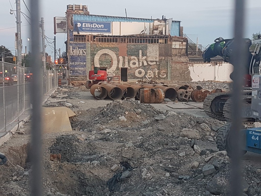
This particular ghost sign at 1042 Pape Avenue is curious in that it promotes multiple elements. The top portion displays a slightly faint but distinct Coca-Cola logo. The bottom half is less familiar and carries much of the mystery. It reads:

BUNT’S FISH & CHIPS
WE DELIVER * GE 5213
POST OFFICE AT 1038

1038-1042 Pape Avenue in 2019. Credit: Google Maps.

It is a bit of cruel irony that a billboard covered the ghost sign for many years, as billboards replaced ghost signs as a mass marketing technique. With the big banner taken down, however, it allows us to dive deeper into the sign’s past and answer some important questions:

  • When was this sign painted?
  • Where was Bunt’s Fish & Chips?
  • When did it exist?
  • What about the post office?
Pape Avenue and Gamble Avenue, before redevelopment. A gas station has been at the corner since the 1950s. Credit: Google Maps.

Dating the Bunt’s ghost sign is an interesting task which is aided by a few pieces of context. The heyday of ghost signs as a promotional technique lasted from the early 20th century to about the 1950s or 1960s, with many coming in the Roaring Twenties when Toronto experienced a commercial, industrial, and demographic boom. This sign is particularly well preserved, so unless it was touched up later on as signs sometimes are/were, one can reasonably speculate it originated after 1920. It also may have helped that the billboard was protecting it from the elements. To know for sure, specific details about Bunt’s Fish and Chips and the post office must be uncovered.

A brief history of fish & chips

Working within the first half of the twentieth century, pinpointing the rise in popularity of fish and chips shops in Toronto is a useful exercise. When one thinks of old fish and chips restaurants today, two come to mind: “Len Duckworth’s Fish & Chips” on Danforth Avenue and “Reliable Fish & Chips” on Queen Street East. Both eateries opened in or around 1930. This means the Twenties and Thirties appear to be a good period to learn more about fish and chips restaurants.

Two fish and chips institutions in Toronto. Credit: Google Maps.

In perusing the Toronto City Directories, fish and chips shops first appear as a business type in 1923. 16 shops were listed for that year. Of course, it is very well possible they existed prior to this year. The Globe advertised business opportunities for fish and chip shops as early as 1922. Nonetheless, we can safely point to the mid-1920s as a period they at least became notable. As a point of comparison, in the United Kingdom, the national dish grew in popularity during World War I and hit its apex in 1927 with 35,000 shops across the country. A similar explosion occurred in Toronto: there were 137 fish and chips enterprises in the 1930 City Directory. It only grew from there.

As fish and chip shops rose in popularity, there were new technologies to make frying more efficient. The Globe, October 9, 1924. Credit: Toronto Public Library and Globe & Mail Archives.
The Globe, March 19, 1937. Credit: Toronto Public Library and Globe & Mail archives.

Solving the Bunt’s mystery

From here we can look at the city directories and newspapers beginning the 1920s for any mention of Bunt’s. The first time this occurs is in the 1930s — albeit not on Pape Avenue. A “Bunt’s Fish Store” appears at 908 Broadview Avenue in 1933. Interestingly, The Globe also mentions this shop and address in February 1933, but it is named “Bunt’s Fish and Chips.” In 1937, a separate Bunt’s Fish & Chips opens at 1036 Pape Avenue.

The Globe, February 24, 1933. Credit: Toronto Public Library and Globe & Mail Archives.
Might’s Greater Toronto city directory, 1937. Credit: City of Toronto Archives.

Curiously, there is also a second (or perhaps, third in this case) Bunt’s Fish & Chips at 866 Broadview Avenue in 1937, located several doors down from the original 908 Broadview shop. The original store ceases in the same year, however. The 866 Broadview Bunt’s location does not seem to last long, either; it disappears by 1940.

In 1942, the remaining Bunt’s Fish & Chips at 1036 Pape Avenue moves to 1042 Pape Avenue. At the same time, Sub Post Office No. 109 changes locations from 1042 Pape to 1038 Pape. (The post office was located at 1038 Pape once before until 1935. It moved to 1042 in the following year.) By 1952, the post office closed. Finally, after twenty years in business, Bunt’s Fish & Chips also shut its doors in 1956.

Might’s Greater Toronto city directory, 1942. Credit: Toronto Public Library

Thus, to date the ghost sign, we must look at the period in which Bunt’s Fish & Chips was located at 1042 Pape Avenue and the Post Office was located at 1038 Pape Avenue. With this, the Bunt’s ghost sign likely went up some time between 1942 and 1952.

Might’s Greater Toronto city directory, 1942. Credit: Toronto Public Library

A legacy continued?

Unfortunately, few details and memories exist or could be located about the inner workings of Bunt’s Fish & Chips. The Coca-Cola advertisement on the ghost sign is appropriate as it likely would have been a drink available at the shop with an order of food. One local East York history recollection recalls that fish sold for 7 cents and chips sold for 5 cents at Bunt’s.

Despite its short twenty-year life, the Bunt’s Fish & Chips’ story is partially captured through this remaining advertisement at its former location. The relic is not only a marker of the business but by extension, Toronto’s intrigue of the humble dish. Finally, another part of its legacy which continues today: the barbecue-themed restaurant now at 1042 Pape Avenue also serves fish and chips.

The Bunt’s Fish & Chips ghost sign as it appeared in June 2021 unfortunately with a graffiti tag. Credit: Bob Georgiou.

Did you ever eat at Bunt’s Fish & Chips or another old fish and chips shop? Leave a comment below!

If you want to read more about the development of this stretch of Pape Avenue in East York, read my article here.

Further reading

Bateman, Chris. “Toronto’s Ghost Signs: Where to Find Traces of Century-Old Ads.” The Globe and Mail, 2 July 2019, www.theglobeandmail.com/canada/toronto/article-torontos-ghost-signs-where-to-find-traces-of-century-old-ads/

“Chipping Away at the History of Fish and Chips.” BBC Travel, BBC, www.bbc.com/travel/article/20130409-chipping-away-at-the-history-of-fish-and-chips.

“Did You Ever Eat at Bunt’s Fish & Chips?” Facebook, Vintage Toronto, www.facebook.com/VintageToronto/posts/5596904233712848

Edwards, Zachary. “Ghost Signs.” MuralForm, Zachary Edwards http://Muralform.com/Wp-Content/Uploads/2014/02/Muralform-Logo-2-300×137.Png, 15 Apr. 2020, muralform.com/2015/ghost-signs/

Hopkin, | By Jeremy. “Sleuthing a Ghost Sign on River Street.” Spacing Toronto, 31 May 2021, spacing.ca/toronto/2021/05/31/sleuthing-a-ghost-sign-on-river-street/.

Jmaxtours. “Toronto Ghost Sign.” Flickr, Yahoo!, 11 Nov. 2020, live-fts.flickr.com/photos/30711218@N00/50588025733/in/pool-tonroto-on/.

Redway, Alan. “East York 1924-1997.” Google Books, Google, books.google.ca/books?id=8TpyDwAAQBAJ&pg=PA281&lpg=PA281&dq=bunt%27s%2Bfish%2Band%2Bchips%2Beast%2Byork%2Bredway&source=bl&ots=QLFlua6CiS&sig=ACfU3U3iuBytSMq1BuFlA-q7gMdX-FIcCw&hl=en&sa=X&ved=2ahUKEwjVtd3kyqLxAhUaX80KHY_pDZMQ6AEwCXoECBIQAw#v=onepage&q=bunt’s%20fish%20and%20chips%20east%20york%20redway&f=false.

Whyilovetoronto. “Why I Love Ghost Signs: The Fading History of…” Why I Love Toronto, 18 Dec. 2015, whyilovetoronto.tumblr.com/post/135400102992.

Scenes From Pape Avenue (East York)

Where does Toronto end and East York begin? On Pape Avenue, it’s a row of Edwardian houses half way between Selkirk Street and Aldwych Avenue. When they were constructed around 1914, Aldwych was named Randolph — a point highlighting the obvious British origins of the area and the evolution.

The history of the rough half-trapezoid between The Danforth, Donlands Avenue, and the Don River goes back to the numbered plots of York Township, which was surveyed and divided beginning in 1791. Lot 11 south of modern-day Browning Avenue and west of Logan Avenue encompassed the community of Chester (also interchangeably known as Doncaster).

Doncaster and Todmordern from the 1878 Illustrated Historical Atlas of the County of York. Credit: Old Toronto Maps.

North of Browning Avenue and west of Donlands Avenue (renamed from Leslie Street around 1916), the Taylors and Helliwells owned lots 12 to 15, which came to be known as the village of Todmorden, named after the families’ paper mill on the Don River on Pottery Road. A nexus of buildings including a post office and hotel sprang up on Broadview Avenue, then named Don Mills Road (more on this later).

Map of the City of Toronto showing wards and tax collectors divisions, 1893. Credit: City of Toronto Archives.

Pape Avenue and Bee (Cosburn) Street, Todmorden Mills, 1911. Credit: City of Toronto Archives.

According to Elizabeth Gillan Muir, author of Riverdale: East of the Don, Chester and Todmorden applied to be part of Toronto in 1890, but were collectively short of the 750 required for annexation (which gives one an insight to their size). Chester would eventually be brought into the big city’s borders in 1909.

Map of Township of York and City of Toronto, ca. 1909. Credit: City of Toronto Archives.

For the residents of Todmorden, they voted to incorporate into the Township of East York in 1922 at a time when the Pape Avenue strip began to grow. The opening of the Prince Edward Viaduct in 1918 along with the East York-Leaside Viaduct (now the Millwood Road Bridge) in 1927 opened the area to modern houses and commercial development. The East York bus line began operation on Pape in the same year, departing from Danforth Avenue up the street and looping back at the top of the bridge. In 1928, it combined with the Leaside bus, extending service into the industrial suburb. By the end of the decade, the street grid, once open fields, gave way to the modern layout.

Construction of the Leaside Bridge, 1927. Credit: City of Toronto Archives.

The Todmorden section of the 1920 edition of the Might’s Greater Toronto city directory offers an insight into the geography and social makeup of this initial period. Area residents, mostly of Anglo-Saxon origin, lived on recognizable streets, such as Woodville, Gamble, and Torrens. However, some roads changed names: Leslie to Donlands, Cronyn to Sammon (sometimes spelled ‘Salmon’), and Gardeners (named after the merchants on the street) to Mortimer, and Bee absorbing into Cosburn. Professions were mostly blue-collar and ranged from employment at the nearby Don Valley Brick Works and Don Valley Paper Mill, to the booming T. Eaton Co. and R. Simpson Co., to the mighty Grand Trunk Railway and Canadian National Railway.

City of Toronto Directory showing Todmorden, 1920. Of note are the members listed under one household and their varying professions, like the Boyes. Credit: Toronto Public Library.

Moving around Pape from Browning to O’Connor, one sees signs of the age, look, and evolution of the old neighbourhood from the first half of the 20th century. At Mortimer, there isn’t a heritage building, but a plaque at Agnes Macphail Square points to the one-time existence of the Kitchener Public School. The school was a three-storey structure of seventeen rooms built in 1915.

Toronto Teacher’s College, 1965. Credit: City of Toronto Archives.

Kitchener School became the Toronto Normal School in 1941, moving from its downtown location on the current Ryerson University campus to Pape Avenue. After that, it was the Toronto Teachers College. Today Centennial College, the park, and a housing complex occupy the space. Macphail Avenue and Square themselves commemorate Agnes Macphail, the first woman elected to the Canadian House of Commons in 1921 and a former Member of Parliament for and resident of East York.

Another school, the Todmorden New School, opened a year prior on Torrens Avenue. It was renamed the William Burgess School in 1922; Burgess was a trustee in 1914.

At Cosburn, another institution – the Bethany Baptist Church – was constructed in 1920. The lot to the north of the church remained empty until the late 1950s, when an addition was completed on the space.

At 873-877 Pape Avenue, there’s a ‘1930’ displayed high above a block of shops. At the time of construction, the corner unit (now a Greek restaurant) was a fruit grocery operated by an Antonio Ruta — Italian in origin by the sounds of it — which represented an important shift in the otherwise largely British neighbourhood at the time and a larger trend in Toronto.

At 1007 Pape Avenue, north of Floyd Avenue, the flooring store currently standing was originally a confectionery by a James Hackin when it came to exist in 1930 (albeit at street address 1005). Interestingly, to the south of it was the ‘East York Miniature Golf Course’.

From Might`s Greater Toronto city directory, 1931. Although their street numbers have changed as well, 913 and 965 remain as a garage and corner store respectively in 2018. Credit: Toronto Public Library.

At 1016 & 1016 1/2 Pape Avenue is a curiosity. The icon above the shop appears to show a ship. A look into the city directories shows this block was built around 1931 when another Italian, Charles Azzarello, opened up a fruit grocery. By 1950, it was Sydney Evans Fish Market. In the 1960s, it came full circle as a ‘Circle Fruits’ and ‘Woman’s Bakery’. Sources are scarce on the ship emblem, although one might attribute it to its fish shop period.

Finally, Don Mills United Church looks down at the strip and is the oldest landmark of all, reaching back to the 19th century — even if the current structure dates to 1950. The adjoined Taylor Cemetery is the final resting place of early pioneering Todmorden families and is neat way to explore its history.

The naming of the church refers to the area’s mills and the street itself around its founding in 1851. Don Mills or just Mills Road originally ran northeast from the Winchester Bridge in Cabbagetown past Danforth Avenue, and turning right just past modern Woodville Avenue at what was then called Patterson’s Corners. From here, it would veer north just past Donlands across the Don River, following a course north to York Mills (it was extended even further in the 1960s.) A smaller section of Don Mills also continued east past the bend, stopping at present day Derwyn Avenue. From here, Plains Road (also called Globe Road) operated south and then east again. The Taylors also had a private right of way in line with Don Mills Road.

Don Mills Road, Plains Road, & Taylor’s Private Road, Goads 1924. Credit: Old Toronto Maps.

Broadview Avenue, first running north from Riverdale Park East (creating the ‘broad view’ of the Toronto skyline) to Danforth Avenue, was extended first to the city limits at Fulton Avenue and then to Patterson’s Corners. In 1929, John H. Taylor proposed the extension of St. Clair Avenue through his property in the Don Valley in exchange for a strip of land owned by The Synod of Toronto to make his private road into a ‘highway’ to connect with Woodbine Avenue.

“St. Clair Extension Through East York Offer of J.H. Taylor,” The Globe, January 21, 1929. Credit: Toronto Public Library.

Whether it was related to Taylor’s wish or not (for what it’s worth, St. Clair was never extended through the valley), the street was indeed completed to Woodbine Avenue in the following decade. In 1936, O’Connor Drive came into existence east of Don Mills Road facilitating an east-west route to the newly built Woodbine Bridge and Scarborough. By 1939, O’Connor would usurp the entire way from Broadview with development along the road growing in the 1940s.

Don Mills Road & O’Connor Drive from Might’s City Directory in 1935, 1936, & 1939. Credit: Toronto Public Library.

After World War II, Canada and Toronto saw a wave of unskilled and semi-skilled Greek migrants leave their homelands for new lives across the ocean. To be sure, Hellenes had been successful restaurateurs along Yonge and Queen Streets since the 1920s, but as Jason Hackworth and Josephine Rekers identify in their paper “Ethnic Identity, Place Marketing, and Gentrification in Toronto,” this new wave would settle around The Danforth beginning in the 1950s and ’60s and peaking in the 1970s. Like their Italian predecessors thirty years prior, they opened up fruit shops and eateries as new businesses or simply took over existing enterprises. Although their studies do not include Pape Avenue, one can see similar trends for the street. Hackworth and Rekers also assert that while the residential Greek population around the Danforth has decreased since the 1970s because of out-migration to the suburbs, the percentage of businesses with Greek affiliation has increased.

988-990 Pape Avenue in 1955 & 1965. The asterisks notes the owner of the building. Credit: Toronto Public Library.

Also in the 1960s, Cosburn Avenue east and west of Pape saw the introduction of apartment tower-tiving, replacing and mixing in with the post-war one-story housing stock dotted over the neighbourhood.

East York, 1965. A row of apartment towers centred on Cosburn begins to form. Business at the time were Dad’s Cookies at 940 Pape and Weston Bakeries at 1070 Pape Avenue. Credit: City of Toronto Archives.

Old and new in East York, 1966. Credit: Toronto Public Library.

In 1986, a new label — the Pape Village Business Improvement Area (BIA) or just ‘Pape Village’ — came into use. The BIA manages and promotes the commercial properties from Mortimer to Gamble, engaging in street improvement initiatives and an annual street festival. Today, the strip is an ecclectic mix of service stations and garages, mid-century houses, churches, and independent businesses and associations. Much of these still have a Greek affiliation, although the area is much more cosmopolitan with a variety ethnic eateries.


Useful Links

Historicist: Greektown on the Danforth

Jason Hackworth and Josephine Rekers – “Ethnic Identity, Place Marketing, and Gentrification in Toronto”

Toronto Normal School, 1847-1947

Toronto Public Library – Digital Toronto City Directories

Ward 29 Bikes & The East York Historical Society – “East York History Bike Ride”

Scenes From Crescent Town

I have a borderline obsessive transit habit. Whenever I travel out of Kennedy Station, I have to sit on the north side of the subway car. Doing that gives me a good view of Warden Woods going by Warden Station and of the Don Valley as it passes under the Bloor Viaduct.

But sitting on the north side of the train presents another sighting: the pedestrian bridge at Victoria Park Station. For the longest time, I never knew what it looked like inside. Or where it went. Or if people use it.

Crescent Town Pedestrian Bridge (1)

Now, walking through it for the first time, I know the sky bridge over Victoria Park Avenue leads to Crescent Town, the towered community in the southeast corner of East York. And yes, people use it. It’s an important link for them and their main transit hub.

Crescent Town Pedestrian Bridge (2)

My introduction to Crescent Town comes with a neat mural that summarizes the neighbourhood with beautiful scenes of its past and present. Funded through the city’s StreetARToronto program, it’s entitled ‘Tempo, Toil, & Foil’ and was created by artists and community members.

Crescent Town Mural (1)

Crescent Town Mural (2)

Crescent Town (1)

This is Dentonia Park, the 6-acre athletic field that fronts a courtyard and its surrounding apartment towers. It’s named for Dentonia Park Farm, the dairy farm established here in 1896 by Walter Massey of the famed Toronto family of benevolent industrialists. It was named after his wife, Susan Denton Massey. Dentonia Park Farm stretched from Dawes Road to Pharmacy Avenue and Dentonia Park Avenue to Medhurst Road.

CrescentTownAerial1924
Dentonia Park Farm, Goads Fire Insurance Atlas, 1924. Source: Old Toronto Maps.

CrescentTownAerial1956
Dentonia Park Farm aerial, 1956. Source: City of Toronto Archives. The section of Victoria Park running adjacent to Crescent Town was built when the community was built.

Dentonia Farm Postcard 1910 (2) East York Then and Now
Dentonia Farm Postcard, circa 1910. Source: East York Then and Now.

Despite the continuity of open space, it’s hard to imagine what this land would’ve looked like a hundred years ago. But I get a little sign of it through the unusual rolling contours in the otherwise flat park. I don’t know it for sure, but my hunch is that the dip in the land hides a former creek valley.

Dentonia Park (1)

Dentonia Park (3)
At the far west end of the park, a tree lined path shields a bit more history about Dentonia Park Farm. The ‘Crescent’ in Crescent Town also goes back to the Masseys, who gifted land for Crescent School, once located here.

Dentonia Park Farm plaque

Dentonia Park Hydro Corridor

Following a corridor of hydro towers (more on that later), I circle back around to the main path and find a way down to Crescent Town Road and Massey Square. Ringed around the streets is the second group of towers in the community.

Massey Dairy Farm was bought by developers in 1969, and by 1971, they constructed apartment towers and marketed the area as Crescent Town, a new way of living in the city.

Crescent Town (2)

Crescent Town
Crescent Town construction, September 16, 1971. Source: Getty Images.

Crescent Town Massey Square Pedestrian Bridge

This development wasn’t isolated to Crescent Town. Across Toronto in the 1960s and 1970s, tower living became the planning focus of the city. Communities were created out of former farms, and then marketed as having onsite amenities  – laundry, shopping, recreation – and conveniently located near transit or highways. The objective of these high-rise towers was to make a profit out of low-cost social housing.

CrescenTownAerial1965
Crescent Town Aerial, 1965. Source: City of Toronto Archives.

CrescentTownAdDec311971
Crescent Town Ad, Toronto Star, December 31, 1971. The sky bridge was a vital part even since the neighbourhood’s inception. Source: Toronto Star Archives.

But the problem with communities like Crescent Town and St. James Town (and Regent Park, for that matter) was that as much as they were made to be their own self-contained ‘towns’, it instead made them isolated from the city around them.

CrescenTownAerial1973
Crescent Town Aerial, 1973. Source: City of Toronto Archives.

As I approach the towers of Massey Square, I’m reminded of a fortress. My goal is to get to the creek trail I know exists on the other side, but I’m not sure if I can get there through the wall of highrises. It’s a definite physical and psychological barrier. Instead, I walk to Victoria Park to get there, passing Crescent Town Elementary School.

Crescent Town Elementary School (1)

Crescent Town Elementary School (2)

One isn’t cognizant of city borders while traveling them (or, at least, I’m not), but across the road is Dentonia Golf Course (also once part of the Massey property) and Scarborough. I’m standing in East York. Further south is the Old City of Toronto. It’s a neat crossroads. It’s our local Four Corners USA.

Dentonia Golf Course

A long stairway leads into the valley of Taylor-Massey Creek. With winter approaching, it’s a rather dead and haunting scene. But even so, it’s easy to see this is a great space.

Massey Creek Trail (1)      Massey Creek Trail (2)

There’s a constructed wetland, and several paths that traverse the rolling topography of the park. By a lookout point, there’s the remnants of a little fire, freshly extinguished and filling the air with its ashy aroma.

Massey Creek Trail (3)

Massey Creek Trail (4)

Massey Creek Trail (6)

Massey Creek Trail (7)

At the park’s highest point, I find the Massey Goulding Estate house, otherwise known as Dentonia. Constructed here in 1921, the cottage is built in a very distinct Tudor style. I struggle to think of other examples of Tudor architecture in the city – there seem to be very few, so this is a treat. Perfectly positioned to overlook the farm once upon a time, Dentonia is its last remaining structure today.

Children's Peace Theatre Dentonia (1)

Dentonia Farm Postcard 1910 (1) East York Then and Now
Dentonia Farm Postcard, circa 1910. Source: East York Then and Now.

Dentonia Park Farm Library Archives (1)
Dentonia Park Farm, undated. Source: Library & Archives Canada.

After the dairy enterprise ceased, the house and park came under the ownership of the Borough of East York and then the City of Toronto. Children’s Peace Theatre – celebrating its 15th year in 2015 – now makes its home inside (and outside) Dentonia.

Children's Peace Theatre Dentonia (2)
Children's Peace Theatre Dentonia (3)

Descending some ancient narrow stairs back down, I follow Taylor Creek Trail under and past Dawes Road. Taylor, by the way, is the other old, industrious Toronto family, who owned mills along the Don River, including Todmorden Mills.

Taylor Creek (1)      Taylor Creek (2)

Taylor Creek Trail continues westward until it meets the Don River near the Forks of the Don. Tracking the trail the entire way sounds like fun, but I opt to take that adventure another day. Instead, I make towards the trail’s entry/exit point towards Lumsden Avenue.

 Taylor Creek Trail (1) Taylor Creek Trail (2)

Lumsden isn’t my goal, however – the Taylor Creek Hydro Corridor is. I’m fascinated by this informal path because of its former incarnation as a railway corridor. Looking at the dead vegetation lining it only increases the thoughts of ghosts and past lives.

Taylor Creek Hydro Corridor Canadian Northern Ontario Railway (1)

Yes, Taylor Creek Hydro Corridor once housed tracks for the now defunct Canadian Northern Ontario Railway, which ran from the also lost Todmorden Station on the north side of Don River, through Taylor Creek valley, and northeast into Scarborough and beyond. It bisected Dentonia Park Farm (now at the north end of Dentonia Park).

CanadianNorthernOntarioRailwaySubway1913
Canadian Northern Ontario Railway, 1913. Source: Toronto Historic Maps.

The Bloor-Danforth subway tracks between Kennedy and Victoria Park Stations are the only tangible remnants of the CNOR’s former corridor in Toronto, which was out of use in the city as early as 1925. (And here I thought the subway was carved out of farmland and expropriated homes). The rest has been swallowed up by the city around it. If one looks, however, the signs of existence are there. (Note to self: take on this adventure).

CanadianNorthernOntarioRailwaySubway2015
Canadian Northern Ontario Railway, 2015. Source: Toronto Historic Maps.

Following the hydro corridor east would bring me back to Dentonia Park, but I make my exit at Eastdale Avenue. Concluding my travels, I find my way back to Dawes Road and follow its odd diagonal routing down to The Danforth. That too is something to explore.

Taylor Creek Hydro Corridor Canadian Northern Ontario Railway (2)         Taylor Creek Hydro Corridor Canadian Northern Ontario Railway (3)


Useful Links

Edward Relph – Toronto: Transformations in a City and Its Region – ‘Chapter 5: A Post-suburban Skyscraper City’

ERA Architects – Toronto Tower Renewal: Lessons From Crescent Town

Globe and Mail – “A Toronto subway station redesign links neighbourhood and nature” by Dave LeBlanc

Ron Brown – In Search of the Grand Trunk: Ghost Rail Lines in Ontario – ‘Chapter 19: The Canadian Northern Railway: Ontario’s Forgotten Main Line From Toronto to Hawkesbury’

Scenes From Warden Woods Park

Toronto Neighbourhood Walks Project – Crescent Town

Toronto Star – “Once Upon a Time: Dentonia Park born of Massey’s dairy dream” by Valerie Hauch

Torontoist – “Historicist: ‘If It’s City Dairy It’s Clean and Pure. That’s Sure.'” by Kevin Plummer

Train Web – Canadian Northern Ontario Railway – Toronto to Ottawa Line

Urban Toronto Forum – ‘Rare Maps of Toronto’ Thread | Page 12

Scenes From Todmorden Mills

I get off the 100C Flemingdon Park bus at Broadview and Mortimer and cross the street. To the west, Mortimer becomes Pottery Road and is my route on the way to Todmorden Mills Heritage Site. A sign ushers me to the descent.

1. Pottery Road Sign

And quite the descent it is! There are several topographical kinks within the city, and this street is definitely one of them. I’m no cyclist myself, but I have to feel for the people coming up the hill. In fact, as I read more about it , Pottery Road ranks up there for people on bikes as the toughest to navigate. My pity pretty soon turn inwards, because I realise that I’ll probably have to muster the climb on the return trip. D’oh.

2. Pottery Road Descent

Another sign and a bricked path ushers me into the Todmorden Mills grounds. Located in the Don River Valley, it’s a site that claims both industrial and natural heritage. In 1967, it was re-adapted as a historic site and operates today under the City of Toronto Museums to help tell the story of Toronto. I was here once before, although very briefly to help out to an event. Today is a long overdue chance to do some more exploring of the museum and the great Wildflower Preserve I’ve heard so much about. (Although, ironically enough, I still don’t have an adequate amount of time to do a just visit). I also read about an intriguing photo exhibition in the Papermill Theatre, which is my first stop.

3. Todmorden Mills City Museum Sign

On the way toward the building, I have to look up to the smokestack, which was nominated for a 2013 Heritage Toronto Award for its recent restoration. Anyone who has ridden down the Don Valley Parkway has seen the chimney and its giant lettering.

4. Brick Path

5. Papermill Theatre Smokestack

Inside the Papermill Theatre is an art show entitled ‘The Past is Never Far.’ It features the work of three people who have visually captured the city at various points in its history: Elizabeth Simcoe, who painted some of the first images of Toronto, William James, who took 6000 some odd photos of the city which are all digitized in the Toronto Archives, and Summer Leigh. If the last name doesn’t ring a bell, it’s because she’s the artist behind the show.

6. The Past Is Never Far

Summer takes the images of her predecessors and photographs their subjects in their modern locations. So we can find James’ photo of the dirty foot of Yonge Street in 1909 mixed in with her take of the same site the 21st century. Or Lady Simcoe’s view of Toronto harbour in 1793 with the current incarnation of the shore as we see it today. It all makes for a great visual look into Toronto’s past and present.

Taken together, the exhibition tells a great story. Its message comes in the title, and is something I have been saying and thinking for a while now: Toronto is a layered city. Some of its (her?) landforms and landmarks have changed a great deal. Some haven’t. Perhaps some of the changes aren’t immediately apparent to us, but they are there nonetheless. The past isn’t far. You just have to dig for it, do some analysis, maybe even put on a photo exhibition.

That said however, perhaps some things do stay the same. Summer has one image up of William James that features the Don River Valley flooded in 1910. 100 years and a parkway later and we’re still facing the wrath of the overflowing Don. I shake my head and smile at that. Plus ca change, plus c’est la meme chose, n’est-ce pas?

9. The Past Is Never Far

As a nice and unexpected treat, the artist herself is on hand, and I am able to pick her brain about what I see – whether she was actually at the disputed  location of the Simcoes’ Castle Frank residence, as an example. Among the random things we talk about are old school horse drawn streetcars and being de facto tour guides for people in our lives. Through that chat it quickly becomes clear that she is a true buff in Toronto history, whose knowledge, talent, and vision really shows in her work. We probably can geek back and forth about the city for another good chunk of time, but alas, time isn’t abundant today and I graciously thank her again and make my exit.

I head up to the brick path and continue down it. To my left, I see a familiar blue marker. The Ontario Heritage Trust sign gives my the need-to-know of  Todmorden’s history. I briefly circle around the exteriors of the buildings. I did some reading prior to coming, and, if I had more more time, I would enjoy a tour, but it will have to wait until next time.

10. Ontario Heritage Trust Todmorden Mills Sign

Also happening on the grounds of the museum is Eco-Art-Fest, an arts, heritage, culture festival put on by No. 9, who I first heard about during Jane’s Walk preparations. There is a designated ‘chilling’ area which has some pretty soothing country tunes going, an elevated platform (I think it’s also a stage) with an oven, picnic benches, and craft table where a few children try their hands at water colour painting (shoutout to Elizabeth Simcoe with that activity).

17. Outdoor Area with Oven

I continue on the brick path once again, heading toward the bridge. I see a few joggers around, and I have to admit that it that this would be a very good place for a run. I would run through here if I loved closer. A few feet before the bridge is a swirly blue line with the words ‘Don Was Here’ in bold lettering. No, some guy named Donald hasn’t marked his presence. It’s actually a public art initiative commissioned by No. 9 and curated by Labspace Studio in partnership with the Toronto Region Conservation Authority. There are several of these ‘Don Was Here’ markers from Todmorden Mills to the mouth of the river which shows the meandering route of the Don before it was rerouted and straightened. It’s a pretty amazing tribute to the city’s natural heritage. The project has got an interactive site too…with a map!

12. Don Was Here at Todmorden Mills

I notice some letter on the side of the bridge as I cross it, but may little mind to it (more on this later). Instead, I focus on the green area it overlooks. I walk around (passing another ‘Don Was Here’ marker) and inspect it a little better. Beyond that it looks really beautiful, I can’t pick out any species or just the entire ecological significance of it.

13. Don Was Here at Todmorden Mills

14. Bridge

I circle around and head back to the open area with the benches so I can give the Wildflower Preserve a walkthrough. I am greeted by a pair of signs to explain everything. It turns out the area under the bridge was the last area on the trail. I get the signs on my phone because I know I’ll need them. And hey, now I know what an Oxbow is.

15. Wildflower Preserve Sign

16. Wildflower Preserve Sign

I spend a few minutes at the pond to take in everything. Gazing out and down at the green surface, I am hoping to spot something alive. Instead, I just see a pop can half-submerged in algae and just think somebody has really missed the point. I do catch movement, something skipping across the water. I can’t tell if it’s a fish or a frog, but I take it anyways and move on.

19. Wildflower Preserve Pond

The tree canopies are tall enough to make me feel closed in and away from everything, but even with the rustling wind, buzzing insects, chirping birds, I still can hear highway traffic. It’s a weird thing spot to be in. I feel like I’m in a secluded spot, but really, I am not. Actually, it reminds me of wandering the Betty Sutherland Trail near the 401. A city within a park, indeed.

At one point, my curiosity is piqued when I spot what looks houses floating in the oxbow. I have to maneuver through and over things to get to the water’s edge. Yup, they are floating houses. Either some trekkers got really mischievous and creative or this is something deliberate and tied to the museum. I suspect the latter. I do some research after the fact, and the Ec0-Art-Fest website and its scrolling banner images provide the answer. The houses are an installation for the festival – as is the lettering on the bridge (which read from the other side says ‘Like a Bridge’) and the ‘Don Was Here’ project. Eureka!

22. Boat houses Todmorden Mills Wildflower Preserve

As I walk the paths, I try to see if I recognize any flora. I think the yellow flowers are goldenrod, but I’m not willing to bet my guitar on it. In co-creating a nature walking tour last summer, I was introduced into identifying certain floral species, but it does not help me out here. Instead, I just go back to marveling at the Preserve in a big picture sense.

20. Goldenrod, maybe

21. Bridge

I remember something Summer said about our former industrial centres. Places like Todmorden, the neighbouring Evergreen Brickworks, and the quarries of Greenwood and Smythe Parks were pretty dirty looking once upon a time. To see their conversion into beautiful natural and park lands is just remarkable. Tormorden and the Brickworks in particular have their own ecosystems, which makes this preserve more amazing to be in and think about.

For a while I try to go off the main path onto offshoot routes, but then I realise that I really have no idea where they would end up. And I’m being stupid with time. So I turn back and get to the end of the wooded area. I’m at the back of the parking lot, and instead of walking through it, I turn around and tour the Preserve again. When I reach the beginning, I spot a warning I missed the first go around. I smile at the mention of the ‘East York’. The borough lives on.

24. Wildflower Preserve

26. Wildflower Preserve Sign Borough of East York

Walking back to Pottery, I give the museum one last look and then head off to do the climb. Part of me wants to visit the Brickworks, but I know this is not doable. I convince myself it would be a real beneficial exercise to power through at a quick pace, but halfway I’m a bit gassed and cursing my idea. Fortuitously, I do break beside a Sumac, though! Happy that I recognize something, I leisurely finish the ascend and then make it back to The Danforth.

27. Todmorden Mills

28. Pottery Road Sumac