I’ve decided to get into the newsletter game! It will serve as another outlet to explore and report on my curiosities in Toronto history and fill the space in between posts. I’ll have what’s interested me, what I’m up to, and sharing some favourite research resources. The articles on this site won’t stop, of course. In fact, I have a few coming down the pipeline in 2026!
Toronto was a brick-making town. Going through the city today, you would not realize it right away. This lost and remade industrial and natural geography is remarkable. Great clay refining enterprises from the Don Valley to Leslieville to Yorkville to North Toronto to the West Toronto Junction now carry transformed greenspaces or residential communities. The Evergreen Brick Works is one of those spaces.
Don Valley clay pits, part of Don Valley Brick Works (Toronto). James Blomfield. June 10, 1939. Credit: City of Ontario Archives.
The Don Valley Brick Works began operations in 1889 and lasted quite a long time, providing the literal building blocks for the city of Toronto until 1984 — not a long time ago. One can think of the Brick Works as the last bastion for smokestack-raising, pollution-spewing, heavy manufacturing in Toronto.
Don Valley Brick Works, Bayview Ave., w. side, s. of Chorley Park in Don Valley; looking s. from Chorley Park, 1952. Credit: Toronto Public Library.
Following its closure, much like a lot of discussions then and now in how to imagine the post-industrial metropolis, the Toronto and Region Conservation Authority and City of Toronto looked to expropriate former brickyard as public space. During this ‘transition’ time, the abandoned factory became a haven for urban explorers.
Don Valley Brickworks, 1986. Credit: Toronto Public Library.
Brickworks, 1990. Credit: Toronto Public Library.
What came out of it was a rejuvenated community hub and parkland with a mandate for environmental sustainability and conservation, led through the efforts of Evergreen. Much of the complex still stands, showing off ovens and other former operations of the Don Valley Brick Works. Today, they make great event and exhibition space which house among other things a great farmer’s market. Only one of the four chimneys remain, though.
The Evergreen Brick Works is a locale full of discovery, starting with its artistic displays. A favourite of mine is “Watershed Consciousness”, which neatly showcases Toronto’s ravines as the sort of veins and life blood of the city. Fitting.
One quizzical installation is a giant pair of metal shoes. This is “Legacy (the mud beneath our feet)” by David Hind, an homage to geologist Arthur Philemon (A.P.) Coleman. Mr. Coleman got his boots dirty many times over at the Don Valley Brick Works, using the quarry’s north cliff to research Toronto’s Ice Ages. A nearby display, “A Rare Geological Study”, presents Coleman’s notes.
Map of Toronto and Vicinity To accompany part 1, Volume 22, Report of Bureau of Mines, 1913. Credit: University of Toronto Map and Data Library.
The Pleistocene of the Toronto region Including the Toronto interglacial formation, 1932. Credit: University of Toronto Map and Data Library.
The allure of the Evergreen Brick Works is its physical landscape. Each step offers more discovery and new vantage points. Wandering deeper into the Weston Family Quarry Garden and its tall reconstructed wetland, the factory behind disappears, aside from the chimney.
Running between the handsome factory buildings is a channelized Mud Creek (which might be the best and worst name for a waterway in Toronto). There’s a more naturalized version of the stream as well, running under the great Governor’s Bridge as one moves out of the park.
Veering away from the marked trails, there is the abandoned Don Branch of the Canadian Pacific Railway, last operating in 2007. With the Belt Line Trail also nearby it’s the second ghost line of sorts at the Brick Works. Following the CPR tracks takes one to the Half-Mile Bridge, seen as one enters the Evergreen Brick Works.
Don Valley Brick Works, Bayview Ave., w. side, s. of Chorley Park in Don Valley; looking w. from Broadview & Mortimer Ayes. 1955. Source: Toronto Public Library.
Perhaps the most inspiring experience of the Brick Works is the view from above. Moving up the cliff one takes in the awe of the full expanse of the site, its winding trails and ponds below, and the houses of Rosedale overlooking the valley.
One can only take in this reclaimed natural landscape and think of its layered makeup. The intersection of industrial, geological, and environmental history make the Evergreen Brick Works make it a special place. A walk around it only proves that.
The Fort York area has some of the oldest built heritage in the city, but also has some of the newest real estate as well. And as much as its history is some of the deepest in the city, its emergence as a neighbourhood – as in, the Fort York neighbourhood or Garrison – is only a recent development.
I begin at Bathurst and Fort York. Across the way is the KPMB Architects-designed Fort York Library, opened in 2014. It’s been celebrated as some of the best new architecture in the city. It’s also important to the neighbourhood itself given the changes in the area.
The walk to the Fort is actually quite a long one, considering that I’m technically walking right in front of it. It also passes under the looming Gardiner Expressway, where there’s construction happening.
The entrance to Fort York National Historic Site is the Visitor Centre, which wasn’t here the last time I was at the museum several years ago. Designed by Patkau Architects and Kearns Mancini Architects, it opened in 2014 to great fanfare and great necessity. The shape of the building is an homage to the bluff that once front the shore of Lake Ontario, which was once located in this spot.
My reason for coming to Fort York is to sample the new Augmented Reality (AR) tour which is in beta testing for the month of October. As an educational and interpretation tool, it’s a significant addition for the museum.
Fort York Western Gate, 1885. Source: Toronto Public Library.
Fort York is the birthplace of Toronto. It was founded in 1797, but its buildings date to the War of 1812.
1818 Phillpotts Plan of York. Source: Old Toronto Maps.
But despite that history, it’s lost a bit of its context given the changes in Toronto over the years. Its historic significance is tied to its geography. The original shoreline, which gave the Fort a strategic location to defend the town of York, is buried under infill. Today, Fort York is landlocked by condos, a highway, and railways.
The AR tour recreates Fort York’s historical environment and instills some of the sense of place that’s been lost. It’s powered by GPS and features audio and visual exhibits which are prompted when you enter particular locations.
My favourite vignettes were the Battle of York, in which British soldiers blew up the grand magazine killing a lot of invading American troops (including the best named figure in Toronto history: Zebulon Pike). The crater in the grass today is said to be from the explosion.
Also, the Gardiner Expressway, which had great audio from the debates of the day. The original proposal for the Gardiner included a plan to route the highway over the Fort. Running it around the site would’ve added eight additional minutes to commuter times (hmm, where have I heard this debate before?).
Fort York, 1934. Source: Toronto Public Library.
The AR tour is overall a great experience. I was awed by the ability to look around and see the Fort and its surroundings as it once stood. For a museum goer that doesn’t necessary seek a social experience, it’s an excellent way to take in the site. I look forward to seeing it in the museum’s regular programming.
After finishing with Fort, I return back to the Visitor Centre to take in Magna Carta: Law, Liberty, Legacy. The exhibition is a great mix of didactic and interactive elements, and its messaging is on point.
The Magna Carta is a significant document in human history, and there’s great continuity in Canada’s and Toronto’s past, particularly in the creation of the CanadianCharter of Rights & Freedoms and the fight for Responsible Government. It’s on display until November 7, 2015. (This is also the first exhibition I’ve been to that explicitly bans selfie sticks.)
From there, I make my way out of the fort and explore the neighbourhood. Passing by Garrison Common, which gets forgotten but is a significant part of the site, I come to Fort York Armouries, built here in 1933.
Further down the way is the 1861 Queen’s Wharf Lighthouse. Like Fort York, it’s a bit removed from its historical situation. It was moved here in 1929 after infill no longer had it on the water. Queen’s Wharf was the location of the recently excavated schooner.
Moving around the weird Fleet Street/Lake Shore Boulevard setup is a pedestrian’s nightmare. There’s car traffic and streetcar tracks to contend with. It’s no wonder the nearby intersection is named one of worst in the city.
Coming to Grand Magazine Street and Iannuzi Street, there’s markers in the ground honouring their naming. Grand Magazine references the Fort, but Iannuzi refers to the nearby OMNI building and the station’s founder Daniel Iannuzi. I remember when it was just named CFMT.
The Tip Top Lofts is a highlight on the street and one of my favourite buildings in the city. It was originally built here in 1929 as a garment factory. After sitting derelict, it reopened as residences in 2006 with an addition that, in my opinion, works very well with the rest of its Art Deco exterior.
The Bathurst/Lakeshore/Fleet Street intersection is an interesting one for the landmarks that stand here and once stood here.
Aerial view of Bathurst Street and Lake Shore Boulevard, 1930s?. Source: City of Toronto Archives.Standing at the northwest corner, there’s Douglas Coupland’s toy soldiers, known as the 2008 Monument to the War of 1812.
Across the way is a gas station that was once the site of Maple Leaf Stadium, which stood here from 1908 to 1968. It hosted the Toronto Maple Leafs baseball team. As Adam Bunch tells in his Illustrated History of Baseball in Toronto, it’s one of a couple of lost baseball venues in the city, joining Hanlan’s Point Stadium on the islands and Riverdale’s Sunlight Park. Today, Stadium Road is only remnant of its existence.
On the southeast corner is the mentioned OMNI building, known historically as the 1927 Crosse and Blackwell Building.
Crosse and Blackwell Building, 1927. Source: Toronto Public Library.
Rounding things out is the landmark Loblaws Groceterias Warehouse, which sadly, has seen better days. A 1927 design by Sparling Martin and Forbes, it completes the Art Deco row happening here on Lake Shore (Carlton Street has another one going too). 90 years later, ERA architects are going to take their shot at revitalizing the worn out building.
Loblaws Groceterias Warehouse, 1929. Source: Toronto Public Library.
Heading east and up onto Dan Leckie Way, the neighbourhood makeover continues. This is CityPlace, whose towers and the amazing Canoe Landing Park disguise the fact that there were once extensive railway lands here. Underneath the Gardiner there’s a park, akin to Underpass Park in the West Don Lands.
Speaking of railways, at its head I cross at the Puente de Luz pedestrian bridge.
Draper Street is a hidden Victorian gem in the city. Anytime I’m in the area I have to traverse it. Its rowhouses are something else. And there’s a couple of cats that can be found roaming it.
At Wellington & Portland, I like the unexpected juxtaposition between the house-turned-restaurant and the condo beside it. I have to believe there was once a vintage row of homes here, but the present looks pretty nice.
Across the way, Victoria Memorial Square went from yesterday’s military burial ground to today’s quiet park. Although geographically disconnected from it, it’s part of Fort York National Historic Site. For a deeper read into the park and its history, do read Hiking The GTA’s piece on Victoria Memorial Square.
Back on Bathurst, I end my urban hike at King Street. The Otto Higel Piano Co. stood at its northwest corner for the better part of the 20th century before being demolished in 1981. It’s one of my favourite lost industrial buildings in the city, and can’t help but wonder what its use would be today. There’s a Second Cup in its place, which I don’t mind getting a coffee from.
Otto Higel Co., 1919. Source: City of Toronto Archives.
The intersection is also a great bookend for the day because of the Wheat Sheaf, which figures into Fort York and Toronto mythology. Soldiers at the fort were said to have dug a tunnel from the garrison to the watering hole. Great story although not true, sadly!
The path of the Garrison bisects streets and runs through parks, joining neighbourhoods like any major throughway in Toronto would today. It clues us into the early geography and industry of York and later Toronto. In tracing its former course, I followed its Discovery Walk from Bloor to Queen Street.
The Garrison ran a longer distance than what I track. For one, the Discovery Walk itself ends at Fort York, which gave the waterway its name. But north of Bloor, it extends to St. Clair. On Shaw, the creek exacts its revenge on a slanted house, deemed the crookedest home in Toronto, which was put up for sale in July 2015.
To its south, Christie Pits has sister green space in Bickford Park, whose history and geography is very similar. With the Garrison running through its centre, there was a brickyard here too. The surrounding neighbourhood on much of Grace and Beatrice Streets and its various laneways (including the arty garage-lined alley bordering Bickford) was filled in after the yard ceased operations in the early 20th century.
Christie Pits and Bickford amount to accidental parkland in my mind: places of industry that weren’t earmarked to be recreational spaces but that ended up being so after outliving their original uses. It’s a more-common-than-expected origin story of Toronto parks.
Source: Goad Fire Insurance Atlas, 1903.
Source: City of Toronto Archives, 1913
On Harbord, a tombstone rises out of the street as a monument to the 1905 bridge that’s buried beneath it. It’s the first of two on this walk.
South of it, through what is now the levelled Art Eggleton Park (named for the former mayor), the valley is just infill. In the yard of Montrose Junior, a school of fishys swim alongside the school of students.
The Garrison may be gone, but its effect on the layout of Toronto is very much apparent. The odd curvy configuration of Crawford & Montrose Streets follows the creek’s path, and further dispels the myth that Toronto is a perfectly formed grid.
Source: Toronto Historic Maps, 2015.
Source: Toronto Historic Maps, 1899.
Source: Toronto Historic Maps, 1858.
Onwards, the Garrison path passes through College’s Little Italy, where the heritage listed MOD club and Revival Bar stand. The former was the 1922 Great War Veterans’ Association (GWVA) Clubhouse and the latter was the Brethren Mission built in 1910.
The ravine’s parade through parkland continues through the less famed, yet quite peaceful Fred Hamilton Park. The Discovery Walk route has its own wayfinding arrows to direct people, but there are other markers alerting people of the ravine’s one time presence through the area.
At the end of Roxton one comes to Dundas West’s Little Portugal and Trinity Bellwoods Park. Its northwest corner is the original Bellwoods Park, as labelled by early maps. There’s a pleasant discovery in the statue of Simon Bolivar, the liberator of South America.
At Crawford Street, there’s a Heritage Toronto marker for the second lost bridge of the walk. Beyond the plaque, there’s no remnant of the Crawford Street bridge’s existence. Like Harbord, its valley too is infill.
But fortunately, interesting topography doesn’t completely escape the park – there are toboggan hills here too.
Topographical Map. Source: City of Toronto Archives, 1913
As expected, Trinity Bellwoods is well used on this day. It is toited as a hipster haven in grand Toronto lore, but that label shouldn’t stop peoples of all demographics from using it. It’s so celebrated that 1990s & 2000s Canadian rock outfit, Treble Charger, sang about it.
At its south end, ornate gates mark the Queen Street entrance to the park. The gates put the Trinity in Trinity Bellwoods and are living memories of the original Trinity College whose buildings stood here for a century from 1852 to 1956.
Queen Street has a perfectly lined streetscape, save for one building set back from everything else. This is the 1847 Georgian style John Farr house – at one time located on the banks of the Garrison as it crossed Queen Street. Farr was a brewer who made use of the creek for his enterprise.
The written discourse about the Garrison as well as the various geographic and commemorative signs in its former path are amazing reminders that the creek’s existence is very much in Toronto’s consciousness.
While digging up some info on a separate topic (expectedly, a look into a former factory in Toronto’s east end), I came across an interesting article in the March 19, 1907 edition of The Globe. It speaks to the growth of Toronto’s built character in that year. It makes reference to many prominent buildings in the story of Toronto then under construction – some still with us, some not.
What fascinated me most is that the article speaks directly to the economic, industrial, and commercial expansion of Toronto in the early 20th century. It’s my theory that this period – that is, the Edwardian era through to the interwar years – was massively transformative on a number of levels – social, economic, and political – and maybe the most crucial period in the city’s history.
Just off the top of my head, one sees the annexation of numerous communities into the grand City of Toronto, the introduction of the automobile, the emergence of Toronto Hydro, the prominence of neighbourhood theatres (and, with that, vaudeville theatre), and, through my own research into Toronto’s industrial history, the erection of countless manufacturing establishments. Such a topic – the expansion of Toronto from 19oo to 1930 (or, pushing it more, 1940) – I believe is deserving of a book or, at least, a scholarly paper. Perhaps I should take this up.
To get a better sense of the locations in the piece, I referred to the ever resourceful Toronto Historic Maps site.
Striking here is the author’s suggestion that the number of building projects underway is unprecedented – upwards of 3 million dollars. There was a push to rebuild Toronto after the Great Fire of 1904, but looks as though in 1907, the expansion was far more accelerated.
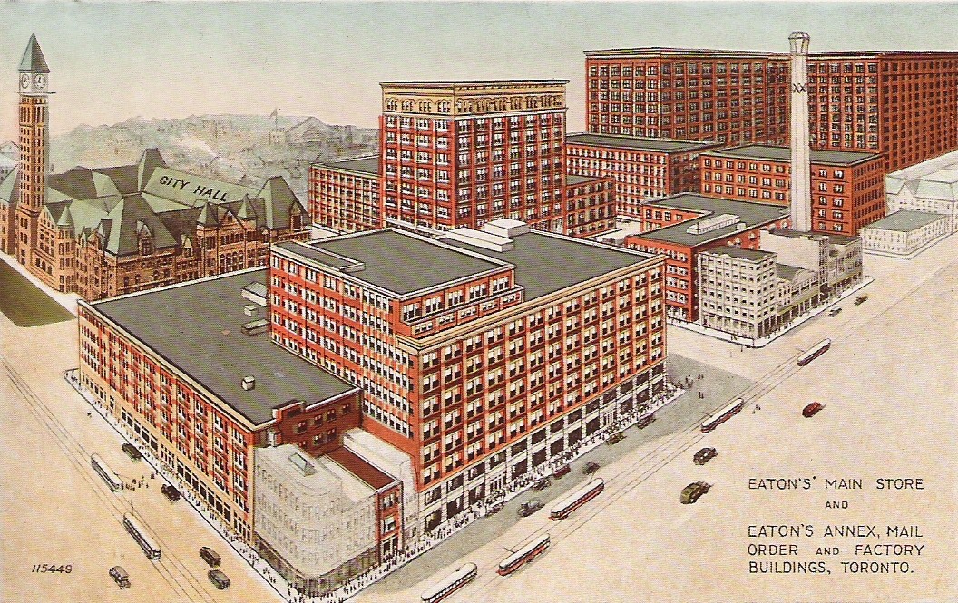
There’s, of course reference, to Eaton’s and Simpson’s, both manufacturing and commercial juggernauts in Toronto at one time. The former’s holdings at what is largely now the Eaton Centre has been completely wiped out, including the mentioned factory at Yonge and Albert. It’s an intersection that no longer exists either! For the expanding Robert Simpson Co., the writer talks about James Street upcoming extension to Richmond, which did indeed happen according to the 1913 Goad’s, but it’s now back to its original terminus.
Familiar to me are the Christie, Brown & Co. factory (now George Brown College) and the Queen City Vinegar Co. (now lofts). Both impressive structures. Also, Riverdale and Leslieville experienced quite a bit of growth in the early century, and that’s reflected here.
Aside from the Canada Foundry Co., located up at Lansdowne between Davenport and Dupont, many of these look to be in what is now the Entertainment District. I’m surprised there’s no reference to the Massey-Harris plants as they surely expanded in this period.
I don’t know if that 20-storey office was ever built. And where this Monarch Bank is/was. I do like the early adaptive re-use though, even if a store to a bank isn’t the hugest stretch!
A couple of E.J. Lennox properties appear in the King Edward Hotel and the Victoria Orange Hall at Queen and Bond, a grand building which stood as a testament to Protestant Toronto. Nearby, Mr. Shea’s theatre was the aptly named Shea at Victoria and Richmond, now lost. The new theatre on King Street West is undoubtedly the Royal Alexandra. The very final point refers to Lol Solman, the man behind Hanlan’s Point Amusement Park.
Note: Adventures as of last fall-ish. Here’s hoping we get some greenery soon!
My first impression of Graffiti Alley? It’s just as much in a hidden corridor and loading zone as it is a gallery. I enter from Augusta, although the path begins at Spadina in the east. The mighty needle rises above some cartoon caricatures dancing around some windows.
Nearby, there’s some more sophisticated aquatic renderings. The creative output in both drawings are impressive. It’s a grand exercise in place making, isn’t it? Here you have previously dead, in-between ‘spaces’ turning into destinations themselves through the creative efforts of some talented individuals.
As a past adventure taught me, names hold meaning, and assigning a name to a space goes a long way into place making. Graffiti Alley is formally recognized as Rush Lane, and doesn’t refer to the trio from Willowdale, but a local who once owned many shops along Queen Street. Making meaning through commemoration. With that knowledge, I come out at Portland and head up to the street.
The Outer Layer hugs the corner of Queen and Portland. The rather unfortunately faded plaque can’t tell me this, but this was built as a Bank of Montreal branch in 1899. It was designed by Frederick Herbert, who, in my opinion, is the second most iconic architect of old Toronto (E.J. Lennox being the first.) Through observation throughout the city, it doesn’t seem too often that an old bank deviates from its original purpose. Of course, it does happen – the most formidable of Banks of Montreal is now the Hockey Hall of Fame.
I do slip inside the shop for a moment. I’m on a mission for some quirky Toronto-themed postcards to send overseas. I don’t find any here, but I do come away with a Lou Reed card and a TTC subway magnet I pick up at the register.
Across the way is the formidable looking Epicure Cafe building. I’ve eaten there a few times…very affordable prices for great food. Even further down (not pictured) is Tequila Bookwork, another great local eatery and drinkery.
I follow the way past Bathurst, where a backpacker greets me on the other side of the crossing. I’m not sure what kind of works he’s packing.
Outside the Dog’s Bullocks (possibly the greatest name for a bar), a group begins a chant that I don’t get but they find wildly amusing. A few doors down is Valhalla Cards, which houses a grand collection of postcards. Among my purchases are a 1910 look up Bay Street and a Captain Canuck cover from 1975.
Next, I take a swing onto Niagara Street, and another alley quickly greets me. Unlike Rush Lane, this one is unnamed – but this is expected. Of the 3000+ alleys in Toronto, only 200 are actually places. One such exists north of Gerrard between Coxwell and Greenwood.
Here I encounter a cyclist and the CN Tower again – albeit anthropomorphized. I love TO too, little needle.
I also get some two-word advice.
For an existential thought, I mentally tag on ‘Yourself’ to this one.
Back on Niagara, another sweet mural presents itself.
Whenever I used to see Niagara Street on a map, I’d always wondered why it curved. All the streets around it follow a grid; what is Niagara’s deal? Did the town planners have a fun day at the office that day?
Only recently did I come to the realization that’s all geography. The now buried Garrison Greek ran roughly parallel to the street. In fact the western side of Niagara used to have breweries and lumber yards, which lined the banks of the creek.
Boulton Atlas, 1858 – Niagara Street and area
Down the way I find Niagara Street Junior Public School, which celebrates its centennial this year. It’s actually the second incarnation of the school, the first built in 1874 and later demolished to make way for the new building.
Maybe it’s my suburban upbringing, but the yard is curiously small for a schoolyard to me. The grass is not actually grass either.
Further down past King Street I find the another institution, the Fu Sien Tong Buddhist Temple. It looks odd to me – not the building itself, because that’s beautiful and an unexpected discovery – but the way it’s set back from the street and not parallel to it.
Where Niagara meets Tecumseth is some more industrial history in the former National Casket Co. buildings. It’s a complex of three structures built between 1884 & 1887. The most easterly is the oldest. You can guess that they’re about to undergo development.
That’s not the extent of the industrial character of the street. At the very foot of Tecumseth is the Toronto Abattoir. Or was, anyway. This year marks the end of a 100+ year history of animal processing in the area. To think: an animal slaughterhouse and a coffin factory steps from each other…kind of dark, no?
Goads Map, 1924 – Toronto Abattoir & National Casket Co.
I can’t tell for sure, but I think there’s a remnant of the radial spur below me. I could be wrong.
Beyond the railway lands below is Fort York National Historic Site, although I can’t see it right now. With that, I turn back up the street, spotting the last bit of street art of the day.
The walk up Tecumseth is rather uneventful – not much happening other than the 1897 Ukrainian Baptist Church near Queen. I snap a picture and then continue on to catch a streetcar.
I’ve been to the City Archives a few times before to toil away in the research hall. But I’ve never made it a destination for any other reason. The Archives, however, does put on museum-eque exhibitions, and its latest – ‘Made in Toronto: Food & Drink Manufacturing in Our City’ – caught my eye. Toronto’s industrial legacy is becoming a big fascination, so this came at a great time.
As the exhibit poster explains, there are a great number of manufacturing enterprises in Toronto today (more than people realize), but before we even get to today, ‘Made in Toronto’ sets out to present the city’s pioneering industrial players – companies like Weston Foods, Willard’s Chocolates, and Gooderham and Warts (among others).
The display is divided thematically into baked goods, meat, milk pantry items, chocolate, and alcohol. There are photos of insides and outsides of factories, maps, posters, and memorabilia in display cases. All of it is very well and thoroughly researched and presented.
Toronto isn’t the manufacturing town it once was and for a number of reasons. Cities and economies change, and industry in the middle of cities just doesn’t make sense anymore. It’s good to back and visit how things were. ‘Made in Toronto’ does just that. It runs until August 2015.
Bonus: and of course, one can’t go to the city archives without taking its ‘Miles of Files”!
Spontaneous, impromptu adventures. They are the best, aren’t they? As a person who overthinks and plans the heck out of things, I’ve realised lately that when you go into something with high hopes and little expectations, things turn out to be more fun.
I find myself at George Brown’s St. James Campus, meeting my brother in front of the Hospitality Building at the top of Frederick on Adelaide. It’s a new state of the art building, but its surroundings for the most part aren’t. Beside it is a trio of heritage buildings: Toronto’s First Post Office, the De La Salle Institute, and the former Bank of Upper Canada Building. Actually, the Hospitality Building was previously occupied by a still existing heritage building that still exists, Campbell House Museum, which was moved to University and Queen in 1972.
This collection of structures is important in telling the story of York and Toronto, but the block-wide red brick building across from us grabs my attention the most. Ah, converted industrial buildings: my great interest in this thing called local history. A good chunk of George Brown features adaptive reuse projects. The one across the street is the former Christie factory.
Christie, Brown & Co., Adelaide St. E., s. side, betw. George & Frederick Sts.; looking s.w. 1902. Credit: Toronto Public Library.
My brother tells me that a pedestrian bridge was planned above the intersection to join the two buildings. It never materialized and after we part, I woefully resign to using the boring old crosswalk. Or maybe not so boring. At the corner I see an inkling of Old Toronto street names. Hello Mr. Duke!
As I meander south, it’s like architectural Pokemon – I gotta catch ‘em all. But this is a journey within a journey. I really want to check out the Market Gallery – I just get some trinkets along the way!
This is also a good time to plug my Map of Toronto’s Industrial Heritage, where I am attempting to plot the city’s industrial and manufacturing places – existing and lost, still running and demolished.
Among these is Young People’s Theatre, which greets me at Front Street. Just as it sounds, YPT is an arts space which puts on performances for young audiences. The building itself, though, was never intended to be a theatre. It started off as stables for Toronto Street Railway Company in 1886 – you know, back when horses used to draw the city’s streetcars. After the system became electrified, it became a power generating plant. It sat vacant for a while, faced demolition (such is the story many old and idle buildings, no?) until YPT moved in. One has to think of the logistics of converting a space like that into a theatre. Industrial buildings into lofts or offices seem like the most common examples of adaptive reuse, so to see a power plant into a theatre is truly remarkable!
Still looking at the south side of Front Street, on the west side of Frederick is another industrial building. This is J&J Taylor Safeworks. As a Toronto Historical Board plaque on the building tells us, the structure was built in 1867 as a meat packing plant. In 1871, it became the home to J&J Taylor. It looks to be office space today.
I didn’t venture over to see it, but there’s a Taylor’s Wharf Lane immediately south of the building which commemorates the wharf that used to exist in the area – when the original shoreline was at about Front. Ironically though, the Taylor and in the wharf and the Taylor in the safe manufacturer are unrelated. More on lanes later.
Continuing westward, I get to St. Lawrence Market and I note the doors are curiously closed. Poor twisted me – it’s Monday! I guess the ‘Toronto Does Her Bit’ exhibition will have to wait. I do get a look down pedestrian Market Street, though. There’s a shiny new Balzac’s there. I continue on to the crazy Church-Wellington-Front intersection, highlighted by the often photographed Flat Iron Building. I have enough shots of it so I opt out of one now and turn north.
I travel past St. James Church and Adelaide Street again. When I hit Lombard I make a left. Impromptu adventure. One of the random nuggets of knowledge in my head tells me there’s something here that I’ve been meaning to check out: 86 Lombard. Today it’s the Fred Victor Women’s Hostel, but in 1907 it was built to be the city morgue. Imagine that: a house of the dead on our streets! There’s some hidden history for you. Actually, more to that point, a now covered sign high above door even once showed its original purpose.
Lombard Street City Morgue, 1936. Credit: City of Toronto Archives
Some former factories catch my attention on Richmond street. Although I cannot find anything on the darker building, the red brick building has a ‘sweet’ past. It is part of a complex of structures that stretch to Queen Street which used to make up Robertson Bros Confection Ltd (established in 1862). If my facts are right, the structure on Richmond was the warehouse and dates around 1906. The purpose of the rest of the buildings and their dates is a little bit more difficult to sort out.
Robertson Brothers Ltd from Goads Atlas, 1924
After capturing them in my phone, I turn around to note my surroundings. There’s some street art dedicated to Nelson Mandela!
Finally, just before Queen Street is Ditty Lane. This coloured little alley was named for the Ditty Hotel that stood at Queen and Church (although I can’t say exactlywhere at the intersection). The beauty of our laneways is they commemorate lost landmarks, unknown local personalitiess, and hidden histories. On Adelaide east of Bay, for example, lies Grand Opera lane – a tribute to, you guessed, the now vanquished Grand Opera.
Oh, and I had to look up ‘Ditty’ – it’s a little song. Perhaps it was a musical hotel?
On Queen Street, my adventure ends (or continues?) as I jump on a westbound streetcar towards my next destination.
I’m going to be venturing outside of Toronto and even Canada for this post. Two weeks ago, I had the opportunity to travel to Oslo, Norway to visit a friend. Even before I got there, I had a list of what I wanted to do and see: taking in the nature the city had to offer as well as the typical tourist-y, sightseeing, museum-y stuff.
But I also wanted to explore. More specifically, pick a neighbourhood, run around, and see what it’s all about. I do that in Toronto already, so why not bring that overseas?
My choice of where to go wasn’t completely random. One of the running themes I love to explore in Toronto is former industrial neighbourhoods and the layers of history within them. Gentrification, transformation, adaptive reuse…it’s all very compelling stuff. I wondered if there was something like that in Olso.
Grünerløkka is a former-manufacturing district located for the most part to the east of Akerselva (river Akers), considered the boundary between East and West Oslo. Are there parallels to Toronto? Definitely. Grünerløkka is basically Oslo’s bohemian, hip(ster) neighbourhood. It’s a cross between Leslieville and West Queen West with a little bit of Yorkville, Liberty Village, Kensington Market, and the Distillery District sprinkled in there.
To get to Grünerløkka, I take the 11 trikk from where I’m staying in Majorstuen and get off at Thorvald Meyers gate at Olaf Ryes plass (square). As I’ve written about before, place names are often important ‘ins’ into understanding the makeup and history of a locale. ‘Grünerløkka’, for instance, refers to Friedrich Grüner, an early property owner in the area. Grüners gate (street), the northern boundary of Olaf Ryes plass, also is an homage to him. Thorvald Meyer was a businessman who bought substantial property in Grünerløkka in 1860. Grunerlokka became part of Oslo in 1858, suggesting there was a distinct identity to the district even before it was absorbed into the city – much like the many annexed communities that would eventually become the city of Toronto.
Exiting the streetcar, I immediately browse my surroundings. Thorvald Myers is one the main commercial throughways in the neighbourhood and is thus quite lively. Across the street, there is the plass; behind me is a building with large words above the door. I don’t know the significance, but imagine there could be a story there. Doing some research after the fact, ‘Paulus Menighetshus’ translates to St. Paul’s Parish, and according to this Digital Museum entry (have to love online museums) has been around since 1965.
I do a quick walk through the square, passing a table of fresh strawberries on the way to the park’s centrepiece – the fountain. All the benches are full. And why not? It’s a gorgeous day to sit around. I head to Grüners gate, noting the row of restaurants with giant patios.
One of my goals in coming to Grünerløkka was to find some of the remaining industrial architecture, and through a pretty educated guess, I figure that there might be some by the river. At the western terminus of Grüners, there’s a nearby grain silo which has been converted into residential space for students. Of the many examples of adaptive reuse I’ve come across, this is one of the most crafty and ingenuous. I wonder about the logistics of such a conversion, though.
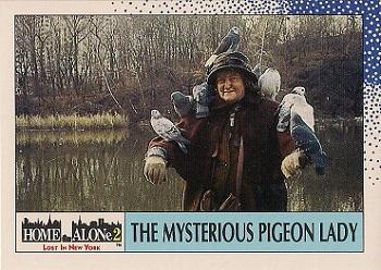
In the other direction, there’s a path leading down to some parkland. Sunbathers rest on grassy hills, and I can see dog and their owners meandering below. Getting close to Akerselva, I note how shallow it is. I think fair to suggest that this is the end-product of vigorous industrialization. This is Oslo’s Don River – the heart of early industry in the city. Like the Don, it has taken a beating over the years, and only recently has there been real attention put toward its value. This article by the City of Oslo tells me of the rejuvenation of the Akers. After years of pollution, a beautifying initiative has sprung up to make the river and the surrounding infrastructure a gorgeous hub for new ecosystems and human activity. Further up I can see a group of people standing in the middle of the ankle-deep waters. It reminds me of parts of the Mimico Creek in Etobicoke. I pass a bridge and a man convening with some pigeons (not quite at a Home Alone II level, though).
Then, I gladly come across a complex of brick buildings, unmistakably industrial in design. The one nearest to me has what I interpret to be a historical plaque (the old years hint toward it). I think about getting a dog-walker to translate for me, but I settle for Google’s help after the fact.
Akers Mek. Workshop. Founded here in 1841. Delivered equipment and services to businesses along the Aker River. Moved in 1854 to the islet in the bay. Was the city’s biggest shipyard pioneer in oil industry. Closed in 1982
I pass another bridge – this one with charming love locks (not quite Paris worthy, though). Up the Akers is a waterfall, one of a few along the river’s course. I head back to the buildings and ascend the stairs. At the top, I find out their adapted purpose (a fine arts school campus) and then a little further down along the cobblestone path a clue on their historic use. Christiana Seildugsfabrik. Christiana was Oslo’s name between 1624 and 1924. Fabrik might refer to clothes. After some research, I’m partially right. Seildugsfabrik was a hefty operation which made textiles for ships. Our friend Thorvald Meyer even had a hand in it.
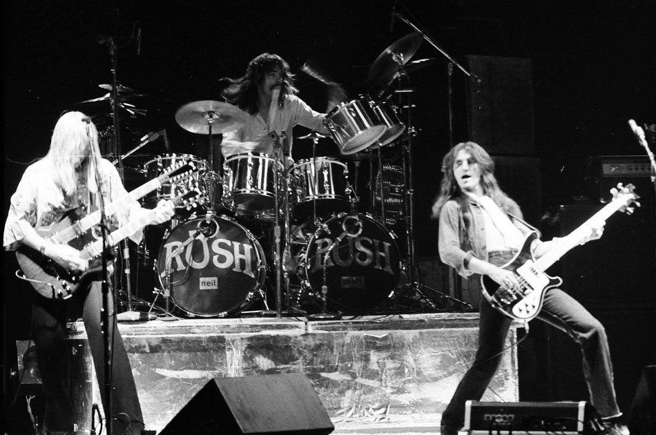
Known as Khio, for short
Is This It?
The collection of buildings under this former entreprise give it a Distillery District feel. Especially with the brick flooring between them.
I find my way to the road network at Seilduksgata. I arbitrarily turn north on the next street I come across (someone’s had fun with the street sign). Walking a bit, to my right I see the back of a church tower. To my left is a school, rich in great masonry and the use of arches.
Erm…
Heading up to and across Sannergata, there’s a different vibe to the district than what I experienced near Olaf Ryes plass. For one thing, the streets are for the most part barren. But the most striking characteristic is the prevailing graffiti. Grünerløkka might be a renewed working class district, but elements of its seedy past still linger on. It reminds me a bit of Toronto’s Leslieville, a neighbourhood in transition. Even with gentrification, hints of the days of yore remain. Travelling south on Toftes gate, a tattoo parlour and an animated mural.
Former factory(?) in the distance at Sannergata
Then I come to Birkelunden, the third park of the day. Grünerløkka is coloured with them. Birkelunden has its own tint. I enter from the side that houses the formidable looking Grünerløkka skole. My sights move across the park to get my second look at Paulus Kirke today, this time from the front. The creation and planning of public parks is a fascinating topic. It looks like Birkelunden was always intended to be a park from the start, but I wonder about the planning that goes into the surrounding environment. More specifically, I wonder if it was deliberate to pit a school and church across from each other with a park in the middle, but something about it works. There’s a religious institution, an educational institution, and then this public forum at the centre.
Then, I unexpectedly come across a market. This is the park’s Sunday bric-a-brac. I meander around the tables, looking for anything eye-catching and useless. I take the time to look for a wallet, but see nothing that suits me. I do come across CDs and used vinyl, though. I find a copy of Queen’s ‘A Day at the Races’. With my takeaway for the day, I exit via the familiar Seilduksgata. I take a moment to examine what looks like an upcoming development. Even the signs and gate are littered with spray paint.
Heading south, I come across Sofienbergparken – park #4 of the day. It’s the biggest of them all thus far. I spoke about the planning of parks earlier. Well, this one has an interesting story – turns out it was once a cemetery. Following a cholera outbreak in the city in 1853, the block that contained Sofienberg, then outside Oslo’s borders, was chosen as a resting place for the victims. Over time it seems people opined it was a bad and unhygienic idea to have a cemetery in the middle of a growing, dense neighbourhood, so it was gradually made into a park.
There’s a Toronto connection, too! St. James Park was also once a graveyard. In 1844, the overcrowded cemetery was moved to its present location on Parliament Street. But before that, Toronto suffered cholera epidemics in 1832 and again in 1834. The story is a portion of St. James Cathedral still holds the unmarked graves of cholera victims. More than that, there was idea that a cemetery in the centre of town (metres away from the financial core no less) was not the best scenario.
Grünerløkka, 1917. Source: Wikimedia
Oblivious to this bit of hidden history, I join the masses in reading and relaxing on the grass. I pull out some Toronto fiction, the classic In The Skin of a Lion, which I keep with me to remind me of home, and then I move on.
I admittedly get lost after this. I’m trying to find my way back to Olaf Ryes plass. Just when I think I’ve found it, I realise it’s not the right place. This is Schous Plass and, in addition to being park #5, has a nice old library. I have to consult a map, which shamefully tells me I’m actually not to far from where I need to go.
A short walk up Thorvald Meyers and I find the park! Before jumping on the tram, I make the executive decision to grab some lunch. I pass by a number of establishments including a famed watering hole in the area, Grünerløkka Brygghus (Brewhouse), and Valouria Vintage (because vintage shops are a must in hipster neighbourhoods – just as Queen Street West) before settling on a sandwich from Something Hotel. It’s an investment I immediately regret for its taste and price point, but it’ll have to do. I eat while I wait for the tram that got me here. I have just as many minutes wait as the number trikk I need. When it does come, it swoops me back to Majorstuen.
This marked the end of my venture on this particular day, but I would return with company to Grünerløkka two more times in the coming days. We would head to the western part of the district on the other side of the Akers. Here one finds the grand Mathallen Food Hall (which was sadly closed when we tried to go) and little alleyways that lead to riverside entreprises. Ingens Gate (which comically translates to Nobody’s Street) in particular is a fun little nook with entertaining street art.
On another occasion, we fuel up at the two microbreweries: the already mentioned Brygghus, and at Schouskjelleren Mikrobryggeria, which is just south of Schous plass. It’s a dimly lit basement bar (really, ‘kjelleren’ means ‘basement’). No music, no trinkets on the wall, no nothing. There is a a sweet fireplace, though! And it’s fittingly located on the grounds of the former Schous Bryggeri (brewery). Christian Schou, a brewer, is another name synonymous with the local history of Grünerløkka that lives on in the neighbourhood.
Actually, the growth of amazing drinking establishments that has (in part) made Grünerløkka the “to go and be” district in Oslo might be attributed to the growth of the craft beer industry in Norway. The beer industry as a whole has been re-animated because of microbrews. It’s interesting because there have been breweries in Oslo for a long time (look at the above 1917 map and look for anything with Bryggeri in the title – I can count 3 of them), but the industry went stagnant. With Oslo and Norway playing catchup, the bar scene in the city – something that Toronto has been doing very well at in recent years – is better than ever.
I’d say that’s a good reason to say “Skål” to Grünerløkka.
Have I just had more of an eye for it or has there been quite a string of places announcing their closures lately? Chapters Runnymede (which actually did close recently), The Annex Book City (done in the spring), and The World’s Biggest Bookstore (over on March 23)…coincidentally all book shops, all neighbourhood landmarks, all ending.
Sunday evening, I made unintended stop at another place that is part of that list: the Eaton Centre Sears. I knew about its closing since the announcement, but was not yet able to get down there before it closed up shop for good. Fortuitously finding myself on Yonge Street, I decided to go for it. I didn’t plan on it happening in such a fashion, but I was also there during its final minutes open to public.
And I admit: even though my personal attachment to that store was not that strong, being there really got to me.
Whether we choose to make a big deal out of it, the closing of Sears does mark the end of a retail era and dynasty in Toronto and a change in the city’s retail landscape – just like the end of Eaton’s before it and the beginning of Nordstrom’s after it. Yes, I realize Sears is not Eaton’s and does not begin to match its iconic status. Regardless of the sad mismanagement that led to its demise, Eaton’s holds an undeniable place within the city’s (and country’s) commercial and retail heritage. Can we claim the same for Sears? Definitely not. But it is still worthy of recognition.
As I walk through the barren space, I am reminded of the Bridlewood Mall Dead Zellers I passed by a few months ago. So empty. The pillars without anything between them is – as odd a choice a word it may be – very unsettling.
The ‘Everything Must Go’ signs throughout the Sears mean, well, everything – even all the makeup fixtures – must go. I get shivers thinking about the retail ghosts on each level, between each column. I think about the hordes of shoppers that have wandered its floors and traveled its escalators over the years.
But even more so, I consider the employees. Some of them currently work the counters for the very last time, ringing in the last few sales ever. I think about their stories as insiders. They knew the store better than anyone. If someone in 10 or 50 years were to ask ‘What was the Eaton Centre Sears like?’, they would be able to tell us. What would they be able to tell us?
And then I think about them, as the store’s final occupants, having to see and experience its operations wind down. What are they feeling? This Toronto Star article highlites some of it. Sadness, lament, nostalgia, surrealness, disbelief, uncertainty, perhaps new opportunity? I suspect any combination of these. Because I too feel it in my life.
I consider all this because I am currently experiencing it first hand at an east end factory that is in its last days as well. Like the Sears, it is the end of era – for manufacturing in Toronto, for the near century year old building, and in the individual lives of its workers.
As a soon to be former employee of Weston Foods, I have been thinking a lot lately about my tenure in the plant. A month ago, I cleaned out my locker. It was an odd experience to say the least. Having been there longer than I should have been, I was glad to close that chapter for good. But seeing the plant emptier and quieter than I had ever seen it and employee morale not overly high, it just felt weird and sad. I was and am very attached to that place and its people. The end was near and that got to me.
On that day, I reminisced with friends and coworkers about the great, stupid, funny times we shared together. We talked about the weird cast of characters that have come and gone over the years. We talked about all the changes in management, employees, jobs, machines etc we’ve seen. Like a considerable chunk of our time spent working, we just told stories. These personal anecdotes will live on with us as long we can recall them.
But I wonder about how others we see this plant after it is converted into a mixed use space – its legacy. Actually, I wonder more about if people will look at it. We, as insiders, are the caretakers of its stories, memories, and legacy.
I often look at the nearby converted factories on Carlaw Avenue and think about what they were like once upon a time: who worked there, what was a work day like, how did that change over time etc.. I wonder if people in the future will think in the same way about our factory on Eastern. They will have the (modified) physical structure still to consider, but what of the things they can’t get from gazing at the brick facade – the intangibles inside its walls? We, as workers, know those intangibles. We can tell stories about mechanization, race, sexual orientation, immigration, gender, management-worker relations, unionism – all as they played out in this 20th century manufacturing plant. As a student and follower of local history and Toronto’s industrial legacy, these inside stories become extremely fascinating to me.
Back at Sears, I hear a three minute warning for shoppers. I wonder if it was a hard announcement to make. The giant doors have been closed save for one. I, along with the last few shoppers, pass through it, wondering about the next chapter in the building’s life.


![Aerial view of Bathurst Street and Lakeshore Road. - [after 1929]](https://i0.wp.com/scenesto.com/wp-content/uploads/2015/10/bathurstlakeshoreafter1929.jpg?ssl=1)


