“Old” Streets of Toronto

Across the map of Toronto, there are several “Old” versions of major streets: Old Yonge Street, Old Leslie Street, et cetera. These are smaller and certainly older streets that predate yet still exist alongside their longer, newer counterparts.

How old are these “old” streets anyways? Why were they built as they were in the first place? Why were they replaced?

Tremaine’s Map showing old courses of Toronto’s streets.
Source: Old Toronto Maps

Here are five examples of “Old” Toronto Streets and their histories:


1. Old Yonge Street

Year rerouted: 1835

When Yonge Street was laid out in the 1790s, it was not the continuous straight path we think of today. The sheer length of the street almost welcomed obstacles. At York Mills, the challenging topography around the West Don River caused it to divert east just south of York Mills Road. It curved north and back west to join the original course. In 1835, the street was realigned and straightened. It seems in the 1920s, Yonge Street was re-routed again slightly to the west to allow for better automobile navigation.

1851 JO Browne Map of the Township of York.
Source: Old Toronto Maps
1950 Aerial showing Old Yonge Street and “new” Yonge Street.
Source: City of Toronto Archives.
“Yonge Street, at York Mills, Again Takes Altered Course” The Globe, February 26, 1921.
Source: Globe & Mail Archives.

Today, the old, “orphaned” course remains as part of Mill Street and Old Yonge Street. Old Yonge’s narrow, curvy course in parts maintains a rural quality. While at one time Yonge and Old Yonge once connected at its north end, this connection is now a roundabout. Finally, because of its length in the province, there are other Old Yonge Streets in Thornhill and Aurora.

Old Yonge Street, 2021
Source: Google Maps
Yonge Street, 2021.
Source: Google Maps.
Source: Google Maps & Bob Georgiou


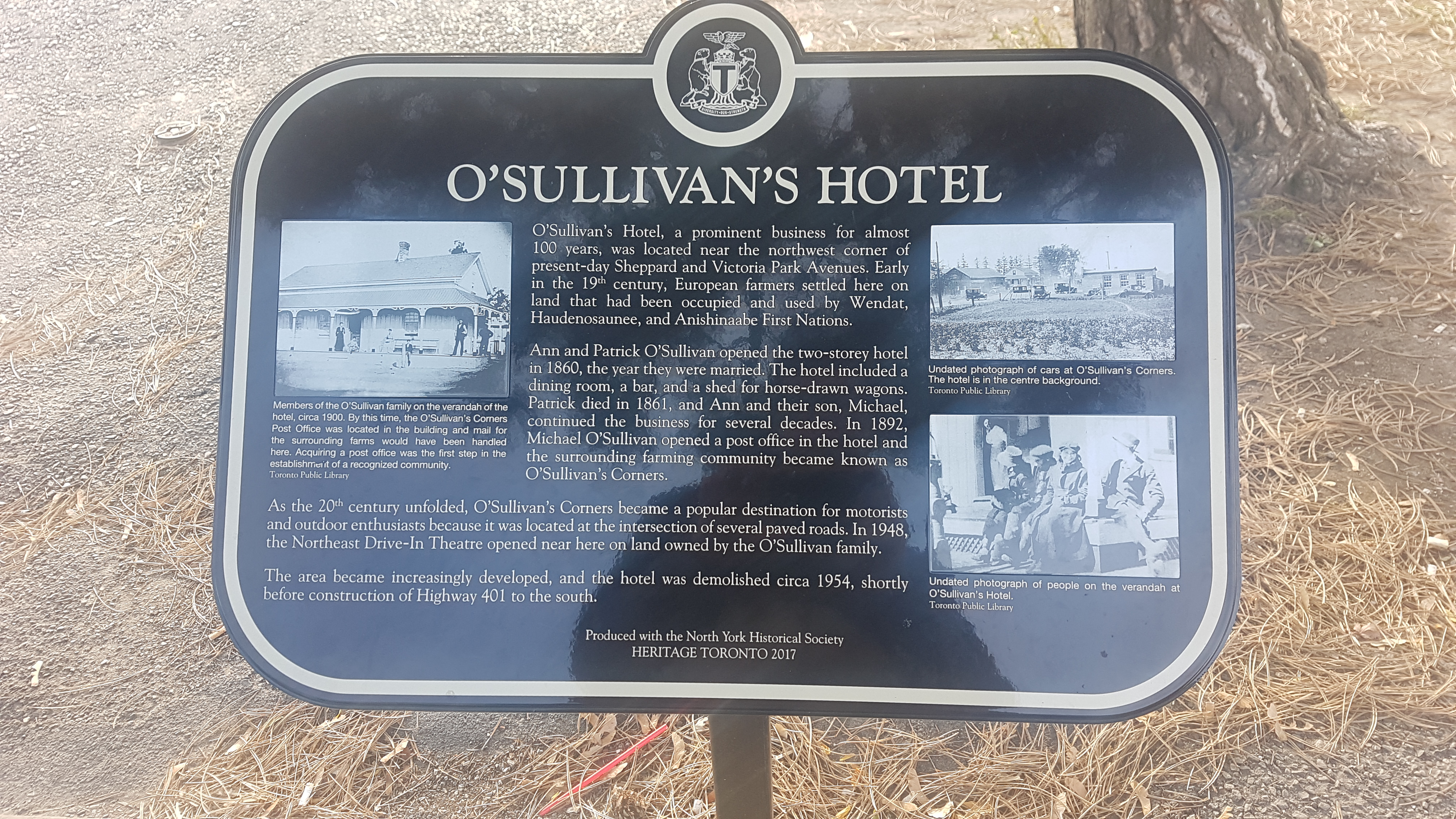
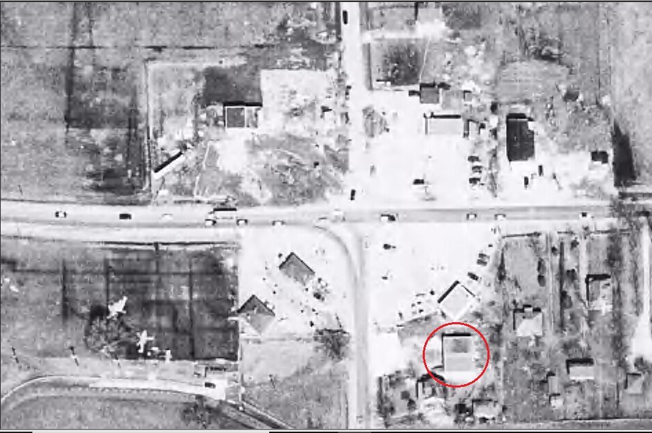
2. Old Sheppard Avenue

Year rerouted: ~1934

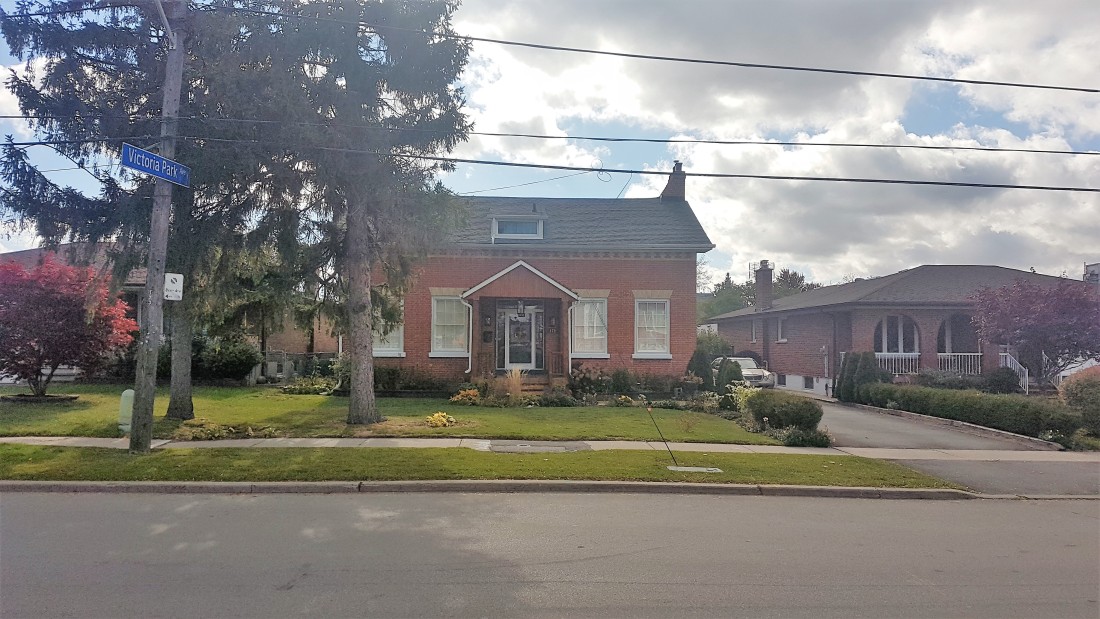
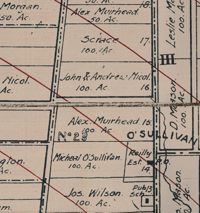
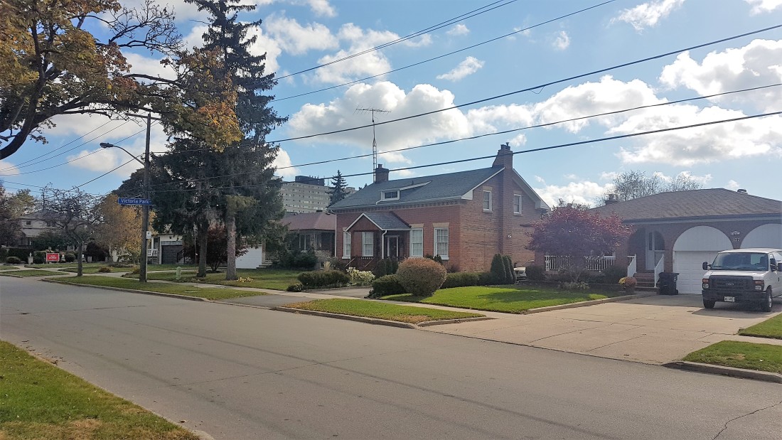
Sheppard Avenue once existed in two separate sections on either side of the Scarborough-North York border. A traveller wishing to travel east or west through the two streets had to jog about 300 metres on Victoria Park to reach the other section. In 1934, the two roads were joined through a curving road running from just past Woodbine Avenue to the lower street in Scarborough. The move was the idea of Ontario Premier George S. Henry whose estate stood where the new Sheppard Avenue connection ran.

1965 Aerial showing Old Sheppard Avenue and “new” Sheppard Avenue.
Source: City of Toronto Archives

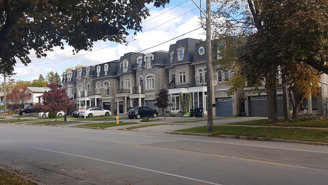
Today, the orphaned North York section of the old road now exists as residential Old Sheppard, albeit with small parts removed around Highway 404.

Old Sheppard Avenue, 2021
Source: Google Maps
Sheppard Avenue, 2021.
Source: Google Maps
Source: Google Maps & Bob Georgiou

More reading: Scenes From O’Sullivan’s Corners & Muirhead’s Corners


3. Old Lawrence Avenue

Year rerouted: ~1961

Lawrence Avenue is and was one of many streets which was impact by Toronto’s ravines. West of Victoria Park Avenue, Lawrence once took an interesting route across the East Don River Valley. Like Sheppard Avenue, there were two sections of the street: the Scarborough section which exists today and a North York section. The North York section jogged up Victoria Park over the Canadian Pacific Railway, ran briefly next to the track, and continued west for 1.5 kilometres. From here, it took a rather curvy route south down the East Don Valley, crossed the Don River via a bridge, and curved back north and west before continuing towards Don Mills Road. Presumably, this was easiest way in the 19th century to navigate the valley.

1860 Tremaine’s Map showing Old Lawrence Avenue
Source: Old Toronto Maps
Looking southwest at intersection of Victoria Park Avenue and Old Lawrence Avenue exit, 1958.
Source: Toronto Public Library
1959 Aerial showing Old Lawrence Avenue
Source: City of Toronto Archives
Lawrence Avenue E., bridge over East Don River, looking northwest,1955.
Source: Toronto Public Library

In 1961, Lawrence Avenue was straightened with a road directly connecting Victoria Park and Woodcliff Place, curling northwest from Scarborough with several new bridges to accommodate the Don River and CPR.

1960 Aerial showing Old Lawrence Avenue and “new” Lawrence Avenue under construction.
Source: City of Toronto Archives.
Lawrence Avenue East and CPR bridge under construction, circa 1960.
Source: City of Toronto Archives.

Today, the orphaned old road exists as roughly as part of Roanoke Road and, more famously, a short access road to the East Don Trail named Old Lawrence. The remaining section west of the river along with the old bridge itself have been lost.

Old Lawrence Avenue, 2021
Source: Google Maps
Lawrence Avenue, 2021
Source: Google Maps
Source: Google Maps & Bob Georgiou

More reading: Scenes From East Don Trail


4. Old Leslie Street

Year rerouted: ~1968

Like Lawrence Avenue, Leslie Street’s course at one time also had to divert around the East Don River. Also of 19th-century origin, a traveller going north on Leslie had to turn west for a short distance and then northwest for about 500 metres to meet with Sheppard Avenue. There was then a jog east on Sheppard, which included a bridge over the river and finally a left turn to travel north again.

1860 Tremaine’s Map showing Old Leslie Street.
Source: Old Toronto Maps
1953 Aerial showing course of Old Leslie Street.
Source: City of Toronto Archives
Sheppard Ave. East bridge near Leslie Street, 1964.
Source: City of Toronto Archives.

In the 1950s, with the construction of Highway 401, Leslie Street was altered to curve through the highway, but the course has otherwise remained the same. In 1968, the street was reconfigured again to join with Sheppard more directly. The Don River was also straightened and a new bridge was constructed which spanned the entirety of the new four-way intersection.

1967 Aerial of “new” Leslie Street under construction.
Source: City of Toronto Archives.

Today, the old course remains as Old Leslie Street, albeit a shorter version of the original route is available today to the public. It joins the new Leslie Street via Esther Shiner Drive. South of that street, there are City facilities. North of Esther Shiner, Old Leslie serves the Leslie Street TTC Station before it crosses over Sheppard via an overpass. It then curls back down to join the street (there is also a parking lot with an entrance to the East Don Parkland trail).

Old Leslie Street, 2021
Source: Google Maps
Leslie Street, 2020.
Source: Google Maps
Source: Google Maps & Bob Georgiou

More reading: Scenes From East Don Parkland


5. Cummer Avenue

Year rerouted: ~1969

The original course of Cummer Avenue west of Leslie Street was an 1819 construction. The street was laid out as a side road from Yonge Street by the Cummer family to access their holdings (a mill and camp) near the East Don River. When it approached the valley, it curved down to roughly follow the river’s course. It crossed the river via a bridge and eventually the railway tracks at a level crossing. Finally, it terminated at Leslie Street.

1860 Tremaine’s Map showing Old Cummer Avenue
Source: Old Toronto Maps
1968 Aerial showing course of Old Cummer Avenue.
Source: City of Toronto Archives

By 1969, the street was rerouted to curve north away from the river (which looks to have been straightened around this time as well). The street passed through a new wider bridge over the Don River and then under a railway overpass before eventually becoming McNiccol Avenue at Leslie Street.

1969 Aerial showing “new” Cummer Avenue under construction and Old Cummer Avenue.
Source: City of Toronto Archives

The old, orphaned course still exists in parts. The curved section lives on as part of the East Don Parkland trail, although not all of it follows the old path. The old bridge is in situ as well. The trail travels east through the hydro corridor where it terminates at the railway tracks. On the other side, Old Cummer Go Station and a hundred-metre long Old Cummer Avenue hold the old name.

Old Cummer Avenue, 2020
Source: Google Maps
Cummer Avenue, 2020.
Source: Google Maps
Source: Google Maps & Bob Georgiou

More reading: Scenes From East Don Parkland

Click here for the map below of “Old” Streets.

Source: Google Maps & Bob Georgiou

For more “Old” Streets, I created a sequel here.

Agincourt’s Brookside: From Farm to Subdivision

A curious item in the Toronto Public Library’s Digital Archive is an image of farm or ranch located in Agincourt. The picturesque scene is “Brookside”, the estate of the Pattersons, located on the northeast lot of the intersection of Kennedy Road and Sheppard Avenue. The evolution of this property is an interesting story.

Paterson, “Brookside”, Sheppard Ave. E., n.e. lot Kennedy Road, 1905. Credit: Toronto Public Library.

The Paterson family of Scarborough had three lots on the east side of Kennedy Road (lot 28) between Sheppard Avenue (Concession III) and Finch Avenue (Concession IV) in Agincourt, together totaling 200 acres. The middle Paterson lot was “Elmridge“, whose farmhouse still exists today.

Illustrated Atlas of York County, 1878. Credit: Historical Maps of Toronto.

The Globe, January 7, 1914. Credit: Globe and Mail Archives.

The 67-acre Brookside was the southern most of these lots running a third of the way to Finch Avenue and edging on the Canadian National Railway. It was opposite the future Tam O’Shanter Golf Club. The West Highland Creek ran through the property, likely giving the estate its name.

Map of the Townships, York, Scarboro, and Etobicoke, 1916. Credit: University of Toronto Map & Data Library.

The Globe, September 24, 1926. Credit: Globe and Mail Archives.

Brookside existed in a rural setting for much of its life, until the second half of the 20th century. By 1950, streets and houses popped up to the east, north, and south of the farm buildings, likely as parts of the Paterson lot was partitioned.

Aerial photo, 1950. Credit: City of Toronto Archives.

Aerial photo, 1953. Credit: City of Toronto Archives.

By the mid-1950s, the streets took their shape and names. Running north to south was Patterson Avenue to honour the family whose farm it was built upon. Running east to west was Station Rd (leading to the CN Station, now a GO Transit Station), Marilyn Avenue, and a tiny Reidmount Avenue. The woodlot behind the farmhouse also seemed to have been cleared.

Map of Metropolitan Toronto, 1955. Credit: University of Toronto Map & Data Library.

Aerial photo, 1956. Credit: City of Toronto Archives.

By the end of the decade, changes were afoot. Patterson Avenue was renamed to an extended Reidmount Avenue and Station Road became Dowry Avenue. (As an aside, on the other side of railroad tracks, First Avenue became Agincourt Drive in 1957. The changes likely resulted from the reworking of the road network following the creation of Metropolitan Toronto.)

The image below is a Planning Map from the 1959 Official Plan of Toronto. The Brookside Farm is labelled as “R.E.” potentially meaning “Residential Estate” or “Rural Estate” or even “Residential Expansion”, which in any case references a larger lot. “R” is “residential” and “C” is “commercial”. The corresponding aerial image provides a visual of the lot division.

Scarborough: streets and names, 1959. Credit: York University Map Library.

Aerial photo, 1959. Credit: City of Toronto Archives.

By 1969, the Paterson farm buildings have completely disappeared. Moreover, the West Highland Creek was channelized and widened along with a new bridge running over Kennedy Road.

Aerial photo, 1969. Credit: City of Toronto Archives.

West Highland Creek looking southeast towards Cardwell Avenue.

By the middle of the 1980s, the area around Kennedy and Sheppard was increasingly built up. A new street named Cardwell Avenue now connected Kennedy and Dowry Street. On either side of Cardwell was a new subdivision of houses.

Aerial photo, 1985. Credit: City of Toronto Archives.

Cardwell Avenue east of Kennedy Road

Today, this group of homes are part of the modern geography of Agincourt. If one looks closer though, the shape of the overall subdivision corresponds to the Patersons’ farm Brookside that was once there.

Google Maps, 2021

Scenes From O’Sullivan’s Corners & Muirhead’s Corners

When does a place stop being a place? On the border of North York and Scarborough, there are two Sheppard Avenues. Old Sheppard Avenue runs east to west from Victoria Park Avenue to just shy of Highway 404. Sheppard Avenue East curves just south of the old street across the border of the two former municipalities.

These two streets — and triangular plot in between — hold quite the history and evolution of two lost junctions: O’Sullivan’s Corners and Muirhead’s Corners. Here is a brief account of their story.

Source: Google Maps.

On Old Sheppard Avenue, there is a house unlike the others around it. Now situated in the middle of a modern subdivision, it was the farmhouse of the Alex Muirhead and his family.

The Muirheads settled the 100-acre plot of land known as Concession IV Lot 15 in York Township in 1853. Alex Muirhead would build his farmhouse in the Ontario Vernacular style in that same year, situating it on the south side of what is now Old Sheppard Avenue. The Muirhead name was prominent in the area — so much so that the odd junction on the northwest corner of the lot was known as Muirhead’s Corners in the early 20th century.

Concession IV Lot 15 from 1860 Tremaine’s Map of the County of York, Canada West. Source: Historical Maps of Toronto.

In 1860, Patrick O’Sullivan and Ann O’Reilly opened the O’Sullivan Hotel on the eastern part of Lot 14, directly south of the Muirhead property. The hotel featured ‘two bedrooms, dining room, and a bar’. The structure was situated on the west side of the York-Scarborough line across the Third concession on the Reilly farm.

O’Sullivan’s Hotel (centre background), circa 1920s. Source: Toronto Public Library & North York Historical Society.

1878 Illustrated Historical Atlas of the County of York. Source: Historical Maps of Toronto.

The area grew from here. In 1873, part of the O’Reilly land was used to house a one-room public school. The school — named School Section #23, later Victoria Park School –roughly served the west side of townline from today’s Lawrence Avenue to Finch Avenue. In 1893, a Post Office opened at the O’Sullivan Hotel, cementing the area as a community with the moniker O’Sullivan’s Corners. The area, sometimes shortened to just O’Sullivan, rose to local landmark status in the early 20th century.

O’Sullivan and SS #3 from the Map of the Townships, York, Scarboro, and Etobicoke, 1916. Source: University of Toronto Map and Data Library.

School Section 23 (1873-1964), Toronto, Ont., 1956. Source: Toronto Public Library.

The rise of automobiles and highways in the early 20th century aided in the growth of O’Sullivan. Beginning in the 1910s, significant changes took place along the roadways of northern Scarborough and North York. Motorized vehicles were on the increase and, with them, convenient and leisurely long-distance travel through the suburbs of Toronto. One can imagine couples and families venturing through O’Sullivan’s Corners and stopping for a Sunday lunch.

Toronto Daily Star, September 11, 1925. Don Mills Road jogged east at York Mills Road and then north to what later be Woodbine Avenue. Source: Toronto Public Library.

The main east-west street through these parts was Lansing Sideroad (sometimes named Lansing Cut-Off), which — next to Kingston Road — was the main way from the centre of Toronto to Pickering and Oshawa. Named after the community it originated in, Lansing Sideroad extended east from Yonge Street, passing the community of Oriole at Leslie Street and Muirhead’s Corners at Don Mills Road (later Woodbine Avenue).It stitched together east-west routes connecting the Concession roads of North York: Bayview (2), Leslie (3), and Woodbine (4).

In the 1920s, newspapers presented weekend road trips through the areas around Toronto. Toronto Daily Star, September 9, 1927. Source: Toronto Public Library.

Lansing then jogged south at the townline near O’Sullivan before continuing into the Scarborough through Agincourt and Malvern following the old Third Concession Road. In 1911, Lansing Sideroad was paved to allow better navigation. It is unclear when it was named Lansing Road, but there is an early mention of improvements to the road in 1903.

The Globe, June 2, 1903. Source: Toronto Public Library

As the 1920s rolled into the 1930s, more upgrades were made to Lansing Sideroad. The Department of Public Highways of Ontario, created in 1916, sought to include the road in a larger highway network to improve motor vehicle travel. And so, on August 25, 1931, Premier George S. Henry inaugurated a new motorway between Lansing and Malvern on the street.

Toronto Daily Star June 21, 1929. Source: Toronto Public Library.

Toronto Daily Star, August 25, 1931. Source: Toronto Public Library.

In another huge development, the two sections of the Lansing Sideroad in Scarborough and North York were aligned in 1934. The new curved section of roadway donated and purchased from several landowners in the area and eliminated multiple jogs between O’Sullivan’s Corners at Dawes Road and Muirhead’s Corners at Don Mills Road. Travellers now could travel more seamlessly between townships.

Toronto Daily Star, June 15, 1934. Source: Toronto Public Library.

Aerial photo of Muihead’s Corners, O’Sullivan, and the Lansing Sideroad, 1954. Source: University of Toronto Map and Data Library.

Along with the O’Sullivan Hotel, there were service centres, gas stations, and some shops to serve the local and commuting populations of O’Sullivan and Muirhead’s Corners in the early 20th century. The North-East Drive-In Theatre also opened between the communities on Lansing Road in 1947, further building on the virtues of car travel.

Looking south on Victoria Park Avenue from north of Sheppard Avenue East, Toronto, Ont, 1958. Source: Toronto Public Library.

Woodbine Avenue looking west at Sheppard Avenue, 1965. Source: City of Toronto Archives.

Toronto Daily Star, September 23, 1947. The North-East Drive-In showed its final film in 1976 as the Consumers Business Park overtook the area. Source: Toronto Public Library.

The second half of the 20th century proved to be a transitional period for the area and the beginning of the end many things recognizable at O’Sullivan’s Corners. For a start, the road network was significantly altered — even more than before. Perhaps as a result of the new Metropolitan Toronto’s efforts to harmonize transportation in the city, Dawes Road and Lansing Sideroad both were renamed to Victoria Park Avenue and Sheppard Avenue East in the 1950s.

Victoria Park Avenue, Sheppard Avenue East, Lansing Road from 1955 Metropolitan Toronto Map. Lansing Side Road seems to have renamed in Scarborough even as the North York section became Sheppard Avenue. Both would be under the Sheppard name in the 1960s. Source: University of Toronto Map and Data Library.

The four-laned Toronto By-Pass — now Highway 401 — opened as the new east-west alternative to Kingston Road and Lansing Road in and out of the Toronto area in 1957. It included an exit at Victoria Park Avenue.

Toronto Bypass, 1956. Source: City of Toronto Archives.

And in a final update to motorways, Highway 404 replaced Woodbine Avenue north of Highway 401 by 1967. The move spelt the end of Muirhead’s Corners, as the junction was physically eliminated to make way for the highway. It also meant Old Sheppard was now cut off at its west end, now looping into a new Muirhead Road (near a school also named for the pioneer of the street).

Aerial of the Don Valley Parkway and Highway 404 under construction in 1966. Consumers Business Park is also roughed in. Source: City of Toronto Archives.

It is hard to pinpoint when O’Sullivan’s Corners stopped being O’Sullivan’s Corners, but the 1950s and ’60s is certainly a start. After nearly a century in operation, O’Sullivan’s Hotel was closed in 1954. The reasons? Perhaps interest had faded from patrons and management. Or the costs were too high. Its replacement was a gas station — a use the corner continues today. To its south, SS #23 was also lost in 1964 to accommodate more lanes for Highway 401. (Its belfry and bell was salvaged by Herbert and Rosa Clark and is now on display at the Guild Park in Scarborough along with our salvaged building fragments of the post-war era)

By at least 1950, the Muirhead farm was also divided up to host a new residential community. Brian Drive (originally Sandra Boulevard) and Patrick Boulevard both hosted houses with large lots. The old Muirhead farmhouse also received new neighbours on its street. Curiously though, Old Sheppard is unnamed in maps from the 1950s. (Perhaps the moniker came into existence when it was orphaned by the highway 404.)

Aerial of Old Sheppard, Brian Drive, Patrick Boulevard in 1953. Source: City of Toronto Archives.

In the early 1970s, brand new houses went in north of Patrick Boulevard and east of Brian Drive, replacing most of the housing stock from twenty years prior. The Muirhead farmhouse was already situated close to the street, so when the new houses went in beside it, it was relatively integrated into its surroundings.

Around the corner on Brian Drive, a line of more modern residences in the middle of the street curiously deviates from neighbouring housing styles. The story: When this area bought up and sold by redevelopers in the 1970s, it seems one property held out on selling. Its deep lot stretched to Wilkinson Drive, leaving the new streets in between incomplete. The holdout looks like it lasted about 30 years until around 2001 when four rows of infill development went in. With that, Doubletree and Wilkinson were finally connected.

Source: OldTO, 1992 vs 2020.

Source: Google Maps

Source: Toronto Star, April 14, 2001

On Patrick Boulevard, a house from the same era as the Brian Drive holdout residence remains. It never had to sell, though. This house is noticeable because, although it is neighbours with houses it predates, it is set back considerably from the street with a long driveway.

Source: Google Maps

On the west side of Brian Drive, apartment towers and townhouses went up steadily through the 1970s too. The ‘Crossroads’ buildings, in particular, are appropriately and geographically named.

Source: Globe and Mail, May 25, 1979

Victoria Park Square is the local mall for the area. It opened in 1972 on the former site of the O’Sullivan Hotel to serve the up-and-coming residences. It was known in those early days for hosting the first Horizon — Eaton’s chain of discount stores. A Heritage Toronto and North York Historical Society plaque today tells the story of O’Sullivan’s Hotel.

Source: Globe and Mail, August 17, 1972

In 1988, a second plaza was built at the corner of Brian Drive and Sheppard Avenue. Named ‘The Shoppes of Brian Village’, the plaza resembles a village centre. It was significant enough to warrant an Urban Design award from the city in 1988. The site also gives the area another name: Brian Village (or perhaps vice versa).

Source: Toronto Star, November 29, 1988


Today, this community is part of the modern Pleasantview census tract – a total area which reaches up to Finch Avenue East. It is a mix of mostly English and Mandarin speakers, with some Italian and Greek households.

The name is not in use anymore, but how much of O’Sullivan’s Corners is left? O’Sullivan School certainly lives at the Guild as a physical remnant. More than that, the busy nexus of Victoria Park and Sheppard — where the hotel once stood — may have a clue. Today, the intersection hosts a gas station, a breakfast spot, a pizza place, and a drugstore. Next to that drug store is the famed Johnny’s Hamburgers. The building housing Johnny’s is from about 1956. The burger joint got its start about ten years later by a Greek immigrant.

Victoria Park Avenue and Sheppard Avenue, shortly after the loss of O’Sullivan’s Hotel, 1956. Note the dual units. By 1970, it was just one unit: Johnny’s. Source: City of Toronto Archives.

Although it post-dates the era of the O’Sullivan Hotel, Johnny’s Hamburgers grew out of the car-centric circumstances that brought the area prominence. The simple, table-less interior also plays tribute to North-East Theatre as its one-time neighbour. Even if the place no longer exists, a visit to Johnny’s may a taste of the O’Sullivan community of old.

Scenes From Lansing & Willowdale

Outside of a McDonald’s and 7-Eleven at Yonge and Sheppard, there’s a blue plaque. The City of Toronto and TTC marker commemorates the 1860 Joseph Shepard/Dempsey Brothers Store which once stood at this site. The plaque tracks the building’s history as a nexus in the historic Lansing community – from the residence of the pioneering Shepard family (for which Sheppard Avenue is named) and post office which gave birth to Lansing to the long-standing hardware store of the Dempseys.

Joseph Shepard House plaque

The funny thing is the building still exists – just not here. The store was transplanted to Dempsey Park on Beecroft Road in 1996.

Yonge looking north at Sheppard 1911
Yonge Street looking north at Sheppard Avenue, 1911. Joseph Shepard House/Dempsey Brothers Store at left. Source: Toronto Public Library.

Nearby, the Joseph Shepard Government Building, built in 1977, also pays tribute to Mr. Shepard (albeit, sometimes  spelled with inexplicably added “P”).

Joseph Shepard Building
Despite running parallel to it only 300 metres to the east, Doris Avenue is noticeably more quiet than Yonge. It offers a great view of its tower-filled skyline.

Yonge Street Doris Avenue

Also on Doris: Willowdale Park. In addition to a large central space with tennis courts and playgrounds, a curving path continues north, crossing a few residential streets.

Willowdale Park

Willowdale Park 3              Willowdale Park 2

The linear park is a little peculiar to me – until I realize that the indent in the land and the sewer grates probably signify a buried waterway.

Willowdale Park Wilket Creek

Willowdale Park Wilket Creek 2

As it turns out, Wilket Creek flows under Willowdale! A section of the creek running northwest from York Mills and Bayview was buried and put into storm sewers in the early 1970s.

Lansing Willowdale 1916
Lansing & Willowdale from the Map of the Townships, York, Scarboro, and Etobicoke, 1916. Source: University of Toronto Map & Data Library.

Willowdale 1966
Lansing & Willowdale, 1966. Source: City of Toronto Archives.

Willowdale 2016
Lansing & Willowdale, 2016.

Another surprise in Willowdale Park: Lee Lifeson Art Park! The soon-to-be art and green space honours founding Rush members and Willowdale natives, Geddy Lee and Alex Lifeson. The park was conceived by the local city councillor and voted on in 2014. Construction began the following year. It – river and all – awaits opening some day.

Lee Lifeson Art Park 1

Lee Lifeson Art Park 2

Lee Lifeson Art Park 3

Across the street, Princess Park looks like a grand courtyard leading up to 1999’s Empress Walk mall and condos. It’s probably my own impression, but something about it seems a little too “planned”.

Princess Park
I suppose it functions well for a park, though: things to see, places to sit and linger. No skateboarding, however.

Princess Park 4

The focal point is a restored hose tower, part of North York’s First Fire Hall. A plaque dates it to 1941. It was moved here from Yonge & Empress.

Princess Park Hose Tower 1

North York's First Fire Hall plaque

A second plaque tells the story of North York’s First Municipal Building, completed in 1923 on the south east corner of Yonge and Empress. The building is largely  gone, but its facade was built into the mall’s eastern entrance.

North York's First Municipal Building plaque

There’s also a floor tile with what looks like a plow. An homage to Willowdale’s farms.

Princess Park 2

If one thing comes out of Princess Park, it’s that Yonge and Empress was a historic nexus. But you’d never know it. As is the case with Dempsey Store, it’s great that the fire hall and civic building still exist in some capacity, but the transplanting of the buildings and plaques away from Yonge Street literally pushes heritage to the side. Their context is diminished.

Yonge and Empress

North York Fire Hall 1957
North York Fire Hall, Yonge Street, 1957. Source: Toronto Public Library.

North York Municipal offices 1957
North York Municipal Offices, Yonge Street, 1957. Source: Toronto Public Library.

The intersection is surrounded on three sides by towers and the mall. On the remaining corner: a much more modest two-storey shop. A cornerstone dates it to 1929. Uptown Yonge has a few of these tiny older stores mixed in with the towers, but the street doesn’t have the character of downtown Yonge, whose history as a retail strip still prevails even among intensification.

North York Waterworks Yonge Street 1
The store, a beauty supply shop, was oddly enough the North York Waterworks. Again, you wouldn’t know it. A parking lot surrounds the building; one wonders how long it will last before another condo takes over the corner.

Waterworks Yonge and Empress
North York Waterworks, Yonge Street, 1957. Source: Toronto Public Library.

Finally, on Parkview  Avenue, there’s the John McKenzie House, a beautiful Queen Anne/Edwardian/Arts and Crafts farmhouse built in 1913. The McKenzies were pioneers in Willowdale who in 1884 purchased a portion of land from the Cummers, the original European settlers of Willowdale in 1797. The McKenzie farm came to amass some 140 acres from Yonge to Bayview.

Ontario Historical Society John McKenzie House

In 1993, the Ontario Historical Society took the house on as their new headquarters, saving it from demolition. Before moving in, the City of North York agreed to  fund the $600,000 restoration of the heritage house. In 2016, the John McKenzie House is getting a new roof.

Useful Links

Scenes From A City – “Scenes From North York Centre, Gibson House Museum, and Mel Lastman Square”

Scott Kennedy – Willowdale: Yesterday’s Farms, Today’s Legacy

Toronto Star – “John McKenzie House a part of North York history” by Shawn Micallef

Vanishing Point – “Wilket Creek Storm Trunk Sewer”