2022 marks ten years for Scenes From Toronto. This year, I committed to a goal of two articles a month when possible. Out of 24 possible articles in the month, I published 17. Although I did not match my goal, I am proud of that output.
2022 also followed the momentum of the previous year in creating original, research-based articles, drawing on primary and secondary sources, as well as the work of great historians and writers. I hope they have added to Toronto’s rich local heritage scene and telling the city’s lesser known (hi)stories.
The Stats
The Best of 2022
To mark the year, I have compiled my favourite ten articles.
1. “Old” Toronto Streets: An exploration of a peculiarity in Toronto’s geography and streets. This is a multi-parter.
6. The Rise of The Hill District, Toronto: The origin of one of Toronto’s exclusive neighbourhoods is an interesting tale of the who’s who in Toronto history and a period in which Old Toronto’s street grid began to fill up.
A&P is part of Toronto’s retail history, especially so because the franchise does not exist anymore in the city.
In the 1950s, the American-based company, formally called the Great Atlantic & Pacific Tea Co., opened several new super markets in Toronto’s outer communities. These stores and their eventful inaugurations offer a lens into not only the history of the brand, but also the emergence and evolution of Toronto’s inner suburbs.
5559 Dundas Street West, Etobicoke
Toronto Daily Star, July 5, 1952. Source: Toronto Star Archives
The A&P at 5559 Dundas Street West at Brown’s Line opened on July 8, 1952. As the advertisement notes, it opened at the junction of two highways: Five (Dundas) and Twenty-Seven (Brown’s Line). It also backed onto a Canadian Pacific rail line. At the time of its opening, the intersection was sparsely populated. The larger community at the western edge of the Toronto area was Eatonville, best known for being the farming property of its namesake family and department store barons, the Eatons.
1953 Aerial Image of 5559 Dundas Street West Source: City of Toronto Archives
Very much in line with other store inaugurations in the period, the A&P advertisement presented the event as a multi-day spectacle. It was broadcasted over radio, with American singer and radio personality Smilin’ Jack Smith hosting. The famed 48th Highlanders band also played. The opening day flyer touts the supermarket as a “Parking Heaven” with plenty free parking. A map also boasted that “all roads” led to the supermarket, noting all the local major roads and the connecting communities. Many cars and people are depicted, including a long line filing towards and into the large glass store entrance. Altogether, it is very optimistic, with new life and new development now existing outside Toronto’s historic busy core.
The Globe and Mail reported the new super market cost $1,000,000 and included a warehouse building and a rail siding. It wrote: “The huge one-story structure provides consumers with the ultimate in shopping conveniences and affords the company the latest facilities for the efficient distribution of groceries in Ontario.”
By the end of the decade, the area had transformed along with the new store. Brown’s Line and Highway 27 were absorbed by the new Highway 427. The new interchange with Dundas resembled a cloverleaf. This development may have inspired the naming of the adjacent Cloverdale Mall directly across from A&P in 1956, an open air shopping centre whose anchor was another super market, Dominion.
1965 Aerial Image of 5559 Dundas Street West Source: City of Toronto Archives
Since 1952, the Dundas Street A&P has undergone a few noted changes. First, it is now Food Basics, which was founded in 1995 as a discount super market subsidiary under the A&P brand. Second, the complex’s area expanded, including an office space. This office is the Metro Ontario Division headquarters. Metro, a Quebec super market chain, acquired A&P Canada in 2005. Interestingly, at the Cloverdale Mall across the street, Dominion was acquired by A&P in the 1980s; the store is now a Metro.
Food Basics, 5559 Dundas Street West, 2021. Source: Google Maps
2022 Aerial Image of 5559 Dundas Street West Source: Google Maps
25 Glen Watford Drive, Scarborough
Toronto Daily Star, March 20, 1957. Source: Toronto Star Archives
The A&P at 25 Glen Watford Drive at Sheppard Avenue opened on March 21, 1957. It served the historic village of Agincourt, a community with roots in the 19th century whose nexus was the crossroads of Church Street (Midland Avenue) and Lansing Road (Sheppard Avenue). First Street, depicted in the advertisement’s map, was part of an Edwardian residential subdivision. In the 1950s, the community opened its earliest post-war subdivision east of the Agincourt High School. In 1959, bus service ran from Kennedy Road to Sheppard Avenue, looping at Glen Watford, Rural Avenue, and Midland; it was one of the first to serve northern Scarborough.
Like the Dundas Street store, the store opening was a week-long affair. It featured giveaways to shoppers, and a radio broadcast, featuring Scarborough Board of Health Officer and Agincourt resident, C.D. Farquharson. Free parking and parcel pickups were emphasized. Nearly thirty stores in Toronto and area were listed, some with details such as having air conditioning.
1957 Aerial Image of 25 Glen Watford Drive and Sheppard Avenue East Source: City of Toronto Archives
The evolution of the area around 25 Glen Watford contains some interesting developments. By the 1960s, Lansing Road became Sheppard Avenue; and Church Street merged with Midland Avenue to the south. First Avenue also became Agincourt Avenue. In 1963, the CP crossing on Sheppard was replaced by a rail overpass; the tracks were temporarily rerouted north during construction. Sheppard Avenue was also widened and Glen Watford was rerouted to curve towards Sheppard.
1963 Aerial Image of 25 Glen Watford Drive and Sheppard Avenue East. Source: City of Toronto Archives
In the late 1970s, the Glen Watford A&P was torn down. In its place, a strip mall was erected. A larger building also went up to the south, taking up space formerly occupied by properties on the north side of Sheppard removed in the improvements along the street the decade prior. This latter building was a roller rink called Roller World.
1963 Aerial Image of 25 Glen Watford Drive and Sheppard Avenue East. Source: City of Toronto Archives
In the mid-1980s, the area experienced its greatest evolution. In 1984, Hong Kong born developers bought the roller rink and transformed it into the Dragon Centre, an indoor Chinese mall (the former rink became a circular walkway for shoppers). It was the first of its kind in Toronto and Canada. The development spurred a change in Agincourt and Scarborough’s demographics, bringing East Asian residents and businesses to the area, including the strip mall to the north which replaced the A&P and the Glen Watford Plaza across the street, today’s Dynasty Centre.
The Dragon Centre wasn’t without controversy in the early years, however. Residents complained about the planning of the mall, particularly the parking and gridlock. There were also racist, xenophobic sentiments. Still, the mall endured, becoming a fixture in Agincourt.
25 Glen Watford Drive, 2021. Source: Google Maps
Today, the East Asian nexus on Glen Watford is set to endure another change. A development proposal has two condominium buildings to be erected on the site. A project entitled “Dragon Centre Stories” exists to preserve the memory of the places set to be replaced.
2022 Aerial Image of 25 Glen Watford Drive and Sheppard Avenue East. Source: City of Toronto Archives
2939 Dufferin Street, North York
Toronto Daily Star, March 10, 1958. Source: Toronto Star Archives
The A&P at 2939 Dufferin Street south of Lawrence Avenue opened on March 11, 1958. After WWII, Dufferin north of Eglinton Avenue filled out as an arterial street with commercial and industrial uses, and its surrounding residential streets with bungalows, schools, and churches. The Dufferin Street A&P backed onto Barker Stream, a tributary of Castle Frank Brook.
1959 Aerial Image of 2939 Dufferin Street Source: City of Toronto Archives
Like the other A&P stores, the opening of the Dufferin store featured contests and giveaways, including “free Cokes for everyone!” It also praised its car-friendly qualities: a giant parking lot, parcel pickup, and “all roads in North West Toronto” led to it. This automobile haven was in the immediately geography too; directly next to the A&P was a drive-in ice cream spot, Tastee Freez. An archival image of the Dufferin A&P offers a comparison with the image in the 1958 ad; the stores are very similar with a noted difference being the positioning of the logo’d tower.
A&P Supermarket, 2939 Dufferin Street, 1950s or 60s. Source: City of Toronto Archives.
Tastee Freeze, 2957 Dufferin Street at Glenbrook Avenue, northeast corner, 1950s or 60s Source: City of Toronto Archives
Today, the A&P store is a Lady York Foods, an Italian grocery store. A Dairy Queen is now on the same lot as the former The Tastee Freez. The transformation to Lady York Foods is particularly intriguing because it represents the general shift in demographics in the Dufferin-Lawrence area: The community is largely Italian-speaking.
2939 Dufferin Street, 2021. Source: Google Maps
Aerial Image of 2939 Dufferin Street, 2022 Source: Google Maps
Do you remember these three A&P super markets or any other early A&P stores? Leave a comment below!
In January, I looked at the origins of “Old” Streets of Toronto — that is, main Toronto roads that have the moniker “old” preceding their names. In many cases, these stories involved the re-routing of streets to create a more direct path for travellers. In doing so, the old paths were sometimes not eliminated.
Tremaine’s Map showing old courses of Toronto’s streets. Source: Old Toronto Maps Created by: Bob Georgiou
Here are six (and a half) more “Old” Streets of Toronto and their quick histories:
Old Dundas Street
Year rerouted: ~1929
Historically, the main crossing over the Humber River on Dundas Street was located about two hundred metres south of the current bridge. This section of Dundas made up the old community of Lambton Mills and served as a main entrance into Toronto from the west on the Dundas highway. There were several versions of Dundas Street bridges here over the years — some made of wood, some iron, but all narrow for traffic and susceptible to the flooding waters of the Humber.
1924 Goads Fire Insurance Map of old course of Dundas Street. Source: Goad’s Toronto
In 1929, a new high-level bridge was completed over the Humber. This altered the main course of Dundas Street to the north. The old course became “Old Dundas Street”. For nearly thirty years, the two Dundas Street bridges existed alongside each other. In 1954, the devastating effects of Hurricane Hazel left the Old Dundas Street bridge in a dilapidated state; it was finally demolished several years later. Today, Old Dundas Street exists on both sides of the Humber River mostly as a quiet residential street. Lambton House, a historic inn turned museum, is a leftover of Old Dundas Street and Lambton Mills’ prominence.
“A New High-Level Bridge”, The Globe, January 16, 1929. Source: Globe and Mail Archives.1950 Aerial Image of Dundas Street and Old Dundas Street. Source: City of Toronto ArchivesOld Dundas Street, 2021. Source: Google Maps
Old Weston Road
Year rerouted: ~1948
Weston Road takes an interesting route through northwest Toronto, running diagonally through its street grid from the historic town of Weston (makes sense, eh?) and creating some unconventional intersections. North of St. Clair Avenue, the route of Weston Road was historically located east of the present road on the other side of the train tracks. It made up the historic village of Carlton with St. Clair and Weston as its nexus. It is highlighted by the still standing, yet altered Heydon House Hotel, built 1890. Weston then ran south to join with Dundas Street.
1851 JO Browne Map of Toronto showing Weston Road and the village of Carlton. Source: Old Toronto Map1927 Heydon House. Source: City of Toronto Archives
Around the 1890s, another “branch” of the street was built north from Keele Street running parallel to the railway on its west side. This street took on the name “Weston Road South”. In the 1910s, the street was completed to join with the main Weston Road.
1908 Map of Toronto showing Weston Road. Source: Old Toronto Maps1909 Map of Toronto showing Weston Road. Source: McMaster University1910 Old Weston Road bridge over C.P.R. Source: City of Toronto Archives
Perhaps because Weston Road South offered a more direct route south into the city, it formally became the more prominent road in the 1940s. First, an “Old Weston Road” began to refer to the section of Weston Road between the railway and Hillary Avenue. This meant that at one time a person could stand at the intersection of Weston Road, Old Weston Road, and Weston Road South. In 1948, Weston Road South became just Weston Road. Also, the entirety of the older eastern section of Weston Road was renamed Old Weston Road, save for the section between the tracks and Hillary which was added to Rogers Road. As the tracks to the south grew, the section of Old Weston near Dundas became severed from the rest of the road. Today, Old Weston Road is a mostly residential street.
1945 Map of Toronto showing Weston Road. Source: Old Toronto Maps1948 Toronto Transit Commission Map showing Weston Road. Source: University of Toronto Map & Data Library.1951 Map of Toronto showing Weston Road. Source: University of Toronto Map & Data Library.
Old Eglinton Avenue
Year rerouted: ~1957
For an east-west street that has become so vital to Toronto’s street grid and home to many neighbourhoods, it is difficult to imagine that Eglinton Avenue did not always exist in one harmonious stretch of road. However, it took some doing to make it into the street of today. Until the 1950s in the eastern half of Toronto, Eglinton Avenue terminated near Brentcliffe Road in Leaside and did not resume again until Victoria Park Avenue in Scarborough. The area in between them was about a five-kilometre stretch of farmland and two ravines — that is, both the east and west branches of the Don River. In the mid-1950s, a massive project was undertaken to join the two sections.
1950 Aerial Image of the future location of the Eglinton Avenue East extension. Source: City of Toronto Archives1953 Map of Metropolitan Toronto. Source: York University Archives 1954 Aerial Image of the future location of the Eglinton Avenue East extension. Source: University of Toronto Map and Data Library
While an “Old Eglinton Avenue” seems to come out of the events of the 1950s, it seems a little unclear why. The street runs parallel to the “new” road for about half a kilometre west from Bermondsey Road. Like the surrounding area, it mostly houses industrial buildings. As Eglinton did not seem to exist between Leaside and Scarborough (at least not in any formal sense), the story of Old Eglinton is a bit of a mystery. Hiking The GTA has located an old roadbed for an “Old Eglinton Road“. This may have been a farm road or a line that divided farm lots. It is also notable how Old Eglinton Avenue aligns with a “pencilled in” Eglinton Avenue between Victoria Park and Leaside, so a theory may lay in that idea.
Extension of Eglinton Avenue east across the West Don River, 1955. Source: City of Toronto ArchivesOld Eglinton Avenue, 2020. Source: Google Maps
Old York Mills Road
Year rerouted: ~1972
The valley near Hogg’s Hollow has proven to be an obstacle to road transportation several times in its history. As I previously noted, Yonge Street was realigned in 1835 after skirting east to better tackle the West Don ravine’s topography. Because of this same geography, Wilson Avenue terminated at Mason Boulevard, meaning there was no direct east-west crossing at Yonge Street as we know it today. In 1972, a project was undertaken to extend Wilson to meet with Yonge and York Mills Road.
1971 Aerial Image of York Mills Road and Wilson Avenue. Source: City of Toronto Archives“Extension of Wilson Avenue”, Toronto Star, May 28, 1972. Source: Toronto Star Archives
To make this extension happen, a curved road was constructed from Wilson Avenue which then crossed Yonge Street and joined York Mills Road between Campbell Crescent and York Ridge Road. This meant the straight section of York Mills near Yonge Street was effectively separated from the main route, becoming “Old York Mills Road”. Today, Old York Mills houses a trailhead, a passenger pickup zone for York Mills Station, a condominium, and a church.
Old York Mills Road and Wilson Avenue Extension, 1973. Source: City of Toronto Archives.
Old Kennedy Road
Year rerouted: ~1987
Kennedy Road just north of Toronto is a prime example of how of a noticeable curve in a street sometimes denotes a street was re-engineered. Kennedy existed in two separate sections north and south of Steeles Avenue, the Scarborough-Markham town line. The roads were about six hundred metres apart, meaning a northbound traveller from Scarborough had to jog east and then north again to continue into Markham. The area as a whole is and was known as Milliken, a historic community with the uncommon characteristic of existing within both municipalities.
1954 Aerial Image of Kennedy Road. Source: University of Toronto Map & Data Library
In 1987, the two sections of Kennedy Road were connected by a curving road running north from Steeles which veered east to meet the Markham section of Kennedy just north of the newly created Denison Street. The circumstances behind the re-alignment were unclear, but given Kennedy Road’s history as a ‘highway’ in Scarborough and the tendency in and around Toronto to harmonize streets within bordering jurisdictions, it is easily conceived why the jog was removed.
1987 Aerial Image of Kennedy Road. Source: City of Toronto Archives.
The eastern section of Kennedy became “orphaned” and was renamed Old Kennedy. Old Kennedy stops at Denison and continues on as Fresno Court, which in turn ends at a cul de sac. A fence separates it and Kennedy Road. Old Kennedy Road is an interesting mix of industrial and residential, with several older-looking houses near Steeles, perhaps lending back to the days when it was a hub in the village of Milliken.
Fresno Court, 2020. Source: Google Maps
Old Finch Avenue
Year rerouted: ~1993
Finch Avenue in Scarborough is relatively straight for much of its course from the North York town line to the Pickering town line — except in its most eastern part. Where Finch passed through Staines Road, the street at one time did a triangular job around the CPR tracks (the detour seems to have been created in the 20th century).
1916 Map of Townships, York, Scarboro, and Etobicoke. Source: University of Toronto Map & Data Library1954 Aerial Map Showing Finch Avenue. Source: Source: University of Toronto Map & Data Library
Further along, Finch did another jog up Sewell’s Road before meandering across the Rouge River and around its valley. It continued straight toward Kirkham’s Road (today’s Meadowvale Road). As there is today, there was an uncleared section of land across to Beare Road, thus one would have to jog up again to Plug Hat Road and back down to reach Finch again. The street resumed once more on its way to the Pickering Border. This stretch of Finch between Sewells and Kirkham’s made up the historic community of Hillside which had a church, school, and mill. The village made up much of the Rouge lands today from Sheppard Avenue/Twyn Rivers to Steeles Avenue.
1965 Aerial Image of Finch Avenue. Source: City of Toronto Archives.1969 City of Toronto Directory showing Finch Avenue. Source: Toronto Public Library
By the 1980s, changes came to Finch Avenue. Morningside Avenue curved from the south to meet Finch. Then, in or around 1993, the street was extended further north of Finch. This changed the alignment of the Finch/Staines intersection and effectively split Finch Avenue. Travellers moving east on Finch had to now follow the curving street north to Morningside Avenue and then curve back south via the same street. The east-west street on the other side was “Old Finch Avenue”, following the older, winding alignment. Because of this, the street bunks the trend of “old” streets which were leftover sections of the re-routed street; there is/was not ever a “newer” Finch Avenue that existed alongside the street. Old Finch terminates at Meadowvale Avenue; after Beare Road, it becomes Finch again and continues into Pickering for another eight kilometres.
“New Metropolitan Toronto Zoo Site”, Toronto Star, June 17, 1972. Source: Toronto Star Archives“Star Trek Run” Toronto Star, June 3, 1978. Source: Toronto Star Archives1983 Aerial Image of Finch Avenue. Source: City of Toronto Archives
Today, Old Finch is mostly known for its ‘haunted’ Bailey bridge and being the northern border of the Toronto Zoo, whose postal address is 361A Old Finch Avenue. The reconfiguration at Staines also facilitated the Morningside Heights neighbourhood.
“Grand Opening”, Globe and Mail, May 20, 1993. Source: City of Toronto Archives
2022 Finch Avenue. Source: Google Maps
The Older Finch Avenue
Year rerouted: 1977
Old Finch Avenue in the Rouge Valley was not the first Old Finch in the city. There was once a severed section of the street near Victoria Park in the old community of L’Amoreaux when the street was realigned directly across the Scarborough-North York border. This curved realignment eliminated a jog along the town line for east-west travellers. This Old Finch Avenue was closed in 1977; Pawnee Avenue roughly follows its old right of way.
1975 Aerial Image of Victoria Park and Finch Avenue Source: City of Toronto Archives
“Borough of North York Notice of Road Closing”, The Globe and Mail, September 9, 1977. Source: The Globe and Mail Archives
For a Google map of “Old” Toronto Streets, click here.
Map of “Old” Toronto Streets. Source: Google Maps Created by: Bob Georgiou
If you have any information to add or have any stories from any of these locations, leave a comment below or email bob@scenesto.com!
Toronto’s street grid is over 200 years old by colonial standards and even older with its Aboriginal trails. There have been additions and extensions, widenings and improvements. They have also been named to reflect the city’s past and present and it values (by those who do the naming, that is) – and to help the postal service.
The city is not a static object and neither are street names. Revisions and renamings have been an understated part of Toronto’s history. However, not all street renamings — proposed and actual — have gone over well. What is the mainly reason for this opposition? Simply put: History and Tradition. Whether successful or not, these episodes in Toronto’s history inform us how the city operated and why Toronto’s geography is as it is today.
Here are seven examples of controversial street name changes:
Old and New St. Patrick Street
In 1917, modern Dundas Street was created by amalgamating and connecting several smaller streets. One of these roads was St. Patrick Street, which ran between McCaul Street and Bathurst Street.
St. Patrick Street looking west to Spadina Avenue, circa 1911. Source: City of Toronto Archives 1913 Goad’s Fire Insurance Map. Source: Goad’s Toronto
One group opposed to changing St. Patrick to Dundas was the St. Patrick’s Old Boys’ Association, which attended the old St. Patrick’s School on William Street. The group deputed to City Council, but was unsuccessful. The story was not all bad as William Street was later renamed to St. Patrick Street to keep the tradition.
Dundas Street, looking east towards McCaul Street (home of St. Patrick’s Church with the new St. Patrick’s Street behind it), 2021. Source: Google Maps
Mimico Mixups
In 1929, a dispute over the renaming of 54 Mimico streets spanned several council meetings. At issue, Toronto’s postal service requested the changes after Mimico and Long Branch were placed in the Toronto postal region. The difficulty was the added municipalities added duplicate street names to the region and potential confusion for postal workers. An ex-mayor attended a September 1929 council meeting arguing why the inclusion of ‘Mimico’ in the mailing addresses would not be sufficient enough for postal workers. Matters got heated in an October meeting when Mimico Mayor and Liberal candidate W.A. Edwards accused Minister of Health and Conservative candidate Dr. Godfrey of “insincerity” when Dr. Godfrey opposed the name changes when the mayor rejected Dr. Godfrey’s wish to have Stanley Avenue changed to Godfrey Crescent.
1924 Goad’s Fire Insurance Map Source: Goad’s Toronto
It is unclear whether the by-law change went through, but in the October council meeting, it was moved and seconded that a second reading for the proposed by-law change be conducted. The Mimico street grid remains generally intact since the 1920s, albeit with notable changes: Church Street is now Royal York Road, Salisbury Avenue is now Park Lawn Road, Brant Street is now Dalesford Avenue, and Winslow Avenue is now Douglas Avenue.
Mimico, 2021. Source: Google Maps
Long Branch Street Changes & Disappearances
In 1952, a ratepayers association in Etobicoke protested the changing of part of Lake Promenade Road to Island Road in Long Branch. Lake Promenade existed in two sections on either side of the main branch of Etobicoke Creek, running all the way to Applewood Creek. To eliminate confusion for postal workers, it was proposed for the western section of Lake Promenade be added to Island Rd, which it already connected to.
1953 Aerial Image Source: City of Toronto Archives
Residents of Island Road did not like the idea as a recent storm severely damaged and condemned several homes on Lake Promenade and the association with that event to their properties was unwanted. The change ultimately took place by 1955, although it ultimately did not matter as the fallout of Hurricane Hazel caused the expropriation of homes on Island and Lake Promenade near Lake Ontario and Etobicoke Creek, as well as the complete removal of Lake Promenade west of Forty Second Street, James Street west of Forty Second Street, all of Forty Third Street, and Island Road parellel to the lake. Today, much of the area is parkland.
2022 Aerial Image. Source: Google Maps
The Pioneers of Scarborough
In 1957, Scarborough Council was tasked with submitting a list of alternate names for 210 streets duplicated elsewhere in the City. Metropolitan Toronto was standardizing operations and services across the city in the decade, including eliminating duplicates of street names.
1957 Map of Metropolitan Toronto Source: University of Toronto Map & Data Library
Confusion over postal delivery was again at issue, but names on the list included Brumwell St, Cornell Avenue, Harris Avenue, Kennedy Road, Little’s Road, Lennox Avenue, Muir Drive, and Paterson Avenue — streets named for Scarborough pioneers. Most streets seem to exist today, save for Lennox Avenue and Agincourt’s Paterson Avenue, which became Reidmount Avenue.
Kennedy Road, looking south to Reidmount Avenue (which amalgamated with the former Paterson Avenue), 2021. Source: Google Map
The Many Orioles
In 1958, duplication was at issue again in midtown Toronto with a proposal to rename the similarly named Oriole Crescent, Oriole Gardens, and Oriole Road. The names were to become Holmfield Crescent, Lower Canada Gardens, and Campus College Road, respectively.
1957 Map of Metropolitan Toronto. Source: University of Toronto Map & Data Library
Fifteen “angry” women of the three streets united to protest the move, even going as far as saying they’d be willing to go to jail for taking down the new signs if they ever went up. They cited the beauty, history, and fame of the “Oriole” name and the inconvenience it’d cause for people living on those streets to having to change addresses on documents. Ultimately, the names remained as they were and as they are today.
Looking east down Oriole Gardens at Oriole Road, 2021. Source: Google Maps.
A Mega-Maxome Avenue
In 1962, Willowdale residents protested the renaming and merger of Halstead and Maxome Avenue to Harkness Street. The three streets were disjointed and together would “form a mile long thoroughfare north of Finch Avenue.”
1955 Map of Metropolitan Toronto. Source: University of Toronto Map & Date Library
A resident of Maxome, representing 37 others on the street, argued the historical naming of the street, which was honouring a surveyor who laid out the original blocks of the area. Ultimately, the proposal did not go through. Curiously, Halstead and Harkness have disappeared from the map, having the name Maxome Avenue instead. Today, Maxome has a windy course, like it was strung together from a few different streets, creating a mega-street of sorts.
Maxome Avenue, 2021. Source: Google Maps.
North York Pioneers
In 1979, Scrace Hill Drive in North York was renamed to Skymark Drive, prompting the opposition of the Scrace family. The Scarces had historical roots in the Finch Avenue and Leslie Street area formerly known as L’Amoreaux, donating land for a church and cemetery, still standing today as Zion Church.
1916 Map of The Townships, York, Scarborough, and Etobicoke. Source: University of Toronto Map & Data Library
The family wrote North York Council a letter, outlining the connection and how several Scraces were even on North York Council. The street was renamed to Skymark after the development on the street, as the old street had a confusing spelling and was not easy to find. North York Controller Esther Shiner said the new name was “such a pretty name” and she would find something else to name after the Scraces. Of irony, Esther Shiner would later become the subject of a street herself.
Skymark Drive, 2021. The Skymark Towers are behind the shot. Zion Methodist Church is on the left. Source: Google Maps.
Sources Cited
“Citizens Protest Against Change In Street Name.” The Globe, 9 Oct. 1952, p. 12.
“’Godfrey Crescent’ Causes Verbal Tilt At Mimico Council.” The Globe, 15 Oct. 1929, p. 16.
“Keep Traditions: Opposes Renaming Traditions.” The Globe, 6 Mar. 1957, p. 4.
“Petty Politics Involved In Changing Street Names.” The Toronto Daily Star, 15 Oct. 1929, p. 5.
“Sees Lakeshore Trustees ‘Trying to Hoodwink Us’.” The Toronto Daily Star, 9 Oct. 1952, p. 26.
“St. Patrick Old Boys Form Strong Body.” The Globe, 7 Apr. 1917, p. 21.
“Street Name Change Bruises Family Pride.” The Globe and Mail, 10 Dec. 1979, p. 4.
“Street Name Change Fought By Residents.” The Globe, 8 Feb. 1962, p. 4.
“Would Go To Jail: 15 Angry Women Save Their Street Names.” The Globe, 5 June 1958, p. 23.
When one thinks of the history of Scarborough, the intersection of Midland Avenue and the 401 might not be the first thought. However, a site that once stood there for more the half the 20th century literally put the local community on the international scientific map. This was the Agincourt Magnetic Observatory.
Aerial image of the Agincourt Magnetic Observatory, 1957. Source: City of Toronto Archives
The story of the Agincourt Magnetic Observatory begins not in Scarborough, but on the grounds of King’s College in downtown Toronto in 1840. The school became the University of Toronto in 1850. Contrary to the dense district of today, the university was then sparsely populated – in other words, perfect conditions to minimize interference. The University granted 2.5 acres for a site that was located on the southwest side of today’s King’s College Circle.
“The Old Toronto Observatory” painted by William Armstrong, 1852. Source: University of Toronto Archives
Boulton Atlas, 1858. Source: Goad’s Toronto
The Globe described the laboratory:
“The first observatory was of logs, rough cast on the outside and plastered on the inside; it was completed during the summer of 1840 and observations were begun in September.”
The Globe, October 1, 1898
University of Toronto Campus Map, 1859. Source: University of Toronto Archives
The second observatory was built in the autumn of 1853, replacing the wooden observatory on the same site. It was built of stone and the nails and fastenings were of copper and zinc.
The Toronto Observatory as seen looking south from University College, 1857. Source: Toronto Public Library.
Dominion of Canada Observatory, 1880s. Source: University of Toronto Archives
In 1892, Toronto’s growing infrastructure began to spell the beginning of the end for the observatory. To be sure, as early as 1876, new structures on the university grounds began to impact the observatory, but it was nothing like the electric railway to come. Streetcars were electrified, first beginning with the Church Street line opened on August 17, 1892, and then the College Street line only steps from the building. Instead of recording magnetic changes, the observatory recorded the starting and stoppings of the trolleys. In 1896, Sir Frederick Stupart, the director at the observatory, took up the issue with the government. There would be no action until a report was received from a committee of meteorologists visiting from England that year. This report recommended the centre be moved far away — to Scarborough.
Goad’s Fire Insurance Map, 1889. Source: Goad’s Toronto.
The observatory was relocated just south of the Agincourt Village centre at the current intersection of Midland Avenue and Sheppard Avenue where a Presbyterian Church and nearby Canadian National and Canadian Pacific stations stood. It was perfect in that no electric railway lines existed – at least not in seven miles and there was little prospect of any lines for many years (the railway did not interfere either). The observatory stood in a 4-acre field at the north end of the southern half of lot 16 (Midland Avenue) and Concession II (Ellesmere Avenue), belonging to the Forfar family. It was constructed over the summer of 1898 and opened in September. The first observations were made on September 10 and by the end of the month, all instruments had been moved from Toronto to the new site.
Map of the Townships, York, Scarboro, and Etobicoke, 1916. Source: University of Toronto Map & Data Library
Aerial image of the Agincourt Magnetic Observatory, 1947. Source: City of Toronto Archives
This Observatory was described in The Globe:
“…[It] consists of two parts, a circular stone collar nineteen feet in diameter, the walls two feet in thickness, the floor concrete and the roof covered with felt and gravel, in which on stone piers sunk in concrete to a depth of six feet below the floor are place the self-recording photographic instruments, namely, the declinometer for recording changes in the direction of the magnetic needle and the bifilar and vertical force instrument, for registering respectively changes in the horizontal and vertical components of the earth’s magnetism: above ground and connected with the cellar by a flight of steps is an erection which divided into two portions, in the larger of which absolute magnetic determinations will be made, piers being provided on which to place the necessary instruments, and an adjustable opening on the roof for transit work – and the smaller, an office, which will be heated by a copper stove.”
The Globe, October 1, 1898
Meteorological buildings, Scarborough, 1917. Source: City of Toronto Archives
The Agincourt Magnetic Observatory, The Globe and Mail, November 26, 1952. Source: Globe and Mail Archives
Basement of Magnetic Building, Agincourt, early 20th Century. Source: City of Toronto Archives
The old Toronto Observatory continued to serve as the central office of the Dominion Meteorological Service. All photographic records from Agincourt were sent there for development. It also conducted astronomical studies. In 1908, the observatory was dismantled to accommodate an extension to King’s College Circle and possibly a new physics building. It was reconstructed brick by brick near Hart House, where it stands today as a students’ union. Some installations stand near its former location between Convocation Hall and the Sandford Fleming Building.
Convocation Hall – East side and Old Observatory, 1907. Source: University of Toronto Archives
Goad’s Fire Insurance Map, 1930. Source: University of Toronto Archives
Louis B. Stewart Observatory (UTSU), 12 Hart House Circle, 1980s or 1990s. Source: City of Toronto Archives
In 1899, severe earthquakes in Alaska were recorded at the Agincourt Magnetic Observatory. In 1903, the observatory recorded the largest magnetic storm on October 30 and 31, which Director Stupart “intimately” connected sunspots and magnetic disturbances on earth. The centre recorded more such magnetic storms attributed to sun sports on Aug 8, 1917. The Agincourt labs were useful in World War II against Germany for “calibration of master compasses and other apparatuses”.
The Toronto Daily Star, September 12, 1917 Source: Toronto Star Archives.
The Globe and Mail, November 26, 1952. Source: Globe and Mail Archives
The significance of the Agincourt Magnetic Observatory and its activities were very well documented and even world-renowned. In 1919, the Observatory was threatened by a proposed Toronto to Port Perry Hydro Radial, which had officials looking for a new site where electricity would not penetrate that observatory’s environment. It was of significant alarm as the Agincourt Magnetic Observatory was one of two of its kind in Canada and by far the more important of the pair. In 1957, a contagion of scientists from around the world visited Agincourt as a part of some sessions by the International Union of Geodesy and Geophysics held at the University of Toronto. They asserted that they knew Agincourt better than Toronto as the village appeared in “thousands of International Geophysical maps” around the world.
Despite its importance, city growth once again spelled the end for the site. Meeting a similar fate to the Toronto Observatory seventy years before, the Agincourt Magnetic Observatory closed in March 1969. In the 1950s, Highway 401 was constructed next to the laboratory. Farms adjacent to the observatory began to turn into housing. Factories were built on either side of the property in the 1960s. On July 1, 1968, a new observatory opened in Ottawa. By 1971, the Agincourt structures were gone completely. Today, government offices stand in its place, hiding the great landmark once housed there.
Aerial image of recently demolished Agincourt Magnetic Observatory, 1971. Source: City of Toronto Archives.
Site of Agincourt Magnetic Observatory, 2022. Source: Google Maps
Works Referenced
“Astronomical Conversation.” The Globe, 21 Jan. 1903, p. 12.
“Chilly Weather.” The Globe, 14 Dec. 1898, p. 2.
Dobson, Jack. “Magnetic Observatory One of Canada’s First.” The Globe and Mail, 26 Nov. 1952, p. 3.
Government of Canada, Natural Resources Canada. “Government of Canada / Gouvernement Du Canada.” Government of Canada, Natural Resources Canada, Canadian Hazards Information Service, Government of Canada / Gouvernement Du Canada, 1 Mar. 2019, https://www.geomag.nrcan.gc.ca/obs/ott-en.php.
Across the map of Toronto, there are several “Old” versions of major streets: Old Yonge Street, Old Leslie Street, et cetera. These are smaller and certainly older streets that predate yet still exist alongside their longer, newer counterparts.
How old are these “old” streets anyways? Why were they built as they were in the first place? Why were they replaced?
Tremaine’s Map showing old courses of Toronto’s streets. Source: Old Toronto Maps
Here are five examples of “Old” Toronto Streets and their histories:
1. Old Yonge Street
Year rerouted: 1835
When Yonge Street was laid out in the 1790s, it was not the continuous straight path we think of today. The sheer length of the street almost welcomed obstacles. At York Mills, the challenging topography around the West Don River caused it to divert east just south of York Mills Road. It curved north and back west to join the original course. In 1835, the street was realigned and straightened. It seems in the 1920s, Yonge Street was re-routed again slightly to the west to allow for better automobile navigation.
1851 JO Browne Map of the Township of York. Source: Old Toronto Maps
1950 Aerial showing Old Yonge Street and “new” Yonge Street. Source: City of Toronto Archives.
“Yonge Street, at York Mills, Again Takes Altered Course” The Globe, February 26, 1921. Source: Globe & Mail Archives.
Today, the old, “orphaned” course remains as part of Mill Street and Old Yonge Street. Old Yonge’s narrow, curvy course in parts maintains a rural quality. While at one time Yonge and Old Yonge once connected at its north end, this connection is now a roundabout. Finally, because of its length in the province, there are other Old Yonge Streets in Thornhill and Aurora.
Old Yonge Street, 2021 Source: Google Maps
Yonge Street, 2021. Source: Google Maps.
Source: Google Maps & Bob Georgiou
2. Old Sheppard Avenue
Year rerouted: ~1934
Sheppard Avenue once existed in two separate sections on either side of the Scarborough-North York border. A traveller wishing to travel east or west through the two streets had to jog about 300 metres on Victoria Park to reach the other section. In 1934, the two roads were joined through a curving road running from just past Woodbine Avenue to the lower street in Scarborough. The move was the idea of Ontario Premier George S. Henry whose estate stood where the new Sheppard Avenue connection ran.
1965 Aerial showing Old Sheppard Avenue and “new” Sheppard Avenue. Source: City of Toronto Archives
Today, the orphaned North York section of the old road now exists as residential Old Sheppard, albeit with small parts removed around Highway 404.
Lawrence Avenue is and was one of many streets which was impact by Toronto’s ravines. West of Victoria Park Avenue, Lawrence once took an interesting route across the East Don River Valley. Like Sheppard Avenue, there were two sections of the street: the Scarborough section which exists today and a North York section. The North York section jogged up Victoria Park over the Canadian Pacific Railway, ran briefly next to the track, and continued west for 1.5 kilometres. From here, it took a rather curvy route south down the East Don Valley, crossed the Don River via a bridge, and curved back north and west before continuing towards Don Mills Road. Presumably, this was easiest way in the 19th century to navigate the valley.
1860 Tremaine’s Map showing Old Lawrence Avenue Source: Old Toronto Maps
Looking southwest at intersection of Victoria Park Avenue and Old Lawrence Avenue exit, 1958. Source: Toronto Public Library
1959 Aerial showing Old Lawrence Avenue Source: City of Toronto Archives
Lawrence Avenue E., bridge over East Don River, looking northwest,1955. Source: Toronto Public Library
In 1961, Lawrence Avenue was straightened with a road directly connecting Victoria Park and Woodcliff Place, curling northwest from Scarborough with several new bridges to accommodate the Don River and CPR.
1960 Aerial showing Old Lawrence Avenue and “new” Lawrence Avenue under construction. Source: City of Toronto Archives.
Lawrence Avenue East and CPR bridge under construction, circa 1960. Source: City of Toronto Archives.
Today, the orphaned old road exists as roughly as part of Roanoke Road and, more famously, a short access road to the East Don Trail named Old Lawrence. The remaining section west of the river along with the old bridge itself have been lost.
Like Lawrence Avenue, Leslie Street’s course at one time also had to divert around the East Don River. Also of 19th-century origin, a traveller going north on Leslie had to turn west for a short distance and then northwest for about 500 metres to meet with Sheppard Avenue. There was then a jog east on Sheppard, which included a bridge over the river and finally a left turn to travel north again.
1860 Tremaine’s Map showing Old Leslie Street. Source: Old Toronto Maps
1953 Aerial showing course of Old Leslie Street. Source: City of Toronto Archives
Sheppard Ave. East bridge near Leslie Street, 1964. Source: City of Toronto Archives.
In the 1950s, with the construction of Highway 401, Leslie Street was altered to curve through the highway, but the course has otherwise remained the same. In 1968, the street was reconfigured again to join with Sheppard more directly. The Don River was also straightened and a new bridge was constructed which spanned the entirety of the new four-way intersection.
1967 Aerial of “new” Leslie Street under construction. Source: City of Toronto Archives.
Today, the old course remains as Old Leslie Street, albeit a shorter version of the original route is available today to the public. It joins the new Leslie Street via Esther Shiner Drive. South of that street, there are City facilities. North of Esther Shiner, Old Leslie serves the Leslie Street TTC Station before it crosses over Sheppard via an overpass. It then curls back down to join the street (there is also a parking lot with an entrance to the East Don Parkland trail).
The original course of Cummer Avenue west of Leslie Street was an 1819 construction. The street was laid out as a side road from Yonge Street by the Cummer family to access their holdings (a mill and camp) near the East Don River. When it approached the valley, it curved down to roughly follow the river’s course. It crossed the river via a bridge and eventually the railway tracks at a level crossing. Finally, it terminated at Leslie Street.
1860 Tremaine’s Map showing Old Cummer Avenue Source: Old Toronto Maps
1968 Aerial showing course of Old Cummer Avenue. Source: City of Toronto Archives
By 1969, the street was rerouted to curve north away from the river (which looks to have been straightened around this time as well). The street passed through a new wider bridge over the Don River and then under a railway overpass before eventually becoming McNiccol Avenue at Leslie Street.
1969 Aerial showing “new” Cummer Avenue under construction and Old Cummer Avenue. Source: City of Toronto Archives
The old, orphaned course still exists in parts. The curved section lives on as part of the East Don Parkland trail, although not all of it follows the old path. The old bridge is in situ as well. The trail travels east through the hydro corridor where it terminates at the railway tracks. On the other side, Old Cummer Go Station and a hundred-metre long Old Cummer Avenue hold the old name.
The Tam and its golf and country club was a beloved local Toronto landmark in Agincourt and Scarborough, which served not only as a hub of sporting activity for golf, hockey, skating, and curling, but also as a social gathering place.
October 3rd, 2021 marks 50 years since a fire that devastated the recreation centre of the Tam O’Shanter Golf, Curling, and Skating Club.
The historical events of the fire and preceded and proceeded it have been documented, but what stands out are the associated memories by its patrons. Here are some of them:
“The thing about the Tam that made it so beloved was that it was a public club that you could pay as you play. You could join a membership but you could also swim and picnic all day for 25 cents. Agincourt in those days was so rural but kids could roam safely all the over the farm lanes and village streets back in the day when you had to be in by dark. The golf course “Newton’s” as Johnny Evelyn the golf pro used to call them, were everywhere collecting golf balls, working in the pro shop, caddying and dreaming of being a golfer. So many were characters in their own right. Every Saturday there would be 3 or 4 weddings which my Dad [Alastair “Big Al”] oversaw ( in either his kilt or his dinner suit/ tux) in addition to all the other sports, banquets and bonspiels so it was always a mad house of get it ready, run it, tear it down set up for the next one. My Mum [Elizabeth “Libby”] did flowers, booked the waitresses and bartenders. In the early days she would sit at the door and take tickets. On New Years eve 1955 my Dad was in a pickle because my Mum was the event hostess and called him just before it was to start saying too bad I’m in labour… and the joke goes he asked her if she could just “hold it for a few hours”.”
“Another thought that will stir up memories is that the Tam had the best toboggan hill anywhere !!! Super steep and fast and the best part there was the creek at the bottom. At one time or another we all went for a dunk and had to walk home as total icicles when winter was real winter. No parents , we were all free range. Across the road was Patterson’s lane between old farmsteads and it was a short cut back to the post war subdivisions that had sprung up around the schools (Agincourt public and Collegiate/ North Agincourt PS. and others). My mum says you should ask for memories of people who were married at the Tam … lots of great tales I’m sure.”
“The golf ball was right at the corner of Kennedy Rd and Sheppard. My mum told me someone cut it down as a Halloween prank and it was never re-erected.”
Kandie Learmonth
The following Tam promotional material are by the Peterborough Post Card Co. and Canadian Post Card Co, as provided by Kandie Learmonth.
Postcard of Aerial view of the Tam probably mid to late 60s. Far right is our house bottom right and Sparkhalls across the road. Postcard of Aerial view of the Tam (reverse). Banquets Halls set up for an event opened up all the way (there were 3 dividers) with stone fireplaces at the end and middle.Emerald Pool looking onto the Skating Club doors on the left and curling club doors in the middle behind the guard tower.Main building with office on the far left and banquet halls across the middle and path back towards the course and lockerrooms on the right.Kidney shaped Emerald PoolReverse of Postcard.Tam O’Shanter Logo. Photo courtesy Kandie Learmonth.Tam O’Shanter Business card with logo
The following photos are courtesy the Toronto Telegram, as provided by Kandie Learmonth.
Bill Sparkhall in front of aerial view of The Tam
Clan snackbar and dining roomCurling lounge, Mike Housey (2nd Left) and my dad Alastair (3rd Left)John Diefenbaker at a Young PC banquet on Wed. June 3, 1964John and Olive Diefenbaker at a Young PC banquetJohn Evelyn and George Hozy at the Sportsman Show. Woman on the easal is Verna Askin who have just won a prestiguous hostess award.My dad Alastair in his kilt (right) with a perhaps Kenneth McRae, Scottish signer at Burns Night eventWoodbine Racetrack with horse owned by John Evelyn golf pro. Horse may have been a Queen’s Plate entrant. My Dad Alastair, Johnny Evelyn, next 3 unsure, EP Taylor, Patricia Evelyn, Mum.
The Golf ball with William Sparkhall and my dad Alaistair
“I grew up on Birchmount Road between Shephard and Finch in the late 50s to about mid 60s. Attended L’Amoreaux Public School and later started high school at Sir John A MacDonald before having to move from Birchmount due to a subdivision being built in place of our nice open fields ….. One house down with a field in between was a tee-off for the Tam O’Shanter. Many weekends (especially during the summer) were spent either being a caddy for the golfers up to the next hole, finding lost golf balls in the field (and at times pretending we didn’t see them and standing on them until golfer gave up looking), then taking those same balls and putting them into the ball washer and reselling them to the next set of golfers. Remember specifically one weekend raising an extra $10 so my best friend and I could go to the CNE (when you could survive on $10/day and free food at the food building). There was a little house that I believe was part of Tam O’Shanter at this Tee-off, and was rented out to various families over the years and an apple orchard right next to this. We’d climb the trees, pick the apples (even if green, we’d take a salt shaker to eat them). Not too far down from that was a creek that ran under Birchmount where I would take pickle jars and collect tadpoles and bring home and watch them develop. Also after a rain I’d go out onto road and collect the tiny little toads that would come out. Once at the creek I caught a snapping turtle, brought it home and kept in our sub-pump hole in basement until it bit me and I took it back. Right down the back of my house was a small ‘forest’ which we used sometimes to go over to the Tam to go swimming, etc. I took a pickle jar down to this ‘forest’ one day and caught a bat which was hanging upside down on a branch, and brought it home. That was the first time I saw my mother’s hair stand straight up. She made my brother return it. I also picked my mother a bouquet of Trilliums and she nearly fainted. She rushed me in the door to make sure no one saw me. Apparently was not supposed to pick this type of flower. LOL At the Tam we would go swimming regularly, I joined a bowling group there one year. I remember they had, I believe, two St. Bernard dogs (one being named Tammy) who regularly came over to our tee-off on Birchmount with the workers when they came to clean up.”
Pat Woodcock (nee Everingham)
Tam O Shanter played a big part in my life. I was a junior member there in the early sixties and learned most of my game. My dad was a real estate salesman and he would drop me off at 8am. He would return as late as 9pm and John Evelyn the pro or Doug Day the assistant would tell him where I could be found..usually with my “shag bag” around the third green where I practiced chipping till dark.
When the hockey school was on I used to have lunch with Peter Mahovolich and Kent Douglas. Can you imagine what a thrill it was for a 11, 12, and 13 year old boy to lunch with those guys.
I had a friend who was three years older than I was and he worked on the course. He met a figure skater there and they have now been married over 50 years!
I remember the fire. I parked on a hill overlooking the property and watched part of my youth disappear. It was very sad.
Dave Beaven
A hole in one at the Tam O’Shanter, 1961 Courtesy: Dave Beaven
Often the Tam burned down a new restaurant went there. It was called Zum Kloster Keller. I don’t think it’s still there. In October of 1978 I was married from that restaurant. My dad was the chef there. It was emotional reading all the posts. I grew up from aged 10 in the Warden and Huntingwood area. Went to Holy Spirit then Leacock. My brothers and I were air cadets at the portable on the Leacock parking lot. Moved to birchmount and Shepherd in later high school. Thanks for the post and the memories
Diane E Webb
For more information and memories on the Tam O’Shanter, read here.
Do you have a memory to share? Leave a comment below or email bob@scenesto.com.
The following article originally appeared in the 2019 Volume 114 Annual Publication of the York Pioneer and Historical Society. It has been slightly edited and altered.
This work grew out of a 2016 walkabout article I wrote (to date, the most engaging piece I have produced) and a 2018 Jane’s Walk I led, both in efforts of telling the story of this historical Scarborough landmark. It was also inspired by severalposts in the Scarborough, Looking Back… Facebook Group which highlights fond memories of The Tam and its fire.
If you have recollection of the old Tam O’Shanter Golf Club, please let me know or leave a comment below!
The Rise and Fall (and Rise Again) of The Tam!
By Bob Georgiou
The afternoon of October 3, 1971 was rough for the beloved Tam O’Shanter Golf, Curling, and Skating Club in Agincourt. On that day, the recreation centre of the Scarborough landmark burned to the ground.
The fire broke out around 4:30pm in the lounge of the curling complex after hockey mats inexplicably erupted in flames. The fire swept quickly through the building, feeding on the varnished woodwork. By 4:40pm, the complex was completely enveloped in flames.
Toronto Daily Star, Nov 4, 1971
Upwards of 10,000 people converged on the smoldering building, reported the Globe and Mail and Toronto Daily Star. Many of them arrived from afar, following the smoke trail. Ontario Police blocked off the area around Kennedy Road and Sheppard Avenue to allow emergency vehicles to reach the site. Firefighters battled the flames – but to no avail. Spectators watched from the parking lot of the recently -opened Agincourt Mall as the centre’s characteristic arches collapsed into the rubble.
The damage was devastating. The recreation complex was gone. Long-time Tam O’Shanter owner William G. Sparkhall vowed that day to rebuild the complex within a year, stating it would be better than the wooden construction that made it so vulnerable against the merciless embers. “I’ve spent a lifetime building this club up and I’m not going to stop now,” Sparkwell declared. “It cost me $1.5 million to build it and it will probably cost me $2.5 million to rebuild it.” The loss was otherwise estimated at $2 million.
Tam O’Shanter Fire, 1917. Credit: Toronto Public Library
There were fortunately no casualties on that hot October day. Staff had ushered to safety all two hundred children taking figure skating lessons. Still, the event called into question the future of the club’s hockey and curling operations, which hosted hockey league matches, a prominent hockey school, and one of the best curling facilities in Ontario and Canada.
The life of ‘the Tam’ began in 1933 when George Sparkhall, William’s father, purchased a 160-acre cattle farm on the south half of lot 29 concession 3, now the east side of Kennedy Road north of Sheppard Avenue. Using a barn as a clubhouse, Sparkhall turned the lot into a 104-acre pay-as-you-play golf course, calling it ‘Meadowbrook’, presumably referring to the meandering west branch of the Highland Creek situated in its southern end.
Globe & Mail, June 30, 1937
Globe & Mail, July 11, 1938
In the following years, the golf and country club served as social gathering point for the area, hosting banquets, weddings, dances, and other events such as the 1948 Easter party to kick off a $100,000 campaign for a new North Scarboro Memorial Centre.
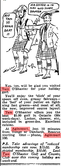
In 1947, the Tam applied for a dining room and a lounge liquor serving license, under the recently enacted Liquor License Act, 1946. Under the provisions of the new law, residents could protest an application made within their district. A group of Agincourt residents did just that when 400 of them petitioned to oppose the Tam O’Shanter application, explaining that there had never been a need for the sale of beer in the village, the club house was used by teenagers for parties, and as the Tam was located on two major streets, the license would encourage drinking and driving. Owner William Sparkhall answered that the country club was actually outside the district’s borders and the application was only meant to sell beer to members.
Dance at Tam O’Shanter Boys Club, November 15, 1956. Credit: Toronto Archives
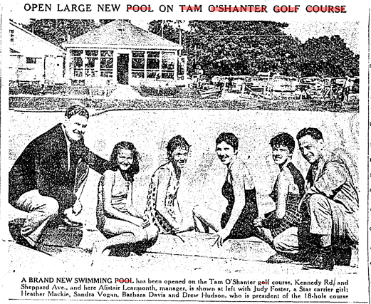
Over the years, the younger Sparkhall, who purchased the golf course from his father in 1938 and renamed it Tam O’Shanter, undertook several upgrades to the property, and added an adjacent lot bordering Birchmount Road. In 1954, the club improved several holes in its 18-hole course, and upgraded its clubhouse and dining room. Two summers later, members and visitors had access to the new and popular Emerald Pool.
Toronto Daily Star July 31, 1956
In 1958, a game-changing addition came in the form of a 12-sheet curling rink. The modernist structure was constructed of fieldstone and housed spectators’ galleries behind three four-sheet sections. It was the “largest in Canada devoted entirely to curling”. The Globe and Mail boasted that even before construction had completed, the club already had a “considerable response to a membership campaign” for new curlers. At this time, the main clubhouse added bowling alleys, two dance floors, two dining areas, and three lounges. Eight more curling sheets followed in 1961. The following year, the Tam could pride itself on “a rink six inches wider than that of Maple Leaf Gardens.” Together, the improvements made the Tam into a formidable and beloved social, sporting, and recreational venue.
Globe & Mail, Feb 26, 1958
While Sparkhall vowed golf would continue as usual after the fire (and indeed it reopened the next day and the following season), most of the club’s functions were severely compromised. A 3-day Oktoberfest scheduled to take place on the Tam grounds that weekend was shortened to a 1-day event at a different venue. Worse, however, the upcoming hockey season was greatly affected by the lack of a rink. The Wexford Hockey Association, whose teams played out of the Tam O’Shanter Arena, scrambled to find other facilities to host its games. North York Mayor Basil Hall elected to bring the matter to Metro Regional Council to see if it could offer assistance in relocating games.
Bruce and Margaret Hyland had to consider their next steps, too. The 5-time Olympic coaches — legendary figures in Canadian skating — ran a popular summer hockey school and the Canada Skating Club at the Tam. The hockey school was one of the largest in the world; Canadian hockey greats Frank and Peter Mahovlich, Kent Douglas, Paul Henderson, and Eddie Shack practiced at Tam O’Shanter Arena. The skating school was supposed to start a day after the fire. By December 1971 though, the Hylands announced initial plans for a $2 million arena built “on four acres of land between Victoria Park Avenue and Don Mills Road, just south of Finch Avenue.” It would be called the Hyland Ice Skating Centre.
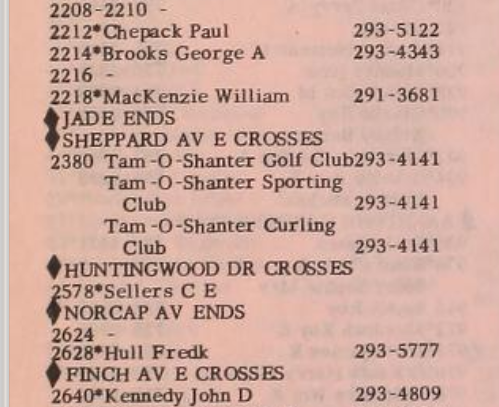
1969 Toronto City Directory of Kennedy Road. Credit: Toronto Public Library.
The club’s 300 curling members elected to remain together, and used membership dues to lease space offered by other clubs in the Toronto area. In June 1972, officials at the Tam-Heather curling club announced they were ready to resume their activities in October of that year. They hoped a new sports complex would be ready by the first anniversary of the fire at Tam O’Shanter.
Interestingly, despite William Sparkhall’s declaration to have the recreation centre up and running in 1972, he – under the Tam-Land Estates Ltd. banner – applied shortly after the fire to rezone the 118-acre golf course to accommodate residential and commercial enterprises. The golf course at the time was zoned for agriculture in its western half and recreation in its eastern half. Tam-Land Estates planned to build a housing and high-rise development on the property. Community opposition, led by future Scarborough Controller and Mayor Joyce Trimmer, successfully fought to keep the area as open public space, harnessing the power of Trimmer’s adamant and ultimately effective letter writing campaign.
These debates around the future of the Tam O’Shanter site also coincided with Metro Parks Commissioner Thomas Thompson’s desire to acquire more parkland for Metro Toronto. The events following Hurricane Hazel in 1954 led the Metro Toronto and Region Conservation Authority (MTRCA) to acquire flood valleys that would push Metro’s parkland to nearly 7,000 acres. However, outside of ravine lands, the region was in short supply of recreation lands to service its expected growth. A potential solution was the acquisition and transformation of private golf courses as they became available.
In what the Globe And Mail called “a bold step toward parks’, Metro Parks Committee allotted $5 million dollars in Metro Council’s 1972 budget to acquire the 165-acre York Downs Golf Course in the Bathurst Street and Sheppard Avenue area and the 118-acre Tam O’Shanter Golf Club in Scarborough. The amount was more than double what Metro spent on parkland acquisition in the previous 10 years. A special subcommittee consisting of Metro Chair Albert Campbell, North York Mayor Basil Hall, Scarborough Mayor Robert White, Metro Parks Commissioner T.W. Thompson, and Metro Planning Commissioner Wojctech Wronski also pushed back Sparkhall’s redevelopment proposal indefinitely so that it could study and report on the possibility of acquiring Tam O’Shanter and York Downs.
With news of the Tam’s availability as potential park space, decision-makers and media urged the purchase. As one Toronto Star editorial put it, Metro Council had to “grab the chance for green space”. It argued that Tam O’Shanter was parkland “in a crowded area” and “there was no obvious recreational land coming on the market nearby.” New Metro Chairman Paul Godfrey called the chance “a golden opportunity that won’t come again”. Another positive was it would not require the demolition of any homes, which was notable because Thomas Thompson’s Metro Parks Committee was also recommending the demolition of 254 houses on the Toronto Islands to create more parkland.
With the sub-committee’s final decision to ultimately buy the course, questions in 1973 revolved around who would pay, how they would pay, and how much they would pay. Metro had $3.5 million budgeted for parks for the next five years; if it took a gander on Tam, it could affect its ability to acquire other parks. Scarborough Controller Karl Mallette added that Scarborough taxpayers could “easily afford” a raise on taxes to pay for new parkland and facilities, such as the new park at Tam O’Shanter. In February of that year, Campbell announced a proposal of a three-way agreement which would see the Ontario government cover half the course’s costs and Metro and Scarborough covering a quarter each. The same formula was used to purchase the York Downs Course. An unknown factor was Tam-Land Estates’ asking price, which was reportedly between $12,000 to $100,000 an acre. In September 1973, the price was eventually set at $10.8 million, a number that had East York Mayor Willis Blair suspecting was too rich. However, two different appraisals valued the land at $10.6 million and $11 million.
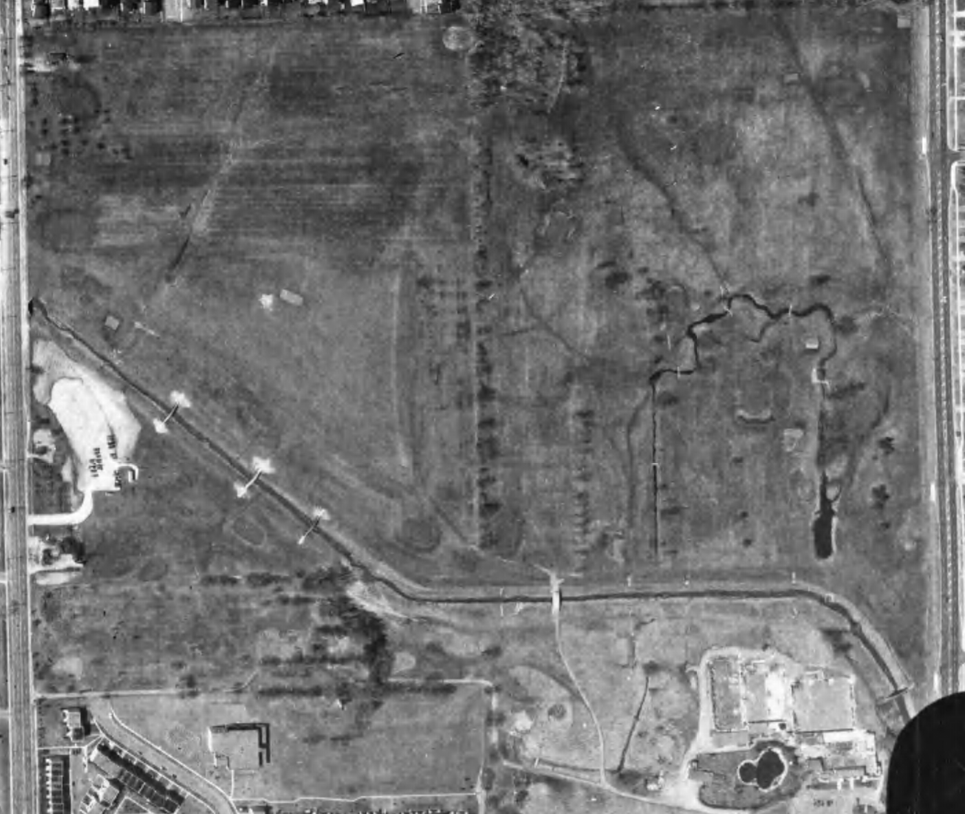
Aerial view of the Tam O’Shanter Golf Course, 1975. Bridges that formerly crossed the West Highland Creek were removed, possibly as the course was awaiting reorganization.
Meanwhile, the Tam’s curling club and hockey and skating schools happily found new homes. Boasting a membership of 540 and set to reach capacity of 640 by the start of the following season, the Tam-Heather Curling Club opened its new eight-sheet, $500,000 complex in March 1973 at Morningside Avenue and Highway 401. Also in 1973, Bruce and Margaret Hyland successfully opened Metropolitan Ice Skating School (later Centre Ice) on Victoria Park Avenue. The complex had three ice surfaces, one of which Mr. Hyland operated a hockey school.
Finally, two years after the fire that devastated the Tam, officials met in Metro Chairman Paul Godfrey’s office to formalize the purchase of Tam O’Shanter Golf Club. On November 10, 1973, William Sparkhall, president of Tam Land Estates, accepted two cheques totalling $10,825,000 for the 118-acre golf course from Godfrey, Education Minister Thomas Wells, Scarborough Mayor Paul Cosgrove, and Fred Wade, chairman of the MTRCA. Tam-Land Estates retained some land for its own redevelopment purposes. With the purchase of Tam and York Downs, Metro Parks also recommended the creation of an inventory of other private courses with the goal of purchasing them in the future. The MTRCA would officially own Tam O’Shanter, but Metro Parks would oversee it.
Following the acquisition, several outlying details remained about the function and form of the new Tam O’Shanter. Scarborough Council disagreed with Metro about the property’s apparent decided future as a municipal golf course. The borough understood that the option was open for it to become a park, and even though discussions during negotiations mentioned that Tam O’Shanter could either continue as a golf course or become a park or a mixture of the two, there was no formal resolution. Wells, the Progressive Conservative representative of Scarborough North, the provincial riding housing Tam O’Shanter, asserted in a February 1973 edition of the Globe and Mail, “It is essential that this site be retained as open space but not necessarily as an 18-hole golf course.” Despite the disagreement, new Metro Committee Parks Commissioner Robert Bundy said the site was “well located for a golf course” and Tam O’Shanter remained a public course – possibly because it was one of the only courses in the east end of Metro Toronto.
The golf course required major upgrades, however. While minor improvements kept the golf club operational through the 1970s, the quality of the greens, which required a new irrigation system, was so poor that Metro Parks lowered its fees in 1975 by 50 cents. With the damage to and the eventual demolition of the old Tam complex in the years after the purchase, the course also required a new clubhouse. In the first half of the 1980s, Tam O’Shanter underwent $800,000 worth of upgrades to update and reconfigure its course with a new entrance of Birchmount Road. Its new clubhouse opened on May 7, 1982.
Aerial, 1983. Credit: City of Toronto Archives
In 1985, Sparkhall and Co. – seemingly the new banner of Tam-Lands Estates Limited – looked to redevelop the land south of the course and north of Agincourt Mall. It proposed, and was allowed to build “1000 apartments, 23,225 square metres (250,000 square feet) of offices, up to 6,040 metres (65,000 square feet) of commercial use, libraries, day nursey, and educational facilities on 6.16 hectares (15.23 acres) of land on Kennedy north of Bonis [Avenue].”
Just as there had been opposition in 1971, residents of Bonis Avenue mobilized to fight the proposal. The community assembled a petition of 500 names and packed the Scarborough Council chambers in March 1985 to voice disapproval of their neighbourhood becoming “a mini-downtown.” Along with the scale of the development, another sticking point was the proposed extension of Bonis, which was at the time a dead-end street running east from Birchmount Road, stopping at the old lot border. The plan called for its lengthening to connect with Cardwell Avenue at Kennedy Road. Residents, including Controller Joyce Trimmer (who beat out former Controller Karl Malette in the 1974 election), argued that the street would only serve as a high-speed detour for Sheppard Avenue traffic. After more consultations, the project did not go through.
Plans for development along Bonis Avenue surfaced again in 1988, this time spearheaded by Tridel Corporation. The new proposal involved “four 24-storey condo towers with a total of 1,112 units, a five-story building with 7,961 square metres of office space, a one-story building with 5,580 square metres of retail space, and two-storey, 1953-square metre public library.” The inclusion of a library was notable because a 1977 plan suggested the erection of a much-needed district library on a portion of the Tam O’Shanter property turned over to Scarborough for municipal parkland. This was opposed by Trimmer and was ultimately nixed by Metro planners.
Despite being a slightly more scaled back version of the Sparkhall and Co. project, Tridel Corp. faced similar challenges and objections as its predecessor. As was the case three years ago, the property, zoned for institutional and recreational use, would have to be rezoned. Planning and traffic studies again recommended an extension of Bonis Avenue. Opponents said the development had double the amount of allowed units. The Highland Heights Community Association warned the street would become a ‘traffic nightmare’, which would bring in 1,000 cars in the evening rush hour (Tridel contended 335 cars). Even with the opposition, calls for the developer to scrap the project largely went unheard.
In October 1988, despite last minute objections, Scarborough council approved the $500-million dollar project behind Agincourt Mall. It was the second major condo project approved in the span of a month in the borough. On September 6, Council approved $1.5 billion, 2,420-unit development – also by Tridel – at the Scarborough Civic Centre.
As a part of the Agincourt deal, Scarborough also received a 1,200-square-metre parcel of land worth more than $300,000 for a $4.5 million library. Tridel also gifted $500,000 for its construction as well as $1.6 million for day care, park development and landscaping. The new Agincourt Library branch opened in 1991 on Bonis, moving from Agincourt Mall and continuing a legacy dating back to 1918.
Also in 1991, ‘The Greens at Tam O’Shanter’, the first tower in the phased project, opened. Described by a 1989 Toronto Star ad as “a magnificent collection of country club style residences overlooking the manicured greens and fairways of the renowned Tam O’Shanter Golf course in Scarborough”, it is a 24-storey construction with “211 one, two and three bedroom suites – many of which open up onto private terraces” which “range from 787 square feet to 1,782 square feet. Its marketing harnessed “the royal and ancient” tradition of golf as it was played on old Scottish courses like St. Andrews and Leith Links, when the game “was the sport of kings”. Although it did not do so in the end, the advertisement could have also referenced the 50+ year history of golf at Tam O’Shanter.
Toronto Star, Oct 7, 1989
The next parts of the Tridel complex – 28 brownstone townhouses and 3 more 24-storey condos – would open over the next twenty years. One of the condos – 1998’s “The Highlands at Tam O’Shanter” at 228 Bonis Avenue – roughly occupies the former site of the Tam’s famed clubhouse and recreation centre.
Today, the Tam O’Shanter Golf Clube operates an 18-hole, Par 72 course from mid-April to mid-November.
A curious item in the Toronto Public Library’s Digital Archive is an image of farm or ranch located in Agincourt. The picturesque scene is “Brookside”, the estate of the Pattersons, located on the northeast lot of the intersection of Kennedy Road and Sheppard Avenue. The evolution of this property is an interesting story.
Paterson, “Brookside”, Sheppard Ave. E., n.e. lot Kennedy Road, 1905. Credit: Toronto Public Library.
The Paterson family of Scarborough had three lots on the east side of Kennedy Road (lot 28) between Sheppard Avenue (Concession III) and Finch Avenue (Concession IV) in Agincourt, together totaling 200 acres. The middle Paterson lot was “Elmridge“, whose farmhouse still exists today.
Illustrated Atlas of York County, 1878. Credit: Historical Maps of Toronto.
The Globe, January 7, 1914. Credit: Globe and Mail Archives.
The 67-acre Brookside was the southern most of these lots running a third of the way to Finch Avenue and edging on the Canadian National Railway. It was opposite the future Tam O’Shanter Golf Club. The West Highland Creek ran through the property, likely giving the estate its name.
Map of the Townships, York, Scarboro, and Etobicoke, 1916. Credit: University of Toronto Map & Data Library.
The Globe, September 24, 1926. Credit: Globe and Mail Archives.
Brookside existed in a rural setting for much of its life, until the second half of the 20th century. By 1950, streets and houses popped up to the east, north, and south of the farm buildings, likely as parts of the Paterson lot was partitioned.
Aerial photo, 1950. Credit: City of Toronto Archives.
Aerial photo, 1953. Credit: City of Toronto Archives.
By the mid-1950s, the streets took their shape and names. Running north to south was Patterson Avenue to honour the family whose farm it was built upon. Running east to west was Station Rd (leading to the CN Station, now a GO Transit Station), Marilyn Avenue, and a tiny Reidmount Avenue. The woodlot behind the farmhouse also seemed to have been cleared.
Map of Metropolitan Toronto, 1955. Credit: University of Toronto Map & Data Library.
Aerial photo, 1956. Credit: City of Toronto Archives.
By the end of the decade, changes were afoot. Patterson Avenue was renamed to an extended Reidmount Avenue and Station Road became Dowry Avenue. (As an aside, on the other side of railroad tracks, First Avenue became Agincourt Drive in 1957. The changes likely resulted from the reworking of the road network following the creation of Metropolitan Toronto.)
The image below is a Planning Map from the 1959 Official Plan of Toronto. The Brookside Farm is labelled as “R.E.” potentially meaning “Residential Estate” or “Rural Estate” or even “Residential Expansion”, which in any case references a larger lot. “R” is “residential” and “C” is “commercial”. The corresponding aerial image provides a visual of the lot division.
Scarborough: streets and names, 1959. Credit: York University Map Library.
Aerial photo, 1959. Credit: City of Toronto Archives.
By 1969, the Paterson farm buildings have completely disappeared. Moreover, the West Highland Creek was channelized and widened along with a new bridge running over Kennedy Road.
Aerial photo, 1969. Credit: City of Toronto Archives.
West Highland Creek looking southeast towards Cardwell Avenue.
By the middle of the 1980s, the area around Kennedy and Sheppard was increasingly built up. A new street named Cardwell Avenue now connected Kennedy and Dowry Street. On either side of Cardwell was a new subdivision of houses.
Aerial photo, 1985. Credit: City of Toronto Archives.
Cardwell Avenue east of Kennedy Road
Today, this group of homes are part of the modern geography of Agincourt. If one looks closer though, the shape of the overall subdivision corresponds to the Patersons’ farm Brookside that was once there.
Twyn Rivers Drive is a curious street in the eastern fringes of Toronto. In a larger metropolis where farms and fields have been replaced by residences and populations, Twyn Rivers Drive is slightly rural in nature and still has visible links to its past.
Twyn Rivers Drive, 2020. Source: Google Maps
Country within The City
Located in the Rouge River Valley, Twyn Rivers Drive’s rural character is very well apparent. First, it’s a two-lane street lacking any sidewalks. Motor vehicles, bicycles, pedestrians, and even wildlife all have to carefully negotiate use of the street. Like some country roads, Twyn Rivers’ route across the valley is not direct. There are slopes, curves, and two near 90 degree turns. It has to navigate what may be the most varied topography in the city. Its path starts with a winding descent from Scarborough’s Sheppard Avenue and eventually on the other side on Sheppard Avenue…in Pickering.
Twyn Rivers Drive, 2018. Source: Google Maps.
Twyn Rivers From The Pleistocene of the Toronto Region, 1932. Source: University of Toronto Map & Data Library.
A History of Twyn Rivers Drive
The historical beginnings of Twyn Rivers Drive is an obvious question, but unfortunately, it does not have an obvious answer. It is old for sure. A September 2017 City of Toronto Traffic Operations Review characterizes Twyn Rivers Drive as “a legacy road from colonial times” and speculates that it is about 200 years old. A June 2017 CBC article says Twyn Rivers Drive is “more than 100-years old” and its main purpose was to get horses to the mills in the valley. Neither report provide any historical context to back up the claims. Twyn Rivers Drive seems to first appear in a 1916 map of Toronto and its surrounding townships, so a hundred years may be accurate at the least.
Twyn Rivers from Map of the Townships, York, Scarboro, and Etobicoke, 1916. Source: University of Toronto Map & Data Library
The naming of Twyn Rivers Drive likely also goes back to its geography. It possibly derives from the Clarence Purcell’s ‘Twyn Waters’ ranch located in the Rouge Valley on what is now Twyn Rivers Drive. The twin rivers in this case are the famed Rouge River and its lesser known brother, the Little Rouge Creek. It is unknown when Twyn Rivers Drive was actually named, but the Twyn Waters ranch existed by the 1930s.
“Picnikers Enjoy Western Hospitality,” Globe and Mail, July 6, 1939. Source: Toronto Public Library and Globe and Mail Archives.
Twyn Rivers Drive in Might’s Greater Toronto city directory, 1969. Source: Toronto Public Library.
Two Rivers, Two Bridges
Twyn Rivers Drive travels over two bridges over the mentioned waterways. The first of these over the Rouge River is a single-lane, metal truss construction. It is named “Stott’s Bridge“. Few details are available about the age and origin of this bridge, but it seems to share a surname with William Stotts, who had his estate house, Glen Eagles Manor, further up the hill at the modern junction of Twyn Rivers Drive and Sheppard Avenue East. The house later became the Glen Eagles Hotel.
Stott’s Bridge, 2019. Source: Google Maps.
William Stotts from Nason’s east and west ridings of the county of York or townships of Etobicoke, Markham, Scarboro’, Vaughan & York directory, 1871. Stott’s property was located on Concession 2 (now Ellesmere Road), on north half of lot #3. He is listed as a freeholding farmer. Highland Creek likely denotes the post office Stotts used. Source: Toronto Public Library.
Twyn Rivers From Tremaine’s Map of the County of York, Canada West, 1860. Source: Old Toronto Maps.
The second causeway is a white arched bridge over the Little Rouge Creek. “Maxwell’s Bridge” is a concrete structure which accommodates two lane traffic. It is at least the second or possibly third version of a water crossing in this location. An antique wooden bridge collapsed in 1914 after a heavy vehicle passed over it. A new bridge was soon ordered to be built. In 1927, Scarboro Township Council funded the construction of a new rainbow arch bridge with a 60-foot span at a cost of $7,797. Several other arch bridges were built in the Nineteen Tens and Nineteen Twenties Kirkham’s Road over the Rouge River in 1910, Don River Boulevard over the West Don River in 1928, and Don Mills Road over the Don River in 1921.
“Antique Bridge Collapses”, Toronto Daily Star, August 7, 1914. Source: Toronto Public Library and Toronto Star Archives.
“BRIDGE AT KIRKHAM’S MILLS”, Globe and Mail, September 13, 1910. Source: Toronto Public Library and Globe and Mail Archives
Maxwell’s Mill
Nearby Maxwell’s Bridge where Twyn Rivers Drive does its second bend are the ruins of a grist mill named “Maxwell’s Mill”. The site was built by a James Maxwell in the 1800s. In 1923, Maxwell sold it to Clarence Purcell who used it to raise livestock on his Twyn Waters ranch.
Twyn Rivers from Illustrated Historical Atlas of the County of York, 1878. Maxwell’s Mill is the Grist Mill labelled on his lot. Source: Old Toronto Maps.
James Maxwell from Nason’s east and west ridings of the county of York or townships of Etobicoke, Markham, Scarboro’, Vaughan & York directory, 1871. Maxwell is listed as a flour mill freeholder with a Post Office at Rouge Hill. His plot of land was located at Concession 3 (now Sheppard Avenue) on lot #2. Source: Toronto Public Library.
MEN OF TREES FAIR AT ‘TWYN WATERS’, Globe and Mail, September 24, 1941. Source: Toronto Public Library and Globe and Mail Archives.
The mill closed in 1929 after a flood weakened it and a fire in the 1970s destroyed much of what remained. Some of the foundations and walls still stand today. An image of Maxwell’s Mill is available on the Scarborough Historical Society’s website.
Mill stone at the Rouge river Twyn River Estate. Toronto, Ont., 1957. Source: Toronto Public Library
The Rouge Valley Inn & Caper Valley Ski Hill
The Rouge Valley Inn (later called the Rouge Valley Olympic Inn) was located on the south side of Twyn Rivers Drive slightly before the Scarborough-Pickering Townline. The site was a major Scarborough attraction in the twentieth century with a hotel, dining, picnicking for families, and “the largest swimming pool in Ontario.” Ambrose Small, the 20th century Ontario theatre titan who mysteriously disappeared in 1919, owned the Rouge Valley Inn for a time starting around 1900.
“Everyday Outings”, Globe and Mail, June 25, 1958. Source: Toronto Public Library and Globe and Mail Archives.
“Rouge Valley Guests” Globe and Mail, August 9, 1940. Source: Toronto Public Library and Globe and Mail Archives.
“$500 Reward,” Toronto Daily Star, January 6, 1920. Source: Toronto Public Library and Toronto Star Archives.
Across the Little Rouge Creek from the Rouge Valley Inn was the Caper Valley Ski Slope, also known as ‘Snake Hill’ for those who used to frequent it. Along with Earl Bales Park and other establishments, it was one of a handful of areas in Metro Toronto that offered the winter passtime. It was operated by Repac, whose name spelled backwards gave the ski hill its moniker. A footbridge linked the inn and the ski slope.
“School children taper at weekly ski outing”, Globe and Mail, January 6, 1972. Source: Toronto Public Library and Globe and Mail Archives.
Caper Valley Ski Hill, 1975. Source: Toronto Public Library.
Twyn Rivers Transformed
By the end of the 1970s, much of the historic landmarks of Twyn Rivers Drive disappeared from its geography. Fire claimed both the Rouge Valley Inn in 1968 and Maxwell’s Mill in 1970. The former site of the hotel is now the parking lot for the Twyn Rivers Rouge Park area. The mill’s ruins make for an interesting place for urban explores. Clarence Purcell sold his Twyn Waters ranch to the Metro Toronto and Region Conservation Authority in 1970, which after Hurricane Hazel in 1954 began to buy other valley and ravine properties for parkland. Today, there are very few residences located in Rouge Valley.
Twyn Rivers Drive, 1953 & 1975. Source: City of Toronto Archives.
By 1973, the Caper Valley Ski Hill was reporting financial difficulty and it too closed by the end of the decade. It now makes for challenging hike in Rouge Park’s Mast Trail. Finally, the Glen Eagles Hotel was also destroyed by fire in 1990, and is now the Glen Eagles Vista park. The site was nearly made condos. Today, most of these are owned and/or managed by Parks Canada.
Glen Eagles Hotel Fire, 1990. Source: Toronto Public Library.
Twyn Rivers Today
Today, Twyn Rivers is quite the nexus for Rouge National Urban Park, being the starting and ending point of multiple trails. The first source of exploration can be enjoyed around the Rouge Park parking lot. The area is situated on the Little Rouge Creek where the foundations of a former dam still stand. A makeshift footbridge crosses the creek where one can walk in the lost tracks of skiers on Snake Hill.
The Orchard Trail
Near Maxwell’s Mill is the southern terminus of the Orchard Trail. The two-kilometre walk slinks within the forest where apple trees grow today. It also offers vistas of the Little Rouge Creek. A particularly stunning area is the ascent/descent near the north end of the trail.