Scenes From Deerlick Creek

Deerlick Creek is located in the post-war Parkwoods-Donalda neighbourhood of North York. The stream runs roughly 3 kilometres from its northern point its mouth at the Don River, making it a tributary to the larger river and part of its watershed. Deerlick Creek passes through a couple of parks — Brookbanks Park and Lynedock Park — and crosses several streets. It is an interesting stroll through nature and suburbia, and through the layers of pre-contact, colonial, and post-war Toronto.

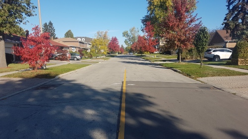
Deerlick Creek, 2023.
Source: Google Maps

Deerlick Creek was given its name in the 19th century (as early as 1841) by farmers of the area, when deer and salmon could be found in the ravine. Unlike other colonial-era waterways in Toronto, there does not appear to have been mills or industry built on the stream, which suggests it was not a forceful current.

Deerlick Creek in the 1860 Tremaine’s Atlas
Source: Old Toronto Maps

The current headwaters of the creek are in Lynedock Park, a locale which also has a middle school. The neighbourhood north of York Mills Road around the creek dates mostly from the early 1960s and is dotted with mostly post-war bungalows.

Deerlick Creek and community, north of York Mills Road, 1992.
Source: City of Toronto Archives

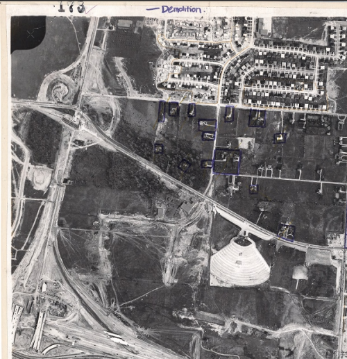
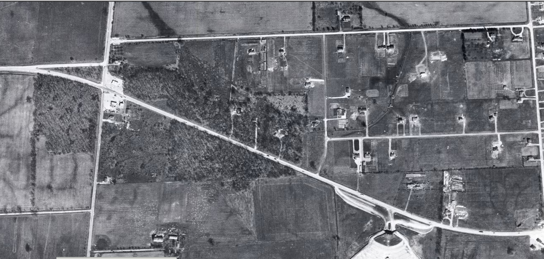
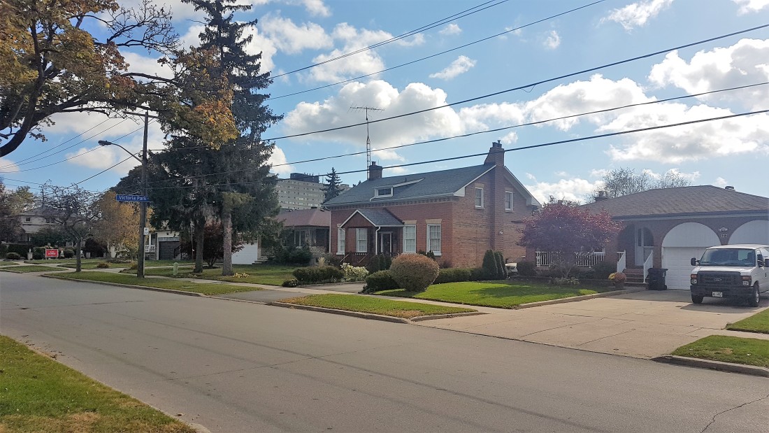
Curiously, these houses were not the first to be built here. In the 1950s, there were at least six houses built before the current neighborhood.  Driveways curled up from York Mills Road, branching off to the houses. Deerlick Creek ran in the middle of them. In 1965, most of the houses were integrated in the neighbourhood. Beginning in the 1970s, more of the houses were razed for other homes and apartment buildings. Possibly two houses remain today — one house for certain and a potentially altered house. Both homes are identifiable through through their odd orientations compared to the street. Their garages face away from the street, pointing to the repositioning of their driveways, as well as a front door placed to the side in one.

Deerlick Creek and community, north of York Mills Road, 1956 & 1965.
Source: City of Toronto Archives

Deerlick Creek was channelized and straightened beginning around 1960 when the neighbourhood was under construction. At its most northern point, the stream disappears into a culvert at Roywood Drive. A footbridge connects the park and schoolyard to the neighboorhood. There are improvements happening along the creek to combat area basement flooding.

Deerlick Creek ventures south under Lynedock Crescent. It is not clear how wide and powerful it might have been historically, but today, it is a narrow, shallow, and murky-looking waterway. Then, it disappears briefly under York Mills Drive.

On the other side, the ravine is part of Brookbanks Park. Deerlick Creek snakes around the park with paved and unpaved paths on either side of it and bridges crossing the creek. The stream is narrow here too and not fast flowing. Evidence of erosion is visible with some retaining walls. While a ‘wild’ element remains on a small level, sections have likely been straightened

Brookbanks Park is the physical heart of the Parkwoods-Donalda neighbourhood. It has multiple entry points and is a well used and valuable greenspace for the surrounding community. This interconnectedness is also present when one looks up from the ravine to see the backs of houses. The neighbourhood was built beginning in the 1960s. A by-product of the development was a lot of of the tree canopy in the ravine was lost. One would think its bio-diversity was also negatively impacted too.

Deerlick Creek and community, south of York Mills Road, 1956 & 1965.
Source: City of Toronto Archives

Deerlick Creek passes under Brookbanks Drive. Like its similarly named park, the street also slinks through the neighbourhood. There is a great vista of the Brookbanks Ravine on the south side of the street which highlights its contours and the tree canopy.

Interestingly, this area has some tangible pre-contact history. Dr. Mima Kapches conducted digs in Deerlick Creek ravine in the 1980s and 1990s. The digs resulted in the discovery of a Meadowood cache blade from 1000 BCE and a small pebble containing a human face in effigy believed to be from 4700 BCE. Jason-Ramsey Brown writes that the discoveries have some archeologists believing the area of Deerlick Creek may have a season pottery production and firing campsite.

In the 1970s, the Toronto Field Naturalists surveyed Brookbanks Ravine and Deerlick Creek and noted 105 species of birds and 167 species of trees could be found in the valley. It also noted that while deer may have roamed freely a century ago, now the largest animal groups were squirrels and skunks. The Naturalists also noted the ravine was threatened by “tidying by the parks department and construction on the edge of the ravine by homeowners.”

Brookbanks Park ends at Cassandra Drive where a narrow path leads one to and from the park. Deerlick Creek veers southwest, under the highway, and flowing into the Don River at a golf course. An unpaved path seems to run next to its course, although it is unclear how far it stretches.

North from Brookbanks Drive, Valley Woods Drive is an interesting street sandwiched between the Don Valley Parkway and the ravine. Valley Woods itself was laid out beginning in 1965, much like the rest of the neighbourhood. At the foot of the street is Citadel Village, which at the time of its construction was a representation of idyllic, post-war, suburban living.

Citadel Village was designed by Tampold & Wells and was completed in 1967. It is a collection of townhouses surrounding a circular apartment — presumably the “citadel”. A 1966 promotional advertisement described Citadel Village as a “southern European village on a mountaintop with a thickly wooded ravine on the east and a panoramic view of the city to the west.” Other selling points in ads in the following years highlight the family-friendly development particularly in its spaciousness and lack of traffic, comfort, and proximity to local amenities and downtown (15 minutes by the new Don Valley Parkway!). Citadel Village is listed as Toronto heritage property.

Citadel Village, 1968.  1                                 Source: Toronto Public Library

Valley Woods Road slinks up the side of the ravine with connections to the park. It also has a bus serving the street. At the top of the street at York Mills Road, a new condominium and planned community are under construction, named “The Ravine”. The development will consist of several towers and homes, and replaces rental townhouses previously on the site. It is the next layer in the history of Deerlick Creek and its surrounding communities.

Works Consulted

“The Biggest Townhouses In Town.” The Toronto Daily Star, 9 Nov. 1968, p. 59.

“Brookbanks Park and Deerlick Creek.” Greck, https://www.greck.ca/Projects/Brookbanks-Park-and-Deerlick-Creek.

“Citadel Village.” The Toronto Daily Star, 22 Aug. 1966, p. 31.

Donvalleygirls. “The History of Brookbanks Park and Deerlick Creek.” Exploring Toronto’s Don Valley, Lake Ontario, and Green Spaces in between., 29 Feb. 2016, https://donvalleygirls.wordpress.com/2014/02/15/the-history-of-brookbanks-and-deerlick-park/.

“The Easy Life of Citadel Village.” The Toronto Daily Star, 20 July 1968, p. A50.

“Friendly People.” The Toronto Daily Star, 31 Dec. 1971, p. 40.

L, Mishy. Brookbanks Park and Deerlick Creek, https://mishylainescorneroftheworld.blogspot.com/2013/04/brookbanks-park-and-deerlick-creek.html.

Lakey, Jack. “Brookbanks Park Still Plagued by Damage from 2005 Flash Flood.” Thestar.com, Toronto Star, 1 Sept. 2014, https://www.thestar.com/yourtoronto/the_fixer/2014/09/01/brookbanks_park_still_plagued_by_damage_from_2005_flash_flood.html.

Little, Olivia. “Brookbanks Park in Toronto Comes with Plenty of Natural Beauty and a Rich History.” BlogTO, BlogTO, 14 Jan. 2021, https://www.blogto.com/city/2021/01/brookbanks-park-toronto-comes-plenty-natural-beauty-and-rich-history/.

“Metro Naturalists Set Plans to Preserve Area Ravines.” The Toronto Star, 26 Feb. 1975, p. C15.

“Parkwoods Donalda.” StrollTO, https://www.strollto.com/stroll/parkwoods-donalda/.

Quinter, David. “Toronto Butterfly Habitat Urged.” The Toronto Star, 6 July 1976, p. B1.

Ramsay-Brown, Jason. Toronto’s Ravines and Urban Forests: Their Natural Heritage and Local History. James Lorimer & Company Ltd., Publishers, 2020.

“The Warmest Townhouses in Town.” The Toronto Daily Star, 1 Feb. 1969, p. 25.

Yu, Sydnia. “Master-Planned Community in the Middle of Mother Nature.” The Globe and Mail, 2015 May 1AD, p. G2.

Free Parking & Free Cokes: A&P Super Markets in 1950s Suburban Toronto

A&P is part of Toronto’s retail history, especially so because the franchise does not exist anymore in the city.

In the 1950s, the American-based company, formally called the Great Atlantic & Pacific Tea Co., opened several new super markets in Toronto’s outer communities. These stores and their eventful inaugurations offer a lens into not only the history of the brand, but also the emergence and evolution of Toronto’s inner suburbs.

5559 Dundas Street West, Etobicoke

Toronto Daily Star, July 5, 1952.
Source: Toronto Star Archives

The A&P at 5559 Dundas Street West at Brown’s Line opened on July 8, 1952. As the advertisement notes, it opened at the junction of two highways: Five (Dundas) and Twenty-Seven (Brown’s Line). It also backed onto a Canadian Pacific rail line. At the time of its opening, the intersection was sparsely populated. The larger community at the western edge of the Toronto area was Eatonville, best known for being the farming property of its namesake family and department store barons, the Eatons.

1953 Aerial Image of 5559 Dundas Street West
Source: City of Toronto Archives

Very much in line with other store inaugurations in the period, the A&P advertisement presented the event as a multi-day spectacle. It was broadcasted over radio, with American singer and radio personality Smilin’ Jack Smith hosting. The famed 48th Highlanders band also played. The opening day flyer touts the supermarket as a “Parking Heaven” with plenty free parking. A map also boasted that “all roads” led to the supermarket, noting all the local major roads and the connecting communities. Many cars and people are depicted, including a long line filing towards and into the large glass store entrance. Altogether, it is very optimistic, with new life and new development now existing outside Toronto’s historic busy core.

The Globe and Mail reported the new super market cost $1,000,000 and included a warehouse building and a rail siding. It wrote: “The huge one-story structure provides consumers with the ultimate in shopping conveniences and affords the company the latest facilities for the efficient distribution of groceries in Ontario.”

By the end of the decade, the area had transformed along with the new store. Brown’s Line and Highway 27 were absorbed by the new Highway 427. The new interchange with Dundas resembled a cloverleaf. This development may have inspired the naming of the adjacent Cloverdale Mall directly across from A&P in 1956, an open air shopping centre whose anchor was another super market, Dominion.

1965 Aerial Image of 5559 Dundas Street West
Source: City of Toronto Archives

Since 1952, the Dundas Street A&P has undergone a few noted changes. First, it is now Food Basics, which was founded in 1995 as a discount super market subsidiary under the A&P brand. Second, the complex’s area expanded, including an office space. This office is the Metro Ontario Division headquarters. Metro, a Quebec super market chain, acquired A&P Canada in 2005. Interestingly, at the Cloverdale Mall across the street, Dominion was acquired by A&P in the 1980s; the store is now a Metro.

Food Basics, 5559 Dundas Street West, 2021.
Source: Google Maps

2022 Aerial Image of 5559 Dundas Street West
Source: Google Maps

25 Glen Watford Drive, Scarborough

Toronto Daily Star, March 20, 1957.
Source: Toronto Star Archives

The A&P at 25 Glen Watford Drive at Sheppard Avenue opened on March 21, 1957. It served the historic village of Agincourt, a community with roots in the 19th century whose nexus was the crossroads of Church Street (Midland Avenue) and Lansing Road (Sheppard Avenue). First Street, depicted in the advertisement’s map, was part of an Edwardian residential subdivision. In the 1950s, the community opened its earliest post-war subdivision east of the Agincourt High School. In 1959, bus service ran from Kennedy Road to Sheppard Avenue, looping at Glen Watford, Rural Avenue, and Midland; it was one of the first to serve northern Scarborough.

Like the Dundas Street store, the store opening was a week-long affair. It featured giveaways to shoppers, and a radio broadcast, featuring Scarborough Board of Health Officer and Agincourt resident, C.D. Farquharson. Free parking and parcel pickups were emphasized. Nearly thirty stores in Toronto and area were listed, some with details such as having air conditioning.

1957 Aerial Image of 25 Glen Watford Drive and Sheppard Avenue East
Source: City of Toronto Archives

The evolution of the area around 25 Glen Watford contains some interesting developments. By the 1960s, Lansing Road became Sheppard Avenue; and Church Street merged with Midland Avenue to the south. First Avenue also became Agincourt Avenue. In 1963, the CP crossing on Sheppard was replaced by a rail overpass; the tracks were temporarily rerouted north during construction. Sheppard Avenue was also widened and Glen Watford was rerouted to curve towards Sheppard.

1963 Aerial Image of 25 Glen Watford Drive and Sheppard Avenue East.
Source: City of Toronto Archives

In the late 1970s, the Glen Watford A&P was torn down. In its place, a strip mall was erected. A larger building also went up to the south, taking up space formerly occupied by properties on the north side of Sheppard removed in the improvements along the street the decade prior. This latter building was a roller rink called Roller World.

1963 Aerial Image of 25 Glen Watford Drive and Sheppard Avenue East.
Source: City of Toronto Archives

In the mid-1980s, the area experienced its greatest evolution. In 1984, Hong Kong born developers bought the roller rink and transformed it into the Dragon Centre, an indoor Chinese mall (the former rink became a circular walkway for shoppers). It was the first of its kind in Toronto and Canada. The development spurred a change in Agincourt and Scarborough’s demographics, bringing East Asian residents and businesses to the area, including the strip mall to the north which replaced the A&P and the Glen Watford Plaza across the street, today’s Dynasty Centre.

The Dragon Centre wasn’t without controversy in the early years, however. Residents complained about the planning of the mall, particularly the parking and gridlock. There were also racist, xenophobic sentiments. Still, the mall endured, becoming a fixture in Agincourt.

25 Glen Watford Drive, 2021.
Source: Google Maps

Today, the East Asian nexus on Glen Watford is set to endure another change. A development proposal has two condominium buildings to be erected on the site. A project entitled “Dragon Centre Stories” exists to preserve the memory of the places set to be replaced.

2022 Aerial Image of 25 Glen Watford Drive and Sheppard Avenue East.
Source: City of Toronto Archives

2939 Dufferin Street, North York

Toronto Daily Star, March 10, 1958.
Source: Toronto Star Archives

The A&P at 2939 Dufferin Street south of Lawrence Avenue opened on March 11, 1958. After WWII, Dufferin north of Eglinton Avenue filled out as an arterial street with commercial and industrial uses, and its surrounding residential streets with bungalows, schools, and churches. The Dufferin Street A&P backed onto Barker Stream, a tributary of Castle Frank Brook.

1959 Aerial Image of 2939 Dufferin Street
Source: City of Toronto Archives

Like the other A&P stores, the opening of the Dufferin store featured contests and giveaways, including “free Cokes for everyone!” It also praised its car-friendly qualities: a giant parking lot, parcel pickup, and “all roads in North West Toronto” led to it. This automobile haven was in the immediately geography too; directly next to the A&P was a drive-in ice cream spot, Tastee Freez. An archival image of the Dufferin A&P offers a comparison with the image in the 1958 ad; the stores are very similar with a noted difference being the positioning of the logo’d tower.

A&P Supermarket, 2939 Dufferin Street, 1950s or 60s.
Source: City of Toronto Archives.
Tastee Freeze, 2957 Dufferin Street at Glenbrook Avenue, northeast corner, 1950s or 60s
Source: City of Toronto Archives

Today, the A&P store is a Lady York Foods, an Italian grocery store. A Dairy Queen is now on the same lot as the former The Tastee Freez. The transformation to Lady York Foods is particularly intriguing because it represents the general shift in demographics in the Dufferin-Lawrence area: The community is largely Italian-speaking.

2939 Dufferin Street, 2021.
Source: Google Maps

Aerial Image of 2939 Dufferin Street, 2022
Source: Google Maps

Do you remember these three A&P super markets or any other early A&P stores? Leave a comment below!

Sources Consulted

Bradburn, Jamie. “Vintage Toronto Ads: Fabulous Cloverdale Mall.” Torontoist, 19 Nov. 2014, https://torontoist.com/2014/11/vintage-toronto-ads-fabulous-cloverdale-mall/.

2016 Neighbourhood Profile Neighbourhood Yorkdale-Glen Park. https://www.toronto.ca/ext/sdfa/Neighbourhood%20Profiles/pdf/2016/pdf1/cpa55.pdf.

“25 Glen Watford Drive – Zoning Amendment and Site Plan Applications – Request for Direction Report.” City of Toronto.

“Eatonville.” Etobicoke Historical Society, https://www.etobicokehistorical.com/eatonville.html.

“Open $1,000,000 Super Market.” The Globe and Mail, July 11, 1952, p. 20.

“Roller Rinks and Magnetic Tapes.” Roller Rinks and Magnetic Tapes : Dragon Centre Stories, https://dragoncentrestories.ca/stories/roller-rinks-and-magnetic-tapes/.

Strauss, Marina and Gordon Pitts. “Grocery” Metro Musles into Ontario, winning A&P Canada bid.” The Globe and Mail, July 20, 2003, p. B1.

A Quick History of Controversial Toronto Street Name Changes

Toronto’s street grid is over 200 years old by colonial standards and even older with its Aboriginal trails. There have been additions and extensions, widenings and improvements. They have also been named to reflect the city’s past and present and it values (by those who do the naming, that is) – and to help the postal service.

The city is not a static object and neither are street names. Revisions and renamings have been an understated part of Toronto’s history. However, not all street renamings — proposed and actual — have gone over well. What is the mainly reason for this opposition? Simply put: History and Tradition. Whether successful or not, these episodes in Toronto’s history inform us how the city operated and why Toronto’s geography is as it is today.

Here are seven examples of controversial street name changes:

Old and New St. Patrick Street

In 1917, modern Dundas Street was created by amalgamating and connecting several smaller streets. One of these roads was St. Patrick Street, which ran between McCaul Street and Bathurst Street.

St. Patrick Street looking west to Spadina Avenue, circa 1911.
Source: City of Toronto Archives
1913 Goad’s Fire Insurance Map.
Source: Goad’s Toronto

One group opposed to changing St. Patrick to Dundas was the St. Patrick’s Old Boys’ Association, which attended the old St. Patrick’s School on William Street. The group deputed to City Council, but was unsuccessful. The story was not all bad as William Street was later renamed to St. Patrick Street to keep the tradition.

Dundas Street, looking east towards McCaul Street (home of St. Patrick’s Church with the new St. Patrick’s Street behind it), 2021.
Source: Google Maps

Mimico Mixups

In 1929, a dispute over the renaming of 54 Mimico streets spanned several council meetings. At issue, Toronto’s postal service requested the changes after Mimico and Long Branch were placed in the Toronto postal region. The difficulty was the added municipalities added duplicate street names to the region and potential confusion for postal workers. An ex-mayor attended a September 1929 council meeting arguing why the inclusion of ‘Mimico’ in the mailing addresses would not be sufficient enough for postal workers. Matters got heated in an October meeting when Mimico Mayor and Liberal candidate W.A. Edwards accused Minister of Health and Conservative candidate Dr. Godfrey of “insincerity” when Dr. Godfrey opposed the name changes when the mayor rejected Dr. Godfrey’s wish to have Stanley Avenue changed to Godfrey Crescent.

1924 Goad’s Fire Insurance Map
Source: Goad’s Toronto

It is unclear whether the by-law change went through, but in the October council meeting, it was moved and seconded that a second reading for the proposed by-law change be conducted. The Mimico street grid remains generally intact since the 1920s, albeit with notable changes: Church Street is now Royal York Road, Salisbury Avenue is now Park Lawn Road, Brant Street is now Dalesford Avenue, and Winslow Avenue is now Douglas Avenue.

Mimico, 2021.
Source: Google Maps

Long Branch Street Changes & Disappearances

In 1952, a ratepayers association in Etobicoke protested the changing of part of Lake Promenade Road to Island Road in Long Branch. Lake Promenade existed in two sections on either side of the main branch of Etobicoke Creek, running all the way to Applewood Creek. To eliminate confusion for postal workers, it was proposed for the western section of Lake Promenade be added to Island Rd, which it already connected to.

1953 Aerial Image
Source: City of Toronto Archives

Residents of Island Road did not like the idea as a recent storm severely damaged and condemned several homes on Lake Promenade and the association with that event to their properties was unwanted. The change ultimately took place by 1955, although it ultimately did not matter as the fallout of Hurricane Hazel caused the expropriation of homes on Island and Lake Promenade near Lake Ontario and Etobicoke Creek, as well as the complete removal of Lake Promenade west of Forty Second Street, James Street west of Forty Second Street, all of Forty Third Street, and Island Road parellel to the lake. Today, much of the area is parkland.

2022 Aerial Image.
Source: Google Maps

The Pioneers of Scarborough

In 1957, Scarborough Council was tasked with submitting a list of alternate names for 210 streets duplicated elsewhere in the City. Metropolitan Toronto was standardizing operations and services across the city in the decade, including eliminating duplicates of street names.

1957 Map of Metropolitan Toronto
Source: University of Toronto Map & Data Library

Confusion over postal delivery was again at issue, but names on the list included Brumwell St, Cornell Avenue, Harris Avenue, Kennedy Road, Little’s Road, Lennox Avenue, Muir Drive, and Paterson Avenue — streets named for Scarborough pioneers. Most streets seem to exist today, save for Lennox Avenue and Agincourt’s Paterson Avenue, which became Reidmount Avenue.

Kennedy Road, looking south to Reidmount Avenue (which amalgamated with the former Paterson Avenue), 2021.
Source: Google Map

The Many Orioles

In 1958, duplication was at issue again in midtown Toronto with a proposal to rename the similarly named Oriole Crescent, Oriole Gardens, and Oriole Road. The names were to become Holmfield Crescent, Lower Canada Gardens, and Campus College Road, respectively.

1957 Map of Metropolitan Toronto.
Source: University of Toronto Map & Data Library

Fifteen “angry” women of the three streets united to protest the move, even going as far as saying they’d be willing to go to jail for taking down the new signs if they ever went up. They cited the beauty, history, and fame of the “Oriole” name and the inconvenience it’d cause for people living on those streets to having to change addresses on documents. Ultimately, the names remained as they were and as they are today.

Looking east down Oriole Gardens at Oriole Road, 2021.
Source: Google Maps.

A Mega-Maxome Avenue

In 1962, Willowdale residents protested the renaming and merger of Halstead and Maxome Avenue to Harkness Street. The three streets were disjointed and together would “form a mile long thoroughfare north of Finch Avenue.”

1955 Map of Metropolitan Toronto.
Source: University of Toronto Map & Date Library

A resident of Maxome, representing 37 others on the street, argued the historical naming of the street, which was honouring a surveyor who laid out the original blocks of the area. Ultimately, the proposal did not go through. Curiously, Halstead and Harkness have disappeared from the map, having the name Maxome Avenue instead. Today, Maxome has a windy course, like it was strung together from a few different streets, creating a mega-street of sorts.

Maxome Avenue, 2021.
Source: Google Maps.

North York Pioneers

In 1979, Scrace Hill Drive in North York was renamed to Skymark Drive, prompting the opposition of the Scrace family. The Scarces had historical roots in the Finch Avenue and Leslie Street area formerly known as L’Amoreaux, donating land for a church and cemetery, still standing today as Zion Church.

1916 Map of The Townships, York, Scarborough, and Etobicoke.
Source: University of Toronto Map & Data Library

The family wrote North York Council a letter, outlining the connection and how several Scraces were even on North York Council. The street was renamed to Skymark after the development on the street, as the old street had a confusing spelling and was not easy to find. North York Controller Esther Shiner said the new name was “such a pretty name” and she would find something else to name after the Scraces. Of irony, Esther Shiner would later become the subject of a street herself.

Skymark Drive, 2021. The Skymark Towers are behind the shot. Zion Methodist Church is on the left.
Source: Google Maps.

Sources Cited

“Citizens Protest Against Change In Street Name.” The Globe, 9 Oct. 1952, p. 12.

“’Godfrey Crescent’ Causes Verbal Tilt At Mimico Council.” The Globe, 15 Oct. 1929, p. 16.

“Keep Traditions: Opposes Renaming Traditions.” The Globe, 6 Mar. 1957, p. 4.

“Petty Politics Involved In Changing Street Names.” The Toronto Daily Star, 15 Oct. 1929, p. 5.

“Sees Lakeshore Trustees ‘Trying to Hoodwink Us’.” The Toronto Daily Star, 9 Oct. 1952, p. 26.

“St. Patrick Old Boys Form Strong Body.” The Globe, 7 Apr. 1917, p. 21.

“Street Name Change Bruises Family Pride.” The Globe and Mail, 10 Dec. 1979, p. 4.

“Street Name Change Fought By Residents.” The Globe, 8 Feb. 1962, p. 4.

“Would Go To Jail: 15 Angry Women Save Their Street Names.” The Globe, 5 June 1958, p. 23.

A geographic history of a North York neighbourhood

Note: This article is written without any prior affiliation to or contextual knowledge of the history of the Highland Memory Gardens or the family farms of North York. Their inclusion is as a reference tool to show change.

This is Highland Memory Gardens. It is located near the intersection of Don Mills and Steeles Avenues, in Toronto’s north end. The development of this cemetery and its surrounding area is an interesting look into the creation and evolution of this inner suburbs.

This is the area around Highland Memory Gardens in 1860. Historically, the area consisted of lot 21 (at today’s Finch Avenue) to lot 25 (at Steeles Avenue) of the Third Concession East of Yonge Street (Leslie Street), which were generally 200-acre lots extending to the Fourth Concession East (Woodbine Avenue/Highway 404). Notably absent is a middle road (now Don Mills Road) between the two concession roads. The cemetery itself is located along the east side of the top half lot 23 and the bottom half of lot 24.

1860 Tremaine’s Map of York Country.
Source: Old Toronto Maps

As seen this 1878 map, the area was part of the larger community of L’Amoreaux (also spelled L’Amaroux). The village crossed both sides of the North York-Scaborough townline, with its spine running along Finch Avenue and lots extending to Steeles and Sheppard Avenue.

The L’Amoreaux Post Office stood just west of Victoria Park Avenue on the south side of a lost section of Finch Avenue (it would be re-aligned through the townline in the 1970s). Further west, a Methodist Church and cemetery, a Temperance Hall, and School House stood near Leslie Street.

1878 Illustrated Atlas of York Country.
Source: Old Toronto Maps
Looking west across Finch Avenue, 1955. The road jogs at Woodbine Avenue. In the distance, York School Section 12 (now Zion Schoolhouse) stands on the left of the street and Zion Primitive Methodist Church (now Zion Church Cultural Centre) stands on the right.

Below: York School Section 12 and Zion Primitive Methodist Church, 1957.

Source: Toronto Public Library.

Cutting diagonally through the large block was a creek, now named Duncan Creek. It ran from near Leslie and Steeles (where its namesake’s farming lots stood) to its terminus near Victoria Park and Finch. It does not to seem to have been a major source of industry, compared to the adjacent Don River which hosted a number of mills. In the 1916 map below, the creek slinks its away across lots, although its course is a bit off compared to the earlier maps and later aerial photographs.

1916 Map of Toronto, York, Scarboro, and Etobicoke.
Source: University of Toronto Map & Data Library.

This 1954 aerial photograph is a visual of the area and tells us that even by this decade, the area still maintained its largely rural character. A more precise view of the creek is visible along with the greenery running along its course.

1954 Aerial Image.
Source: University of Toronto Map & Data Library.

For the area plot that would become the Highland Memory Gardens, 1953 was last year it existed as farm fields. A key reference point is the small roadway leading from Woodbine Avenue to a farm near the banks of Duncan Creek. This roadway was the divisor between lots 23 and 24.

1953 Aerial Image.
Source: City of Toronto Archives

The cemetery found a home to the west of Woodbine Avenue, with an entrance leading off the street. The initial layout of the cemetery is a circular path. Some “offshooting” paths seem to laid out as well.

1954 Aerial Image.
Source: University of Toronto Map & Data Library

By 1956, an “arm” shoots off the southern half of the main circle, looping west to connect to the main roadway.

1956 Aerial Image.
Source: City of Toronto Archives

By the close of the decade, the layout of the cemetery increased more with off shoots on the north of the main circle.

1959 Aerial Image
Source: City of Toronto Archives

In 1962, more acreage is added westward and a pond on the north east corner of the plot seems to be more completed. The lawns of the ground look to be landscaped. A tiny building, potentially the administrative centre, appears at the top of the lot.

1962 Aerial Image
Source: City of Toronto Archives

The midpoint of the decade saw few geographic changes, but the notable start of residential development to the west of the creek.

1965 Aerial Image
Source: City of Toronto Archives

By 1968, the cemetery expands again to the west. It would be its last major territorial expansion. The subdivision to the west of the creek appears complete, clearly stopping at the property line midway between Woodbine and Leslie.

1968 Aerial Image
Source: City of Toronto Archives

By the start of the 1970s, development starts to grow to the south of the cemetery, replacing the longtime farm buildings. An early Don Mills Road begins to curl in from the the south as well as an early McNiccol Avenue slinks from west to east.

1970 Aerial Image
Source: City of Toronto Archives

By 1973, the farm buildings near the creek are razed as the land is about to be filled in by housing. The creek itself disappears under the subdivision to the south of the cemetery. The land north of the cemetery also sees new subdivisions.

1973 Aerial Image
Source: City of Toronto Archives

By 1976, Don Mills Road is completed, seemingly bending through the area to provide a second access point to the cemetery. Townhouses are built between the creek and Don Mills Road.

1976 Aerial Image
Source: City of Toronto Archives

By the 1980s, Highland Memory Gardens took on the form seen today. Highway 404 was completed in the late 1970s replacing the former Woodbine Avenue right of way. With that, the main entrance to the cemetery shifted to Don Mills Road with the old entrance off Woodbine being built over. Several other buildings would later fill the northeast corner.

1981 Aerial Image
Source: City of Toronto Archives

Today, Highland Memory Gardens is part of the Hillcrest Village neighbourhood of Toronto, an area roughly encompassed by Steeles Avenue, Finch Avenue, Leslie Street, and Victoria Park Avenue.

The Zion Church and Schoolhouse still stand today as 19th century reminders, but references to the area as L’Amoreaux are non-existent today. The post office and its street are gone, with the Old Finch Avenue closed in 1977 and Pawnee Avenue roughly replacing it as the two Finches were connected. (The L’Amoreaux name does live on in Scarborough, of course.)

“Borough of North York Notice of Road Closing”, The Globe and Mail, September 9, 1977.
Source: The Globe and Mail Archives

There is a trail and parkland which follows Duncan Creek; the Seneca Newnham Campus, founded in the late 1960s, now runs over a buried portion of the creek. The property lines of the 40-acre Highland Memory Gardens reference the old concession lots, offering a forgotten link to the past.

1975 Aerial Image of Victoria Park and Finch Avenue
Source: City of Toronto Archives

“Old” Streets of Toronto

Across the map of Toronto, there are several “Old” versions of major streets: Old Yonge Street, Old Leslie Street, et cetera. These are smaller and certainly older streets that predate yet still exist alongside their longer, newer counterparts.

How old are these “old” streets anyways? Why were they built as they were in the first place? Why were they replaced?

Tremaine’s Map showing old courses of Toronto’s streets.
Source: Old Toronto Maps

Here are five examples of “Old” Toronto Streets and their histories:


1. Old Yonge Street

Year rerouted: 1835

When Yonge Street was laid out in the 1790s, it was not the continuous straight path we think of today. The sheer length of the street almost welcomed obstacles. At York Mills, the challenging topography around the West Don River caused it to divert east just south of York Mills Road. It curved north and back west to join the original course. In 1835, the street was realigned and straightened. It seems in the 1920s, Yonge Street was re-routed again slightly to the west to allow for better automobile navigation.

1851 JO Browne Map of the Township of York.
Source: Old Toronto Maps
1950 Aerial showing Old Yonge Street and “new” Yonge Street.
Source: City of Toronto Archives.
“Yonge Street, at York Mills, Again Takes Altered Course” The Globe, February 26, 1921.
Source: Globe & Mail Archives.

Today, the old, “orphaned” course remains as part of Mill Street and Old Yonge Street. Old Yonge’s narrow, curvy course in parts maintains a rural quality. While at one time Yonge and Old Yonge once connected at its north end, this connection is now a roundabout. Finally, because of its length in the province, there are other Old Yonge Streets in Thornhill and Aurora.

Old Yonge Street, 2021
Source: Google Maps
Yonge Street, 2021.
Source: Google Maps.
Source: Google Maps & Bob Georgiou


2. Old Sheppard Avenue

Year rerouted: ~1934

Sheppard Avenue once existed in two separate sections on either side of the Scarborough-North York border. A traveller wishing to travel east or west through the two streets had to jog about 300 metres on Victoria Park to reach the other section. In 1934, the two roads were joined through a curving road running from just past Woodbine Avenue to the lower street in Scarborough. The move was the idea of Ontario Premier George S. Henry whose estate stood where the new Sheppard Avenue connection ran.

1965 Aerial showing Old Sheppard Avenue and “new” Sheppard Avenue.
Source: City of Toronto Archives

Today, the orphaned North York section of the old road now exists as residential Old Sheppard, albeit with small parts removed around Highway 404.

Old Sheppard Avenue, 2021
Source: Google Maps
Sheppard Avenue, 2021.
Source: Google Maps
Source: Google Maps & Bob Georgiou

More reading: Scenes From O’Sullivan’s Corners & Muirhead’s Corners


3. Old Lawrence Avenue

Year rerouted: ~1961

Lawrence Avenue is and was one of many streets which was impact by Toronto’s ravines. West of Victoria Park Avenue, Lawrence once took an interesting route across the East Don River Valley. Like Sheppard Avenue, there were two sections of the street: the Scarborough section which exists today and a North York section. The North York section jogged up Victoria Park over the Canadian Pacific Railway, ran briefly next to the track, and continued west for 1.5 kilometres. From here, it took a rather curvy route south down the East Don Valley, crossed the Don River via a bridge, and curved back north and west before continuing towards Don Mills Road. Presumably, this was easiest way in the 19th century to navigate the valley.

1860 Tremaine’s Map showing Old Lawrence Avenue
Source: Old Toronto Maps
Looking southwest at intersection of Victoria Park Avenue and Old Lawrence Avenue exit, 1958.
Source: Toronto Public Library
1959 Aerial showing Old Lawrence Avenue
Source: City of Toronto Archives
Lawrence Avenue E., bridge over East Don River, looking northwest,1955.
Source: Toronto Public Library

In 1961, Lawrence Avenue was straightened with a road directly connecting Victoria Park and Woodcliff Place, curling northwest from Scarborough with several new bridges to accommodate the Don River and CPR.

1960 Aerial showing Old Lawrence Avenue and “new” Lawrence Avenue under construction.
Source: City of Toronto Archives.
Lawrence Avenue East and CPR bridge under construction, circa 1960.
Source: City of Toronto Archives.

Today, the orphaned old road exists as roughly as part of Roanoke Road and, more famously, a short access road to the East Don Trail named Old Lawrence. The remaining section west of the river along with the old bridge itself have been lost.

Old Lawrence Avenue, 2021
Source: Google Maps
Lawrence Avenue, 2021
Source: Google Maps
Source: Google Maps & Bob Georgiou

More reading: Scenes From East Don Trail


4. Old Leslie Street

Year rerouted: ~1968

Like Lawrence Avenue, Leslie Street’s course at one time also had to divert around the East Don River. Also of 19th-century origin, a traveller going north on Leslie had to turn west for a short distance and then northwest for about 500 metres to meet with Sheppard Avenue. There was then a jog east on Sheppard, which included a bridge over the river and finally a left turn to travel north again.

1860 Tremaine’s Map showing Old Leslie Street.
Source: Old Toronto Maps
1953 Aerial showing course of Old Leslie Street.
Source: City of Toronto Archives
Sheppard Ave. East bridge near Leslie Street, 1964.
Source: City of Toronto Archives.

In the 1950s, with the construction of Highway 401, Leslie Street was altered to curve through the highway, but the course has otherwise remained the same. In 1968, the street was reconfigured again to join with Sheppard more directly. The Don River was also straightened and a new bridge was constructed which spanned the entirety of the new four-way intersection.

1967 Aerial of “new” Leslie Street under construction.
Source: City of Toronto Archives.

Today, the old course remains as Old Leslie Street, albeit a shorter version of the original route is available today to the public. It joins the new Leslie Street via Esther Shiner Drive. South of that street, there are City facilities. North of Esther Shiner, Old Leslie serves the Leslie Street TTC Station before it crosses over Sheppard via an overpass. It then curls back down to join the street (there is also a parking lot with an entrance to the East Don Parkland trail).

Old Leslie Street, 2021
Source: Google Maps
Leslie Street, 2020.
Source: Google Maps
Source: Google Maps & Bob Georgiou

More reading: Scenes From East Don Parkland


5. Cummer Avenue

Year rerouted: ~1969

The original course of Cummer Avenue west of Leslie Street was an 1819 construction. The street was laid out as a side road from Yonge Street by the Cummer family to access their holdings (a mill and camp) near the East Don River. When it approached the valley, it curved down to roughly follow the river’s course. It crossed the river via a bridge and eventually the railway tracks at a level crossing. Finally, it terminated at Leslie Street.

1860 Tremaine’s Map showing Old Cummer Avenue
Source: Old Toronto Maps
1968 Aerial showing course of Old Cummer Avenue.
Source: City of Toronto Archives

By 1969, the street was rerouted to curve north away from the river (which looks to have been straightened around this time as well). The street passed through a new wider bridge over the Don River and then under a railway overpass before eventually becoming McNiccol Avenue at Leslie Street.

1969 Aerial showing “new” Cummer Avenue under construction and Old Cummer Avenue.
Source: City of Toronto Archives

The old, orphaned course still exists in parts. The curved section lives on as part of the East Don Parkland trail, although not all of it follows the old path. The old bridge is in situ as well. The trail travels east through the hydro corridor where it terminates at the railway tracks. On the other side, Old Cummer Go Station and a hundred-metre long Old Cummer Avenue hold the old name.

Old Cummer Avenue, 2020
Source: Google Maps
Cummer Avenue, 2020.
Source: Google Maps
Source: Google Maps & Bob Georgiou

More reading: Scenes From East Don Parkland

Click here for the map below of “Old” Streets.

Source: Google Maps & Bob Georgiou

For more “Old” Streets, I created a sequel here.

Scenes From Leaside Spur Trail

Note: The City of Toronto refers to the Don Mills Trail as running from York Mills Road to just north of Eglinton Avenue. Google Maps labels the path north of Bond Park as the Leaside Spur Trail. These two names are generally used interchangeably. As this article will focus on the northern part of the trail, Leaside Spur Trail will be primarily used.

The neatest feature on the Leaside Spur Trail is also the most visible sign of its history. This is an elevated bridge with a narrow tunnel connecting Bond Avenue and the linear parking lot of Bond Park.

The bridge was built in 1912 in preparation for a new railway spur. This line, built by the Canadian Northern Ontario Railway (CNOR), linked two existing railways to the north and south, with the failed idea of moving passengers to North Toronto Station. The spur line also travelled down to the Canadian Northern’s shops on Laird Drive in Leaside, explaining the Leaside name despite being nowhere near that community.

The Canadian Northern Ontario Railway before the Leaside Spur in the Map of the Townships, York, Scarboro, and Etobicoke, 1916. Source: University of Toronto Map and Data Library.

From the Bond Avenue bridge, the spur trail travels parallel to the adjacent Bond Park. The park has existed since at least the 1960s and its triangular footprint is shaped by the two railways. The street and park are named for the Bond family which farmed the area historically. On the other side of the trail are the industries of Scarsdale Road. There are unofficial entries points on both sides.

The Leaside Spur Trail then runs parallel to the existing railway. The path briefly travels under the York Mills overpass with exits points at Scarsdale and the Longos parking lot at York Mills Gardens. Cyclists can continue north through the Lesmill Business Park to the Betty Sutherland Trail and beyond.

The Leaside Spur Line finally opened in 1918, but the CNOR did not operate it. The CNOR folded in that year, and its assets fell to the Canadian National Railway (CNR or CN). The CNR used the right of way to move freight. It ceased operations altogether on the Leslie Spur Line in 1999 and the tracks were subsequently removed.

Leaside Spur Line in The Pleistocene of the Toronto Region, 1932. Source: University of Toronto Map & Data Library
Leaside Spur Line in the Topographical map, Ontario, circa 1942. Source: City of Toronto Archives.

In the early 2000s, the City of Toronto purchased the former Leaside Spur right of way. In 2011, construction began on the Don Mills Trail. The section south of Bond Avenue was completed first. The future of the century-old Bond railway bridge was nearly in question. The section north of Bond Avenue, which before paved was previously a gravel path that dead-ended at a fence where the rail bed once met the CNR line, was finished in 2016 — fortunately with the restored rail bridge intact.

At the north end of the Leaside Spur Trail, there is a great piece of hidden history. For the majority of the 20th century, there was a railway station on the south side of York Mills Road where it met the CN line at a level crossing. Built in 1905, this was Duncan Station (later addressed at 845 York Mills Road). The station was named for the Duncan family. It served the farmers of Oriole and, later, the community of Don Mills. Duncan Station was later redubbed Oriole Station, possibly to avoid confusion with another Duncan Station on the line and to reference to the community to the north at today’s Leslie Street and Sheppard Avenue. For this reason, the Leaside Spur Line was also known as the Duncan Cut-Off and later the Oriole Cut-Off. Oriole Station was a two-storey structure and was notable in that it was a third-class Canadian Northern Railway station typically found in rural Western Canada.

The former Oriole Station in an undated photo, likely the 1960s or 1970s. Source: Toronto Public Library.

By at least the 1950s, Oriole Station was moved away from the tracks and replaced a smaller flag stop. The original station became a private residence. In 1954, the station briefly served as the northern terminus of the new Don Mills bus line during rush hour (permanent service was extended to the area a few years later). In 1970, the York Mills Road Overpass was completed over the railway, replacing the level crossing. Finally, CNR closed Oriole in 1978. In that year, GO transit opened a new transport hub further north on the corridor nearer to the historic location of Oriole at Leslie Street and Highway 401. It was called Oriole GO Station.

The second Oriole Station in 1955. Source: Toronto Public Library.
Toronto Transit Commission System, 1954. Source: Transit Toronto.

In the 1980s, CN intended to demolish the surplus station over safety concerns. By this time, the abandoned station (vacated in 1984) was in a poor state and vandalized several times. In 1985, the North York Historical Board recommended the station to be moved to Moatfield Park at Lesmill Road and Leslie Street, restored, and then repurposed to a soccer clubhouse. Unfortunately, North York Council did not like the $100,000 price tag. The interest in saving the building lay in the former station being the oldest remaining railway station in North York and the last remaining third-class CNOR station in Ontario.

Reprieves and deferrals were granted in 1986, delaying the demolition while a solution could be found. CN was reported to be willing to lease the land to North York (to leave open the possibility of employing the land for future industrial uses) and keep the old Oriole Station in its historic location (albeit moved 20 feet away). At the same time, a North York teachers’ group expressed interest in buying the building and using it in situ as a clubhouse. The agreement was CN was to rent the property to North York for $9,600 a year, who would then sublet to the newly formed North York Railway House Faculty Club for the same price. The only caveat was the faculty club needed to raise a $100,000 letter of credit to cover rental payments if the club went bankrupt. In March 1987, with the teacher’s group unable to secure the financial requirements, North York advised the railway to proceed with demolition. The old Oriole Station was razed shortly after.

No markers or plaques currently stand to honour the Bond Avenue bridge, the Oriole Cut-off/Leaside Spur Line, or the former Oriole Station. They would likely have a decent audience as many walkers, cyclists, and joggers frequent the Leaside Spur Trail today.

The approximate former location of Oriole Station in 2021.

Further Reading

“Don Mills.” Google Books, Google, http://www.google.ca/books/edition/Don_Mills/E_vuCwAAQBAJ?hl=en&gbpv=0.

“Don Mills Trail.” Wikipedia, Wikimedia Foundation, 18 Apr. 2021, en.wikipedia.org/wiki/Don_Mills_Trail.

“Oriole Station.” Toronto Railway Historical Association, 28 Jan. 2021, http://www.trha.ca/trha/history/stations/oriole-station/.

“Toronto’s Lost Villages.” Google Books, Google, http://www.google.ca/books/edition/Toronto_s_Lost_Villages/ummlDwAAQBAJ?hl=en&gbpv=0.

Scenes From O’Sullivan’s Corners & Muirhead’s Corners

When does a place stop being a place? On the border of North York and Scarborough, there are two Sheppard Avenues. Old Sheppard Avenue runs east to west from Victoria Park Avenue to just shy of Highway 404. Sheppard Avenue East curves just south of the old street across the border of the two former municipalities.

These two streets — and triangular plot in between — hold quite the history and evolution of two lost junctions: O’Sullivan’s Corners and Muirhead’s Corners. Here is a brief account of their story.

Source: Google Maps.

On Old Sheppard Avenue, there is a house unlike the others around it. Now situated in the middle of a modern subdivision, it was the farmhouse of the Alex Muirhead and his family.

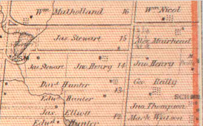
The Muirheads settled the 100-acre plot of land known as Concession IV Lot 15 in York Township in 1853. Alex Muirhead would build his farmhouse in the Ontario Vernacular style in that same year, situating it on the south side of what is now Old Sheppard Avenue. The Muirhead name was prominent in the area — so much so that the odd junction on the northwest corner of the lot was known as Muirhead’s Corners in the early 20th century.

Concession IV Lot 15 from 1860 Tremaine’s Map of the County of York, Canada West. Source: Historical Maps of Toronto.

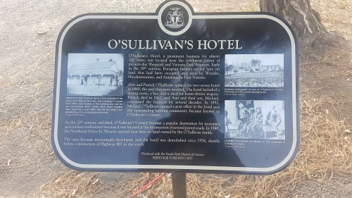
In 1860, Patrick O’Sullivan and Ann O’Reilly opened the O’Sullivan Hotel on the eastern part of Lot 14, directly south of the Muirhead property. The hotel featured ‘two bedrooms, dining room, and a bar’. The structure was situated on the west side of the York-Scarborough line across the Third concession on the Reilly farm.

O’Sullivan’s Hotel (centre background), circa 1920s. Source: Toronto Public Library & North York Historical Society.

1878 Illustrated Historical Atlas of the County of York. Source: Historical Maps of Toronto.

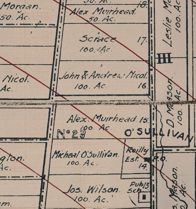
The area grew from here. In 1873, part of the O’Reilly land was used to house a one-room public school. The school — named School Section #23, later Victoria Park School –roughly served the west side of townline from today’s Lawrence Avenue to Finch Avenue. In 1893, a Post Office opened at the O’Sullivan Hotel, cementing the area as a community with the moniker O’Sullivan’s Corners. The area, sometimes shortened to just O’Sullivan, rose to local landmark status in the early 20th century.

O’Sullivan and SS #3 from the Map of the Townships, York, Scarboro, and Etobicoke, 1916. Source: University of Toronto Map and Data Library.

School Section 23 (1873-1964), Toronto, Ont., 1956. Source: Toronto Public Library.

The rise of automobiles and highways in the early 20th century aided in the growth of O’Sullivan. Beginning in the 1910s, significant changes took place along the roadways of northern Scarborough and North York. Motorized vehicles were on the increase and, with them, convenient and leisurely long-distance travel through the suburbs of Toronto. One can imagine couples and families venturing through O’Sullivan’s Corners and stopping for a Sunday lunch.

Toronto Daily Star, September 11, 1925. Don Mills Road jogged east at York Mills Road and then north to what later be Woodbine Avenue. Source: Toronto Public Library.

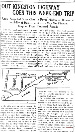
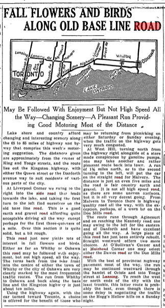
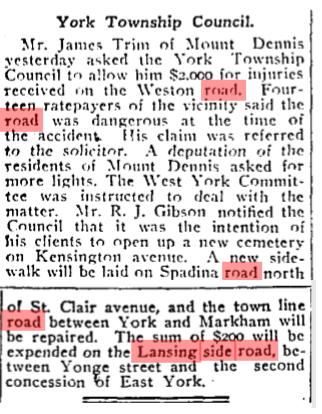
The main east-west street through these parts was Lansing Sideroad (sometimes named Lansing Cut-Off), which — next to Kingston Road — was the main way from the centre of Toronto to Pickering and Oshawa. Named after the community it originated in, Lansing Sideroad extended east from Yonge Street, passing the community of Oriole at Leslie Street and Muirhead’s Corners at Don Mills Road (later Woodbine Avenue).It stitched together east-west routes connecting the Concession roads of North York: Bayview (2), Leslie (3), and Woodbine (4).

In the 1920s, newspapers presented weekend road trips through the areas around Toronto. Toronto Daily Star, September 9, 1927. Source: Toronto Public Library.

Lansing then jogged south at the townline near O’Sullivan before continuing into the Scarborough through Agincourt and Malvern following the old Third Concession Road. In 1911, Lansing Sideroad was paved to allow better navigation. It is unclear when it was named Lansing Road, but there is an early mention of improvements to the road in 1903.

The Globe, June 2, 1903. Source: Toronto Public Library

As the 1920s rolled into the 1930s, more upgrades were made to Lansing Sideroad. The Department of Public Highways of Ontario, created in 1916, sought to include the road in a larger highway network to improve motor vehicle travel. And so, on August 25, 1931, Premier George S. Henry inaugurated a new motorway between Lansing and Malvern on the street.

Toronto Daily Star June 21, 1929. Source: Toronto Public Library.

Toronto Daily Star, August 25, 1931. Source: Toronto Public Library.

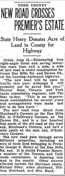
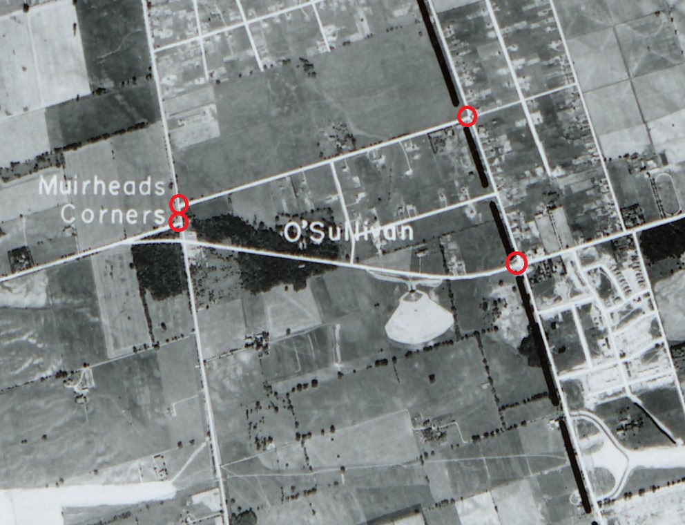
In another huge development, the two sections of the Lansing Sideroad in Scarborough and North York were aligned in 1934. The new curved section of roadway donated and purchased from several landowners in the area and eliminated multiple jogs between O’Sullivan’s Corners at Dawes Road and Muirhead’s Corners at Don Mills Road. Travellers now could travel more seamlessly between townships.

Toronto Daily Star, June 15, 1934. Source: Toronto Public Library.

Aerial photo of Muihead’s Corners, O’Sullivan, and the Lansing Sideroad, 1954. Source: University of Toronto Map and Data Library.

Along with the O’Sullivan Hotel, there were service centres, gas stations, and some shops to serve the local and commuting populations of O’Sullivan and Muirhead’s Corners in the early 20th century. The North-East Drive-In Theatre also opened between the communities on Lansing Road in 1947, further building on the virtues of car travel.

Looking south on Victoria Park Avenue from north of Sheppard Avenue East, Toronto, Ont, 1958. Source: Toronto Public Library.

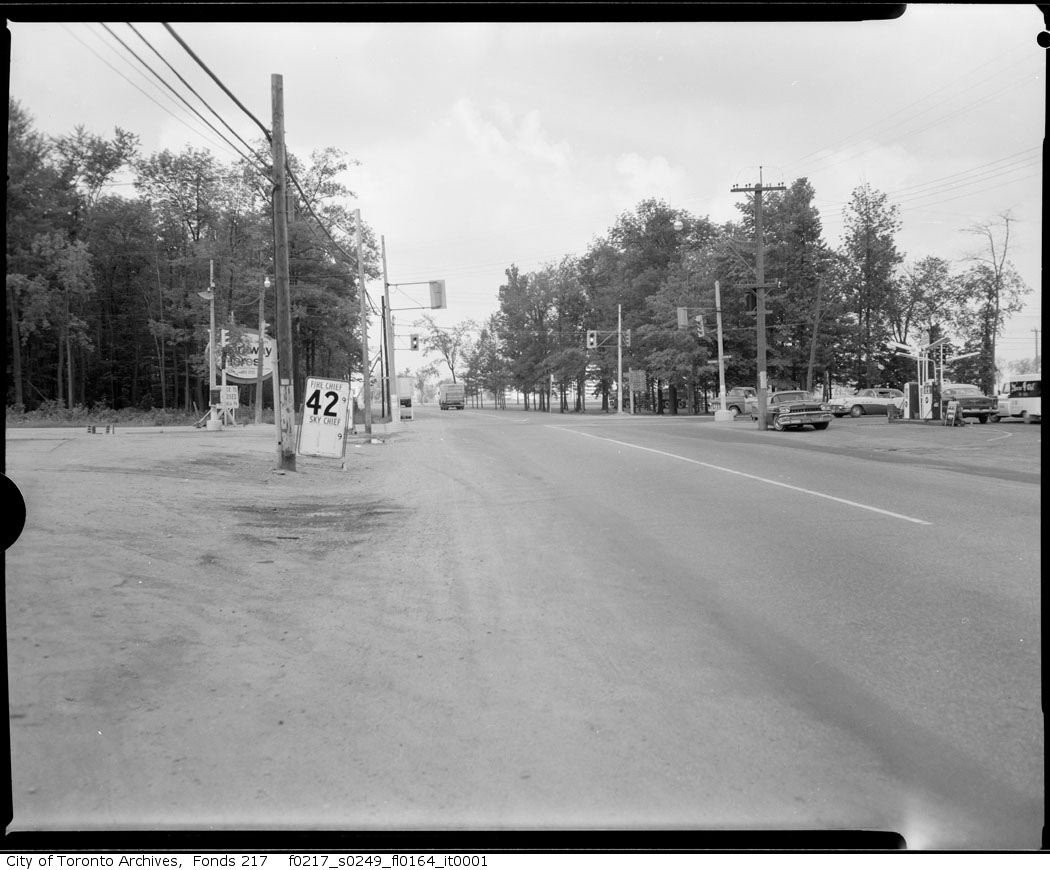
Woodbine Avenue looking west at Sheppard Avenue, 1965. Source: City of Toronto Archives.

Toronto Daily Star, September 23, 1947. The North-East Drive-In showed its final film in 1976 as the Consumers Business Park overtook the area. Source: Toronto Public Library.

The second half of the 20th century proved to be a transitional period for the area and the beginning of the end many things recognizable at O’Sullivan’s Corners. For a start, the road network was significantly altered — even more than before. Perhaps as a result of the new Metropolitan Toronto’s efforts to harmonize transportation in the city, Dawes Road and Lansing Sideroad both were renamed to Victoria Park Avenue and Sheppard Avenue East in the 1950s.

Victoria Park Avenue, Sheppard Avenue East, Lansing Road from 1955 Metropolitan Toronto Map. Lansing Side Road seems to have renamed in Scarborough even as the North York section became Sheppard Avenue. Both would be under the Sheppard name in the 1960s. Source: University of Toronto Map and Data Library.

The four-laned Toronto By-Pass — now Highway 401 — opened as the new east-west alternative to Kingston Road and Lansing Road in and out of the Toronto area in 1957. It included an exit at Victoria Park Avenue.

Toronto Bypass, 1956. Source: City of Toronto Archives.

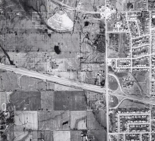
And in a final update to motorways, Highway 404 replaced Woodbine Avenue north of Highway 401 by 1967. The move spelt the end of Muirhead’s Corners, as the junction was physically eliminated to make way for the highway. It also meant Old Sheppard was now cut off at its west end, now looping into a new Muirhead Road (near a school also named for the pioneer of the street).

Aerial of the Don Valley Parkway and Highway 404 under construction in 1966. Consumers Business Park is also roughed in. Source: City of Toronto Archives.

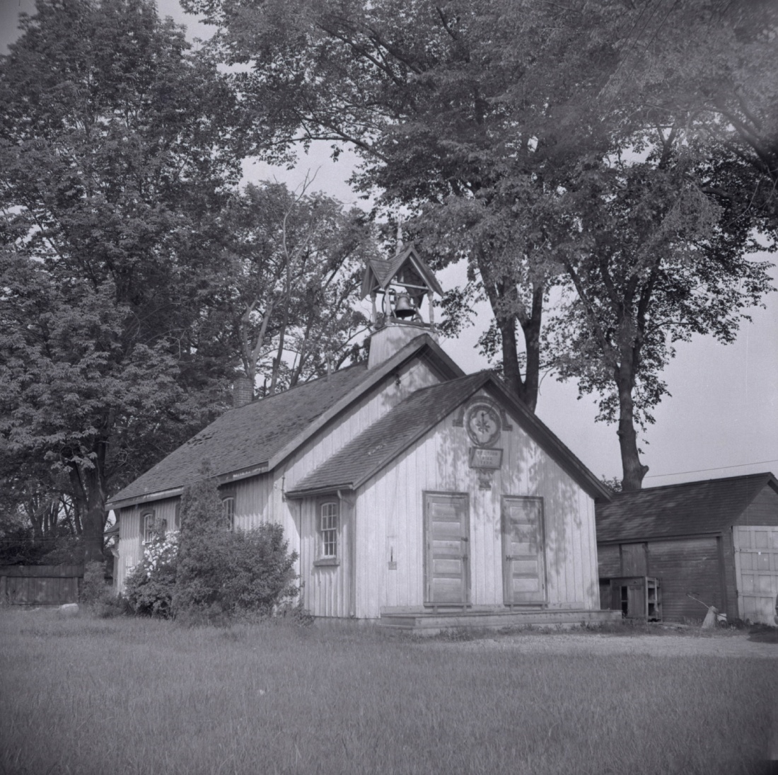
It is hard to pinpoint when O’Sullivan’s Corners stopped being O’Sullivan’s Corners, but the 1950s and ’60s is certainly a start. After nearly a century in operation, O’Sullivan’s Hotel was closed in 1954. The reasons? Perhaps interest had faded from patrons and management. Or the costs were too high. Its replacement was a gas station — a use the corner continues today. To its south, SS #23 was also lost in 1964 to accommodate more lanes for Highway 401. (Its belfry and bell was salvaged by Herbert and Rosa Clark and is now on display at the Guild Park in Scarborough along with our salvaged building fragments of the post-war era)

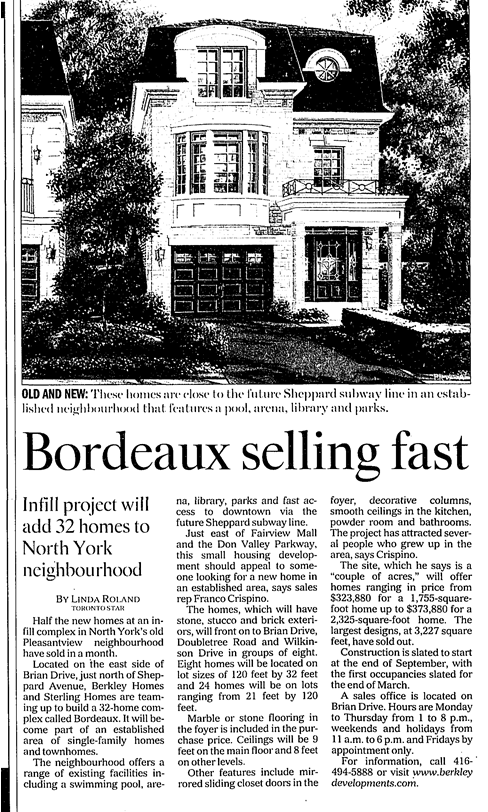
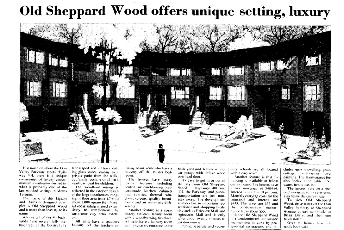
By at least 1950, the Muirhead farm was also divided up to host a new residential community. Brian Drive (originally Sandra Boulevard) and Patrick Boulevard both hosted houses with large lots. The old Muirhead farmhouse also received new neighbours on its street. Curiously though, Old Sheppard is unnamed in maps from the 1950s. (Perhaps the moniker came into existence when it was orphaned by the highway 404.)

Aerial of Old Sheppard, Brian Drive, Patrick Boulevard in 1953. Source: City of Toronto Archives.

In the early 1970s, brand new houses went in north of Patrick Boulevard and east of Brian Drive, replacing most of the housing stock from twenty years prior. The Muirhead farmhouse was already situated close to the street, so when the new houses went in beside it, it was relatively integrated into its surroundings.

Around the corner on Brian Drive, a line of more modern residences in the middle of the street curiously deviates from neighbouring housing styles. The story: When this area bought up and sold by redevelopers in the 1970s, it seems one property held out on selling. Its deep lot stretched to Wilkinson Drive, leaving the new streets in between incomplete. The holdout looks like it lasted about 30 years until around 2001 when four rows of infill development went in. With that, Doubletree and Wilkinson were finally connected.

Source: OldTO, 1992 vs 2020.

Source: Google Maps

Source: Toronto Star, April 14, 2001

On Patrick Boulevard, a house from the same era as the Brian Drive holdout residence remains. It never had to sell, though. This house is noticeable because, although it is neighbours with houses it predates, it is set back considerably from the street with a long driveway.

Source: Google Maps

On the west side of Brian Drive, apartment towers and townhouses went up steadily through the 1970s too. The ‘Crossroads’ buildings, in particular, are appropriately and geographically named.

Source: Globe and Mail, May 25, 1979

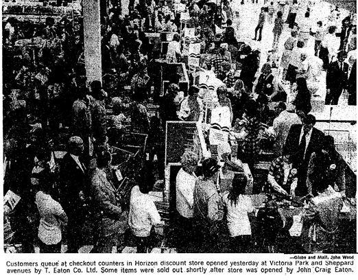
Victoria Park Square is the local mall for the area. It opened in 1972 on the former site of the O’Sullivan Hotel to serve the up-and-coming residences. It was known in those early days for hosting the first Horizon — Eaton’s chain of discount stores. A Heritage Toronto and North York Historical Society plaque today tells the story of O’Sullivan’s Hotel.

Source: Globe and Mail, August 17, 1972

In 1988, a second plaza was built at the corner of Brian Drive and Sheppard Avenue. Named ‘The Shoppes of Brian Village’, the plaza resembles a village centre. It was significant enough to warrant an Urban Design award from the city in 1988. The site also gives the area another name: Brian Village (or perhaps vice versa).

Source: Toronto Star, November 29, 1988


Today, this community is part of the modern Pleasantview census tract – a total area which reaches up to Finch Avenue East. It is a mix of mostly English and Mandarin speakers, with some Italian and Greek households.

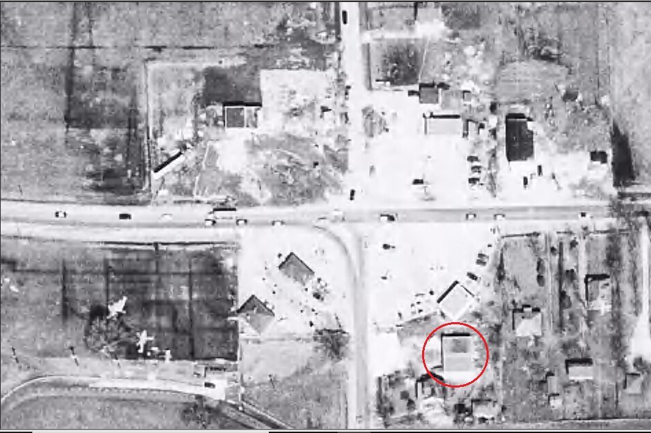
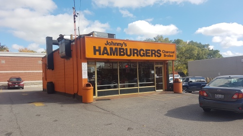
The name is not in use anymore, but how much of O’Sullivan’s Corners is left? O’Sullivan School certainly lives at the Guild as a physical remnant. More than that, the busy nexus of Victoria Park and Sheppard — where the hotel once stood — may have a clue. Today, the intersection hosts a gas station, a breakfast spot, a pizza place, and a drugstore. Next to that drug store is the famed Johnny’s Hamburgers. The building housing Johnny’s is from about 1956. The burger joint got its start about ten years later by a Greek immigrant.

Victoria Park Avenue and Sheppard Avenue, shortly after the loss of O’Sullivan’s Hotel, 1956. Note the dual units. By 1970, it was just one unit: Johnny’s. Source: City of Toronto Archives.

Although it post-dates the era of the O’Sullivan Hotel, Johnny’s Hamburgers grew out of the car-centric circumstances that brought the area prominence. The simple, table-less interior also plays tribute to North-East Theatre as its one-time neighbour. Even if the place no longer exists, a visit to Johnny’s may a taste of the O’Sullivan community of old.

Toronto’s First McDonald’s

With restaurants located in nearly every pocket of Toronto, McDonald’s — for better or worse — is ubiquitous in the city. Although Torontonians may not give their existence a second thought, the origin story of this mega-chain is largely unknown. Just how did McDonald’s get its start in Toronto and where was the first eatery located?

McDonald’s locations of Toronto as of 2019.

The first McDonald’s opened in Toronto was in North York at 3777 Keele Street near LePage Court (just south of Finch Avenue) in May 1969. The Big Mac had just made its way onto the hamburger chain’s menu. It was also several decades into Toronto’s post-WWII suburban growth and a fast food boom was already underway.

The first McDonald’s — centre of image — was located at suburban Keele Street and LePage Court. Credit: City of Toronto Archives, 1971.

The event came after a couple of other Canadian McDonald’s milestones. The first ever outlet in the country (and indeed, outside of the United States of America) opened in Richmond, British Columbia in 1967, spearheaded by future Keg founder George Tidball. The premiere franchise in Ontario (and Eastern Canada) opened its doors at 520 Oxford Street West in London. The date was November 11, 1968. The man in charge of that operation and growing McDonald’s in Canada was George Cohon. He opened another locale at 344 Queen Street East in Brampton in the same year, which was the first in the Greater Toronto Area. In 1971, Western and Eastern Canada operations merged to create McDonald’s Canada with Cohon at the helm.

The original London location and its golden arches look as they appeared when it opened in 1968. A time capsule and plaque marks its significance. Credit: Google Maps, 2018.

Credit: Globe & Mail, February, 10, 1971

Subsequent Toronto McDonald’s locations opened in the same year as Keele Street. There were eateries at 6170 Bathurst Street, 3660 Dufferin Street, 1068 Islington Avenue (originally 170 Islington Avenue South), 2116 Kipling Avenue (originally 1466 Kipling Avenue North), and 2701 Lawrence Avenue East. The latter was also the first McDonald’s in Scarborough. Two more locations — 5955 Leslie Street and 2870 Eglinton Avenue East — opened in 1970. Advertisements in those years marked contests, store openings, a reduction in menu prices, and job openings (oddly, many were targeted to mothers). Adding to these original eight locales, McDonald’s Canada would continue to steadily open more franchises as the decade marched on.

McDonald’s and its famed clown mascot draw up a Toy World contest. Note the list of restaurants in existance at the time. Credit: Toronto Daily Star, November 21, 1969.

Credit: Toronto Daily Star, August 9, 1969.

Credit: Toronto Daily Star, November 6, 1970.

Credit: Toronto Daily Star, June 3, 1970.

All these initial locations were purposely situated outside Toronto’s downtown core. As was the case in the United States, McDonald’s policy was to find “suburban situations” with a “backup community”. The idea was captured in the company slogan: ‘We count the church steeples and station wagons’. In other words, McDonald’s restaurants were to be located within a built-in market of families and traffic flow. According to Cohon, they were to be active parts of their new communities.

McDonald’s locations of Toronto as of 1971.

A growing Bathurst and Steeles area in 1971. McDonald’s is situated at the bottom of the image. Credit: City of Toronto Archives.

The McDonald’s origin story goes back to a hamburger and fries stand in 1940s San Bernardino, California. Two brothers, Richard “Dick” McDonald and Maurice “Mac” McDonald, invented the ‘Speedee Service System’ — a Henry Ford-eque approach on food production. No carhops, no tables, no plates, and no half-hour wait times. People only had to drive to the lot, place their order at the window via a very streamlined menu, receive their meal, drive away, and enjoy wherever they wanted. With this, fast food and the drive-in restaurant was born. Ray Croc — the McDonald brothers’ ambitious business partner until he aggressively bought out the company from them in 1961 — made the entreprise into a national and international icon.

To be sure, McDonald’s was not the first to enter the drive-in, fast-food restaurant market in Toronto. The first Harvey’s in Canada opened just north of the city at Yonge Street and Observatory Lane in Richmond Hill in 1959. Tim Horton’s originally failed in the 1960s because of competition from other drive-ins. McDonald’s did, however, help to increase the profile of fast food at a time where it was not yet at modern day levels. A 1970 Globe and Mail article explained the 1960s had seen a buzz around fast food but that had slowed by the end of the decade as land, food, and construction costs rose and the market was over-saturated with eateries. It also went into detail about the specific criteria of fast food, as if the concept was not fully developed. With competitor Burger King opening their first Toronto restaurant a year after McDonald’s and now defunct Burger Chef giving both a real run for consumer dollars, a new era was on the way.
The look of the McDonald’s Canada restaurants mirrored their American counterparts. Buildings were usually one storey, highlighted architecturally with two golden arches. Following the drive-in model, parking spaces surrounded the structure and a large, recognizable ‘M’ sign stood at the end of the driveway. However, a key difference with Canadian franchises was more space to eat meals inside the diner. As the 1970s progressed, McDonald’s restaurants came to be more sit-down eateries.

A look at the architecture of early McDonald’s Drive-Ins. Credit: Toronto Daily Star, November 13, 1970.

Despite McDonald’s commitment to be contributing members of their new communities, not all neighbourhoods were receptive to the Golden Arches. In 1971, residents of suburban Roe Avenue argued against a McDonald’s that was set to go on their street at the corner of Avenue Road. The company took over a defunct gas station and subsequently bought and demolished two houses to make a parking lot. Residents argued that the area was zoned for residential use and the drive-in would only bring noise to the quiet neighbourhood. The McDonald’s ultimately went in as planned.

Credit: Globe & Mail, November 30, 1971.

A similar battle took place in Markland Wood in Etobicoke in 1977. Residents fought against a location at a mall at Bloor Street and Mill Street. They argued the restaurant did not fit zoning bylaws (McDonald’s argued it was a sitdown restaurant rather than a drive-in). They almost won too, but like Roe Avenue, a McDonald’s is still there today.

Credit: Toronto Star, October 22, 1977.

These battles highlight the theme of the McDonald’s — and drive-ins in general — as evolutionary by-products of automobile-centred suburbs. By the arrival of the 1970s, ‘quiet, tree-lined’ suburbs had grown to encompass new uses for the car, which now included a new method of food consumption. Steve Penfold writes they were a part of a new transformed landscape of “gas stations, car washes, and other drive-in uses”. As highlighted by Roe Avenue and Markland Wood, the placement of parking lots to serve these new spaces and the implications on zoning became serious issues. Politicians like North York Controller Mel Lastman, Alderman Paul Godfrey, and Scarborough Mayor Paul Cosgrove waged some sort of battle to curtail the expansion of more drive-ins.

By the end of the 1970s, McDonald’s dropped its exclusivity of suburban locations. The first downtowner was on Yonge Street south of Bloor around the middle of the decade. Others would open up on the street near King and Adelaide Streets and further north near St. Clair and Eglinton Avenues. Fifty years and around a hundred frachises later, McDonald’s fingers extends into Toronto’s modern and heritage buildings, food courts, strip malls, Wal-Marts, subway stations, and even the Toronto Zoo.

McDonald’s at Yonge Street and Grenville Street between 1977 and 1983. Credit: City of Toronto Archives.

The original Keele Street McDonald’s closed around 2006. It would however relocate to a new building slightly to its north. Outlets at Islington, Dufferin, and Leslie each converted to other restaurants too. The Bathurst and Steeles location is now the oldest continually operating site in Toronto, although the building — like many others in the city — has been heavily altered.

The oldest McDonald’s in Toronto, Bathurst and Steeles Avenue. Credit: Google Maps, 2018.

A question might be if a historical marker like the ones in London or Richmond is warranted on either the first or earliest surviving Toronto McDonald’s. The proliferation of fast food and the chain itself has certainly had negative impacts on society, and this is a case against ‘celebrating’ McDonald’s significance as something of deep value. But in a more neutral sense, the geographic and cultural reach of the company, its impact on daily Toronto life, and its association with the development of suburban Toronto may bring on at least a closer recognition of its significance and existence. And with existence comes the origin story.

Sources

Advertisement for McDonald’s, Toronto Daily Star, 21 Nov, 1969, p. 37.

Advertisement for McDonald’s, Toronto Daily Star, 06 Nov, 1970, p. 11.

Advertisement for McDonald’s, Toronto Daily Star, 13 Nov, 1970, p. 11.

Advertisement for McDonald’s, Toronto Daily Star, 04 Oct, 1975, p. 19.

Bateman, Chris. “That Time Toronto Got Its First Taste of Tim Hortons.” BlogTO.

Bradburn, Jamie. “Vintage Toronto Ads: McLower Prices at McDonald’s.” Torontoist, 14 Aug. 2012.

Bullock, Helen. “Arch enemy: A counter atteck repels Big Mac in the battle of Markland Woods” The Toronto Star, 22 Oct 1977, p. A10.

Cohon, George. To Russian With Fries. McClelland & Stewart, 1999

“Dining with Liz.” Toronto Daily Star, 9 Aug. 1969, p. 32.

Gray, Stuart. “Maple leaf forever.” The Globe and Mail, 5 Jul 1973, p. 39.

Howlett, Karen. “Subway Plan Could Benefit Sorbara Family.” The Globe and Mail, 23 Apr. 2018.

Job Advertisement for McDonald’s, Toronto Daily Star, 03 June 1970, p. 61.

Job Advertisement for McDonald’s, Toronto Star, 28 Aug 1979, p. C19

Johnson, Arthur. “For the man on the beat, meals are cheap.” The Globe and Mail, 10 Aug 1976, pg 1.

Lancashire, David. “Burgers, Chicken Pizza Boom: Fast food is tops with Canadians.” The Globe and Mail, 23 May, 1979, p. 7.

Mirsky, Jesse. “Original Harvey’s Restaurant Demolished to Make Way for Condos.” National Post, 13 Mar. 2012.

Moore, Michael. “Pace slowing as fast food meets snags” The Globe and Mail, 05 Aug 1970, p. B1.

Moore, Michael. “Supermarkets can be major factor as burger giants battle to keep growing.” The Globe and Mail, 06 Aug 1970, p. B3.

Parsons, Anne. “Fears swallowed: McDonald’s is picked to cater in new zoo.” The Globe and Mail, 6 Jul 1973, p. 1

Penfold, Steve. “‘Are We to Go Literally to the Hot Dogs?” Parking Lots, Drive-Ins, and the Critique of Progress in Toronto’s Suburbs, 1965–1975 – Urban History Review.” Érudit, Urban History Review / Revue D’histoire Urbaine, 17 May 2013.

Rasky, Frank. “McBreakfast: Fast food grabs the morning rush” Toronto Star, 02 April 1979, p. C1.

Rauchwerger, Daniel. “The Architecture of ‘McDonald’s’ – Architizer Journal.” Journal, 7 Nov. 2017.

Roseman, Ellen. “The man who’s eating up Canada’s fast food industry.” Toronto Star, 22 Feb 1975, p. B1.

Roseman, Ellen. “The Consumer Game: Salad bars good news for waist watchers.” The Globe and Mail, 13 Mar 1979, p. 14.

Shepherd, Harvey. “51 Canadian outlets: Merger brings McDonald’s units under single direction.” The Globe and Mail, 10 Feb 1971, p. B1.

Shepherd, Harvey. “Speed the crux as McDonald’s anticipates costumers’ orders, healthy profits.” The Globe and Mail, 10 Feb 1971, p. B13.

Slover, Frank. “McDonald’s expects profit near $6 million” The Globe and Mail, 03 May 1973, p. B3.

Stern, Beverley. “The Canadian Jewish News, Thursday, May 15,1980 – Page 9.” SFU Digitized Newspapers.

“Truce called in hamburger fray.” The Globe and Mail, 3 Dec 1971, p. 5.

Whelan, Peter. “The hamburger drive-in and the quiet street.” The Globe and Mail, 30 Nov 1971, p. 5.

Scenes From Earl Bales Park

The history of Earl Bales Park starts with the John Bales House. The family arrived in the Bathurst and Sheppard area in 1824, finding a hilly topography bordering on the West Don River. John Bales cleared the land and built a log farmhouse south of Sheppard and east of Bathurst. From there, the layers of story build.

Bales House, south-east view, date unknown. From North York Historical Society. Credit: Toronto Public Library.

Tremaine’s Map of the County of York, Canada West, 1860. Credit: Historical Maps of Toronto.

Steps from the John Bales House is the Earl Bales Community Centre. The meeting place for classes and events came to us by 1981 (a revitalization project took place in 2018 too). Before its arrival, another complex of buildings were neighbours to the John Bales House: The York Downs Golf and Country Club.

York Downs Golf and Country Club near Armour Heights, North Toronto, 1926. Credit: Toronto Public Library.

In 1922, the York Downs Golf Course opened on the former Bales land (albeit by then property passed into the hands of Shedden Company). The John Bales homestead was actually the residence of the groundskeeper and the barn was part of the clubhouse.

“York Downs Course Ready Next Summer” The Globe, February 6, 1922. Credit: Toronto Public Library

Map of the Townships, York, Scarboro, and Etobicoke, 1916. Credit: University of Toronto Map and Data Library.

Ownership map – township of york showing unsubdivided area of 10 acres and over with names of owners and acreages, 1922. Credit: City of Toronto Archives

York Downs Golf and Country Club, 1953. Credit: City of Toronto Archives.

Ownership map for the region formerly known as the Township of York including York, North York, East York, Forest Hill, Swansea, 1932. Credit: City of Toronto Archives.

In 1968, the club’s executive voted to move to Unionville and to sell the property to Max Tanenbaum of Pinetree Developments for $6,400,000. Tanenbaum intended to build apartments and houses on the former course. After much debate, local protests under the banner of ‘Save York Downs’ stopped the proposal. Ultimately, Metro Toronto Council purchased the property in 1972 for $9 million to use for parkland. Council also did the same with the Tam O’Shanter Golf and Country Club in Scarborough, although that ultimately became mostly a municipally owned golf course. Earl Bales Park — named for a former North York Reeve and great-grandson of John Bales — opened on a chilly December 2, 1973 with one last round of golf on the 163 acre site.

“Max Tanenbaum and Morry Smith”, Toronto Daily Star, April 16, 1971. Credit: Toronto Public Library.

Walking south from the Bales homestead, the landscaping leftovers of the York Downs course are still evident on the land with sand traps, mounds, and trees. Then and now aerial maps provide an interesting comparison of the layouts of the course and the park.

York Downs Golf Course & Earl Bales Park, 1947 & 2019. Credit: Sidewalk Labs OldTO.

Walking down the western half of Earl Bales Park, you can see several attractions added to the park over the years. Taking advantage of the park’s elevation, the North York Ski Centre came in 1973 to provide local skiing to the residents of North York and Toronto.

“North York’s Big Opener”, Globe and Mail, Jan 9, 1974. Credit: Toronto Public Library.

There is also the Barry Zukerman Amphitheatre, which came by 1989 and named for a prominent Canadian Jewish businessman. The theatre is notable for its great performances in the summer.

The most powerful installation in Earl Bales Park is undoubtedly the Yad Vashem Holocaust Memorial. It was unveiled in 1991 with The Wall of Remembrance devoted to victims and survivors coming in 2001. Particularly sombre is the portion dedicated to children, including Anne Frank. The obelisk is the Spirit of Bravery Memorial.

Finally, a bust of Philippine National Hero Dr. Jose P. Rizal came as a gift from the Philippine Government to the City of Toronto in 1998.

These additions to Earl Bales Park represent the notion that parks can be and should be reflections of their environs. For example, the John Bales House — a representation of British colonial York — is now the Russian House Toronto. Since the end of the World War II, the area around the park along Bathurst Street gradually grew with new subdivisions and new populations. Toronto’s Jewish population (and Eastern Europeans in general) moved north on Bathurst to Forest Hill by 1950 and even further to Bathurst Manor in 1957. Toronto’s Filipino population arrived to the city mostly in the 1960s, first to St. Jamestown and then to ‘Little Manila’ at the Bathurst and Wilson area.

“Bathurst Manor Shopping Plaza Grand Opening”, Globe and Mail, November 21, 1957. Credit: Toronto Public Library.

One neighbouring area tied to the history of the York Down Golf Course is Armour Heights. The community, located directly south of Earl Bales Park, is named for the Armour family who were contemporaries of the Bales clan. The Armour lands came under the control of the Robins Real Estate Limited in the early 20th century, who in the 1910s and 1920s intended on making three master-planned, upscale communities in north Toronto: Armour Heights, Ridley Park, and Melrose Park. Together these were to be the ‘Highlands of Toronto‘. Robins Ltd also had a hand in Cedarvale’s ambitious genesis. Much in the same way as that suburb, Armour Heights was planned with lavish roundabouts, gardens, squares, and tennis courts and bowling greens.

Armour Heights – being the subdivision of parts t lots 11, 12, 13, Concession 1, west of Yonge Street, circa 1913. Credit: City of Toronto Library.

“The Highlands of Toronto”, Toronto Daily Star, April 13, 1923. Credit: Toronto Public Library.

“Why People Are Buying in Armour Heights”, The Globe, April 9, 1923. Credit: Toronto Public Library.

The owner, Colonel Frederick Burton Robins, built a Tudor-style estate house near Yonge Street and Wilson Avenue. Marketing pieces highlighted a bus line between Yonge and Bathurst Streets via Yonge Boulevard and Armour Heights’ proximity to the York Downs Golf Course. Armour Heights hosted air demonstrations and was even considered by McMaster University for a campus.

Robins Country Estate, Wilson Avenue west of Yonge Street, circa 1930. Credit: City of Toronto Archives.

“Robins Limited Motor Bus Service”, Toronto Daily Star, May 21, 1914. Credit: Toronto Public Library.

“A Plan of The Splendid Site on Armour Heights”, Toronto Daily Star, December 24, 1926. Credit: Toronto Public Library.

Like in Cedarvale, Colonel F.B. Robins’ vision for Armour Heights never fully materialized. By 1929, he sold the 300 acres to R. K. Lillico and associates for $930,000. Their idea was to re-brand the area as ‘Beverley Hills’, but the moniker never caught on. The street grid developed under its current form, filling out completely by 1950. It did eventually receive its bus line with the Toronto Transit Commission’s Armour Heights route in 1952. Armour Heights Robins’ grand estate house is now used by the Canadian Forces College. Today York Downs Boulevard — one of the early streets — remains as a tribute to the golf club and fittingly connects the park and subdivision.

Back in Earl Bales Park, a man-made pond exists on the southern end. Earl Bales Lake is a storm-water management pond. Beyond it is the Don Valley Golf Course. The Hoggs Hollow Bridge portion of Highway 401 runs over the course. The Toronto By-Pass, as the expressway was known before it was numbered, opened here in 1953, splitting up the golf course and Armour Heights.

Don Valley Golf Course, Yonge St., w. side, from s. to n. of Macdonald-Cartier Freeway; looking n.w. to Macdonald-Cartier Freeway bridge over West Don River., 1955. Credit: Toronto Public Library.

The east side of Earl Bales Park is scenic walk through nature. One is struck by the tree cover, both on this hills and in the valley. A topographical map of the West Don River from 1915 shows off the contours and some cases the tree types of the land that would become the park.

Plan of west branch Don River Valley from Lawrence Avenue to corner Sheppard and Bathurst, 1915. Credit: City of Toronto Archives.

One also gets a look from below at the ski slope. ‘Downs’ refers to a grassy hill, so this might explain the naming of golf course.

A shallow west branch of the Don River runs through the edge of the property. The river and the way across it has had a few interventions in the second have the 20th century. At one time, albeit north and south of the park, the waterway hosted saw and grist mills. In 1956, the river’s winding course was straightened.

West Don River, 1953-1956. Credit: City of Toronto Archives.

Further up, at the park’s northern entrance, one looks up at the massive bridge carrying Sheppard Avenue West over the West Don River Valley. A marker dates the bridge to 1961, but it is not the first structure in this location

The history is unclear, but the first photographed bridge was a wooden construction that existed until at least from 1910 (its construction date is unknown).

Sheppard Avenue bridge over the Don River near Bathurst Street., 1910. From North York Historical Society. Credit: Toronto Public Library.

Wooden bridge over Don, 1908-1910. From North York Historical Society. Credit: Toronto Public Library.

Its replacement — a more sturdy setup — came by 1920. Flood damage from Hurricane Hazel briefly closed the bridge in November 1954. The storm did, however, completely wipe out the nearby Bathurst Street Bridge. The event might have led to the bridge’s replacement in the following decade.

Sheppard Avenue West bridge over West Don River, 1920. This is the same view as the above wooden bridge photo. Credit: City of Toronto Archives.

“Find Flood Damage, Close Sheppard Bridge” Globe and Mail, November 26, 1954. Credit: Toronto Public Library.

Don River (West Don R.), looking w. across Sheppard Ave. bridge, 1954. Photographer James Salmon notes the bridge’s washout after Hurricane Hazel. Credit: Toronto Public Library.

The third – and present – bridge began construction in 1961 and opened by 1962 or 1963. The section of the West Don River below it was channelized with concrete holdings. Also in 1962, the Don River Boulevard bridge replaced an earlier bridge opened in 1928. The short and quiet street curiously dates to the 19th century – at least to 1860 by cartographic accounts – and ran through the Shepard family property in Lansing to Bathurst. When both bridges were replaced in the 1960s, Don River Boulevard was also reconfigured to circle up the Sheppard Avenue, linking the street with the park.

Sheppard Avenue over Don River, 1962 & 1963. Credit: City of Toronto Archives.

Source: Toronto Daily Star November 30, 1928.


Exiting Earl Bales Park, one may go up to the main street or cross the bridge into the Hinder Property, leaving behind a great history.

Useful Links

Marshall’s Musings – “Exploring Earl Bales Park”

North York Historical Society – “June-August 2015 Newsletter”

OldTO Mapping historical photos

Scott Kennedy – Willowdale: Yesterday’s Farms, Today’s Legacy

Scenes From East Don Parkland

It’s all about the layers in the East Don Parkland. The residual landscape from the last Ice Age, the ravine, which stretches from Leslie and Steeles to Don Mills and Sheppard, has come to see pre-contact wilderness, colonial farming and industry, and post-war revitalization and reconfiguration.

But ‘East Don Parkland’ is a bit of a misnomer if only because it encompasses not only the east branch of the Don River but another – albeit smaller – tributary waterway.

German Mills Creek originates just to the north of Steeles in its historic namesake Markham community (sadly, now lost). The label is pretty literal, too: German Mills was once an industrious village along John Street founded by Bavarian-born William Berczy and a group of his countrymen and women. In addition to being a prosperous settlement, the community was instrumental in the early development of York too. The goods supplied by the mills aided in constructing the actual built form of the young town. The German Mills pioneers also cleared Yonge Street from Eglinton to Thornhill before the Queen’s Rangers finished the job.

East Don Parkland became part of Toronto’s parks network in the 1980s after efforts to remediate and rehabilate a river that had been worn out by European activity. Today, it is home to a number of flora and fauna, most notably salmon and white-tailed deer, the latter which are prominently displayed on the park’s signage. A neat tidbit: the deer’s precense in Toronto dates back to around 9000 years after the end of the last Ice Age.

Cummer Avenue bisects (or trisects?) East Don Parkland and offers more history. Unsurprisingly, the street’s name plays homage to the family who toiled around and built it – although to different designs.

Jacob and Elizabeth Kummer (the name was inexplicably changed to a ‘C’ around 1820), like the pioneers of Markham were of German descent, and came to the Toronto area in 1795, first settling near Yonge and Eglinton. They would relocate further up the main street to Willowdale where they would amass an extraordinary fortune. Their original property was a 190-acre lot fronting Yonge and stretching to Bayview. With subsequent generations of Cummers, their holdings grew to encompass not only large plots fronting Yonge but portions of the East Don Valley too. Whereas the former real estate was good for farming and commercial activities, the power of the river allowed the Cummers to engage in some industry. In 1819, they built and began operating a sawmill.

The Don property was interestingly significant in that early settlers as well as First Nations peoples took part in church and camp activities there. Through the meetings, the area was famously known as “Scripture Town” and “Angel Valley”.

East Don from Tremaine’s Map, 1860. Source: Toronto Historic Maps.

Around the 1850s, Jacob III, grandson of Jacob Kummer, built a farmhouse to overlook the valley. The home isn’t perfectly parallel to the street it rests on, making it a bit of an intriguing anomaly with the surrounding post-war subdivision.

To connect the Cummers’ Yonge and East Don holdings, a side road was constructed. Today, we know that road allowance as Cummer Avenue. Where the street crossed the East Don, it veered south to follow the curve of the river on its way to Leslie Street. The aforementioned mill was also located near this junction.

East Don River and Old Cummer, 1950. Source: City of Toronto Archives.

In the mid-1960s, Cummer was re-oriented away from the valley. A bridge that used to carry car traffic across the river serves as a reminder of its former course. One has to think of the vehicular ghosts when traversing the recreational trail that replaced the street.

A paved portion also leads to Old Cummer GO Station, where the street once passed through before the station’s construction in 1978. For years I puzzled about the station’s name. 

South of Finch Avenue, with golden foliage of fall to accentuate the walk, the trail winds on. 

So does the river, although not as it once did. Like Cummer Avenue, the Don’s history has come with some alterations. Along the way is at least one algae-covered oxbow – an orphaned or even ghost segments separated from the river’s course. This particular one was severed around the early 1950s.

East Don River, 1950. Source: City of Toronto Archives.

East Don River oxbow, 1965. Source: City of Toronto Archives.

One has to note the monstrosity of human construction that is the CNR Richmond Hill GO line looming above the park.

A fallen tree trunk spanning across the river instantly urges me of more pioneering connections. It reminds me of an Elizabeth Simcoe depiction of an early bridge across the Lower Don River.

Winchester Street, bridge over Don R. (Playter’s bridge), 1794. Source: Toronto Public Library.

Finally, at the park’s southern end is Old Leslie Street. Just like Old Cummer, Leslie used to take on a different route. Heading south, the street used to jogged west at Sheppard before continuing south, all presumably to avoid crossing the Don River.

Sheppard and Leslie, 1961. Source: City of Toronto Archives.

The junction of Old Leslie and Sheppard was the nexus of the tiny, lost mill community of Oriole, named for George S. Henry’s homestead located off the Betty Sutherland Trail

Old Leslie Street and Sheppard, 1956. Source: Toronto Public Library. Oriole Wesleyan Methodist Church stood on the southwest corner from 1873 to the 1950s.

By 1969, the street was rerouted directly through Sheppard. Old Leslie remains mainly as a service road for the Leslie TTC Station, terminating across from North York General Hospital.

Useful Links

City in the Trees – Retrospective: Sheppard, Leslie, and the Don

Discover the Don – Walk The Don – East Don Parkland 

City in the Trees – Treasures on the Doorstep

Hiking The GTA – Old Cummer Road 

Lone Primate – Closed Old Cummer Avenue

Patricia W. Hart – Pioneering in North York: A History of the Borough

Richard Fiennes-Clinton – Muddy York: A History of Toronto Until 1834

Scott Kennedy – Willowdale: Yesterday’s Farms, Today’s Legacy