
A&P is part of Toronto’s retail history, especially so because the franchise does not exist anymore in the city.
In the 1950s, the American-based company, formally called the Great Atlantic & Pacific Tea Co., opened several new super markets in Toronto’s outer communities. These stores and their eventful inaugurations offer a lens into not only the history of the brand, but also the emergence and evolution of Toronto’s inner suburbs.
5559 Dundas Street West, Etobicoke

Source: Toronto Star Archives
The A&P at 5559 Dundas Street West at Brown’s Line opened on July 8, 1952. As the advertisement notes, it opened at the junction of two highways: Five (Dundas) and Twenty-Seven (Brown’s Line). It also backed onto a Canadian Pacific rail line. At the time of its opening, the intersection was sparsely populated. The larger community at the western edge of the Toronto area was Eatonville, best known for being the farming property of its namesake family and department store barons, the Eatons.

Source: City of Toronto Archives
Very much in line with other store inaugurations in the period, the A&P advertisement presented the event as a multi-day spectacle. It was broadcasted over radio, with American singer and radio personality Smilin’ Jack Smith hosting. The famed 48th Highlanders band also played. The opening day flyer touts the supermarket as a “Parking Heaven” with plenty free parking. A map also boasted that “all roads” led to the supermarket, noting all the local major roads and the connecting communities. Many cars and people are depicted, including a long line filing towards and into the large glass store entrance. Altogether, it is very optimistic, with new life and new development now existing outside Toronto’s historic busy core.
The Globe and Mail reported the new super market cost $1,000,000 and included a warehouse building and a rail siding. It wrote: “The huge one-story structure provides consumers with the ultimate in shopping conveniences and affords the company the latest facilities for the efficient distribution of groceries in Ontario.”
By the end of the decade, the area had transformed along with the new store. Brown’s Line and Highway 27 were absorbed by the new Highway 427. The new interchange with Dundas resembled a cloverleaf. This development may have inspired the naming of the adjacent Cloverdale Mall directly across from A&P in 1956, an open air shopping centre whose anchor was another super market, Dominion.

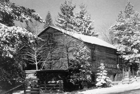
Source: City of Toronto Archives
Since 1952, the Dundas Street A&P has undergone a few noted changes. First, it is now Food Basics, which was founded in 1995 as a discount super market subsidiary under the A&P brand. Second, the complex’s area expanded, including an office space. This office is the Metro Ontario Division headquarters. Metro, a Quebec super market chain, acquired A&P Canada in 2005. Interestingly, at the Cloverdale Mall across the street, Dominion was acquired by A&P in the 1980s; the store is now a Metro.

Source: Google Maps

Source: Google Maps
25 Glen Watford Drive, Scarborough

Source: Toronto Star Archives
The A&P at 25 Glen Watford Drive at Sheppard Avenue opened on March 21, 1957. It served the historic village of Agincourt, a community with roots in the 19th century whose nexus was the crossroads of Church Street (Midland Avenue) and Lansing Road (Sheppard Avenue). First Street, depicted in the advertisement’s map, was part of an Edwardian residential subdivision. In the 1950s, the community opened its earliest post-war subdivision east of the Agincourt High School. In 1959, bus service ran from Kennedy Road to Sheppard Avenue, looping at Glen Watford, Rural Avenue, and Midland; it was one of the first to serve northern Scarborough.
Like the Dundas Street store, the store opening was a week-long affair. It featured giveaways to shoppers, and a radio broadcast, featuring Scarborough Board of Health Officer and Agincourt resident, C.D. Farquharson. Free parking and parcel pickups were emphasized. Nearly thirty stores in Toronto and area were listed, some with details such as having air conditioning.

Source: City of Toronto Archives
The evolution of the area around 25 Glen Watford contains some interesting developments. By the 1960s, Lansing Road became Sheppard Avenue; and Church Street merged with Midland Avenue to the south. First Avenue also became Agincourt Avenue. In 1963, the CP crossing on Sheppard was replaced by a rail overpass; the tracks were temporarily rerouted north during construction. Sheppard Avenue was also widened and Glen Watford was rerouted to curve towards Sheppard.

Source: City of Toronto Archives
In the late 1970s, the Glen Watford A&P was torn down. In its place, a strip mall was erected. A larger building also went up to the south, taking up space formerly occupied by properties on the north side of Sheppard removed in the improvements along the street the decade prior. This latter building was a roller rink called Roller World.

Source: City of Toronto Archives
In the mid-1980s, the area experienced its greatest evolution. In 1984, Hong Kong born developers bought the roller rink and transformed it into the Dragon Centre, an indoor Chinese mall (the former rink became a circular walkway for shoppers). It was the first of its kind in Toronto and Canada. The development spurred a change in Agincourt and Scarborough’s demographics, bringing East Asian residents and businesses to the area, including the strip mall to the north which replaced the A&P and the Glen Watford Plaza across the street, today’s Dynasty Centre.
The Dragon Centre wasn’t without controversy in the early years, however. Residents complained about the planning of the mall, particularly the parking and gridlock. There were also racist, xenophobic sentiments. Still, the mall endured, becoming a fixture in Agincourt.

Source: Google Maps
Today, the East Asian nexus on Glen Watford is set to endure another change. A development proposal has two condominium buildings to be erected on the site. A project entitled “Dragon Centre Stories” exists to preserve the memory of the places set to be replaced.

Source: City of Toronto Archives
2939 Dufferin Street, North York

Source: Toronto Star Archives
The A&P at 2939 Dufferin Street south of Lawrence Avenue opened on March 11, 1958. After WWII, Dufferin north of Eglinton Avenue filled out as an arterial street with commercial and industrial uses, and its surrounding residential streets with bungalows, schools, and churches. The Dufferin Street A&P backed onto Barker Stream, a tributary of Castle Frank Brook.

Source: City of Toronto Archives
Like the other A&P stores, the opening of the Dufferin store featured contests and giveaways, including “free Cokes for everyone!” It also praised its car-friendly qualities: a giant parking lot, parcel pickup, and “all roads in North West Toronto” led to it. This automobile haven was in the immediately geography too; directly next to the A&P was a drive-in ice cream spot, Tastee Freez. An archival image of the Dufferin A&P offers a comparison with the image in the 1958 ad; the stores are very similar with a noted difference being the positioning of the logo’d tower.

Source: City of Toronto Archives.

Source: City of Toronto Archives
Today, the A&P store is a Lady York Foods, an Italian grocery store. A Dairy Queen is now on the same lot as the former The Tastee Freez. The transformation to Lady York Foods is particularly intriguing because it represents the general shift in demographics in the Dufferin-Lawrence area: The community is largely Italian-speaking.

Source: Google Maps

Source: Google Maps
Do you remember these three A&P super markets or any other early A&P stores? Leave a comment below!
Sources Consulted
Bradburn, Jamie. “Vintage Toronto Ads: Fabulous Cloverdale Mall.” Torontoist, 19 Nov. 2014, https://torontoist.com/2014/11/vintage-toronto-ads-fabulous-cloverdale-mall/.
2016 Neighbourhood Profile Neighbourhood Yorkdale-Glen Park. https://www.toronto.ca/ext/sdfa/Neighbourhood%20Profiles/pdf/2016/pdf1/cpa55.pdf.
“25 Glen Watford Drive – Zoning Amendment and Site Plan Applications – Request for Direction Report.” City of Toronto.
“Eatonville.” Etobicoke Historical Society, https://www.etobicokehistorical.com/eatonville.html.
“Open $1,000,000 Super Market.” The Globe and Mail, July 11, 1952, p. 20.
“Roller Rinks and Magnetic Tapes.” Roller Rinks and Magnetic Tapes : Dragon Centre Stories, https://dragoncentrestories.ca/stories/roller-rinks-and-magnetic-tapes/.
Strauss, Marina and Gordon Pitts. “Grocery” Metro Musles into Ontario, winning A&P Canada bid.” The Globe and Mail, July 20, 2003, p. B1.


