I’ve been to the City Archives a few times before to toil away in the research hall. But I’ve never made it a destination for any other reason. The Archives, however, does put on museum-eque exhibitions, and its latest – ‘Made in Toronto: Food & Drink Manufacturing in Our City’ – caught my eye. Toronto’s industrial legacy is becoming a big fascination, so this came at a great time.
As the exhibit poster explains, there are a great number of manufacturing enterprises in Toronto today (more than people realize), but before we even get to today, ‘Made in Toronto’ sets out to present the city’s pioneering industrial players – companies like Weston Foods, Willard’s Chocolates, and Gooderham and Warts (among others).
The display is divided thematically into baked goods, meat, milk pantry items, chocolate, and alcohol. There are photos of insides and outsides of factories, maps, posters, and memorabilia in display cases. All of it is very well and thoroughly researched and presented.
Toronto isn’t the manufacturing town it once was and for a number of reasons. Cities and economies change, and industry in the middle of cities just doesn’t make sense anymore. It’s good to back and visit how things were. ‘Made in Toronto’ does just that. It runs until August 2015.
Bonus: and of course, one can’t go to the city archives without taking its ‘Miles of Files”!
Deep in the heart of suburbia on Wynford Drive just off the DVP, one can find the newest addition to Toronto’s museum scene – the Aga Khan Museum. It’s a curious place for an arts & culture hub, even with the Ontario Science Centre just a hop away.
In addition to its non-downtown location, the arrival of the AGM was marked with curiousity and a bit of controversy. The opening was delayed, its thematic content is unlike any other museum or gallery in the city, and its construction came with the demolition of the Modernist-designed Bata Shoe Headquarters. Talk surrounding the Aga Khan Museum overwhelming features the question: “Was it worth it losing one unique building for another?”
As I walk up to the museum, I don’t have an answer because it is tough to justify that kind of loss. That said, I can admit that it is a very impressive structure and a fine addition to Toronto’s architectural scene. The entire site consists of the museum itself, the Ismaili Centre, and, between them, a garden and terrace. It’s all a marvel, but I can’t help but wonder how it all looks in the summer (see below).
The inside is as much a visual wonder. Geometric patterning is a big part of the aesthetic of the Aga Khan Museum. I made a venture out into the courtyard after dropping my belongings at the (complimentary) coat check, which proved to be ill-advised because it was quite chilly. Again, I imagine a different vibe in warmer temperatures.
The main floor exhibition space features the museum’s permanent collection, which is essentially a historical journey through Islam. For me, it’s a subject matter that I did not encounter during my time as an undergrad of history, so it was a nice treat. The layout, design, and use of the space was very well done (not to mention, it’s got a distinct ‘new museum’ smell!).
The upper level dons ‘The Lost Dhow’, a temporary exhibit on loan to the AKM which features the recovered objects from a sunken ship in Indonesia. So much of the details of its sinking is unknown, but the interpretation and presentation is very well done!
Also on the second floor is the ‘Garden of Ideas’, a more contemporary art exhibition that overlooks the permanent collection below (people watching, anyone?). Towards the end of the exhibition was a fun artistic piece featuring a picture books of individuals saying ‘I love you’. Clever!
The Aga Khan Museum is also unique in that it contains a performing arts centre! The theatre itself is modestly sized and has great acoustics. The white star-like ceiling is a sight. The angular staircase in the lobby is also of great note.
In all, between the entire collection and the space itself, the museum doesn’t feel too big, but it’s not underwhelming either. It also helps that the building in of itself makes the Aga Khan Museum a destination. I spent a little over two hours exploring and taking in everything and would gladly return in the spring or summer to take it in again.
Update: Aga Khan Museum Park and Ismaili Centre, Summer 2015
Arriving on 69 bus, I find myself at the intersection of Kingston Road and Warden Avenue in the Birch Cliff neighbourhood of southern Scarborough. As a northern Scarberian, I’ve never been here before, but it’s a place I at least recognize through my fascination of ‘Before and After’ images.
Warden Avenue and Kingston Road, 1950s-60s to Today. Note the continuity in the bus and bank in both images. Credit: Scarborough Historical Society
I cross the street and stand in front of Taylor Memorial Library. I’m here to see a talk given by Historian Allan Levine on his new book ‘Toronto: Biography of a City’, which is part the Toronto Public Library’s Eh List. It’s 5:50pm. The talk isn’t for another hour and ten minutes, so I get to explore Birch Cliff – or a tiny bit of it, anyways. The first thing that strikes me is the road construction. Kingston Road is seemingly always under perennial maintenance. Must be a headache for Birchcliffians (?).
Warden Avenue south of Kingston is the only portion of the throughway that isn’t served by public transit. It is narrow, tree lined, and entirely residential. Above all, it’s quiet and quiet nice. There are a number of people outside as I walk, and I wonder how they feel about living here and if there’s some kind of Birch Cliff identity. The houses themselves are a mixture of older one-storey homes, bungalows, and post-modern creations.
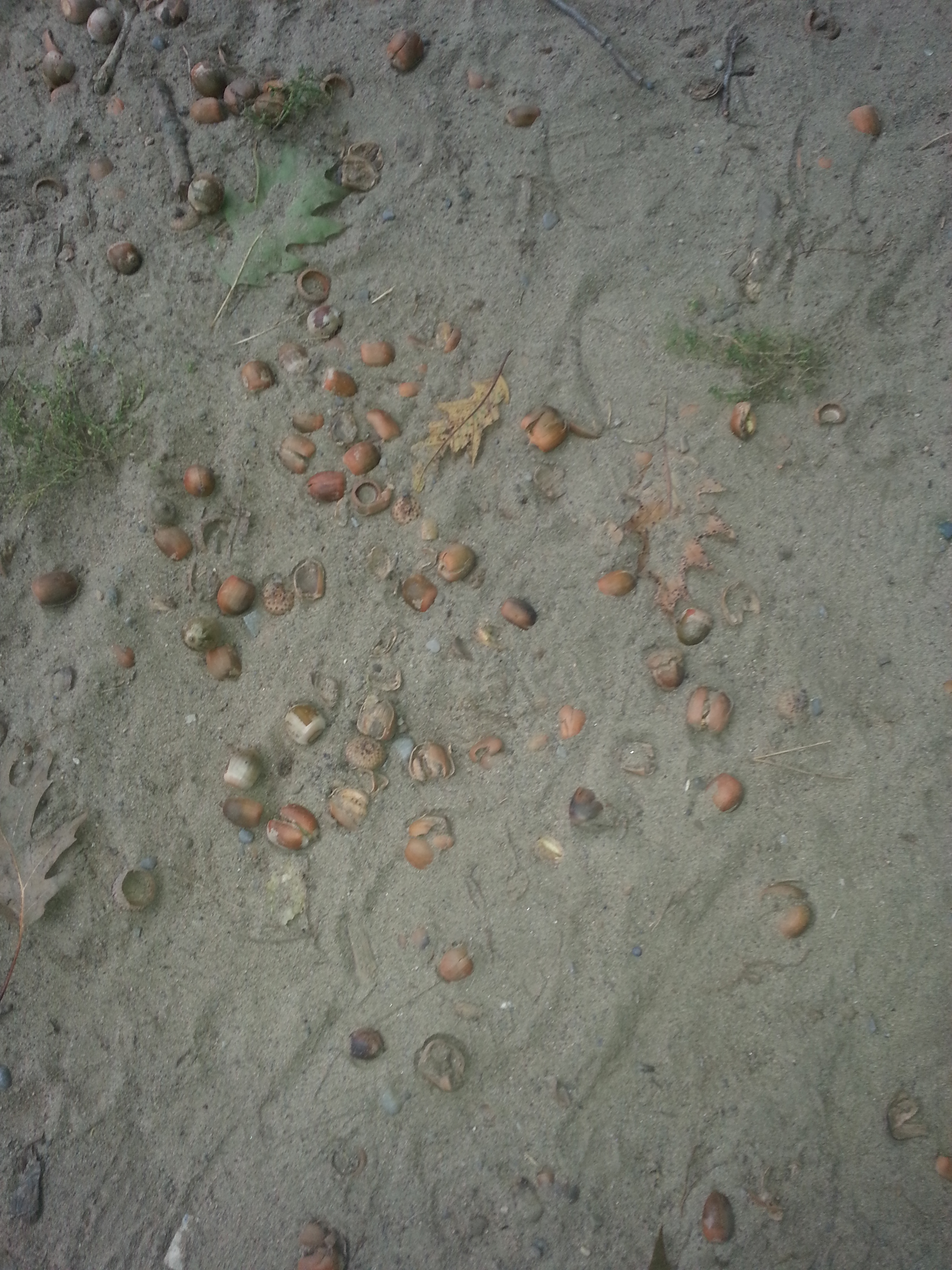
Eventually, I come to the foot of Warden Avenue. It’s not exactly a landmark, but it’s cool enough to me. Where the street ends, a path begins. As I walk, I hear crunching under my feet. There are fallen nuts or something embedded in the sand. I pick one up as a souvenir and place it in my bag. At the end of the path is a gate – or, at least, was a gate. Past it is, of course, the Scarborough Bluffs. I can hear the waves from where I am. It looks as though someone might’ve attempted this descent or at least part of it, but it’s not an adventure I’m up for, so I turn back.
I return to Kingston and start heading west. The street was built as a motel lined highway into Toronto – the Dundas Street of Scarborough, if you will. The strip of shops near Warden features a cafe, an empty store, and a bar with karaoke.
As I keep walking, I’m not awed. It’s a rather sad street, and that goes beyond just the construction. Looking across the way, there’s nothing lively – certainly not like the stretch of Kingston that runs through the Beach.
Continuing on, to my left is a long fence with trees rising above it. I have no idea what’s on the other side. When the opportunity is right, I peek my head over. A golf course. Further down, I put it all together. This is the Toronto Hunt Club, which is fed in by a private road. It’s a long established organization, and has been here for at least a hundred years.
Oaklands Avenue was Warden south of Kingston. Credit: Goads Atlas, 1913.
Kingston does a curve and turns residential for a bit. At Blantyre, I have to head south. Before that, I stop in at the Petro Canada. It’s a fortuitous break because with all the walking, I forgot to pack water with me (number one rule for an explorer). I refuel and continue. It’s somewhat fitting considering my destination – a great big water temple.
But first, Blantyre reminds me a bit of Warden Avenue in its array of homes, but it’s clear that it’s a bit more upscale (understandable as I’m closer to the Beach). At Queen Street, for example, are houses that require a stairs to get to.
At just after 6:30pm, I cross Queen Street and find myself before the R.C. Harris Water Treatment Plant, a long yellow building with a massive lawn. I get in close to inspect it while a couple dogs (with their owners nearby) come in to inspect me. I amicably oblige them for a bit, but know I don’t have too much time. What I see is impressive, but I know the other side is where the real marvel lies.
Immortalized in Ondaatje’s In the Skin of a Lion, rhe R.C. Harris Plant, named for Roland Caldwell, the city’s Public Works Commissioner at the time of its construction, is one of the most photographed landmarks in the city. I have to join the masses in capturing its grandeur. It is built in the Art Deco style of the 1920s and 30s, the same as Commerce Court North – although it is nothing like that tower. This is industrial architecture at its finest and because of it, I’m pretty giddy.
The facility is located at the foot of Victoria Park Avenue, which is named for the amusement park and forestland that the treatment plant now occupies. As I meander around and note individuals with their animals and/or human companions, it’s funny how it’s still a gathering place – an odd one if one thinks about it. “Let’s take the dog out for walk to the water treatment plant and we’ll talk as well.”
Credit: Goads Atlas, 1913Victoria Park Amusement Park, Year Unknown. Credit: Scarborough Historical Society
I head down to the water and capture it from below. It’s a moody day, and part of me was hoping for an animated sunset, but there’s still something appealing with the dreariness and fog. There’s no rain, though – that’s a plus.
My phone indicates it’s 6:50pm, so I regrettable decide to leave Mr. Harris’ great achievement. I know have to get a move on in order to make Mr. Levine’s talk without being too late. I’m not helped by the fact that it’s almost entirely uphill to Kingston road – from the shore, up to the plant, to Queen Street, and up Courcelette Road. I’d take my time to admire the street, but I’m too winded to give it thought. I haven’t been through such strenuous exercise in a while. When I consider it, I’ve missed it and make a note to put myself through that – under less stressful circumstances. By the time I reach the main road, it’s dark. The fog reflects beautiful on the street lights and I can’t resist one last picture.
I reach Taylor Memorial Library at 7:10pm. Not bad, although I’m still very gassed. It’s a really cozy branch.
I’m directed to the back meeting room where Mr. Levine has already begun lecturing on his book. It’s a great presentation on the ‘life’ of Toronto – Muddy York, The Toronto Maple Leafs, The Ward, The Orange Order, former mayor Nathan Phillips – a lot of which I know about, but still some that garner notes in my Moleskine.
The audience discussion that follows it is most interesting. There were comments about the inadequacy of Toronto’s infrastructure (the TTC at the centre, naturally), how Torontonians are whiners, and, most notably, how the city is soulless. Thinking of my day today, I argue that city does have a character and soul. The examples of soulful cities given include Montreal, Quebec City, and European metropolises. I suppose their souls are wrapped in long, documented histories. Toronto’s is perhaps less obvious, but I say it’s character lies in its neighbourhoods – like Birch Cliff – and the landmarks within them – like the R.C. Harris Treatment Plant. I think it’s a fair point and very fitting given the evening I’ve had.
It’s worth noting that what I saw today is only a small portion of Birch Cliff. The Quarry Lands at Victoria Park and Gerrard, for example, were a big part of the area once upon a time and now await aan uncertain future. Their exploration also await me.
Spontaneous, impromptu adventures. They are the best, aren’t they? As a person who overthinks and plans the heck out of things, I’ve realised lately that when you go into something with high hopes and little expectations, things turn out to be more fun.
I find myself at George Brown’s St. James Campus, meeting my brother in front of the Hospitality Building at the top of Frederick on Adelaide. It’s a new state of the art building, but its surroundings for the most part aren’t. Beside it is a trio of heritage buildings: Toronto’s First Post Office, the De La Salle Institute, and the former Bank of Upper Canada Building. Actually, the Hospitality Building was previously occupied by a still existing heritage building that still exists, Campbell House Museum, which was moved to University and Queen in 1972.
This collection of structures is important in telling the story of York and Toronto, but the block-wide red brick building across from us grabs my attention the most. Ah, converted industrial buildings: my great interest in this thing called local history. A good chunk of George Brown features adaptive reuse projects. The one across the street is the former Christie factory.
Christie, Brown & Co., Adelaide St. E., s. side, betw. George & Frederick Sts.; looking s.w. 1902. Credit: Toronto Public Library.
My brother tells me that a pedestrian bridge was planned above the intersection to join the two buildings. It never materialized and after we part, I woefully resign to using the boring old crosswalk. Or maybe not so boring. At the corner I see an inkling of Old Toronto street names. Hello Mr. Duke!
As I meander south, it’s like architectural Pokemon – I gotta catch ‘em all. But this is a journey within a journey. I really want to check out the Market Gallery – I just get some trinkets along the way!
This is also a good time to plug my Map of Toronto’s Industrial Heritage, where I am attempting to plot the city’s industrial and manufacturing places – existing and lost, still running and demolished.
Among these is Young People’s Theatre, which greets me at Front Street. Just as it sounds, YPT is an arts space which puts on performances for young audiences. The building itself, though, was never intended to be a theatre. It started off as stables for Toronto Street Railway Company in 1886 – you know, back when horses used to draw the city’s streetcars. After the system became electrified, it became a power generating plant. It sat vacant for a while, faced demolition (such is the story many old and idle buildings, no?) until YPT moved in. One has to think of the logistics of converting a space like that into a theatre. Industrial buildings into lofts or offices seem like the most common examples of adaptive reuse, so to see a power plant into a theatre is truly remarkable!
Still looking at the south side of Front Street, on the west side of Frederick is another industrial building. This is J&J Taylor Safeworks. As a Toronto Historical Board plaque on the building tells us, the structure was built in 1867 as a meat packing plant. In 1871, it became the home to J&J Taylor. It looks to be office space today.
I didn’t venture over to see it, but there’s a Taylor’s Wharf Lane immediately south of the building which commemorates the wharf that used to exist in the area – when the original shoreline was at about Front. Ironically though, the Taylor and in the wharf and the Taylor in the safe manufacturer are unrelated. More on lanes later.
Continuing westward, I get to St. Lawrence Market and I note the doors are curiously closed. Poor twisted me – it’s Monday! I guess the ‘Toronto Does Her Bit’ exhibition will have to wait. I do get a look down pedestrian Market Street, though. There’s a shiny new Balzac’s there. I continue on to the crazy Church-Wellington-Front intersection, highlighted by the often photographed Flat Iron Building. I have enough shots of it so I opt out of one now and turn north.
I travel past St. James Church and Adelaide Street again. When I hit Lombard I make a left. Impromptu adventure. One of the random nuggets of knowledge in my head tells me there’s something here that I’ve been meaning to check out: 86 Lombard. Today it’s the Fred Victor Women’s Hostel, but in 1907 it was built to be the city morgue. Imagine that: a house of the dead on our streets! There’s some hidden history for you. Actually, more to that point, a now covered sign high above door even once showed its original purpose.
Lombard Street City Morgue, 1936. Credit: City of Toronto Archives
Some former factories catch my attention on Richmond street. Although I cannot find anything on the darker building, the red brick building has a ‘sweet’ past. It is part of a complex of structures that stretch to Queen Street which used to make up Robertson Bros Confection Ltd (established in 1862). If my facts are right, the structure on Richmond was the warehouse and dates around 1906. The purpose of the rest of the buildings and their dates is a little bit more difficult to sort out.
Robertson Brothers Ltd from Goads Atlas, 1924
After capturing them in my phone, I turn around to note my surroundings. There’s some street art dedicated to Nelson Mandela!
Finally, just before Queen Street is Ditty Lane. This coloured little alley was named for the Ditty Hotel that stood at Queen and Church (although I can’t say exactlywhere at the intersection). The beauty of our laneways is they commemorate lost landmarks, unknown local personalitiess, and hidden histories. On Adelaide east of Bay, for example, lies Grand Opera lane – a tribute to, you guessed, the now vanquished Grand Opera.
Oh, and I had to look up ‘Ditty’ – it’s a little song. Perhaps it was a musical hotel?
On Queen Street, my adventure ends (or continues?) as I jump on a westbound streetcar towards my next destination.
For all the houses, farmland, communities that been sold or expropriated to build infrastructure in and around Toronto – roads, highways, subway lines, airports, even our city hall – there isn’t a lot made of the losses that went into the gains. At least, I haven’t encountered a lot. Historian Jay Young explores the expropriation of homes to build Toronto’s underground transit network in his dissertation “Searching for a Better Way: Subway Life and Metropolitan Growth in Toronto, 1942-1978” . It is a fascinating read and I wonder if there’s more out there (Young does cites another article by Jason Gilliland about expropriation in Montreal). If history is about telling stories that haven’t been told yet and recounting perhaps lost perspectives, then I’d like to hear these stories and perspectives. Where are they and where did they go?
They are important ones and vital to how we see and experience the city today. When waiting for a plane at Pearson International’s Terminal 1 or for a bus at Pape Station’s loading bay, it isn’t obvious to think about the structures and the lives that pre-existed those grand transportation hubs. There’s no marker for their sacrifices. Urban landscapes shift and streetscapes change as the new replaces the old. And when the tangible goes, often so does the intangible. But they were here and I wonder what became of them. Progress shifted their life paths. How many of them expected to live in their settings for many years to come? There’s a segment of the population today that boast multi-generational ownership of their homes; perhaps that number could have been higher.
To be clear, I’m not lamenting the construction of the Yonge-University-Spadina line or YYZ or Highway 401. They move people around and are needed to accommodate a growing metropolis. I’m just left with the questions about the people that made it happen. How was the dialogue with the city to give up their homes? What was it like looking at their empty houses and properties for the last time? Where did they even go after? How did their lives differ? What was the good? What was the bad? Are there relatives today that claim those stories? I think those are stories worth hearing and remembering.
Future site of Pape Subway Station, 1927. Credit: City of Toronto Archives, Fonds 16, Series 71, Item 4828Future site of Dupont Subway Station, 1954. Credit: City of Toronto Archives, Fonds 200, Series 372, Subseries 33b, Item 425
I’m going to be venturing outside of Toronto and even Canada for this post. Two weeks ago, I had the opportunity to travel to Oslo, Norway to visit a friend. Even before I got there, I had a list of what I wanted to do and see: taking in the nature the city had to offer as well as the typical tourist-y, sightseeing, museum-y stuff.
But I also wanted to explore. More specifically, pick a neighbourhood, run around, and see what it’s all about. I do that in Toronto already, so why not bring that overseas?
My choice of where to go wasn’t completely random. One of the running themes I love to explore in Toronto is former industrial neighbourhoods and the layers of history within them. Gentrification, transformation, adaptive reuse…it’s all very compelling stuff. I wondered if there was something like that in Olso.
Grünerløkka is a former-manufacturing district located for the most part to the east of Akerselva (river Akers), considered the boundary between East and West Oslo. Are there parallels to Toronto? Definitely. Grünerløkka is basically Oslo’s bohemian, hip(ster) neighbourhood. It’s a cross between Leslieville and West Queen West with a little bit of Yorkville, Liberty Village, Kensington Market, and the Distillery District sprinkled in there.
To get to Grünerløkka, I take the 11 trikk from where I’m staying in Majorstuen and get off at Thorvald Meyers gate at Olaf Ryes plass (square). As I’ve written about before, place names are often important ‘ins’ into understanding the makeup and history of a locale. ‘Grünerløkka’, for instance, refers to Friedrich Grüner, an early property owner in the area. Grüners gate (street), the northern boundary of Olaf Ryes plass, also is an homage to him. Thorvald Meyer was a businessman who bought substantial property in Grünerløkka in 1860. Grunerlokka became part of Oslo in 1858, suggesting there was a distinct identity to the district even before it was absorbed into the city – much like the many annexed communities that would eventually become the city of Toronto.
Exiting the streetcar, I immediately browse my surroundings. Thorvald Myers is one the main commercial throughways in the neighbourhood and is thus quite lively. Across the street, there is the plass; behind me is a building with large words above the door. I don’t know the significance, but imagine there could be a story there. Doing some research after the fact, ‘Paulus Menighetshus’ translates to St. Paul’s Parish, and according to this Digital Museum entry (have to love online museums) has been around since 1965.
I do a quick walk through the square, passing a table of fresh strawberries on the way to the park’s centrepiece – the fountain. All the benches are full. And why not? It’s a gorgeous day to sit around. I head to Grüners gate, noting the row of restaurants with giant patios.
One of my goals in coming to Grünerløkka was to find some of the remaining industrial architecture, and through a pretty educated guess, I figure that there might be some by the river. At the western terminus of Grüners, there’s a nearby grain silo which has been converted into residential space for students. Of the many examples of adaptive reuse I’ve come across, this is one of the most crafty and ingenuous. I wonder about the logistics of such a conversion, though.
In the other direction, there’s a path leading down to some parkland. Sunbathers rest on grassy hills, and I can see dog and their owners meandering below. Getting close to Akerselva, I note how shallow it is. I think fair to suggest that this is the end-product of vigorous industrialization. This is Oslo’s Don River – the heart of early industry in the city. Like the Don, it has taken a beating over the years, and only recently has there been real attention put toward its value. This article by the City of Oslo tells me of the rejuvenation of the Akers. After years of pollution, a beautifying initiative has sprung up to make the river and the surrounding infrastructure a gorgeous hub for new ecosystems and human activity. Further up I can see a group of people standing in the middle of the ankle-deep waters. It reminds me of parts of the Mimico Creek in Etobicoke. I pass a bridge and a man convening with some pigeons (not quite at a Home Alone II level, though).
Then, I gladly come across a complex of brick buildings, unmistakably industrial in design. The one nearest to me has what I interpret to be a historical plaque (the old years hint toward it). I think about getting a dog-walker to translate for me, but I settle for Google’s help after the fact.
Akers Mek. Workshop. Founded here in 1841. Delivered equipment and services to businesses along the Aker River. Moved in 1854 to the islet in the bay. Was the city’s biggest shipyard pioneer in oil industry. Closed in 1982
I pass another bridge – this one with charming love locks (not quite Paris worthy, though). Up the Akers is a waterfall, one of a few along the river’s course. I head back to the buildings and ascend the stairs. At the top, I find out their adapted purpose (a fine arts school campus) and then a little further down along the cobblestone path a clue on their historic use. Christiana Seildugsfabrik. Christiana was Oslo’s name between 1624 and 1924. Fabrik might refer to clothes. After some research, I’m partially right. Seildugsfabrik was a hefty operation which made textiles for ships. Our friend Thorvald Meyer even had a hand in it.
Known as Khio, for short
Is This It?The collection of buildings under this former entreprise give it a Distillery District feel. Especially with the brick flooring between them.
I find my way to the road network at Seilduksgata. I arbitrarily turn north on the next street I come across (someone’s had fun with the street sign). Walking a bit, to my right I see the back of a church tower. To my left is a school, rich in great masonry and the use of arches.
Erm…
Heading up to and across Sannergata, there’s a different vibe to the district than what I experienced near Olaf Ryes plass. For one thing, the streets are for the most part barren. But the most striking characteristic is the prevailing graffiti. Grünerløkka might be a renewed working class district, but elements of its seedy past still linger on. It reminds me a bit of Toronto’s Leslieville, a neighbourhood in transition. Even with gentrification, hints of the days of yore remain. Travelling south on Toftes gate, a tattoo parlour and an animated mural.
Former factory(?) in the distance at Sannergata
Then I come to Birkelunden, the third park of the day. Grünerløkka is coloured with them. Birkelunden has its own tint. I enter from the side that houses the formidable looking Grünerløkka skole. My sights move across the park to get my second look at Paulus Kirke today, this time from the front. The creation and planning of public parks is a fascinating topic. It looks like Birkelunden was always intended to be a park from the start, but I wonder about the planning that goes into the surrounding environment. More specifically, I wonder if it was deliberate to pit a school and church across from each other with a park in the middle, but something about it works. There’s a religious institution, an educational institution, and then this public forum at the centre.
Then, I unexpectedly come across a market. This is the park’s Sunday bric-a-brac. I meander around the tables, looking for anything eye-catching and useless. I take the time to look for a wallet, but see nothing that suits me. I do come across CDs and used vinyl, though. I find a copy of Queen’s ‘A Day at the Races’. With my takeaway for the day, I exit via the familiar Seilduksgata. I take a moment to examine what looks like an upcoming development. Even the signs and gate are littered with spray paint.
Heading south, I come across Sofienbergparken – park #4 of the day. It’s the biggest of them all thus far. I spoke about the planning of parks earlier. Well, this one has an interesting story – turns out it was once a cemetery. Following a cholera outbreak in the city in 1853, the block that contained Sofienberg, then outside Oslo’s borders, was chosen as a resting place for the victims. Over time it seems people opined it was a bad and unhygienic idea to have a cemetery in the middle of a growing, dense neighbourhood, so it was gradually made into a park.
There’s a Toronto connection, too! St. James Park was also once a graveyard. In 1844, the overcrowded cemetery was moved to its present location on Parliament Street. But before that, Toronto suffered cholera epidemics in 1832 and again in 1834. The story is a portion of St. James Cathedral still holds the unmarked graves of cholera victims. More than that, there was idea that a cemetery in the centre of town (metres away from the financial core no less) was not the best scenario.
Grünerløkka, 1917. Source: Wikimedia
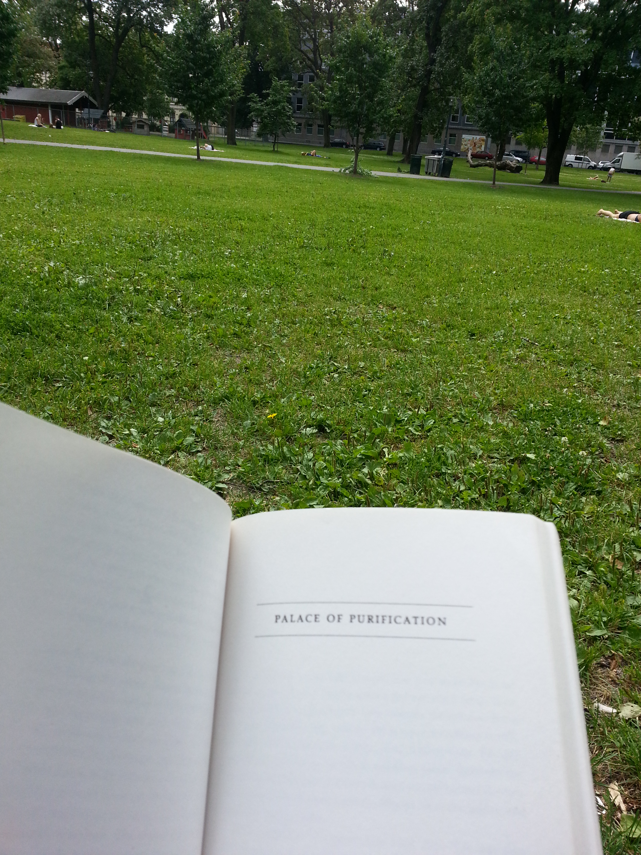
Oblivious to this bit of hidden history, I join the masses in reading and relaxing on the grass. I pull out some Toronto fiction, the classic In The Skin of a Lion, which I keep with me to remind me of home, and then I move on.
I admittedly get lost after this. I’m trying to find my way back to Olaf Ryes plass. Just when I think I’ve found it, I realise it’s not the right place. This is Schous Plass and, in addition to being park #5, has a nice old library. I have to consult a map, which shamefully tells me I’m actually not to far from where I need to go.
A short walk up Thorvald Meyers and I find the park! Before jumping on the tram, I make the executive decision to grab some lunch. I pass by a number of establishments including a famed watering hole in the area, Grünerløkka Brygghus (Brewhouse), and Valouria Vintage (because vintage shops are a must in hipster neighbourhoods – just as Queen Street West) before settling on a sandwich from Something Hotel. It’s an investment I immediately regret for its taste and price point, but it’ll have to do. I eat while I wait for the tram that got me here. I have just as many minutes wait as the number trikk I need. When it does come, it swoops me back to Majorstuen.
This marked the end of my venture on this particular day, but I would return with company to Grünerløkka two more times in the coming days. We would head to the western part of the district on the other side of the Akers. Here one finds the grand Mathallen Food Hall (which was sadly closed when we tried to go) and little alleyways that lead to riverside entreprises. Ingens Gate (which comically translates to Nobody’s Street) in particular is a fun little nook with entertaining street art.
On another occasion, we fuel up at the two microbreweries: the already mentioned Brygghus, and at Schouskjelleren Mikrobryggeria, which is just south of Schous plass. It’s a dimly lit basement bar (really, ‘kjelleren’ means ‘basement’). No music, no trinkets on the wall, no nothing. There is a a sweet fireplace, though! And it’s fittingly located on the grounds of the former Schous Bryggeri (brewery). Christian Schou, a brewer, is another name synonymous with the local history of Grünerløkka that lives on in the neighbourhood.
Actually, the growth of amazing drinking establishments that has (in part) made Grünerløkka the “to go and be” district in Oslo might be attributed to the growth of the craft beer industry in Norway. The beer industry as a whole has been re-animated because of microbrews. It’s interesting because there have been breweries in Oslo for a long time (look at the above 1917 map and look for anything with Bryggeri in the title – I can count 3 of them), but the industry went stagnant. With Oslo and Norway playing catchup, the bar scene in the city – something that Toronto has been doing very well at in recent years – is better than ever.
I’d say that’s a good reason to say “Skål” to Grünerløkka.
North York Centre. Lansing. Uptown. The House that Mel Built. What was intended as a simple errand at Yonge and Sheppard turned into a tour of this downtown away from downtown.
It’s been a few years since I frequented the area on a semi-regular basis, so I was slightly shocked at the amount of growth since I was last here. At Yonge and Sheppard – the fortuitous cross-section between two subway lines – towers in differing stages of development have displaced the Metro-flanked strip mall.
Walking up the street, I can see even more cranes with upcoming condos in the distance. Below them, big box stores and restaurants line the streets. My destination is Gibson House Museum – one of the few historic sites operated by the City of Toronto that I have not visited. The towers I saw earlier surround the museum and tell me that a certain Gibson Square is coming to the corner of Yonge and Park Home. I’m compelled to do me a little look around of the museum to see the extent of the ‘takeover’. From Park Home I can see the hint of the brick building beyond the construction site. I continue to Beecroft, where I pass a parkette . I would examine it better after my museum visit. I notice a a house across the street which I immediate recognize as being of an earlier architectural style. I snap a photo and make a note to ask the Gibson House staff about it.
Moving around Gibson House via Basil Hill Court, I’m struck by the contrast of the back of the house and the condominiums going up in front of it. I circle to the front of the house where I’m greeted by a familiar blue plaque. This marker was erected by the Ontario Heritage Trust (interestingly known as the Archaeological and Historic Sites Board in the text) to commemorate David Gibson. I take a few steps back to admire the entirety of the house – but am stopped by the construction wall behind me. Finally, I go around to the side where the entrance is a modern addition to the back the house.
I’m greeted at the desk by a nice administrator and I immediately mention my observations while getting to the museum. She concurs that it’s tough situation being “landlocked by condos.” It has affected their foot traffic. I pay my 6.29 for an adult visit, she takes my bag to store while I take the guided tour, and I wait for a costumed interpreter in the Discovery Gallery, reading up on textiles and the Gibson story.
This was not the first home the Gibsons owned on this property. A wood frame house stood here, but after the rebellion of 1837, Gibson – a traitor – fled to the United States and the house was burned. Was he returned in 1850, he built this grand Georgian house.
We start in the living room where Claire tells me about Mr. Gibson and the room we are in. He was a land surveyor, which caused him to be often away doing work . This allowed the family the ability to be financially stable enough – not rich, not poor. Of the room itself, Claire tells how the idea was to give off that the impressions they were well off – “perception becomes reality” at work. It sounds like a pompous attitude to have, but it’s a dynamic I have seen in my own life in the 21st century, so perhaps it’s become somewhat normalized. The room is seperated by doors, which divide the room into an entertaining space for guests and an area where the children could play. The public/private divide comes up again later in my tour.
The room is decked out in Christmas decor, although a tree would have been anachronistic for the time. Christmas as a whole was not a big deal; perhaps a meal was had and that was it. Hogmanay was the big holiday celebration. Although, if there were adult drinks involved, at least Eliza Gibson was not involved in them, as she was temperate (I think?).
We go to the upper level where Claire tells me about the hired hand David Gibson employed to run the farm (because Gibson was often away). His room was sizable enough for a comfortable enough living, and was situated far away from the children’s bedrooms (locked as well). Claire says there is speculation about his relationship to the family – whether it was strictly an employer-employee dynamic or the family and their good friend. His room faces westward and allowed him a view of the property he managed. The Gibson farm extended all the way to Bathurst from Yonge but wasn’t very wide. He could look out and see all flat fields. Today, the view presents a challenge in interpreting the site because as Claire mentions one sees “a lovely building” when one looks out today.
The children’s bedroom – consisting of a boys and a girls – are low-key in their appearance. And this was on purpose. Nobody went into the bedrooms save for the children themselves and that was in the morning and at night. All the bells and whistles, with the notable exception of the master and guest bedrooms, were reserved for the public areas of the house. The idea, as Claire presented it, was to create a facade for guests: impressing them into thinking they were better off than reality.
As mentioned before, the Gibsons weren’t poor, but they weren’t the elite of the elite. They owned this great house that, if not for the lack of indoor plumbing, might suit a family today. These facts prompt to ask myself – and Claire – “If the Gibsons were nothing special, why does the family’s story survive, as opposed to other comparable households in the area?” The answer includes a couple of factors working together. First, because of his line of work, David Gibson wrote a lot of things down that inform us about the family and their lives. Unfortunately Gibson House records do not include records from the other occupants (Claire says it is not even known if Eliza Gibson was literate), but his paper trail is sizable enough. Second, it helps that the house itself survived. Being brick, it did not burn down like other residences. It also survived demolition even after the farm was broken up for development. During the Centennial celebrations of 1967, the Canadian government alloted money to restore historic houses and turn them into museums. The Dempsey Brothers Store/Joseph Shepard House that I saw on Beecroft might very well have been a museum, but the Gibson home instead was commemorated.
In addition to these rooms, there is a place for the seamstresses hired by the family, as well as a guest room (which is the nicest of the non-master bedroom rooms).
Downstairs, Claire takes me through the Gibson’s office, the kitchen, and dining room. The former is populated by the man’s surveying equipment (not original, of, course). In the kitchen, my guide takes me through the Gibson’s diet (a lot of potatoes) and says Eliza Gibson took care of the kitchen herself, no help. The focal point of the room is the fireplace. One can only imagine the difficulties in cooking an entire meal on it – and worrying about the real hazard of not catching fire. (Tidbit: museum workers and volunteers need safety training just for this reason). The nearby dining room is a showcase of how great the Gibson had it (or were believed to have it, anyways. It also houses two original artefacts: a clock and a cabinet.
Our tour ends where it began. Claire shows me a posted map where visitors have plotted their place of origins on a map. Also presented to me is a full family tree of the family. I heard about it upstairs, but I need to visualize it. Interesting fact: Eliza and David Gibson were related before they married. I forgot the exact connection, but perhaps it was 2nd cousins. My guide says they didn’t grow up together, so it might alright by today’s standards? I might agree with that.
I thank her and she leaves me to browse a little bit. After that I pay my appreciation to the staff and head my way. My adventure in understanding the area and the museum is not done, however. I head down to Gibson Park to see some public installations related to the Gibsons. You may read about that here.
After the park, I head back to Yonge. My final stop for the day will be Mel Lastman Square. This is the Nathan Phillips and Albert Campbell Squares of North York. The former civic heart of the borough and a cultural gathering place. Just to note a few events associated with it, it hosts skating, a farmer’s market, and Canada Day celebrations. Lastman himself was a former mayor of North York and the first mayor of the Mega-City. His fingerprints are all over the borough.
I have a look around, noting the North York Central Library, where I ventured to on a few occasions during university, and a gazebo of sorts. Satisfied, I head for the subway.
I get off the 100C Flemingdon Park bus at Broadview and Mortimer and cross the street. To the west, Mortimer becomes Pottery Road and is my route on the way to Todmorden Mills Heritage Site. A sign ushers me to the descent.
And quite the descent it is! There are several topographical kinks within the city, and this street is definitely one of them. I’m no cyclist myself, but I have to feel for the people coming up the hill. In fact, as I read more about it , Pottery Road ranks up there for people on bikes as the toughest to navigate. My pity pretty soon turn inwards, because I realise that I’ll probably have to muster the climb on the return trip. D’oh.
Another sign and a bricked path ushers me into the Todmorden Mills grounds. Located in the Don River Valley, it’s a site that claims both industrial and natural heritage. In 1967, it was re-adapted as a historic site and operates today under the City of Toronto Museums to help tell the story of Toronto. I was here once before, although very briefly to help out to an event. Today is a long overdue chance to do some more exploring of the museum and the great Wildflower Preserve I’ve heard so much about. (Although, ironically enough, I still don’t have an adequate amount of time to do a just visit). I also read about an intriguing photo exhibition in the Papermill Theatre, which is my first stop.
On the way toward the building, I have to look up to the smokestack, which was nominated for a 2013 Heritage Toronto Award for its recent restoration. Anyone who has ridden down the Don Valley Parkway has seen the chimney and its giant lettering.
Inside the Papermill Theatre is an art show entitled ‘The Past is Never Far.’ It features the work of three people who have visually captured the city at various points in its history: Elizabeth Simcoe, who painted some of the first images of Toronto, William James, who took 6000 some odd photos of the city which are all digitized in the Toronto Archives, and Summer Leigh. If the last name doesn’t ring a bell, it’s because she’s the artist behind the show.
Summer takes the images of her predecessors and photographs their subjects in their modern locations. So we can find James’ photo of the dirty foot of Yonge Street in 1909 mixed in with her take of the same site the 21st century. Or Lady Simcoe’s view of Toronto harbour in 1793 with the current incarnation of the shore as we see it today. It all makes for a great visual look into Toronto’s past and present.
Taken together, the exhibition tells a great story. Its message comes in the title, and is something I have been saying and thinking for a while now: Toronto is a layered city. Some of its (her?) landforms and landmarks have changed a great deal. Some haven’t. Perhaps some of the changes aren’t immediately apparent to us, but they are there nonetheless. The past isn’t far. You just have to dig for it, do some analysis, maybe even put on a photo exhibition.
That said however, perhaps some things do stay the same. Summer has one image up of William James that features the Don River Valley flooded in 1910. 100 years and a parkway later and we’re still facing the wrath of the overflowing Don. I shake my head and smile at that. Plus ca change, plus c’est la meme chose, n’est-ce pas?
As a nice and unexpected treat, the artist herself is on hand, and I am able to pick her brain about what I see – whether she was actually at the disputed location of the Simcoes’ Castle Frank residence, as an example. Among the random things we talk about are old school horse drawn streetcars and being de facto tour guides for people in our lives. Through that chat it quickly becomes clear that she is a true buff in Toronto history, whose knowledge, talent, and vision really shows in her work. We probably can geek back and forth about the city for another good chunk of time, but alas, time isn’t abundant today and I graciously thank her again and make my exit.
I head up to the brick path and continue down it. To my left, I see a familiar blue marker. The Ontario Heritage Trust sign gives my the need-to-know of Todmorden’s history. I briefly circle around the exteriors of the buildings. I did some reading prior to coming, and, if I had more more time, I would enjoy a tour, but it will have to wait until next time.
Also happening on the grounds of the museum is Eco-Art-Fest, an arts, heritage, culture festival put on by No. 9, who I first heard about during Jane’s Walk preparations. There is a designated ‘chilling’ area which has some pretty soothing country tunes going, an elevated platform (I think it’s also a stage) with an oven, picnic benches, and craft table where a few children try their hands at water colour painting (shoutout to Elizabeth Simcoe with that activity).
I continue on the brick path once again, heading toward the bridge. I see a few joggers around, and I have to admit that it that this would be a very good place for a run. I would run through here if I loved closer. A few feet before the bridge is a swirly blue line with the words ‘Don Was Here’ in bold lettering. No, some guy named Donald hasn’t marked his presence. It’s actually a public art initiative commissioned by No. 9 and curated by Labspace Studio in partnership with the Toronto Region Conservation Authority. There are several of these ‘Don Was Here’ markers from Todmorden Mills to the mouth of the river which shows the meandering route of the Don before it was rerouted and straightened. It’s a pretty amazing tribute to the city’s natural heritage. The project has got an interactive site too…with a map!
I notice some letter on the side of the bridge as I cross it, but may little mind to it (more on this later). Instead, I focus on the green area it overlooks. I walk around (passing another ‘Don Was Here’ marker) and inspect it a little better. Beyond that it looks really beautiful, I can’t pick out any species or just the entire ecological significance of it.
I circle around and head back to the open area with the benches so I can give the Wildflower Preserve a walkthrough. I am greeted by a pair of signs to explain everything. It turns out the area under the bridge was the last area on the trail. I get the signs on my phone because I know I’ll need them. And hey, now I know what an Oxbow is.
I spend a few minutes at the pond to take in everything. Gazing out and down at the green surface, I am hoping to spot something alive. Instead, I just see a pop can half-submerged in algae and just think somebody has really missed the point. I do catch movement, something skipping across the water. I can’t tell if it’s a fish or a frog, but I take it anyways and move on.
The tree canopies are tall enough to make me feel closed in and away from everything, but even with the rustling wind, buzzing insects, chirping birds, I still can hear highway traffic. It’s a weird thing spot to be in. I feel like I’m in a secluded spot, but really, I am not. Actually, it reminds me of wandering the Betty Sutherland Trail near the 401. A city within a park, indeed.
At one point, my curiosity is piqued when I spot what looks houses floating in the oxbow. I have to maneuver through and over things to get to the water’s edge. Yup, they are floating houses. Either some trekkers got really mischievous and creative or this is something deliberate and tied to the museum. I suspect the latter. I do some research after the fact, and the Ec0-Art-Fest website and its scrolling banner images provide the answer. The houses are an installation for the festival – as is the lettering on the bridge (which read from the other side says ‘Like a Bridge’) and the ‘Don Was Here’ project. Eureka!
As I walk the paths, I try to see if I recognize any flora. I think the yellow flowers are goldenrod, but I’m not willing to bet my guitar on it. In co-creating a nature walking tour last summer, I was introduced into identifying certain floral species, but it does not help me out here. Instead, I just go back to marveling at the Preserve in a big picture sense.
I remember something Summer said about our former industrial centres. Places like Todmorden, the neighbouring Evergreen Brickworks, and the quarries of Greenwood and Smythe Parks were pretty dirty looking once upon a time. To see their conversion into beautiful natural and park lands is just remarkable. Tormorden and the Brickworks in particular have their own ecosystems, which makes this preserve more amazing to be in and think about.
For a while I try to go off the main path onto offshoot routes, but then I realise that I really have no idea where they would end up. And I’m being stupid with time. So I turn back and get to the end of the wooded area. I’m at the back of the parking lot, and instead of walking through it, I turn around and tour the Preserve again. When I reach the beginning, I spot a warning I missed the first go around. I smile at the mention of the ‘East York’. The borough lives on.
Walking back to Pottery, I give the museum one last look and then head off to do the climb. Part of me wants to visit the Brickworks, but I know this is not doable. I convince myself it would be a real beneficial exercise to power through at a quick pace, but halfway I’m a bit gassed and cursing my idea. Fortuitously, I do break beside a Sumac, though! Happy that I recognize something, I leisurely finish the ascend and then make it back to The Danforth.
It’s fun to think about what was happening in different parts of the city at the same time. You have communities with no formal connections to each other growing alongside each other. Communities that eventually form the modern City of Toronto.
Wikipedia’s page on the History of Toronto has articles on History of Neighbourhoods, Historic places, Oldest buildings and structures, and Timeline of Toronto History. It would interesting to combine these into a giant timeline of events in Toronto’s history. More than that, because this relies on displaying information tied to places, I’d like to see the information displayed on a map (because really, who doesn’t like looking at maps?). I imagine being able to look at map of a given year and clicking on different nodes placed on that map. Then, being able to explore the map from the following year.
I imagine being able to draw observations about how the city developed, what was settled when, what areas were industrializing/de-industrializing, when and how natural landforms were shaped (think the burial of creeks) etc..
In all, it would be another way to capture the story of Toronto. Just an idea.
Edmund Wyly Grier’s “A View of York (Toronto) Upper Canada, 1820” Credit: Toronto Public Library
In making this list, I quickly realised I would see the whole city if I could, so there are sites I likely neglected. I also had to map things in order to visualize how I’d go about the weekend, so check that out too.
Have to see:
Arcadian: Only open on the Sunday. I had no prior knowledge of its existence, but I am all for cultural and social venues in the city – especially those done in Art Deco. And I wonder about this City View Cafe…
Carlaw Creative Lofts: Anyone that has seen my posts, knows I’m fascinated by the industrial heritage of Carlaw Avenue. I’m very excited to see this readapted factory space.
The Great Hall: More West Queen West goodness. It’s impressive to look up at every time and I’m very curious about it. Plus, haunted stories!
The Theatre Centre: Practically adjacent to The Great Hall which makes this very convenient. Former Carnegie library converted into a cultural space. And a cafe!
Bank of Upper Canada: 1834 Neo-classical building in the oldest part of the city. Sounds fun enough…
Would love to see:
Artscape Youngplace: I remember reading about the opening of this place and thought it was a good idea. The reuse of old spaces, especially to turn them into community hubs, is a fascinating thing. Plus, there’s a Youngplace Coffee Pub. Hmm, I suspect coffee is going to be a theme in where I decided to go…
Bloor Hot Docs Cinema:The first non-new-this-year venue on this list. Choice here comes through an interest in old cinemas. Might have to weary that it closes at 3 though…
Bridgepoint Active Care Centre: This is the Don Jail – who doesn’t want to tour it? Actually, for that reason, Bridgepoint has warned several times about lineups and are making this a ticketed thing. Tickets will be handed out at 9:40am each day. Worth the hassle? Possibly. The crowds might be a deterrence…
CAMH Walls: West Queen West seems to be a goldmine for sites this year. The walls are the last physical remnant of the Lunatic Asylum. I would be curious to know about them…
R.C. Harris Plant: It’s a fan favourite and has eluded me every year. Will this time be the one? Possibly. I wonder if the construction on Queen East will get in my way…
Russell Carhouse – Old structure, old streetcars (and the new streetcars as well!) Similar transportation issues as R.C. Harris, though…
Necropolis – Fits right in with the ‘Spirits’ theme of the weekend. I’ve been here before, but never really toured it in search of the great Toronto names. This would be a great opportunity…
Scenes From Toronto
Explorations into the history and geography of Toronto


