Scenes From The Lesmill Office Park

Welcome to the Lesmill Office Park

The Lesmill Office Park is located in the Don Mills neighbourhood of Toronto. While on the surface this post-war collection of industries may be uninspiring, its history and current make-up is interesting.

The Lesmill Office Park, 2021.
Source: Google Maps.

The City of Toronto defines the Office Park’s borders as roughly the East Don River in the north, Leslie Street to the west, Don Mills Road to the east, and Bond Avenue and Canadian National Railway to the south (excluding parkland and residential areas). For the purposes of this article, only the area north of York Mills Road will be explored.

Office Parks and Employment Zones in Toronto.
Source: City of Toronto.

The Lesmill Office Park mixes light industry, offices, courier companies, and some retail to make for an eclectic combination of enterprises. In modern terms, it is an important employment area for the City of Toronto. Historically, it is an overlooked part of the post-war development and growth of Don Mills. Moreover, the fascinating part of the Office Park is its evolution from farms lot and how they continue to play into the modern fabric of the district.

The Lesmill Office Park with historic farm lots. The circles denote the locations of farmhouses.
Source: Google Maps & Bob Georgiou.

The Duncan Plot & York Mills Road

Beginning in the 1800s, the Duncan family owned 200 acres at Lot 11, Third Concession East of Yonge in the historic community of Oriole. In modern references, this was the north side of York Mills Road between Leslie Street and Highway 404. David Duncan in 1865 constructed a farmhouse which would be named “Moatfield”.

1860 Tremaine’s Map of York County.
Source: Old Toronto Maps.
Duncan, David, ”Moatfield”, York Mills Road, north side, west of Don Mills Road, 1905.
Source: Toronto Public Library
1956 North York Pioneers and Landmarks c. 1878, by Ted Chirnside.
Source: North York Historical Society

By the end of the 1950s, changes came to York Mills Road and the Duncan family lot. At Leslie Street, a British American (B/A) Oil Company service centre opened at 800 York Mills.  By 1960, the gas station expanded to occupy more of the corner. B/A was defunct by 1970; today there is a PetroCanada on site.

1947 Aerial of the future site of the Lesmill Business Park.
Source: City of Toronto Archives.
House and service station on the northeast corner of Leslie Street and York Mills Road, 1957. Note the B/A gasoline sign in front of the house.
Source: Toronto Public Library.

In 1960, industry came to this part of Don Mills. The Imperial Tobacco Sales Company of Canada and the Canadian Westinghouse Company opened on either side of the CNR tracks on York Mills Road. The coming of the railway to Don Mills in the late 19th century and early 20th-century was important in the future arrival of the Office Park. A siding served the former factory. Today, both factories no longer exist, being replaced in the 21st century by the York Mills Gardens mall and an empty lot seemingly ready for redevelopment, respectively.

1960 Aerial of York Mills Road, east of Leslie Street.
Source: City of Toronto Archives.
1969 Toronto City Directory showing York Mills, north side between Leslie Street and Don Mills Road.
Source: Toronto Public Library.

At 860 York Mills, a second gas station – Harry’s Shell Service – stood at the southern entrance of the Business Park at Lesmill Rd. In 1998, the land was rezoned from industrial to commercial use to accommodate a one-storey building. A City of Toronto report stated the properties in the Business Park were “under-utilized” and the proposed building was “to facilitate the articulation of this important intersection and serve to enhance the general appearance of the area” and “provided increased amenities to the area”. The adjacent Don Mills Car Wash at 862 York Mills was another early business of the Business Park. The structure still operates in its original use and used the Don Mills Car Wash name until about 2014!

The Moatfield House at 866 York Mills Road itself was impacted directly by redevelopment. In Don Mills: From Forest and Farms to Forces of Change, Scott Kennedy wrote by 1962, the Duncan farm was reduced to sixteen acres near the farm house. By this point, the property belonged to Kate Duncan, the widow of Gordon Duncan, son of David Duncan, the house’s builder. In 1972, Kate Duncan passed away. The Prince Hotel (later the Westin Prince, now the Pan Pacific) opened on the former Moatfield property on June 1, 1974.

The empty, derelict farmhouse was moved closer to York Mills Road to accommodate the development, but its survival was not secure. With the future of the Moatfield house in jeopardy, the Tzioumis brothers rescued the property in 1986 and moved it 300 metres north, where it operates as the the David Duncan House. The steakhouse still stands on the original Duncan plot from the 1800s. Both Moatfield and The Prince Hotel are Toronto heritage properties.

Gordon (son of David) Duncan House, 1961.
Source: Toronto Public Library.

Don Mills Road goes north

An important event in the creation of the Business Park was the northward extension of Don Mills Road from its terminus at York Mills Road. The latter road curved through the intersection. The idea was first proposed in 1961 at a cost of $3.75 million and was meant to accommodate the loss of Woodbine Avenue, which was absorbed into the new Don Valley Parkway. Land acquisition took place between 1962, with construction on the road, including new bridges over the East Don River and Highway 401 taking place in the following years. The Don Mills Road extension opened by 1966.

York Mills Road And Don Mills Road, 1963.
Source: City of Toronto Archives.
1963 Aerial of York Mills Road and Don Mills Road.
Source: City of Toronto Archives.
“New Bridge Takes Shape Over No. 401 Highway Where Don Mills Road Crosses”, The Globe and Mail, August 6, 1964.
Source: Globe and Mail Archives.

The Toronto Transit Commission’s Don Mills bus route began servicing York Mills Road in 1954. With the extension of the street, the 25 route also grew, even taking on an “A” branch in 1971 which serviced the business park. The 122 Graydon Hall bus took over in 1985.

1971 TTC Route Map.
Source: Transit Toronto.

Layers and layers on Lesmill Road

Lesmill Road was the first street to go up in the Business Park, being built north only to the Duncan property line in 1963. Warehouses, factories, and offices lined both sides of the streets, hinting at was to come.

1969 Toronto City Directory showing Lesmill Road, east side north of Leslie Street.
Source: Toronto Public Library

The origins of the Business Park lay in 1964 when the North York Planning approved a plan by Wretham Estates Ltd to develop 120 acres of land east of Leslie Street between York Mills Road and Highway 401 for industry. Wrentham Estates Ltd. seems to have been a real estate company spearheaded by industrialist E.P. Taylor which managed residential, commercial, and industrial properties. Taylor initiated the Don Mills project in the 1950s. It might be fair to say in this period “Oriole” as a descriptor for the area fell out of use as the community’s farms slowly started to disappear; it would be supplanted by Don Mills. The Wrentham Estates themselves was a residential and commercial project in York Mills around Bayview Avenue; the York Mills Shopping Centre was one of the by-products.

1957 Aerial of the area which would become the Lesmill Office Park.
Source: City of Toronto Archives.

For this reason, the Lesmill Business Park is/was also known as the Wretham Estates Business/Industrial/Office Park, although use of the name seems to have dwindled this century. The 1966 Annual Report of the Canadian Equity & Development Company (later owners of the Wrentham Estates Ltd) cited that 23.6 acres of the industrial park had been sold at $40,000 to $50,000 per acre. Some remaining 43 acres were expected to be sold over the next few years and all services had been installed.

Lesmill Road, seemingly a portmanteau of Leslie and (York) Mill(s), was constructed between 1965 and 1969. It was laid out mostly over the 19th century plots 12 and 13, mostly belonging to the Elliot and Hunter families (and as others as ownership changed).

1965 The Lesmill Business Park starts to take form.
Source: City of Toronto Archives.

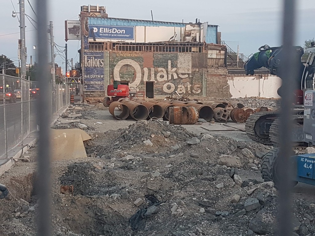
Lesmill is lined with many factories on either side. As it curves towards the CNR tracks, a long-removed siding served a former Johnson and Johnson plant at 66 Lesmill. As one moves up the street, there is an interesting mix of businesses.

1969 Toronto City Directory showing Lesmill Road, east side.
Source: Toronto Public Library.

At the road’s northern end, Moatfield Park edges on a branch of the East Don and has a couple of neat tidbits. Although it named after Moatfield, the farm did not actually extend this far north. In 1985, a recommendation was made by the North York Historical Board to move and restore the derelict Duncan/Oriole Station on York Mills Road, which was ultimately rejected by the city (the old station was sadly and ultimately demolished). More interesting, the park’s soccer field was the site of a 14th-century Huron-Wendat ossuary, discovered in 1997. It is a reminder that before the Business Park and the European settlers before it, there was human settlement here.

Lesmill Road once terminated at Moatfield Park, at the line which divided the north and south halves of Lot 13, another Hunter family plot. In 1983, a Metro Transportation study recommended its northward extension to Leslie Street, one of several suggestions to alleviate road congestion in Toronto. In 1988, an Environment Assessment Study was conducted and the street was extended. The move provided another entrance to the office park, access to and from the highway, and alleviated congestion along Leslie Street.

1983 Aerial showing Lesmill Road
Source: City of Toronto Archives.
“Lesmill Road Extension”, Toronto Star, January 13, 1988.
Source: Toronto Star Archives.
1991 Aerial showing Lesmill Road.
Source: City of Toronto Archives.

Out of Place? The Locke and Goodwin Houses

At the north end of Lesmill Road off a driveway, two historic houses stand next to the on-ramp for the eastbound 401. They look out of place, and rightfully so: their contexts have shifted.

The first house is a Tudor Revival-style home built in 1933, informally named the Clark Locke House. Now with the modern address of 355 Lesmill Road, the house was called “Birches End”. The house’s namesake married into the family of former Ontario Premier George S. Henry, who held property here north to Sheppard Avenue. Scott Kennedy wrote Birches End was located “on a high point of land near the top of a ravine that contains one of the oldest stands of white pines in Ontario”.

The Locke House was historically accessible from Leslie Street. When Highway 401 was constructed in the 1950s, the Henry farm was split on either side of the motorway, including landing Birches End on the south side. The widening of the highway expropriated the property in the following decade. The house sat derelict and empty until it was saved by the Ontario Nature. The City of Toronto Forestry Department uses the house now. When Lesmill was extended in the 1980s, it became the driveway for the property. Perhaps it is a candidate for a future Doors Open.

1947 aerial of the Locke House.
Source: City of Toronto Archives.

Easy to miss but sharing the same address, the William Goodwin House stands beside the Locke House. It was built in 1845 and is not original to the property. It stood on Yonge Street in York Mills until the 1980s. Much like the Locke House, it fell into disrepair until it was saved and moved beside the Locke House. Its survival makes it the oldest standing house in North York.

Duncan Mill Road: New and Old

Today, Duncan Mill Road hosts an interesting collection of buildings, including two medical buildings (one of which lights up at night), the headquarters for Herjavec Group, a co-working space, and storage complex.

Duncan Mill Road was laid out in the mid-1960s at the same time as the other streets in the office park. Its naming seems to references the Duncan family, although their plot was not its direct vicinity (the mill part will be explained shortly). Running from Don Mills to Lesmill, its construction necessitated a bridge over the East Don River, which was completed around 1968. It is, however, not the first crossing here.

A former road was situated just north of the present one, which ran between Graydon Hall Manor to the east of the river and the farms to the west. This was on the north half of Lot 12, historically associated by the Elliots, but likely passed through different owners and subdivisions in the mid-twentieth century. The farm had a horse track on the plot.

1963 Aerial showing the Old Duncan Mill Road.
Source: City of Toronto Archives.

When one ventures into the valley of the Betty Sutherland Trail, a couple clues point to the old road’s former existence. The first relics are obvious – at least in the sense that they are visible. These are the “Duncan Mill Ruins”: a larger roofless structure containing a boiler and a smaller, square structure which house more elaborate equipment.

The origin of these buildings are unknown. Scott Kennedy speculated the larger building may be the remains of a mill from the Hunter property, which once may or may not be the same one seen in maps to the south of here. He also theorized the smaller “newer” building was connected to the 1930s Graydon Mall manor as its style references the mansion’s architecture (other writers have pinned it as a water pump for the house itself, but Kennedy does not seem to go as far to make that connection). The North York Historical Society speculated it was a water pumping station for the residents of North York.

A lesser known remnant of this old road are some concrete pads located south of the ruins on either side of the river. These look to be leftovers of leftovers: bridge abutments of the former bridge that ran through here! The leftovers were once more pronounced, as seen by these 2004 images. Today, the new Duncan Mill bridge looms over in eyesight of the site of the old bridge and its neighbouring relics.

1970 Aerial showing the new Duncan Mill Road and the old bridge over the East Don River.
Source: City of Toronto Archives.

Opposite the Betty Sutherland Trail, the Duncan Mill Greenbelt offers some neat surprises. A foot bridge travels over the East Don River. On the east side of the river, there is a baseball diamond, sandy volleyball court, and views of the river. Most oddly yet intriguing of all, some wooden stairs lead up to Duncan Mill Road. Their origin is unknown, but their existence is intriguing.

On the west side, more greenspace offers up a soccer field. There is an ascend up to Moatfield Drive, which is prominent at the Bayview Glen Independent School, whose stairs are built over the topography. The school moved into the Brutalist 1970s-era building in the 1980s. There are currently renovations on the side facing Duncan Mill. Across the street, a Moatfield campus was opened in 2014 using some excess space in a parking lot. The site of the school itself has a history which reaches back many generations.

Scott Kennedy wrote that the Hunters built a home on southern lot of plot 13 west of the Don River in the 1840s. It had a long driveway leading from Leslie Street which straddled the property line with the northern lot. A victim of fire, this house had a survived until 1961 when the property was under the Anderson family. A new house called Green Acres went up in its place and even had an address in the city directory: 85 Valleybrook Road. Much like Moatfield, Green Acres continued to stand even as offices and warehouses went up around it. It survived until the early 1980s.

Valleybrook Drive has a couple of notable modern landmarks. At 41 Valleybrook, there is the headquarters for SOCAN, an organization founded in 1990 to represent Canadian publishers and songwriters. When the structure was first built, it hosted BMI Music. Beside it at 1 Valleybrook, an interestingly-designed office building houses Parkin Architects, which seems to be the firm of famed Canadian modernist architect John C. Parkin. It also hosted a IBM plant too at one point.

1969 Toronto City Directory showing Valleybrook Drive.
Source: Toronto Public Library.

By the early-1980s, Moatfield Drive was added to the business park, running between Valleywood Drive and Don Mills Road and effectively completing the layout we see today. Interestingly, although it seems to be named after the Duncan farm, only a small portion actually runs through the old Duncan lot. In the 1980s, the first buildings went up on the street: the current Kraft Heinz office and Thales Group structures. Green Acres once stood in a parking lot adjacent to these buildings before the Bayview Glen School was built.

Aerial of The Lesmill Office Park, 1991
Source: City of Toronto Archives.

One newer structure is the headquarters for the Ontario Association of Architects at 111 Moatfield Drive. Although this building looks like a 21st-century construction, it opened in 1992 and was designed by Toronto architect Ruth Cawker. It is an interesting two-storey building with many windows and natural light. It too may be a good candidate for a future Doors Open.

Finally, the David Duncan House is situated at 125 Moatfield Drive. As mentioned, it was moved here in 1986, still on the original Moatfield lot, although facing Don Mills instead of York Mills. It is one of a few visible links of the Lesmill Business Park’s former life.

The History of the Kemp Manufacturing Co., Toronto

For nearly a hundred years, the Kemp Manufacturing Company of Toronto and its predecessor and successors manufactured household metal products. Its rise, growth, and leadership is an interesting chapter in Toronto history.

The Sheet Metal Products Company (right), successor to the Kemp Manufacturing Company, looking west from the Gerrard Street Bridge.
Credit: City of Toronto Archives

The Beginnings

In 1867, Thomas McDonald founded his Dominion Tin & Stamping Works, operating out of 153-159 Queen Street East near George Street. McDonald was joined by Quebec-born Albert Edward Kemp in 1885 to form the McDonald, Kemp, and Co.

The new partners moved the business to the southeast corner of River Street and Gerrard Street East in then working-class Cabbagetown, eventually taking the street address 199-207 River Street. The joint venture between Kemp and McDonald did not last long as the men had a falling around 1888. Kemp bought out McDonald and brought in his brother William from Quebec as his new partner. Together, the brothers formed the Kemp Manufacturing Company. McDonald moved to Montreal in 1893 where he ran another iron and tinware business; he passed away four years later.

The Kemp Manufacturing Company in 1885 from “The Kemp Manufacturing Co.” The Globe, April 21, 1894.
Credit: Globe and Mail Archives.

Growth & Expansion

From a structure at the corner of River and Gerrard, the Kemp Manufacturing Company grew to house a grand complex that spanned an entire city block. In 1894, The Globe toured the factory and described it as having a main building that extended from the Don River to River Street on Gerrard containing workshops, warehouses, and shipping departments. Offices were located at the corner of streets. Storerooms containing pig tin and plates, rod iron, hoop do., iron and steel sheets, zinc, spelter, copper, and more were located on the other side of a laneway separating the building and covered bridges connected departments.

“The Kemp Manufacturing Co.” The Globe, April 21, 1894.
Credit: Globe and Mail Archives.
The Kemp Manufacturing Co from The Insurance Plan of 1889. This likely was the layout the Globe toured through in 1894. Note the labelled old course of the Don River; the lower Don River was straightened in the latter half of the 1880s.
Credit: Goad’s Toronto

The decades that followed effectively resulted in the annexation of nearly the entire block from Gerrard Street East to Oak Street and River Street to the Don River:

  • May 1895: The company asks for a lease of a site on the Don for the new enamelled iron and steelworks, and for exemption for the building to be erected there
  • July 1895: Kemp purchases the balance of the whole block of Gerrard to Bell Street and from River street to the Don; this new site will be occupied by a fully equipped factory specially adapted for their new Diamond specialties of enamelled goods
  • June 1896: Kemp expresses his intention to make some extensions to its premises as soon as it knows what the policy of the new (federal) Government
The Kemp Manufacturing Co. from the Klondike Official Guide, 1898. There is likely some artistic license on the layout and scale of the factory.
Credit: Klondike Official Guide, Google Books.
  • April 1898: The company applies to lay a 12-inch water main at its own cost from the Don for fire protection
  • June 1898: The company, now occupying the block bounded by Gerrard, River, and Bell Street, makes an application to the Assessment Commissioners department for the terms in which they may get city property at the east end of Bell Street to the road on the Don Flats and north to the Gerrard Street Bridge. It was awarded to another company the following month.
Goad’s Atlas of the City of Toronto, 1903.
Credit: Goad’s Toronto.
Southeast corner of Gerrard and River Street,1921. The company offices are on the left. Note the covered alley separating the two buildings.
Credit: City of Toronto Archives.
  • October-November 1902: The Kemp Manufacturing Co ask Mayor Howland and Council to purchase a portion of Bell Street and the Don Terrace to extend their works to the south and east and give them a railway connection. The Assessment Commissioner favoured the purchase but fixes the sale price at $5000. A.E. Kemp, now MP, argues that a new building would not disturb the houses remaining on the street.
  • April-October 1903: The Kemp Manufacturing Co was permitted to erect a bridge from the east side of their factory to Gerrard Street, and to construct a siding running from the Grand Trunk Belt to their property.
The Kemp Manufacturing Co, 1906.
Credit: Toronto Public Library
Goad’s Atlas of the City of Toronto, 1910. Note the southern and eastern expansions. The straightening of the Don River two decades earlier allowed the latter addition.
Credit: Goad’s Toronto.
  • November 1906: AE Kemp denies intending to build an automobile factory opposite the company overlooking Riverdale Park. The land was bought for the Kemp Mfg Co by Victoria Harbor Lumber Co.
  • June 1920: The Sheet Metal Products Co. applies for a title to the land consisting of the remainder of Bell Street and the north side of Oak Street.
Goad’s Atlas of the City of Toronto, 1922. Only a row of houses on River Street at Oak Street was not owned by the company.
Credit: Goad’s Toronto.
The Sheet Metal Products catalogue, 1922.
Credit: Toronto Public Library.


An ambitious leader

Edward Kemp was the ambitious head of the Kemp Manufacturing Co. and Sheet Metal Products. In addition to the savvy business moves that expanded the company’s footprint in the River and Gerrard Street area, Kemp added factories in Winnipeg and Montreal in the early 1900s. Kemp and his brother also purchased the MacDonald Manufacturing Co. located at 401 Richmond Street West at Spadina Avenue, adding it as a subsidiary.

The Sheet Metal Products catalogue, 1922.
Credit: Toronto Public Library.
A.E. Kemp.
Credit: Wikimedia Commons

At the turn of the century, Edward Kemp took a step back from the company as he pursued a political career. He was first elected to the House of Commons in 1900 as the Conservative Member for East Toronto. In 1916, he was appointed Minister of the Militia. He was knighted after World War I for his political efforts in the conflict. Kemp was also appointed to the Senate in 1921.

While Kemp was keen on growing his prosperity, he also furthered general Toronto and Canadian manufacturing interests. He was President of the Canadian Manufacturers’ Association in 1895 and 1896; President of the Toronto Board of Trade in 1899 and 1900; and Director of the National Trust Company, the Imperial Life Assurance Company, and other high-profile corporations.

Toronto Board of Trade Building, Yonge and Front Streets, 1900.
Credit: Toronto Public Library.

Unsurprisingly, Kemp and his wives (he married in 1879 and remarried in 1925) were part of high society in Toronto. He was listed in the Toronto Society Blue Book of the city’s ‘elite’ on multiple occasions. In 1902, he built his massive estate ‘Castle Frank’ after previously living at 124 Winchester Street and 119 Wellesley Street. He was a member of the National Club, Albany Club, York Club, and other prestigious exclusive organizations.

1893 Directory.
Source: Toronto Public Library
1900 City Directory.
Source: Toronto Public Library
A.E. Kemp’s ‘Castle Frank” formerly at 72 Castle Frank Road. It was named for the ancient Simcoe family home once located near the Kemp estate.
Credit: Toronto Public Library.

In 1929, Edward Kemp died suddenly in his summer home near Pigeon Lake of reported “acute indigestion”. It was only hours after his seventy-first birthday. The Globe described his success as “bound up in the growth of Toronto.”

SMP Quality

The Kemp Manufacturing Co. and later the Steel Metal Metal Products Co. were renowned for their household goods. A 1922 SMP Catalogue offers an interesting insight into the product line, which was divided into types of products by material, all with quality assurances!

Products ranged from baby baths to chamber pails to ash sifters, and of course, lanterns.


A dedicated workforce

A worker looks out the window of the East Wall of the Steel Metal Products factory, 1922.
Credit: City of Toronto Archives

Workers of the Kemp Manufacturing Co. lived on Sumach Street, River Street, and Oak Street, among others. Injuries such as limp lacerations and crushing were reported in the newspapers. Notable is the young age of some of the injured men, which were between seventeen and nineteen years.

As described in Sojourners and Settlers, Macedonians made up the highest proportion of the Kemp Manufacturing and Sheet Metal Products Co.’s workforce. A noted number of Ethnic Macedonians arrived in Toronto around 1910 and worked hard manufacturing jobs. The Globe noted two unfortunate events involving Macedonian employees of the company: in 1909, Peter Dassil, aged 17, was instantly killed after being jammed between the floor of a freight hoist and the ceiling; and in 1910, Christo Tomie, aged 22, drowned in the Don River near Riverdale Park.

In 1896, The Globe described an ‘old fashioned tea meeting’, organized by Mr Thomas A. Scott, ‘a colored man’, held at the African Methodist church. He was employed by the company for twenty years. The event had members of the Kemp Manufacturing Co. and the Wrought Iron Range Co.

The End of an Era

In 1927, Steel Metal Products Co merged with the McClary Manufacturing Co. and the Thomas Davidson Manufacturing Co. to form General Steel Wares Limited. The new company continued to operate the River Street plant for another fifty years. A. E. Kemp did not head the new company.

Aerial view of the lower Don River, 1947. The General Steel Wares Co. is at centre-left.
Credit: Toronto Public Library.

General Steel Wares closed the River Street plant in 1964 and shifted production to Montreal, Fergus, and London. The building sat vacant until the construction of a 3-tower, 984-suite apartment complex requiring Ontario Municipal Board approval was built on the site. It makes up part of today’s Regent Park neighbourhood.

View of the former site of the Kemp Manufacturing Co., 2021.
Credit: Google Maps.
The southeast corner of Gerrard Street East and River Street, 2019.
Credit: Google Maps

Two Amazing Rooftop Views of Toronto’s The Ward


In the early 1900s, St. John’s Ward or familiarly just ‘The Ward’ was a dense, immigrant enclave in the central core of the City of Toronto. The neighbourhood was roughly bound by Queen Street, College Street, Yonge Street, and University Avenue, and housed some of the city’s first Black, Jewish, Chinese, Irish, and Italian colonies. Two early 20th-century rooftop photos provide interesting overhead views of the physical makeup of the district.

The first rooftop view was taken in 1920 by iconic Toronto photographer William James from the top of the Alexandra Palace Apartments, formerly located at 184 University Avenue opposite the terminus of Gerrard Street West on the edge of The Ward.

The southeasterly scene below and far beyond the Alexandra Palace Apartments is fascinating. In the foreground is a great visualization of University Avenue’s history as two separate streets. Among the recognizable landmarks are Old City Hall and the T. Eaton Co. factory complex in the background (more on this further down), the Hester How School at centre-left, the Presto-O-Lite factory and the Toronto House of Industry at centre, and the African Methodist Episcopal Church, First Baptist Church, and Maclean Publishing Co factories at centre-right. Interspersed is a dense grid of low-rise housing and other structures which ultimately came to define The Ward.

Looking southeast from University Avenue, 1920. Source: City of Toronto Archives. Annotations by Bob Georgiou.

There was another photograph also taken by James from the Alexandra Apartments, this one dated to “circa 1920”. Although generally quite similar, noticeable differences exist between this and the 1920 photo, most visibly that the latter is a much broader view of the same general area of The Ward.

Looking southeast from University Avenue, c 1920. Source: City of Toronto Archives.

While the date of the zoomed-in image is approximate, it almost certainly precedes 1920. The main differences between this and the 1920 photo is the lack of the Prest-O-Lite Factory (built 1917) and the northernmost Eaton’s factories (also built 1917). The most important detail, however, is the Eaton’s Annex building, which appears under construction. The store opened in 1913, which likely dates the image to 1912 or 1913.

The Alexandra Palace Apartments (also simply called the ‘Alexandra Apartments’, ‘The Alexandra Palace’, or ‘The Palace’) was a 7-storey, luxury apartment building constructed in 1904 during Toronto’s first apartment building boom, meaning it was one of the first of its kind in the city. The architect was the prolific George W. Gouinlock, who also designed the Temple Building. Famous residents included tycoon E.P. Taylor and Ontario Hydro founder Sir Adam Beck (the old Ontario Hydro Headquarters was directly north of the apartment). It is said that residents moved into the Palace to retire.

Alexandra Palace Apartments, No. 184-188 University Avenue (erected 1909), 1919. Source: City of Toronto Archives.

In the 1920s, the Palace went from apartment house to apartment hotel with a dining room already in its offerings. In the 1940s, the building was slated to become a nurses’ residence for Sick Children’s Hospital. By the 1950s, the building ceased to be a residence and was heavily remodelled to be a modern office building, losing much of its original exterior features. In 1968, the Alexandra Apartments building was demolished.

Postcard of The Alexandra, Queen’s Park Avenue, Toronto, Canada’s Finest Apartment House, 1910. Source: Toronto Public Library.
Alexandra Apartments, University Avenue, west side, between Elm & Orde Streets, 1954. Source: Toronto Public Library.

The second rooftop photograph comes from the top of an Eaton’s factory tower once located adjacent to the Church of the Holy Trinity. Like the Alexandra Apartments picture, it was taken by William James. It is dated “circa 1910.”

The view is looking northwesterly over The Ward and has several common landmarks with the 1920 Alexandra Apartments image, such as Toronto House of Industry, the Hester How School, and the Grace Church. In the foreground along Bay Street (at the time called Terauley Street) and Dundas Street (Agnes Street) are the Terauley Street Synagogue, the Lyric Yiddish Theatre, and Police Station #2 (which appears to have officers in its yard). As with The Palace image, there are also the tightly packed streets of tiny residences, many undoubtedly housing men and women who were employed by Eaton’s. Finally, the distinctive rooflines of Queen’s Park and Toronto General Hospital loom far in the distance (with the Alexandra Apartments somewhere nearby).

Looking north from top of Eaton’s factory, c 1910. Source: City of Toronto Archives. Annotations by Bob Georgiou.

The Eaton’s factory itself where James captured the image was a 12-storey structure located adjacent to the Church of The Holy Trinity. It was built around 1910 in a period when the Eaton’s footprint in the area expanded from a single store at 190 Yonge Street in 1883 to encompass at least half the block between Yonge, Bay, Queen and Dundas Streets by 1920. The factory was demolished in the 1970s when other Eaton’s factories and warehouses were razed in part to make way for the Eaton Centre (The Eaton’s Annex store referenced earlier was destroyed by fire in 1977).

T. Eaton Company factory from Louisa Street, 1910. Source: City of Toronto Archives.
The Eaton’s store, the Eaton’s Annex, mail order facilities and factories in Toronto, at Yonge and Queen Streets, in 1920. Source: Wikimedia Commons.

The Eaton’s image is dated “circa 1910”, which is likely accurate as it is very comparable to the “circa 1920, but likely 1912-3” Alexandra Apartments photo. The Prest-O-Lite factory does not appear in the image, thus 1910-1917 is a fair timeframe.

T. Eaton factory from Louisa Street, c 1920. Note the addition of the north tower (1920). Source: City of Toronto Archives.

Today, if the two William James rooftop photos were recreated, they would be taken from Mount Sanai Hospital and the Bell Trinity Square office building, respectively. Ironically, the Alexandra Apartments and the Eaton’s factory were both constructed and demolished in similar periods: the 1900s to 1910s and 1960s to 1970s. The dwellings, houses of worship, and businesses of The Ward also largely disappeared by the 1950s as lands were expropriated for various projects. The district continued to change since then until the present-day, making these century-old views a far cry to today’s world.

A modern view of the area formerly known as The Ward, 2021. The sites of The Alexandra Apartments and Eaton’s factory are circled. Source: Google Maps.

Scenes From Algonquin Park – Highway 60 Corridor

Ontario’s First Provincial Park

Algonquin Park was established in May 1893, the result of a Royal Commission to create “a wildlife and forest preserve, a health refuge, and field laboratory for scientific study.” It is the first provincial park in Ontario, a system with over 300 parks today. Algonquin Park is the province’s premiere location to take in fall colours, but more importantly, the park has an illustrious past and present to be discovered.

Algonquin Park. Source: Google Maps

Native Land

The Eastern Gate of Algonquin Park has an arched drive-thru entrance and a Parks Ontario store where permits are purchased here as well. It also has the Peace and Reconciliation Totem Pole. It was presented to Algonquin Park by the Algonquins of Ontario in 2015 and is beautifully carved from a century-old pine tree by Dan Bowers. The totem pole is traditionally associated with Nations in what is now Western Canada, but the artist wished to use the medium to pass on Algonquin culture.

It is a reminder that the park’s name is not just a name and should refer more to more than hiking, canoeing, camping, fall colours, or any other park activity or sight. It refers to the Algonquin peoples, a nation with rich culture and history whose traditional territory encompasses the park with active claims to the area.

An Industrious Past & Present

J.R. Booth was a logging baron who had a lot of activity in Algonquin Park’s rich forests. Logging in the Park stretches back to the 1800s and is a critical part in its history. To aid in transportation, Booth had a heavy hand in creating the Ottawa, Arnprior and Parry Sound Railway (OA&PSR) in 1897. The route ran across central Ontario and the south portion of Algonquin Park.

The Algonquin Logging Museum is a main structure and a 1.5km trail of outdoor installations which the story of the people, events, technology of the logging industry, including the friction between preservation and industry. It is also a history that continues: logging is still allowed in the park today.

By Highway & Railway

Highway 60 winds its way through the southwestern portion of Algonquin Park over and between rivers, lakes, and hills. It runs from west to east from Huntsville in Muskoka to Renfrew near Ottawa. The Algonquin Park portion is named the Frank MacDougall Parkway. Highway 60 was completed through Algonquin Park in 1936. While there were smaller “roads” within the park connecting lakes, there was no main corridor passing across the park before the construction of Highway 60.

Before the main road, the main access to the park was the railroad. In 1905, J.R. Booth’s Ottawa, Arnprior and Parry Sound Railway was sold to the Grand Trunk Railroad (GTR). The GTR was in turn absorbed in the the Canadian National Railway (CNR) in the 1920s. The railway ran in a rough northwest-southeast orientation, crossing Highway 60 near Cache Lake, an area which served as the Algonquin Park Headquarters for many years and hosted a popular GTR hotel, the Highland Inn. The Park’s Highlands proved an challenge for the railway as many trusses over waterways were required as well as blasting through the Canadian Shield terrain. The railway survived until sections were abandoned by CRN between 1940 and 1959. A section of the old railway serves as a bike trail near Cache Lake at the Track and Tower Trail.

Algonquin Park in 1914. Source: Wikimedia Commons

Welcome to Algonquin!

The Algonquin Visitor Centre opened in 1993 to mark the park’s centennial. It has a shop operated by The Friends of Algonquin Park, a not-for-profit organization who purpose is to advance educational and interpretive programs in the park. They also publish self-guided tour books of the major trails in the park.

The building also has an exhibition which details the history of Algonquin Park. The lower level of the space details the natural history while the upper levels contains the cultural human history. It contains one of many references throughout the park to Tom Thomson, the famed early 20th century Canadian Painter who carried Algonquin Park as a muse for his works.

The Visitor Centre also opens up to a lookout spot and has a mini Fire Tower Trail, both which overlook Sunday Creek.

Boardwalking

The Spruce Bog Boardwalk Trail is a gentle, relaxing 1.5 km walk. It runs over boardwalk and forest and showcases the diversity of environments within Algonquin Park. A keen eye while walking this trail should produce some interesting flora and fauna, like mushrooms and the Spruce Grouse (in the spring months).

A Trail with a View

The Lookout Trail is a look through millions of years of pre-history of Algonquin Park. It is a grueling 2 km loop, the first half of which is a steep uphill climb. Along the way are giant boulders which were deposited in the last Ice Age as the ice retreated from this area and left this rolling landscape of hills, lakes, and rivers. For this reason, the topography gives the area the name “The Algonquin Highlands”.

The apex of the climb produces a worth-while, breath-taking view of the Park and the Lake of Two Rivers. The elevation and cooler climate of the Algonquin Highlands allow for this colour change much earlier than latitudes to the south around Toronto.

It’s Art!

The Algonquin Art Centre celebrates the artistic legacy of Algonquin Park. This of course begins with “The Legacy Path”, an outdoor exhibit about Tom Thomson’s life and time in the Park.

The museum building itself is a beautiful 1950s construction of wood and stone which actually served as the park’s first visitor centre. The indoor exhibition space in 2021 featured “The Spirit of The Group of Seven”, a collection of inspired works of the noted artists.

Tom Thomson & Canoe Lake

Canoe Lake’s modern association is in part with its namesake, day-long or multiple-day long canoe trips across its waters and between its islands. The facility at the lake outfits visitors with the essentials to make trips around the waterway.

Historically however, Canoe Lake is associated with the activities of Tom Thomson. The artist spent a good part of four years in Algonquin Park between 1914 and 1917. He spent his winters in Toronto (at the Studio Building) while exploring and painting the park during the more temperate months. Thomson arrived in the Park by train, getting off at the Canoe Lake Station on the north end of the lake.

Canoe Lake Station. Source: Friends of Algonquin Park

Thomson stayed in the milling town of Mowat on the northwest shore of the lake during the summers. He painted many of his artistic scenes from around Canoe Lake. He even took jobs in the Park, such as being a fire ranger in the summer of 1916.

Tom Thomson’s “Canoe Lake, Mowat Lodge,” 1914. Source: Wikimedia Commons

Thomson disappeared in the summer of 1917. His upturned canoe was found in the north end of lake on July 8, 1917 with no sign of the painter. Nearly week later, Thomson’s body turned up as well. Although the reported cause of death is by drowning, the events leading up to his death are a mystery even today as Thomson was an expert paddler and swimmer. Today there are several tributes to Tom Thomson, such a cairn (whose inscription is also viewed in the Visitor Centre) and totem pole near where he passed and a several plaques on the south shore of the park.

A visit to Algonquin Park is a sobering connection with the millions of years of natural history and the thousands of years of human history with the people who have inhabited, worked in, and enjoyed the Park’s many offerings.

Further Reading

“Algonquin Provincial Park: Ontario, Canada.” The Friends of Algonquin Park, https://www.algonquinpark.on.ca/index.php.

The Country Connection Magazine Story: Algonquin Park — Ontario’s Wilderness Legacy, http://www.pinecone.on.ca/MAGAZINE/stories/AlgonquinPark.html.

Kate, and Kate. “Paddling after Tom: A Canoe Lake Adventure.” The Great Canadian Wilderness, 27 July 2021, https://thegreatcanadianwilderness.com/paddling-tom-historical-canoe-lake-adventure/.

Mackay, Roderick. “Establishing Algonquin Park, a Place for Promoting Health and Recreation.” Toronto.com, 6 June 2019, https://www.toronto.com/community-story/9422828-establishing-algonquin-park-a-place-for-promoting-health-and-recreation/.

“Mowat (Tom Thomson Murder).” Ontario Abandoned Places, https://www.ontarioabandonedplaces.com/ontario/algonquin-park/mowat-tom-thomson-murder#:~:text=Unknown%20Ghost%20Town%20in%20Algonquin%20Park%2C%20Ontario%2C%20Canada&text=Mowat%20was%20a%20lumberman’s%20town,largest%20town%20in%20the%20Park.

“Riding the Old Railways Bike Trail.” Algonquin Outfitters – Your Outdoor Adventure Store, 6 Aug. 2017, https://algonquinoutfitters.com/riding-old-railways-bike-trail/.

ttlastspring, Author. Tom Thomson’s Last Spring, 23 Aug. 2020, https://ttlastspring.com/.

Vipond, Patti. “Wilderness Art in the Woods – the Algonquin Art Centre.” MuskokaRegion.com, 6 June 2019, https://www.muskokaregion.com/whatson-story/9423040-wilderness-art-in-the-woods-the-algonquin-art-centre/.

“Welcome to the Algonquin Park Archives and Collections Online.” The Friends of Algonquin Park : Online Collections, https://algonquinpark.pastperfectonline.com/.

Fifty Years Since The Fire: Memories of The Tam

The Tam and its golf and country club was a beloved local Toronto landmark in Agincourt and Scarborough, which served not only as a hub of sporting activity for golf, hockey, skating, and curling, but also as a social gathering place.

October 3rd, 2021 marks 50 years since a fire that devastated the recreation centre of the Tam O’Shanter Golf, Curling, and Skating Club.

The historical events of the fire and preceded and proceeded it have been documented, but what stands out are the associated memories by its patrons. Here are some of them in a sort-of oral history collection:

“The thing about the Tam that made it so beloved was that it was a public club that you could pay as you play. You could join a membership but you could also swim and picnic all day for 25 cents. Agincourt in those days was so rural but kids could roam safely all the over the farm lanes and village streets back in the day when you had to be in by dark. The golf course “Newton’s” as Johnny Evelyn the golf pro used to call them, were everywhere collecting golf balls, working in the pro shop, caddying and dreaming of being a golfer. So many were characters in their own right. Every Saturday there would be 3 or 4 weddings which my Dad [Alastair “Big Al”] oversaw ( in either his kilt or his dinner suit/ tux) in addition to all the other sports, banquets and bonspiels so it was always a mad house of get it ready, run it, tear it down set up for the next one. My Mum [Elizabeth “Libby”] did flowers, booked the waitresses and bartenders. In the early days she would sit at the door and take tickets. On New Years eve 1955 my Dad was in a pickle because my Mum was the event hostess and called him just before it was to start saying too bad I’m in labour… and the joke goes he asked her if she could just “hold it for a few hours”.”

“Another thought that will stir up memories is that the Tam had the best toboggan hill anywhere !!! Super steep and fast and the best part there was the creek at the bottom. At one time or another we all went for a dunk and had to walk home as total icicles when winter was real winter. No parents , we were all free range. Across the road was Patterson’s lane between old farmsteads and it was a short cut back to the post war subdivisions that had sprung up around the schools (Agincourt public and Collegiate/ North Agincourt PS. and others). My mum says you should ask for memories of people who were married at the Tam … lots of great tales I’m sure.”

“The golf ball was right at the corner of Kennedy Rd and Sheppard. My mum told me someone cut it down as a Halloween prank and it was never re-erected.”

Kandie Learmonth

The following Tam promotional material are by the Peterborough Post Card Co. and Canadian Post Card Co, as provided by Kandie Learmonth.

My dad Alastair Learmonth with the giant gold ball at the corner of Kennedy Road and Sheppard Avenue, circa mid 50’s

The following photos are courtesy the Toronto Telegram, as provided by Kandie Learmonth.

Bill Sparkhall in front of aerial view of The Tam
Clan snackbar and dining room
Curling lounge, Mike Housey (2nd Left) and my dad Alastair (3rd Left)
The Golf ball with William Sparkhall and my dad Alaistair

“I grew up on Birchmount Road between Shephard and Finch in the late 50s to about mid 60s.  Attended L’Amoreaux Public School and later started high school at Sir John A MacDonald before having to move from Birchmount due to a subdivision being built in place of our nice open fields …..  One house down with a field in between was a tee-off for the Tam O’Shanter.  Many weekends (especially during the summer) were spent either being a caddy for the golfers up to the next hole, finding lost golf balls in the field (and at times pretending we didn’t see them and standing on them until golfer gave up looking), then taking those same balls and putting them into the ball washer and reselling them to the next set of golfers.  Remember specifically one weekend raising an extra $10 so my best friend and I could go to the CNE (when you could survive on $10/day and free food at the food building).  There was a little house that I believe was part of Tam O’Shanter at this Tee-off, and was rented out to various families over the years and an apple orchard right next to this.  We’d climb the trees, pick the apples (even if green, we’d take a salt shaker to eat them).   Not too far down from that was a creek that ran under Birchmount where I would take pickle jars and collect tadpoles and bring home and watch them develop.  Also after a rain I’d go out onto road and collect the tiny little toads that would come out.  Once at the creek I caught a snapping turtle, brought it home and kept in our sub-pump hole in basement until it bit me and I took it back.  Right down the back of my house was a small ‘forest’ which we used sometimes to go over to the Tam to go swimming, etc.   I took a pickle jar down to this ‘forest’ one day and caught a bat which was hanging upside down on a branch, and brought it home.  That was the first time I saw my mother’s hair stand straight up.  She made my brother return it.  I also picked my mother a bouquet of Trilliums and she nearly fainted.  She rushed me in the door to make sure no one saw me.  Apparently was not supposed to pick this type of flower.  LOL   At the Tam we would go swimming regularly, I joined a bowling group there one year.   I remember they had, I believe, two St. Bernard dogs (one being named Tammy) who regularly came over to our tee-off on Birchmount with the workers when they came to clean up.”

Pat Woodcock (nee Everingham)

Tam O Shanter played a big part in my life.  I was a junior member there in the early sixties and learned most of my game.  My dad was a real estate salesman and he would drop me off at 8am.  He would return as late as 9pm and John Evelyn the pro or Doug Day the assistant would tell him where I could be found..usually with my “shag bag” around the third green where I practiced chipping till dark.

When the hockey school was on I used to have lunch with Peter Mahovolich and Kent Douglas.  Can you imagine what a thrill it was for a 11, 12, and 13 year old boy to lunch with those guys.

I had a friend who was three years older than I was and he worked on the course.  He met a figure skater there and they have now been married over 50 years!

I remember the fire.  I parked on a hill overlooking the property and watched part of my youth disappear.  It was very sad.

Dave Beaven

A hole in one at the Tam O’Shanter, 1961
Courtesy: Dave Beaven

Often the Tam burned down a new restaurant went there. It was called Zum Kloster Keller. I don’t think it’s still there. In October of 1978 I was married from that restaurant. My dad was the chef there. It was emotional reading all the posts. I grew up from aged 10 in the Warden and Huntingwood area. Went to Holy Spirit then Leacock. My brothers and I were air cadets at the portable on the Leacock parking lot. Moved to birchmount and Shepherd in later high school. Thanks for the post and the memories

Diane E Webb

For more information and memories on the Tam O’Shanter, read here.

Do you have a memory to share? Leave a comment below or email bob@scenesto.com.

Scenes From Leaside Spur Trail

Note: The City of Toronto refers to the Don Mills Trail as running from York Mills Road to just north of Eglinton Avenue. Google Maps labels the path north of Bond Park as the Leaside Spur Trail. These two names are generally used interchangeably. As this article will focus on the northern part of the trail, Leaside Spur Trail will be primarily used.

The neatest feature on the Leaside Spur Trail is also the most visible sign of its history. This is an elevated bridge with a narrow tunnel connecting Bond Avenue and the linear parking lot of Bond Park.

The bridge was built in 1912 in preparation for a new railway spur. This line, built by the Canadian Northern Ontario Railway (CNOR), linked two existing railways to the north and south, with the failed idea of moving passengers to North Toronto Station. The spur line also travelled down to the Canadian Northern’s shops on Laird Drive in Leaside, explaining the Leaside name despite being nowhere near that community.

The Canadian Northern Ontario Railway before the Leaside Spur in the Map of the Townships, York, Scarboro, and Etobicoke, 1916. Source: University of Toronto Map and Data Library.

From the Bond Avenue bridge, the spur trail travels parallel to the adjacent Bond Park. The park has existed since at least the 1960s and its triangular footprint is shaped by the two railways. The street and park are named for the Bond family which farmed the area historically. On the other side of the trail are the industries of Scarsdale Road. There are unofficial entries points on both sides.

The Leaside Spur Trail then runs parallel to the existing railway. The path briefly travels under the York Mills overpass with exits points at Scarsdale and the Longos parking lot at York Mills Gardens. Cyclists can continue north through the Lesmill Business Park to the Betty Sutherland Trail and beyond.

The Leaside Spur Line finally opened in 1918, but the CNOR did not operate it. The CNOR folded in that year, and its assets fell to the Canadian National Railway (CNR or CN). The CNR used the right of way to move freight. It ceased operations altogether on the Leslie Spur Line in 1999 and the tracks were subsequently removed.

Leaside Spur Line in The Pleistocene of the Toronto Region, 1932. Source: University of Toronto Map & Data Library
Leaside Spur Line in the Topographical map, Ontario, circa 1942. Source: City of Toronto Archives.

In the early 2000s, the City of Toronto purchased the former Leaside Spur right of way. In 2011, construction began on the Don Mills Trail. The section south of Bond Avenue was completed first. The future of the century-old Bond railway bridge was nearly in question. The section north of Bond Avenue, which before paved was previously a gravel path that dead-ended at a fence where the rail bed once met the CNR line, was finished in 2016 — fortunately with the restored rail bridge intact.

At the north end of the Leaside Spur Trail, there is a great piece of hidden history. For the majority of the 20th century, there was a railway station on the south side of York Mills Road where it met the CN line at a level crossing. Built in 1905, this was Duncan Station (later addressed at 845 York Mills Road). The station was named for the Duncan family. It served the farmers of Oriole and, later, the community of Don Mills. Duncan Station was later redubbed Oriole Station, possibly to avoid confusion with another Duncan Station on the line and to reference to the community to the north at today’s Leslie Street and Sheppard Avenue. For this reason, the Leaside Spur Line was also known as the Duncan Cut-Off and later the Oriole Cut-Off. Oriole Station was a two-storey structure and was notable in that it was a third-class Canadian Northern Railway station typically found in rural Western Canada.

The former Oriole Station in an undated photo, likely the 1960s or 1970s. Source: Toronto Public Library.

By at least the 1950s, Oriole Station was moved away from the tracks and replaced a smaller flag stop. The original station became a private residence. In 1954, the station briefly served as the northern terminus of the new Don Mills bus line during rush hour (permanent service was extended to the area a few years later). In 1970, the York Mills Road Overpass was completed over the railway, replacing the level crossing. Finally, CNR closed Oriole in 1978. In that year, GO transit opened a new transport hub further north on the corridor nearer to the historic location of Oriole at Leslie Street and Highway 401. It was called Oriole GO Station.

The second Oriole Station in 1955. Source: Toronto Public Library.
Toronto Transit Commission System, 1954. Source: Transit Toronto.

In the 1980s, CN intended to demolish the surplus station over safety concerns. By this time, the abandoned station (vacated in 1984) was in a poor state and vandalized several times. In 1985, the North York Historical Board recommended the station to be moved to Moatfield Park at Lesmill Road and Leslie Street, restored, and then repurposed to a soccer clubhouse. Unfortunately, North York Council did not like the $100,000 price tag. The interest in saving the building lay in the former station being the oldest remaining railway station in North York and the last remaining third-class CNOR station in Ontario.

Reprieves and deferrals were granted in 1986, delaying the demolition while a solution could be found. CN was reported to be willing to lease the land to North York (to leave open the possibility of employing the land for future industrial uses) and keep the old Oriole Station in its historic location (albeit moved 20 feet away). At the same time, a North York teachers’ group expressed interest in buying the building and using it in situ as a clubhouse. The agreement was CN was to rent the property to North York for $9,600 a year, who would then sublet to the newly formed North York Railway House Faculty Club for the same price. The only caveat was the faculty club needed to raise a $100,000 letter of credit to cover rental payments if the club went bankrupt. In March 1987, with the teacher’s group unable to secure the financial requirements, North York advised the railway to proceed with demolition. The old Oriole Station was razed shortly after.

No markers or plaques currently stand to honour the Bond Avenue bridge, the Oriole Cut-off/Leaside Spur Line, or the former Oriole Station. They would likely have a decent audience as many walkers, cyclists, and joggers frequent the Leaside Spur Trail today.

The approximate former location of Oriole Station in 2021.

Further Reading

“Don Mills.” Google Books, Google, http://www.google.ca/books/edition/Don_Mills/E_vuCwAAQBAJ?hl=en&gbpv=0.

“Don Mills Trail.” Wikipedia, Wikimedia Foundation, 18 Apr. 2021, en.wikipedia.org/wiki/Don_Mills_Trail.

“Oriole Station.” Toronto Railway Historical Association, 28 Jan. 2021, http://www.trha.ca/trha/history/stations/oriole-station/.

“Toronto’s Lost Villages.” Google Books, Google, http://www.google.ca/books/edition/Toronto_s_Lost_Villages/ummlDwAAQBAJ?hl=en&gbpv=0.

A Toronto ghost sign explained (with a side of tartar sauce)

Recently, the redevelopment of a lot on the southwest corner of Pape and Gamble Avenues revealed an interesting bit of local Toronto history. The result of the removal of a billboard, an intriguing image on the north wall of 1042 Pape Avenue in East York was uncovered, revealing an intriguing tale of a small business and a city’s fascination with a popular dish: fish and chips.

Bunt’s Fish & Chips ghost sign, October 2020. For a detailed image, click here. Credit: Google Maps.

Signs of the past

Ghost signs are or were hand-painted advertisements located on the sides of buildings, which promoted businesses and products. A key to their placement is often the enterprises and subjects contained in the advertisements were situated or available nearby.

A ghost sign promoting Quaker Oats and others was revealed in the Honest Ed’s redevelopment in May 2018. Credit: Bob Georgiou.

This particular ghost sign at 1042 Pape Avenue is curious in that it promotes multiple elements. The top portion displays a slightly faint but distinct Coca-Cola logo. The bottom half is less familiar and carries much of the mystery. It reads:

BUNT’S FISH & CHIPS
WE DELIVER * GE 5213
POST OFFICE AT 1038

1038-1042 Pape Avenue in 2019. Credit: Google Maps.

It is a bit of cruel irony that a billboard covered the ghost sign for many years, as billboards replaced ghost signs as a mass marketing technique. With the big banner taken down, however, it allows us to dive deeper into the sign’s past and answer some important questions:

  • When was this sign painted?
  • Where was Bunt’s Fish & Chips?
  • When did it exist?
  • What about the post office?
Pape Avenue and Gamble Avenue, before redevelopment. A gas station has been at the corner since the 1950s. Credit: Google Maps.

Dating the Bunt’s ghost sign is an interesting task which is aided by a few pieces of context. The heyday of ghost signs as a promotional technique lasted from the early 20th century to about the 1950s or 1960s, with many coming in the Roaring Twenties when Toronto experienced a commercial, industrial, and demographic boom. This sign is particularly well preserved, so unless it was touched up later on as signs sometimes are/were, one can reasonably speculate it originated after 1920. It also may have helped that the billboard was protecting it from the elements. To know for sure, specific details about Bunt’s Fish and Chips and the post office must be uncovered.

A brief history of fish & chips

Working within the first half of the twentieth century, pinpointing the rise in popularity of fish and chips shops in Toronto is a useful exercise. When one thinks of old fish and chips restaurants today, two come to mind: “Len Duckworth’s Fish & Chips” on Danforth Avenue and “Reliable Fish & Chips” on Queen Street East. Both eateries opened in or around 1930. This means the Twenties and Thirties appear to be a good period to learn more about fish and chips restaurants.

Two fish and chips institutions in Toronto. Credit: Google Maps.

In perusing the Toronto City Directories, fish and chips shops first appear as a business type in 1923. 16 shops were listed for that year. Of course, it is very well possible they existed prior to this year. The Globe advertised business opportunities for fish and chip shops as early as 1922. Nonetheless, we can safely point to the mid-1920s as a period they at least became notable. As a point of comparison, in the United Kingdom, the national dish grew in popularity during World War I and hit its apex in 1927 with 35,000 shops across the country. A similar explosion occurred in Toronto: there were 137 fish and chips enterprises in the 1930 City Directory. It only grew from there.

As fish and chip shops rose in popularity, there were new technologies to make frying more efficient. The Globe, October 9, 1924. Credit: Toronto Public Library and Globe & Mail Archives.
The Globe, March 19, 1937. Credit: Toronto Public Library and Globe & Mail archives.

Solving the Bunt’s mystery

From here we can look at the city directories and newspapers beginning the 1920s for any mention of Bunt’s. The first time this occurs is in the 1930s — albeit not on Pape Avenue. A “Bunt’s Fish Store” appears at 908 Broadview Avenue in 1933. Interestingly, The Globe also mentions this shop and address in February 1933, but it is named “Bunt’s Fish and Chips.” In 1937, a separate Bunt’s Fish & Chips opens at 1036 Pape Avenue.

The Globe, February 24, 1933. Credit: Toronto Public Library and Globe & Mail Archives.
Might’s Greater Toronto city directory, 1937. Credit: City of Toronto Archives.

Curiously, there is also a second (or perhaps, third in this case) Bunt’s Fish & Chips at 866 Broadview Avenue in 1937, located several doors down from the original 908 Broadview shop. The original store ceases in the same year, however. The 866 Broadview Bunt’s location does not seem to last long, either; it disappears by 1940.

In 1942, the remaining Bunt’s Fish & Chips at 1036 Pape Avenue moved to 1042 Pape Avenue.  According to Postal History Society of Canada, Sub Post Office No. 109 first appeared on Pape at 1027 in 1925 but moved to 1038 in the same year, where it remained until 1980. It was located at 1032 from 1987 to 1992. Finally, after twenty years in business, according to the lack of entries in the city directories, Bunt’s Fish & Chips also shut its doors in 1956.

Postal History Society of Canada record for Postal Sub 109 at 1038 Pape Avenue.
Credit: Richard E. Ruggle

Might’s Greater Toronto city directory, 1942. Credit: Toronto Public Library

Thus, to date the ghost sign, we must look at the period in which Bunt’s Fish & Chips was located at 1042 Pape Avenue and the Post Office was located at 1038 Pape Avenue. With this, the Bunt’s ghost sign likely went up some time between 1942 and 1956.

Might’s Greater Toronto city directory, 1942. Credit: Toronto Public Library

A legacy continued?

Unfortunately, few details and memories exist or could be located about the inner workings of Bunt’s Fish & Chips. The Coca-Cola advertisement on the ghost sign is appropriate as it likely would have been a drink available at the shop with an order of food. One local East York history recollection recalls that fish sold for 7 cents and chips sold for 5 cents at Bunt’s.

Despite its short twenty-year life, the Bunt’s Fish & Chips’ story is partially captured through this remaining advertisement at its former location. The relic is not only a marker of the business but by extension, Toronto’s intrigue of the humble dish. Finally, another part of its legacy which continues today: the barbecue-themed restaurant now at 1042 Pape Avenue also serves fish and chips.

The Bunt’s Fish & Chips ghost sign as it appeared in June 2021 unfortunately with a graffiti tag. Credit: Bob Georgiou.

Did you ever eat at Bunt’s Fish & Chips or another old fish and chips shop? Leave a comment below!

If you want to read more about the development of this stretch of Pape Avenue in East York, read my article here.

Further reading

Bateman, Chris. “Toronto’s Ghost Signs: Where to Find Traces of Century-Old Ads.” The Globe and Mail, 2 July 2019, www.theglobeandmail.com/canada/toronto/article-torontos-ghost-signs-where-to-find-traces-of-century-old-ads/

“Chipping Away at the History of Fish and Chips.” BBC Travel, BBC, www.bbc.com/travel/article/20130409-chipping-away-at-the-history-of-fish-and-chips.

“Did You Ever Eat at Bunt’s Fish & Chips?” Facebook, Vintage Toronto, www.facebook.com/VintageToronto/posts/5596904233712848

Edwards, Zachary. “Ghost Signs.” MuralForm, Zachary Edwards http://Muralform.com/Wp-Content/Uploads/2014/02/Muralform-Logo-2-300×137.Png, 15 Apr. 2020, muralform.com/2015/ghost-signs/

Hopkin, | By Jeremy. “Sleuthing a Ghost Sign on River Street.” Spacing Toronto, 31 May 2021, spacing.ca/toronto/2021/05/31/sleuthing-a-ghost-sign-on-river-street/.

Jmaxtours. “Toronto Ghost Sign.” Flickr, Yahoo!, 11 Nov. 2020, live-fts.flickr.com/photos/30711218@N00/50588025733/in/pool-tonroto-on/.

Redway, Alan. “East York 1924-1997.” Google Books, Google, books.google.ca/books?id=8TpyDwAAQBAJ&pg=PA281&lpg=PA281&dq=bunt%27s%2Bfish%2Band%2Bchips%2Beast%2Byork%2Bredway&source=bl&ots=QLFlua6CiS&sig=ACfU3U3iuBytSMq1BuFlA-q7gMdX-FIcCw&hl=en&sa=X&ved=2ahUKEwjVtd3kyqLxAhUaX80KHY_pDZMQ6AEwCXoECBIQAw#v=onepage&q=bunt’s%20fish%20and%20chips%20east%20york%20redway&f=false.

Whyilovetoronto. “Why I Love Ghost Signs: The Fading History of…” Why I Love Toronto, 18 Dec. 2015, whyilovetoronto.tumblr.com/post/135400102992.

Scenes From Tommy Thompson Park and The Leslie Street Spit

Tommy Thompson Park and The Leslie Street Spit contain some of the most interesting and oddest landscapes in Toronto. They’ve been called an Urban Wilderness and an Accidental Wilderness. Exploring their history and geography, one can see why. They embody Toronto as a whole: the intriguing and sometimes unexpected intersection of nature and city.


Many Paths, Many Landscapes

First, there’s a careful distinction to be made of the two places. Tommy Thompson Park and the Leslie Street Spit (or the Leslie Spit or just The Spit) are used interchangeably by many people. The reality is one is located within the other. That is to say, the Leslie Spit is a geographic feature and Tommy Thompson Park is the recreational area housed in it.

The entrance of Tommy Thompson Park and the Leslie Spit is located at Unwin Street where it meets the bottom of Leslie Street. If travelling south from Lake Shore Boulevard by road, one is struck by how bizarre a stretch it is. A streetcar barn, a mail facility, a concrete plant, tool and equipment rental place, and most curiously, an allotment garden all make up the scene. At the same time, the Martin Goodman Trail also passes through the area, making bicycle traffic a natural thing for the Spit (the park’s car lot also has a BikeShare station.)

The Baselands just off the entrance is Tommy Thompson Park’s first landscape. This is a thicket of bushes, shrubs, and trees — and rubble. The red-osier dogwood offer some colour in the spring-time grey and brown.

One emerges from Baselands to meet with the Multi-Use Trail, a paved path used by walkers, runners, cyclists, and sometimes park staff vehicles. The trail runs the course of the Spit from the entrance to its most southern tip. If one doesn’t pass through pedestrian bridge nearly half-way through the 5-kilometre length, one can branch out to the north of the cell bays and pass through the Flats and Headlands. The lighthouse is a natural goal and following the multi-use trail to the end offers a great reward. But the side-trails are well worth it too.

The Spit splits into the three paths. Along with the Multi-Use path, there is a Nature Trail and Pedestrian Trail. If on foot, these quiet and more slower-paced alternatives allow one to take in the Spit in a truly unique way.

The Nature Trail on the north side of the main paved path hugs the north shore of the Spit. It offers views of the marina, embayments, and the great skyline of Toronto beyond them all along the way. Numbered trail markers show the way. It is also on the way to the Ecological Bird Research Centre, one of a few scientific and educational functions of the park.

The Pedestrian Trail runs south of the Multi-Use Trail. It offers clear blue lake views, along with views of Cell 1 where wildlife undoubtedly lives. The shores along this trail also show the most interesting debris.

A History of Many Names

The curious history of the Leslie Street Spit started in the late 1950’s and continued into the 1960s. It was designed to be a breakwater for Toronto harbour. For this reason, the official name for the Leslie Spit is the mouthful-ish “Outer Harbour East Headland”. By 1970, a 5-kilometre “arm” made of infill and construction materials extended into the water. The main road on this landform is now the Multi-Use trail. Over the next several decades, several “branches” would be made to jut out from this “spine”, creating endikements and bays. For this reason, the Leslie Spit is better labelled as a man-made peninsula rather than a naturally-occuring spit.

A pre-Leslie Spit eastern Toronto waterfront, 1950. Source: City of Toronto Archives.
“Harbor Headland Ahead Of Schedule” The Globe & Mail, Oct 3, 1968. Source: Toronto Public Library and Globe & Mail Archives.
“The big key to waterfront development”, The Globe & Mail, May 27, 1971. Source: Toronto Public Library and Globe & Mail Archives.

By the early 1970s, the anticipated port activity in Toronto’s waters never materialized. The East Headland became obsolete as a commercial project. As the decade progressed, a curious thing happened. Nature took over. Birds used the peninsula as migratory stop. The potential of the Spit as a recreational area, namely sailing and boating, also entered the conversation. So much so that the area was known as “The Aquatic Park”.

“New park: Do we want wall-to-wall boats?”, The Globe & Mail, Feb 4, 1977. Source: Toronto Public Library and Globe & Mail Archives.

In 1977, a client group consisting of Metro Toronto Regional Conservation Authority and Metro Toronto Park Commission members hired a consultant firm to report on the possibilities of the peninsula. Ideas included a sailing school, marine hotel, camp grounds, a hostel, and a wildlife and nature preserve. Curiously, the north shore of the Spit, already used by recreational boats, was not included in the report. The report put naturalists and recreationists at odds — a theme that continues today. In 1983, the Leslie Street Spit was named “Tommy Thompson Park”, after the longtime Toronto Parks Commissioner. The Toronto & Region Conservation Authority manages the parkland today.

The Leslie Street Spit, 1992. Source: City of Toronto Archives.


Trash or Built Heritage?

A common sight of The Leslie Spit is the piles of bricks, cement blocks, rebar, scrap metal, and more on its trails and on its shores. People have combined two of these elements — the rebar and bricks — to make some makeshift art installations.

It has been said that because the Spit is in a way akin to garbage dump, it is a valuable asset in that it literally is the “archaeology of Toronto”. Indeed, debris excavated to build the downtown subway lines is said to rest at the peninsula. Beyond that, is any of the rubble of the headland actually important?

One brick has the pressing of “F Price” and it may provide an insight into Toronto history a whole. The Prices were a family of brick makers on Greenwood Avenue. The most famous of them are perhaps brothers Isaac Price and John Price — the latter who ran last brickmaking entreprise on Greenwood.

The identity and origin of this “F Price” on this particular brick is a mystery, but may refer to a Fred Price, who was in business in the 1920s. He may have been a brother or son or nephew to the Isaac and John. Fred Price looks to have partnered with a George J Smith. Together they formed Price & Smith, which operated on the west side of Greenwood Avenue north of the railway tracks (where the subway yard now sits). By the mid-1930s, the establishment ceased to appear in the city directories. The historical significance of Price & Smith and brickyards from the same period is in providing the bricks which made the housing stock of Toronto in its growth period after World War I.

“Price & Smith”, The Globe, April 18, 1924. Source: Toronto Public Library and Globe & Mail Archives.

Urban Wilderness

Today, the Leslie Spit is an intriguing refuge for many plants and animals. Some of these are species found in other parts of Toronto, like cattails, goldenrod, trumpeter swans, red-wing black birds, and beavers. Some are to the city as a whole, like bats, owls, and cottonwood trees, which are threatened by the pesky cormorant. The Leslie Spit’s importance as a migratory bird stopover led to it to being declared an “Important Bird Area” by Birdlife International in 2000.

There are two main rules to Tommy Thompson Park: no motorized vehicles and no dogs. Both are to safeguard the peninsula as a habitat to seen and unseen wildlife. The lack of cars is an obvious rule with the exhaust fumes and loudness among other threats providing obvious disruptions. Bikes are allowed and are popular on the Spit, but speeds are capped at 20 km/hour to protect not only pedestrians but wildlife like turtles that may wander onto the path. The dogs or pets policy dates back to the 1980s. Dogs can be a threat to ground-nesting birds and other wildlife. With a population of coyotes on the Spit, pets themselves can also be at risk too.

The balance between human use and environmental respect remains today. With new controversies and challenges arising (like filming), careful stewartship should perserve the Leslie Street Spit for decades and centuries to come!

Agincourt’s Brookside: From Farm to Subdivision

A curious item in the Toronto Public Library’s Digital Archive is an image of farm or ranch located in Agincourt. The picturesque scene is “Brookside”, the estate of the Pattersons, located on the northeast lot of the intersection of Kennedy Road and Sheppard Avenue. The evolution of this property is an interesting story.

Paterson, “Brookside”, Sheppard Ave. E., n.e. lot Kennedy Road, 1905. Credit: Toronto Public Library.

The Paterson family of Scarborough had three lots on the east side of Kennedy Road (lot 28) between Sheppard Avenue (Concession III) and Finch Avenue (Concession IV) in Agincourt, together totaling 200 acres. The middle Paterson lot was “Elmridge“, whose farmhouse still exists today.

Illustrated Atlas of York County, 1878. Credit: Historical Maps of Toronto.

The Globe, January 7, 1914. Credit: Globe and Mail Archives.

The 67-acre Brookside was the southern most of these lots running a third of the way to Finch Avenue and edging on the Canadian National Railway. It was opposite the future Tam O’Shanter Golf Club. The West Highland Creek ran through the property, likely giving the estate its name.

Map of the Townships, York, Scarboro, and Etobicoke, 1916. Credit: University of Toronto Map & Data Library.

The Globe, September 24, 1926. Credit: Globe and Mail Archives.

Brookside existed in a rural setting for much of its life, until the second half of the 20th century. By 1950, streets and houses popped up to the east, north, and south of the farm buildings, likely as parts of the Paterson lot was partitioned.

Aerial photo, 1950. Credit: City of Toronto Archives.

Aerial photo, 1953. Credit: City of Toronto Archives.

By the mid-1950s, the streets took their shape and names. Running north to south was Patterson Avenue to honour the family whose farm it was built upon. Running east to west was Station Rd (leading to the CN Station, now a GO Transit Station), Marilyn Avenue, and a tiny Reidmount Avenue. The woodlot behind the farmhouse also seemed to have been cleared.

Map of Metropolitan Toronto, 1955. Credit: University of Toronto Map & Data Library.

Aerial photo, 1956. Credit: City of Toronto Archives.

By the end of the decade, changes were afoot. Patterson Avenue was renamed to an extended Reidmount Avenue and Station Road became Dowry Avenue. (As an aside, on the other side of railroad tracks, First Avenue became Agincourt Drive in 1957. The changes likely resulted from the reworking of the road network following the creation of Metropolitan Toronto.)

The image below is a Planning Map from the 1959 Official Plan of Toronto. The Brookside Farm is labelled as “R.E.” potentially meaning “Residential Estate” or “Rural Estate” or even “Residential Expansion”, which in any case references a larger lot. “R” is “residential” and “C” is “commercial”. The corresponding aerial image provides a visual of the lot division.

Scarborough: streets and names, 1959. Credit: York University Map Library.

Aerial photo, 1959. Credit: City of Toronto Archives.

By 1969, the Paterson farm buildings have completely disappeared. Moreover, the West Highland Creek was channelized and widened along with a new bridge running over Kennedy Road.

Aerial photo, 1969. Credit: City of Toronto Archives.

West Highland Creek looking southeast towards Cardwell Avenue.

By the middle of the 1980s, the area around Kennedy and Sheppard was increasingly built up. A new street named Cardwell Avenue now connected Kennedy and Dowry Street. On either side of Cardwell was a new subdivision of houses.

Aerial photo, 1985. Credit: City of Toronto Archives.

Cardwell Avenue east of Kennedy Road

Today, this group of homes are part of the modern geography of Agincourt. If one looks closer though, the shape of the overall subdivision corresponds to the Patersons’ farm Brookside that was once there.

Google Maps, 2021

Scenes From The Alexander Muir Memorial Gardens

The Alexander Muir Memorial Gardens is a beautiful park in midtown Toronto which dates back almost ninety years. The cause to memorialize its namesake Alexander Muir was so great that he had the gardens dedicated to him twice.

Alexander Muir Memorial Gardens, 2020. Source: Google Maps.

The first Alexander Muir Memorial Gardens was located near Lawton Boulevard. It was in a triangular plot of land caused by the unusual eastward veering of Yonge Street near Heath Street. The “correction” was made to directly align Yonge Street in the original Town of York with Lake Simcoe when the street was originally surveyed in the 1790s. Yellow Creek flowed through the park.

Tremaine’s Map of the County of York, Canada West, 1860. Source: Old Toronto Maps.

With construction beginning in 1933, the Alexander Muir Memorial Gardens were officially opened on August 6, 1934. It was established 24 years after Muir’s death on June 26, 1906. The Gardens were located directly across Mount Pleasant Cemetery — his final resting spot.

Alexander Muir Memorial Gardens, 1934. Source: City of Toronto Archives.

“Alexander Muir Memorial Garden Officially Opened”, The Globe August 7, 1934. Source: Globe and Mail Archives & Toronto Public Library.

Alexander Muir Memorial Gardens, 1947. Source: City of Toronto Archives.

The entrance to the gardens featured an ornamental gate at Yonge Street. This led to an impressive stone wall and terrace with a carving of a verse of ‘The Maple Leaf Forever” — Alexander Muir’s best known work. In the garden were 1,000 rose bushes and a well-manicured lawn. In the north of the park was a sunken rockery garden and lily pools below a willow tree. Other ‘Canadian’ trees and Japanese cherry trees were also planted.

Old Alexander Muir Memorial Gardens Gates, 1935. Source: City of Toronto Archives.

Old Alexander Muir Memorial Gardens, 1935. Source: City of Toronto Archives.

Old Alexander Muir Memorial Gardens with Mount Pleasant Cemetery, 1935. Source: City of Toronto Archives.

Old Alexander Muir Memorial Gardens ravine or pond, 1935. Source: City of Toronto Archives.

Alexander Muir himself was a hero of sorts of old, colonial, British Toronto, so the appetite to pay tribute to him in the 1930s was high, especially with centennial celebration of incorporation of the City of Toronto happening in the decade. Among other identities, Muir was a patriot, educator, and composer. In addition to Yonge Street, Muir’s geographic footprint stretches across Toronto from Scarborough to Leslieville to Little Portugal — all school sites associated with him late 19th century.

Muir, Alexander, 1830-1906, 1855. Source: Toronto Public Library.

His ‘Maple Leaf Forever’ is an anthem for British Canada. Its original lyrics made a point of celebrating General Wolfe — the man who led the English to victory over the French at the Plains of Abraham — and highlighted scrimmages in the War of 1812 — a conflict used heavily in the construction of  ‘Canadiana’. His funeral in 1906 was “impressive” and attended by “hundreds”, including the many older Toronto organizations Muir was affiliated with — the Loyal Orange Association, the York Pioneers, the Independent Order of Oddfellows, and others.

Muir, Alexander, gravestone, Mount Pleasant Cemetery, 1920. Source: Toronto Public Library.

In the 1950s, Toronto’s character was changing — both culturally and physically. The coming of Yonge Street subway almost spelled the disappearance of the Alexander Muir Memorial Gardens. The Toronto Transit Commission needed to fill in the ravine to make way for the Davisville Yard. The TTC eventually pledged to cover the $100,000 cost of moving the memorial. Proposed new sites for the gardens included on Lawton Boulevard itself which would have removed four houses and on Gladstone Avenue where Muir himself once worked. Eventually, a spot only several blocks north on Yonge Street was chosen.

“Subway Forces Move of Muir Memorial”, The Globe, December 29, 1950. Source: Globe and Mail Archives & Toronto Public Library.

Davisville Yard, 1956. Source: City of Toronto Archives.

The new location for the Alexander Muir Memorial Gardens was located near St. Edmunds Drive. The Lawrence Park neighbourhood was laid out in 1908 as a garden suburb with winding streets and comfortably sized lots. It also kept a ravine space extending south from the southeast corner of Yonge and Lawrence as parkland. This area would come to house the new Alexander Muir Memorial Gardens. In preparation, several hundred trees were cut down. A red maple from the old park was also moved to the new park.

Lawrence Park, 1934. Source: City of Toronto Archives.

Lawrence Park, 1947. Source: City of Toronto Archives.

The new Alexander Muir Memorial Gardens opened in Lawrence Park on May 28, 1952. Impressively, the wall and terrace were reconstructed in the new location and new trees and gardens were landscaped. A new, maple leaf-ornamented plaque was added to the gates to mark the occasion.

“Alexander Muir Memorial Gardens,”, The Globe, May 23, 1952. Source: Globe and Mail Archives & Toronto Public Library.

Alexander Muir Memorial Gardens, 1952. Source: City of Toronto Archives.

Alexander Muir Memorial Gardens terrace, 1952. Source: City of Toronto Archives.

Alexander Muir Memorial Gardens, 1956. Source: City of Toronto Archives.

A walk through the Alexander Muir Gardens today is a marvel. Leading from the gates is almost a labyrinth of paths and corners to discover. Well-presented flora and accompanying fauna catch one’s eye at almost every look.


Leading off the spacious lawn in the west part of the Alexander Muir Gardens, the park’s contours show themselves on the way up to Dawlish Avenue. This tree-covered topography hides Burke Brook, a Don River tributary. Following Alexander Muir Road past the tennis and lawn bowling courts, the trail continues through several parks ending at Sunnybrook Park.

As it has historically, the central wall and stairs rightfully remain the focal point of the Alexander Muir Memorial Gardens. In its modern use, the structure is best known as a popular destination for wedding parties. One wonders how much would-be brides and grooms and other park users have a look at the additional words of re-dedication which accompany the poem by Muir and reflect on his legacy and origins of the park. With everything that may come with it, Muir loved his country, and his profession in education is generally a commendable one.

In a current social climate in which the focus of commemorating Toronto history should be on untold stories rather than its colonial figures, these Memorial Gardens likely would not be a priority if they were created today. But alas, their visual beauty is a positive. Alexander Muir and his poem still live on today within the park.