Scenes From Birch Cliff and the R.C. Harris Water Treatment Plant

3. Warden Avenue Birch Cliff

Arriving on 69 bus, I find myself at the intersection of Kingston Road and Warden Avenue in the Birch Cliff neighbourhood of southern Scarborough. As a northern Scarberian, I’ve never been here before, but it’s a place I at least recognize through my fascination of ‘Before and After’ images.

warden-and-kingston-road
Warden Avenue and Kingston Road, 1950s-60s to Today. Note the continuity in the bus and bank in both images. Credit: Scarborough Historical Society

I cross the street and stand in front of Taylor Memorial Library. I’m here to see a talk given by Historian Allan Levine on his new book ‘Toronto: Biography of a City’, which is part the Toronto Public Library’s Eh List. It’s 5:50pm. The talk isn’t for another hour and ten minutes, so I get to explore Birch Cliff – or a tiny bit of it, anyways. The first thing that strikes me is the road construction. Kingston Road is seemingly always under perennial maintenance. Must be a headache for Birchcliffians (?).

1. Taylor Memorial Public Library

2. Kingston Road Construction

Warden Avenue south of Kingston is the only portion of the throughway that isn’t served by public transit. It is narrow, tree lined, and entirely residential. Above all, it’s quiet and quiet nice. There are a number of people outside as I walk, and I wonder how they feel about living here and if there’s some kind of Birch Cliff identity. The houses themselves are a mixture of older one-storey homes, bungalows, and post-modern creations.

4. Post-Modern Birch Cliff

5. Warden Avenue

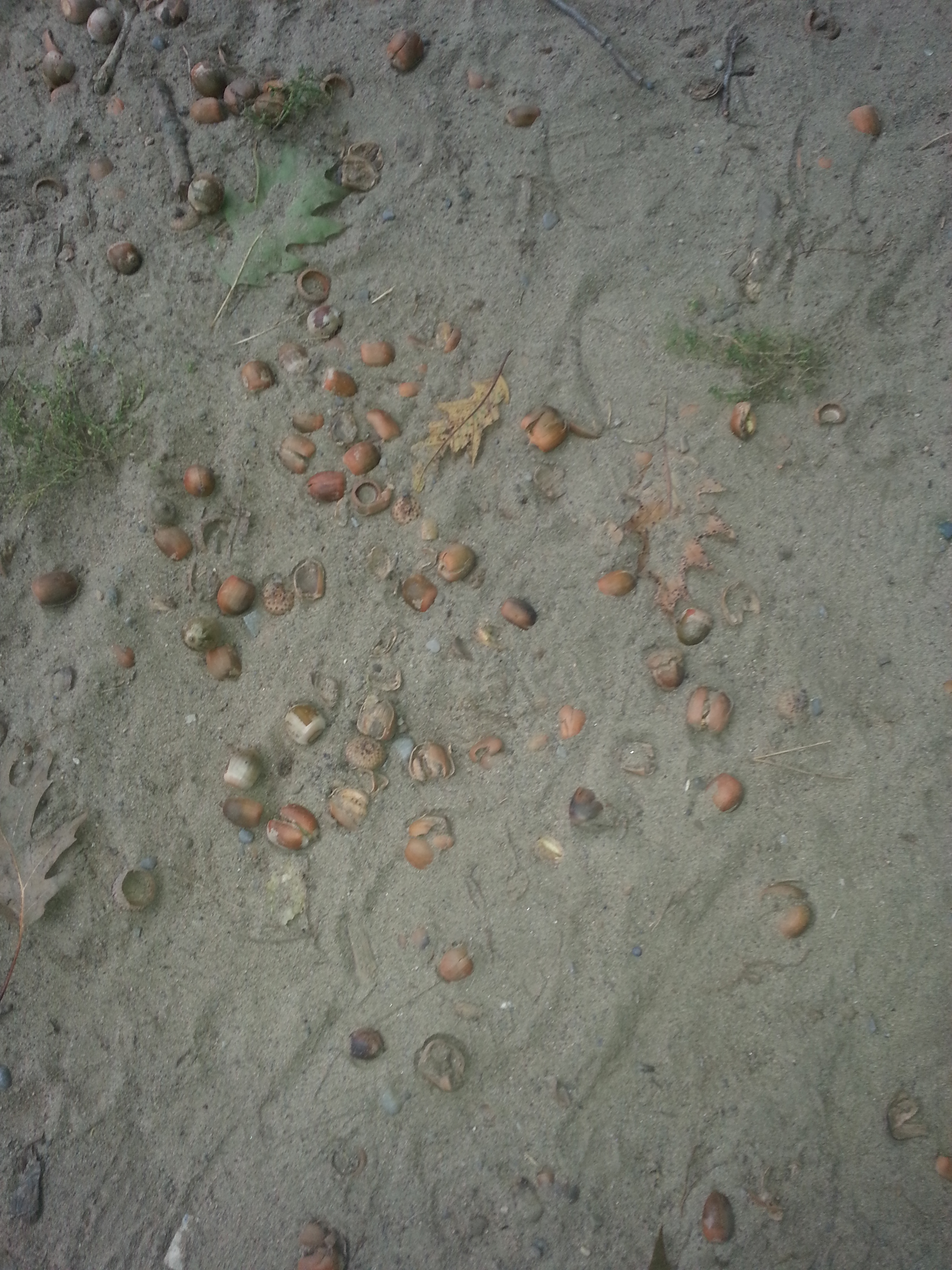
Eventually, I come to the foot of Warden Avenue. It’s not exactly a landmark, but it’s cool enough to me. Where the street ends, a path begins. As I walk, I hear crunching under my feet. There are fallen nuts or something embedded in the sand. I pick one up as a souvenir and place it in my bag.  At the end of the path is a gate – or, at least, was a gate. Past it is, of course, the Scarborough Bluffs. I can hear the waves from where I am. It looks as though someone might’ve attempted this descent or at least part of it, but it’s not an adventure I’m up for, so I turn back.

6. Foot of Warden Avenue

7. Foot of Warden Avenue

8. Nuts

9. Warden Scarborough Bluffs

10. Warden Scarborough Bluffs

I return to Kingston and start heading west. The street was built as a motel lined highway into Toronto – the Dundas Street of Scarborough, if you will. The strip of shops near Warden features a cafe, an empty store, and a bar with karaoke.

As I keep walking, I’m not awed. It’s a rather sad street, and that goes beyond just the construction. Looking across the way, there’s nothing lively – certainly not like the stretch of Kingston that runs through the Beach.

11. Warden Avenue Helene Cafe           12. Warden Avenue Helene Cafe

13. Warden Avenue Closed Store

14. Faded Mural

15. Kingston Road Birch Cliff

Continuing on, to my left is a long fence with trees rising above it. I have no idea what’s on the other side. When the opportunity is right, I peek my head over. A golf course. Further down, I put it all together. This is the Toronto Hunt Club, which is fed in by a private road. It’s a long established organization, and has been here for at least a hundred years.

16. Toronto Hunt Club Kingston Road

17. Toronto Hunt Club Kingston Road

Toronto Hunt Club Kingston Road, Goads, 1913
Oaklands Avenue was Warden south of Kingston. Credit: Goads Atlas, 1913.

Kingston does a curve and turns residential for a bit. At Blantyre, I have to head south. Before that, I stop in at the Petro Canada. It’s a fortuitous break because with all the walking, I forgot to pack water with me (number one rule for an explorer). I refuel and continue. It’s somewhat fitting considering my destination – a great big water temple.

18. Kingston Road Birch Cliff

But first, Blantyre reminds me a bit of Warden Avenue in its array of homes, but it’s clear that it’s a bit more upscale (understandable as I’m closer to the Beach). At Queen Street, for example, are houses that require a stairs to get to.

19. Post-Modern Home

20. Blantyre Avenue

21. Blantyre Avenue

At just after 6:30pm, I cross Queen Street and find myself before the R.C. Harris Water Treatment Plant, a long yellow building with a massive lawn. I get in close to inspect it while a couple dogs (with their owners nearby) come in to inspect me. I amicably oblige them for a bit, but know I don’t have too much time. What I see is impressive, but I know the other side is where the real marvel lies.

22. R.C. Harris Water Treatment Plant Back

23. R.C. Harris Water Treatment Plant Back
35. R.C. Harris Water Treatment Plant dogs

Immortalized in Ondaatje’s In the Skin of a Lion, rhe R.C. Harris Plant, named for Roland Caldwell, the city’s Public Works Commissioner at the time of its construction, is one of the most photographed landmarks in the city. I have to join the masses in capturing its grandeur. It is built in the Art Deco style of the 1920s and 30s, the same as Commerce Court North – although it is nothing like that tower. This is industrial architecture at its finest and because of it, I’m pretty giddy.

24. R.C. Harris Water Treatment Plant

26. R.C. Harris Water Treatment  Front

27. R.C. Harris Water Treatment Plant Front

The facility is located at the foot of Victoria Park Avenue, which is  named for the amusement park and forestland that the treatment plant now occupies. As I meander around and note individuals with their animals and/or human companions, it’s funny how it’s still a gathering place – an odd one if one thinks about it. “Let’s take the dog out for walk to the water treatment plant and we’ll talk as well.”

Victoria Park RC Harris Plant, Goads 1913
Credit: Goads Atlas, 1913
Victoria Park RC Harris Water Plant
Victoria Park Amusement Park, Year Unknown. Credit: Scarborough Historical Society

28. R.C. Harris Water Treatment Plant

29. R.C. Harris Water Treatment Plant

I head down to the water and capture it from below. It’s a moody day, and part of me was hoping for an animated sunset, but there’s still something appealing with the dreariness and fog. There’s no rain, though – that’s a plus.

30. R.C. Harris Water Treatment Plant

31. R.C. Harris Water Treatment Plant shore

32. R.C. Harris Water Treatment Plant shore

33. R.C. Harris Water Treatment Plant

34. R.C. Harris Water Treatment Plant plaque

My phone indicates it’s 6:50pm, so I regrettable decide to leave Mr. Harris’ great achievement. I know have to get a move on in order to make Mr. Levine’s talk without being too late. I’m not helped by the fact that it’s almost entirely uphill to Kingston road – from the shore, up to the plant, to Queen Street, and up Courcelette Road. I’d take my time to admire the street, but I’m too winded to give it thought. I haven’t been through such strenuous exercise in a while. When I consider it, I’ve missed it and make a note to put myself through that – under less stressful circumstances. By the time I reach the main road, it’s dark. The fog reflects beautiful on the street lights and I can’t resist one last picture.

36. Kingston Road Birch Cliff

I reach Taylor Memorial Library at 7:10pm. Not bad, although I’m still very gassed. It’s a really cozy branch.

I’m directed to the back meeting room where Mr. Levine has already begun lecturing on his book. It’s a great presentation on the ‘life’ of Toronto – Muddy York, The Toronto Maple Leafs, The Ward, The Orange Order, former mayor Nathan Phillips – a lot of which I know about, but still some that garner notes in my Moleskine.

The audience discussion that follows it is most interesting. There were comments about the inadequacy of Toronto’s infrastructure (the TTC at the centre, naturally), how Torontonians are whiners, and, most notably, how the city is soulless. Thinking of my day today, I argue that city does have a character and soul. The examples of soulful cities given include Montreal, Quebec City, and European metropolises. I suppose their souls are wrapped in long, documented histories. Toronto’s is perhaps less obvious, but I say it’s character lies in its neighbourhoods – like Birch Cliff – and the landmarks within them – like the R.C. Harris Treatment Plant. I think it’s a fair point and very fitting given the evening I’ve had.

It’s worth noting that what I saw today is only a small portion of Birch Cliff. The Quarry Lands at Victoria Park and Gerrard, for example, were a big part of the area once upon a time and now await aan uncertain future. Their exploration also await me.

Scenes From North York Centre, Gibson House Museum, and Mel Lastman Square

North York Centre. Lansing.  Uptown. The House that Mel Built. What was intended as a simple errand at Yonge and Sheppard turned into a tour of this downtown away from downtown.

It’s been a few years since I frequented the area on a semi-regular basis, so I was slightly shocked at the amount of growth since I was last here. At Yonge and Sheppard – the fortuitous cross-section between two subway lines – towers in differing stages of development have displaced the Metro-flanked strip mall.

1. Yonge and Sheppard towers

2. Yonge and Sheppard towers

Walking up the street, I can see even more cranes with upcoming condos in the distance. Below them, big box stores and restaurants line the streets. My destination is Gibson House Museum – one of the few historic sites operated by the City of Toronto that I have not visited. The towers I saw earlier surround the museum and tell me that a certain Gibson Square is coming to the corner of Yonge and Park Home. I’m compelled to do me a little look around of the museum to see the extent of the ‘takeover’. From Park Home I can see the hint of the brick building beyond the construction site. I continue to Beecroft, where I pass a parkette . I would examine it better after my museum visit. I notice a a house across the street which I immediate recognize as being of an earlier architectural style. I snap a photo and make a note to ask the Gibson House staff about it.

3. Dempsey House on Beecroft

4. Gibson House back Condo

Moving around Gibson House via Basil Hill Court, I’m struck by the contrast of the back of the house and the condominiums going up in front of it. I circle to the front of the house where I’m greeted by a familiar blue plaque. This marker was erected by the Ontario Heritage Trust (interestingly known as the Archaeological and Historic Sites Board in the text) to commemorate David Gibson. I take a few steps back to admire the entirety of the house – but am stopped by the construction wall behind me. Finally, I go around to the side where the entrance is a modern addition to the back the house.

5. David Gibson Ontario Heritage Trust

6. Gibson House front

7. Gibson House side

I’m greeted at the desk by a nice administrator and I immediately mention my observations while getting to the museum. She concurs that it’s tough situation being “landlocked by condos.” It has affected their foot traffic. I pay my 6.29 for an adult visit, she takes my bag to store while I take the guided tour, and I wait for a costumed interpreter in the Discovery Gallery, reading up on textiles and the Gibson story.

This was not the first home the Gibsons owned on this property. A wood frame house stood here, but after the rebellion of 1837, Gibson – a traitor – fled to the United States and the house was burned. Was he returned in 1850, he built this grand Georgian house.

We start in the living room where Claire tells me about Mr. Gibson and the room we are in. He was a land surveyor, which caused him to be often away doing work . This allowed the family the ability to be financially stable enough – not rich, not poor. Of the room itself, Claire tells how the idea was to give off that the impressions they were well off – “perception becomes reality” at work. It sounds like a pompous attitude to have, but it’s a dynamic I have seen in my own life in the 21st century, so perhaps it’s become somewhat normalized. The room is seperated by doors, which divide the room into an entertaining space for guests and an area where the children could play. The public/private divide comes up again later in my tour.

8. Gibson House Living RoomThe room is decked out in Christmas decor,  although a tree would have been anachronistic for the time. Christmas as a whole was not a big deal; perhaps a meal was had and that was it. Hogmanay was the big holiday celebration. Although, if there were adult drinks involved, at least Eliza Gibson was not involved in them, as she was temperate (I think?).

We go to the upper level where Claire tells me about the hired hand David Gibson employed to run the farm (because Gibson was often away). His room was sizable enough for a comfortable enough living, and was situated far away from the children’s bedrooms (locked as well). Claire says there is speculation about his relationship to the family – whether it was strictly an employer-employee dynamic or the family and their good friend. His room faces westward and allowed him a view of the property he managed. The Gibson farm extended all the way to Bathurst from Yonge but wasn’t very wide. He could look out and see all flat fields. Today, the view presents a challenge in interpreting the site because as Claire mentions one sees “a lovely building” when one looks out today.

The children’s bedroom – consisting of a boys and a girls – are low-key in their appearance. And this was on purpose. Nobody went into the bedrooms save for the children themselves and that was in the morning and at night. All the bells and whistles, with the notable exception of the master and guest bedrooms, were reserved for the public areas of the house. The idea, as Claire presented it, was to create a facade for guests: impressing them into thinking they were better off than reality.

As mentioned before, the Gibsons weren’t poor, but they weren’t the elite of the elite. They owned this great house that, if not for the lack of indoor plumbing, might suit a family today. These facts prompt to ask myself – and Claire – “If the Gibsons were nothing special, why does the family’s story survive, as opposed to other comparable households in the area?” The answer includes a couple of factors working together. First, because of his line of work, David Gibson wrote a lot of things down that inform us about the family and their lives. Unfortunately Gibson House records do not include records from the other occupants (Claire says it is not even known if Eliza Gibson was literate), but his paper trail is sizable enough. Second, it helps that the house itself survived. Being brick, it did not burn down like other residences. It also survived demolition even after the farm was broken up for development. During the Centennial celebrations of 1967, the Canadian government alloted money to restore historic houses and turn them into museums. The Dempsey Brothers Store/Joseph Shepard House that I saw on Beecroft might very well have been a museum, but the Gibson home instead was commemorated.

In addition to these rooms, there is a place for the seamstresses hired by the family, as well as a guest room (which is the nicest of the non-master bedroom rooms).

Downstairs, Claire takes me through the Gibson’s office, the kitchen, and dining room. The former is populated by the man’s surveying equipment (not original, of, course). In the kitchen, my guide takes me through the Gibson’s diet (a lot of potatoes) and says Eliza Gibson took care of the kitchen herself, no help. The focal point of the room is the fireplace. One can only imagine the difficulties in cooking an entire meal on it – and worrying about the real hazard of not catching fire. (Tidbit: museum workers and volunteers need safety training just for this reason). The nearby dining room is a showcase of how great the Gibson had it (or were believed to have it, anyways. It also houses two original artefacts: a clock and a cabinet.

9. Gibson House Office

10. Gibson House Kitchen

11. Gibson House Dining Room

Our tour ends where it began. Claire shows me a posted map where visitors have plotted their place of origins on a map. Also presented to me is a full family tree of the family. I heard about it upstairs, but I need to visualize it. Interesting fact: Eliza and David Gibson were related before they married. I forgot the exact connection, but perhaps it was 2nd cousins. My guide says they didn’t grow up together, so it might alright by today’s standards? I might agree with that.

12. Gibson House Archive Photo

13. Gibson House Family Tree

I thank her and she leaves me to browse a little bit. After that I pay my appreciation to the staff and head my way. My adventure in understanding the area and the museum is not done, however. I head down to Gibson Park to see some public installations related to the Gibsons. You may read about that here.

After the park, I head back to Yonge. My final stop for the day will be Mel Lastman Square. This is the Nathan Phillips and Albert Campbell Squares of North York. The former civic heart of the borough and a cultural gathering place. Just to note a few events associated with it, it hosts skating, a farmer’s market, and Canada Day celebrations. Lastman himself was a former mayor of North York and the first mayor of the Mega-City. His fingerprints are all over the borough.

I have a look around, noting the North York Central Library, where I ventured to on a few occasions during university, and a gazebo of sorts. Satisfied, I head for the subway.

14. Mel Lastman Square

15. Mel Lastman Square Rink

16. North York Central Library

17. Mel Lastman Square sign 18. Mel Lastman Square

19. Mel Lastman Square gazebo


20. Mel Lastman Square


Scenes From Todmorden Mills

I get off the 100C Flemingdon Park bus at Broadview and Mortimer and cross the street. To the west, Mortimer becomes Pottery Road and is my route on the way to Todmorden Mills Heritage Site. A sign ushers me to the descent.

1. Pottery Road Sign

And quite the descent it is! There are several topographical kinks within the city, and this street is definitely one of them. I’m no cyclist myself, but I have to feel for the people coming up the hill. In fact, as I read more about it , Pottery Road ranks up there for people on bikes as the toughest to navigate. My pity pretty soon turn inwards, because I realise that I’ll probably have to muster the climb on the return trip. D’oh.

2. Pottery Road Descent

Another sign and a bricked path ushers me into the Todmorden Mills grounds. Located in the Don River Valley, it’s a site that claims both industrial and natural heritage. In 1967, it was re-adapted as a historic site and operates today under the City of Toronto Museums to help tell the story of Toronto. I was here once before, although very briefly to help out to an event. Today is a long overdue chance to do some more exploring of the museum and the great Wildflower Preserve I’ve heard so much about. (Although, ironically enough, I still don’t have an adequate amount of time to do a just visit). I also read about an intriguing photo exhibition in the Papermill Theatre, which is my first stop.

3. Todmorden Mills City Museum Sign

On the way toward the building, I have to look up to the smokestack, which was nominated for a 2013 Heritage Toronto Award for its recent restoration. Anyone who has ridden down the Don Valley Parkway has seen the chimney and its giant lettering.

4. Brick Path

5. Papermill Theatre Smokestack

Inside the Papermill Theatre is an art show entitled ‘The Past is Never Far.’ It features the work of three people who have visually captured the city at various points in its history: Elizabeth Simcoe, who painted some of the first images of Toronto, William James, who took 6000 some odd photos of the city which are all digitized in the Toronto Archives, and Summer Leigh. If the last name doesn’t ring a bell, it’s because she’s the artist behind the show.

6. The Past Is Never Far

Summer takes the images of her predecessors and photographs their subjects in their modern locations. So we can find James’ photo of the dirty foot of Yonge Street in 1909 mixed in with her take of the same site the 21st century. Or Lady Simcoe’s view of Toronto harbour in 1793 with the current incarnation of the shore as we see it today. It all makes for a great visual look into Toronto’s past and present.

Taken together, the exhibition tells a great story. Its message comes in the title, and is something I have been saying and thinking for a while now: Toronto is a layered city. Some of its (her?) landforms and landmarks have changed a great deal. Some haven’t. Perhaps some of the changes aren’t immediately apparent to us, but they are there nonetheless. The past isn’t far. You just have to dig for it, do some analysis, maybe even put on a photo exhibition.

That said however, perhaps some things do stay the same. Summer has one image up of William James that features the Don River Valley flooded in 1910. 100 years and a parkway later and we’re still facing the wrath of the overflowing Don. I shake my head and smile at that. Plus ca change, plus c’est la meme chose, n’est-ce pas?

9. The Past Is Never Far

As a nice and unexpected treat, the artist herself is on hand, and I am able to pick her brain about what I see – whether she was actually at the disputed  location of the Simcoes’ Castle Frank residence, as an example. Among the random things we talk about are old school horse drawn streetcars and being de facto tour guides for people in our lives. Through that chat it quickly becomes clear that she is a true buff in Toronto history, whose knowledge, talent, and vision really shows in her work. We probably can geek back and forth about the city for another good chunk of time, but alas, time isn’t abundant today and I graciously thank her again and make my exit.

I head up to the brick path and continue down it. To my left, I see a familiar blue marker. The Ontario Heritage Trust sign gives my the need-to-know of  Todmorden’s history. I briefly circle around the exteriors of the buildings. I did some reading prior to coming, and, if I had more more time, I would enjoy a tour, but it will have to wait until next time.

10. Ontario Heritage Trust Todmorden Mills Sign

Also happening on the grounds of the museum is Eco-Art-Fest, an arts, heritage, culture festival put on by No. 9, who I first heard about during Jane’s Walk preparations. There is a designated ‘chilling’ area which has some pretty soothing country tunes going, an elevated platform (I think it’s also a stage) with an oven, picnic benches, and craft table where a few children try their hands at water colour painting (shoutout to Elizabeth Simcoe with that activity).

17. Outdoor Area with Oven

I continue on the brick path once again, heading toward the bridge. I see a few joggers around, and I have to admit that it that this would be a very good place for a run. I would run through here if I loved closer. A few feet before the bridge is a swirly blue line with the words ‘Don Was Here’ in bold lettering. No, some guy named Donald hasn’t marked his presence. It’s actually a public art initiative commissioned by No. 9 and curated by Labspace Studio in partnership with the Toronto Region Conservation Authority. There are several of these ‘Don Was Here’ markers from Todmorden Mills to the mouth of the river which shows the meandering route of the Don before it was rerouted and straightened. It’s a pretty amazing tribute to the city’s natural heritage. The project has got an interactive site too…with a map!

12. Don Was Here at Todmorden Mills

I notice some letter on the side of the bridge as I cross it, but may little mind to it (more on this later). Instead, I focus on the green area it overlooks. I walk around (passing another ‘Don Was Here’ marker) and inspect it a little better. Beyond that it looks really beautiful, I can’t pick out any species or just the entire ecological significance of it.

13. Don Was Here at Todmorden Mills

14. Bridge

I circle around and head back to the open area with the benches so I can give the Wildflower Preserve a walkthrough. I am greeted by a pair of signs to explain everything. It turns out the area under the bridge was the last area on the trail. I get the signs on my phone because I know I’ll need them. And hey, now I know what an Oxbow is.

15. Wildflower Preserve Sign

16. Wildflower Preserve Sign

I spend a few minutes at the pond to take in everything. Gazing out and down at the green surface, I am hoping to spot something alive. Instead, I just see a pop can half-submerged in algae and just think somebody has really missed the point. I do catch movement, something skipping across the water. I can’t tell if it’s a fish or a frog, but I take it anyways and move on.

19. Wildflower Preserve Pond

The tree canopies are tall enough to make me feel closed in and away from everything, but even with the rustling wind, buzzing insects, chirping birds, I still can hear highway traffic. It’s a weird thing spot to be in. I feel like I’m in a secluded spot, but really, I am not. Actually, it reminds me of wandering the Betty Sutherland Trail near the 401. A city within a park, indeed.

At one point, my curiosity is piqued when I spot what looks houses floating in the oxbow. I have to maneuver through and over things to get to the water’s edge. Yup, they are floating houses. Either some trekkers got really mischievous and creative or this is something deliberate and tied to the museum. I suspect the latter. I do some research after the fact, and the Ec0-Art-Fest website and its scrolling banner images provide the answer. The houses are an installation for the festival – as is the lettering on the bridge (which read from the other side says ‘Like a Bridge’) and the ‘Don Was Here’ project. Eureka!

22. Boat houses Todmorden Mills Wildflower Preserve

As I walk the paths, I try to see if I recognize any flora. I think the yellow flowers are goldenrod, but I’m not willing to bet my guitar on it. In co-creating a nature walking tour last summer, I was introduced into identifying certain floral species, but it does not help me out here. Instead, I just go back to marveling at the Preserve in a big picture sense.

20. Goldenrod, maybe

21. Bridge

I remember something Summer said about our former industrial centres. Places like Todmorden, the neighbouring Evergreen Brickworks, and the quarries of Greenwood and Smythe Parks were pretty dirty looking once upon a time. To see their conversion into beautiful natural and park lands is just remarkable. Tormorden and the Brickworks in particular have their own ecosystems, which makes this preserve more amazing to be in and think about.

For a while I try to go off the main path onto offshoot routes, but then I realise that I really have no idea where they would end up. And I’m being stupid with time. So I turn back and get to the end of the wooded area. I’m at the back of the parking lot, and instead of walking through it, I turn around and tour the Preserve again. When I reach the beginning, I spot a warning I missed the first go around. I smile at the mention of the ‘East York’. The borough lives on.

24. Wildflower Preserve

26. Wildflower Preserve Sign Borough of East York

Walking back to Pottery, I give the museum one last look and then head off to do the climb. Part of me wants to visit the Brickworks, but I know this is not doable. I convince myself it would be a real beneficial exercise to power through at a quick pace, but halfway I’m a bit gassed and cursing my idea. Fortuitously, I do break beside a Sumac, though! Happy that I recognize something, I leisurely finish the ascend and then make it back to The Danforth.

27. Todmorden Mills

28. Pottery Road Sumac

A Grand Geographic Timeline of Toronto History?

This is just me trying to get down some ideas. It may be rough and unclear, but hopefully something to build on.

As a follower of Toronto’s history, I come across a lot of dates – when something was built, when a town is incorporated, when a park is founded etc.

What’s interesting, though, is I’ve started noticing how certain years come up in different stories across the city.

Take the year 1858 as an example. A storm splits Toronto Peninsula to create the Toronto Islands. 26 km to the northeast John Hill founds a post office in Agincourt which signals the start of that community.

It’s fun to think about what was happening in different parts of the city at the same time. You have communities with no formal connections to each other growing alongside each other. Communities that eventually form the modern City of Toronto.

Wikipedia’s page on the History of Toronto has articles on History of Neighbourhoods, Historic places, Oldest buildings and structures, and Timeline of Toronto History. It would interesting to combine these into a giant timeline of events in Toronto’s history. More than that, because this relies on displaying information tied to places, I’d like to see the information displayed on a map (because really, who doesn’t like looking at maps?). I imagine being able to look at map of a given year and clicking on different nodes placed on that map. Then, being able to explore the map from the following year.

I imagine being able to draw observations about how the city developed, what was settled when, what areas were industrializing/de-industrializing, when and how natural landforms were shaped (think the burial of creeks) etc..

In all, it would be another way to capture the story of Toronto. Just an idea.

A View of York (Toronto) Upper Canada, 1820
Edmund Wyly Grier’s “A View of York (Toronto) Upper Canada, 1820” Credit: Toronto Public Library

My Doors Open Toronto 2014 Itinerary

In making this list, I quickly realised I would see the whole city if I could, so there are sites I likely neglected. I also had to map things in order to visualize how I’d go about the weekend, so check that out too.

Have to see:

Arcadian: Only open on the Sunday. I had no prior knowledge of its existence, but I am all for cultural and social venues in the city – especially those done in Art Deco. And I wonder about this City View Cafe…

Carlaw Creative Lofts: Anyone that has seen my posts, knows I’m fascinated by the industrial heritage of Carlaw Avenue. I’m very excited to see this readapted factory space.

The Great Hall: More West Queen West goodness. It’s impressive to look up at every time and I’m very curious about it. Plus, haunted stories!

The Theatre Centre: Practically adjacent to The Great Hall which makes this very convenient. Former Carnegie library converted into a cultural space. And a cafe!

Bank of Upper Canada: 1834 Neo-classical building in the oldest part of the city. Sounds fun enough…

Would love to see:

Artscape Youngplace: I remember reading about the opening of this place and thought it was a good idea. The reuse of old spaces, especially to turn them into community hubs, is a fascinating thing. Plus, there’s a Youngplace Coffee Pub. Hmm, I suspect coffee is going to be a theme in where I decided to go…

Bloor Hot Docs Cinema: The first non-new-this-year venue on this list. Choice here comes through an interest in old cinemas. Might have to weary that it closes at 3 though…

Bridgepoint Active Care Centre: This is the Don Jail – who doesn’t want to tour it? Actually, for that reason, Bridgepoint has warned several times about lineups and are making this a ticketed thing. Tickets will be handed out at 9:40am each day. Worth the hassle? Possibly. The crowds might be a deterrence…

CAMH Walls: West Queen West seems to be a goldmine for sites this year. The walls are the last physical remnant of the Lunatic Asylum. I would be curious to know about them…

R.C. Harris Plant: It’s a fan favourite and has eluded me every year. Will this time be the one? Possibly. I wonder if the construction on Queen East will get in my way…

Russell Carhouse – Old structure, old streetcars (and the new streetcars as well!) Similar transportation issues as R.C. Harris, though…

Necropolis – Fits right in with the ‘Spirits’ theme of the weekend. I’ve been here before, but never really toured it in search of the great Toronto names. This would be a great opportunity…

Scenes From St. Lawrence Neighbourhood

I begin at St. Lawrence Hall, the famed 1850s building that impressively mans the corner of King and Jarvis. It’s become a habit to stop and look up at things I pass, including the archways above doors. Much of the story, allure, and yes, even seduction lies in them. As a civic building, it appropriate contains Toronto’s former coat of arms, which deciphered alludes to the city’s colonial and aboriginal foundations. Above that is the stern visage of an Olympian-like caricature. Glory, mystique, and fear. That’s how I feel.

1. St Lawrence Hall Door Toronto Coat of Arms

Shallow puddles provide distorted reflections of the towers above. It’s a drizzly one in Toronto, but that’s OK. Hopefully the falling rain will help eliminate the black half snow, half ice banks for good. I turn onto Market Lane  heading to Front Street. With the exception of a portion of the Hall, the buildings lining the way are relatively new. But I’m reminded from a past heritage walk that the lane itself isn’t. A sign of that is the watering station – explained to me as a gas station of yore for horse-drawn travellers. There’s a fountain for people and one for non-human beings below it.

2. King Street East at Jarvis

3. Market Lane Fountain

Across Front, the lane continues on as Market Street, recently made to be exclusive to pedestrian traffic. Beside that of course is St. Lawrence Market, itself a former city hall. Beyond the great assortment of tasty foods, it is also a house of culture. The Market Gallery on the upper floors stands where the old council chamber  was located. Without a dedicated Toronto museum, the Market Gallery is a favourite place to indulge in the city’s past. Right now the space houses a Toronto Black History exhibition which I admittedly have not seen yet. The previous one, however, on Art Deco in Toronto was masterful.

4. St Lawrence Market

The south side of Front is lined with a row of heritage buildings, all now food franchises. “New ideas meet old buildings”, to put a spin on Jane Jacobs. The street leads up to the most photographed landmark in the city, the Flat Iron Building. I have to think of an old photo of the intersection featuring the Coffin Block, the building’s predecessor. It’s a reminder how layered the city is – that even some of the oldest structures in the city were not the first  on their respective sites. The quirkiness of the Front-Church-Wellington intersection which allows such a quirky building disspells the dominant fantasy that Toronto is a perfect grid.

5. Front Street looking to Church

Coffin Block, Front and Wellington streets. - 1873

The ‘nose’ of the Gooderham Building is the entrance to a Firkin pub chain, but the entrance to the structure itself is on the south side. Like the St. Lawrence Hall it is marked with a great arch and decorative ornaments. I wonder if it’s all original, but it nonetheless looks really well done.

6. Gooderham Flat Iron Building Entrance

Passing Pravda, next I come to Leader Lane. Although the naming of lanes is a curiosity, I don’t follow the lane (get it?). It’s a shame because through further research it is part of a relatively hidden network of narrow streets.

Outside the Vagabondo restaurant (great name) I see a sculpture featuring a bowl-like platform and a spherical thing. Although I have not idea what UV Ceti is or represents, the ball look like a celestial body of some sort. Turns out I was on the right track. A UV Ceti variable, also known as a flare star, is a dwarf star whose temperature and brightness drastically in a span of minutes. Pretty cool, eh? A thank you to Mr. Andrew Posa for his creation!

7. Leader Lane and Wellington

8. U.V. Ceti on Wellington

Over my time of studying streetscapes I’ve  developed a theory: the greatest structures in terms of grandeur are, in order, churches, government buildings (city halls, parliaments etc), banks, and post offices. Considered under its original incarnation, the Irish Embassy Pub falls into the third category. With its arched windows and doorways and mansard roof, the design is spectacular. There is even ornamental faces – this time of lions! Looking up though, it’s apparent the wears of history and the elements have left their marks.

9. Irish Embassy 1

10. Irish Embassy 2

I cross Yonge and then Wellington to head southbound towards Front. Along the way I pass beautifully restored and coloured historic facades. My destination and terminus on this walk is a new building,  Brookfield Place. The centre has been on my list of places to visit, so this was a treat. I enter into Sam Pollock Square, named for arguably the smartest man in hockey (at least, according to Don Cherry in an interview with Nardwuar the Human Serviette). The famed roofed is the main attraction with arches and criss-crossing wires.

11. Yonge Street south of Wellington

12. Sam Pollock Square Brookfield Place

I move into The Allen Lambert Galleria and am greeted by a photo exhibition: George Steinmetz’s Desert Air. It’s a fabulous little showing of unique natural landscapes running until April 17. No pictures from me, but it’s worth a look. Beside them is a restored heritage facade to a bank building. The appeal here is obvious – old with the new.

13. Heritage Archtecture Brookfield Place

The main attraction, though, is the atrium. The tall atrium. Someone once described to me as a forest – a tall, symmetrical, sterile forest. I personally would not have seen it if not pointed to me, but I see where the comparison comes in. Steel trucks row by row, branches high above with little peeks of the sky between them. Just as I began the walk, I end by sticking around a while to just look up. Yes, definitely a habit.

14. Allen Lambert Galleria Brookfield

Satisfied, I am tempted to take a tour through the Hockey Hall of Fame – it would be my first in 15 years. Alas, I nix the idea, reasoning it would be better under more social circumstances. I do hit the store briefly for some browsing. No whim purchases though – everything is nearly above what I’m willing to shell out. After that, I exit and walk up Yonge Street for lunch and coffee, courtesy of Dineen Coffee.

Scenes From Shops At Don Mills

Don Mills and Lawrence is at the epicentre for suburbia in Toronto. In 1953, it became the city’s first planned community – the first suburb. The affluent suburb. That’s not to say that residential areas did not exist outside of Hogtown’s core before this. Suburb here refers to cookie cutter bungalow-lined side streets and shopping centre-defined main ways – all tied together by the epitome of affluence: the automobile.

Don Mills Aerial 1960s

Don Mills represented a new consciousness in city building – a shift away from dense metropolises and a needed way to handle the post-war population boom. Some 50+ years later, Don Mills and Lawrence is at the centre of more innovation.

My first visit to the Shops at Don Mills was stemmed from a specific purpose: scouting out locales for a hair trim. It also gave me a chance to scout out a place I’ve heard about in name but never visited.

It’s a fun test to characterize the Shops. This is a mall, there’s little doubt about that. But at the same time, it’s very much unlike other malls we find in Toronto’s suburbia. It’s not the ‘multi-levelled, department store archored Scarborough Town Centre’ kind of mall. Although the shops stand side by side, this isn’t a ‘Golden Mile style strip mall’ kind of shopping centre either. For one, both types involve huge tracts of parking. The Shops at Don Mills lacks that. In its place we have a layout of narrow individually named streets and sidewalks decked out with lampposts, greenery, and benches.

Shops at Don Mills Leadley Lane
The Shops’ streets are named for original residents of Don Mills

Shops at Don Mills Sidewalk 3

Shops At Don Mills Clock Tower Road

At this point, it strikes me: this is all supposed to recreate a city feel. A look on the Shops website cements it: The Urban Village.

Here we have an urban environ in the heart of suburbia. That duality is very intriguing.

The shops themselves make the place a destination: Pandora, Aroma Espresso, Fisker, Glow Fresh Grill & Wine Bar, and the like. Incidentally, as a person that still labels himself as a poor student and not very shopping inclined, these are intimidating establishments with intimidating prices. The cut I was there to cut was a number I do not want to repeat. But I digress.

Shops At Don Mills Stores
Shops at Don Mills is the second mall existing on this site. It opened in 2009 on what was once the Don Mills Shopping Centre.
Shops At Don Mills Bier Markt
A visit to Bier Markt still eludes me.

Two final pieces contribute to the village/town/city characterization. The Shops boasts a gathering area at its centre, aptly called the Town Square. Right now it is a skating track, but I imagine a beautiful lawn in the summer.

Shops at Don Mills Town Square  Rink
The Town Square

The southern edge of the square is marked by a Clock Tower, a landmark that normally highlights many a town or city, but here takes on an interesting form. I recognized the ‘branches’ as houses, but could not place its overall significance. Help via Instagram (thanks again @bobofeed) told me that the piece was the brain child of Douglas Coupland, and highlights the emergence (or explosion?) and importance of the suburb and Don Mills’ place in history as the host of this development. It is a great reminder to the pedestrians and motorists of this urban village that they are still, after all, situated in a suburb.

Shops At Don Mills Clock Tower
Douglas Coupland’s Supernova

Related Links

Don Mills: Rediscovering the Suburban Dream
BlogTO – Nostalgia Tripping: The Construction of Don Mills, Toronto’s First Suburb
Torontoist – The Ghosts of Don Mills
CBC Archives – Don Mills Turns 50
Live at the Shops – Back in The Day: Don Mills & Lawrence
Toronto Star – Toronto’s Mother of All Suburbs: Don Mills
Reurbanist – The Evolution of Don Mills Shopping Centre

‘David Bowie is…’ a vast insight into a complex artist

David Bowie is is a simple, yet fitting title. At its core, the Art Gallery of Ontario’s big ticket exhibition is about definition and identity – and for David Bowie is, identity is a fluid and complex thing.

David Bowie is an artist. David Bowie is a visual artist. David Bowie is a musician. David Bowie is pop musician. David Bowie is rock musician. David Bowie is a folk musician. David Bowie is an entertainer. David Bowie is an actor. David Bowie is a shape shifter. David Bowie is a mask-wearer. David Bowie is Ziggy Stardust. David Bowie is The Thin While Duke. David Bowie is a style icon. David Bowie is a creator. David Bowie is a provoker. David Bowie is an icon.

The vital first room superbly introduces the visitor into the complexities of a Mr. Davie Jones. From here, David Bowie has proven his ability throughout his career to draw from multiple influences whether it was 1984 or the American space missions or Andy Warhol or the Dadaist art movement or Kabuki theatre. He is a multidisciplinary artist who did not place parametres on  what or who David Bowie is or could be. A paraphrased quote that stuck out in my mind was Bowie’s assertion that he wanted to do more than write pop songs. There was so much more to the imagination.

David Bowie Is poster
No photos allowed in the exhibition, but a promotional poster outside was worthy of a snap. He is forever.

The ‘ping’ moment for me came on the fifth floor while watching a performance of “Boys Keep Swinging” and reading about Bowie’s tendency to dress in drag. It was amazing to see the hand written lyrics to “Rebel Rebel”. ‘She’s not sure if you’re a boy or girl’ sums it well; David Bowie tested his audiences to figure out what exactly he was. Whether he was dressing in drag or appearing as half-man, half-dog, David Bowie could not be simply defined.

The audio guide was not your typical audio guide. Like Bowie himself, it was very innovative. In the large ‘live performances’ room, one can read a sentiment of Bowie’s that asserts his desire to generate visuals based on how his music sounded. This need to create a full experience is echoed with the area triggered sounds of the guide and the imagery of the exhibition that perhaps, for me, only became overwhelming when having to process text with the headset on.

All in all, David Bowie is is an extraordinary exploration into a great figure in popular culture. Even with the hour and fifteen minutes spent, I was not able to take in everything as wanted. But this only speaks to the richness of the exhibition. Bravo AGO.

Related Links

thirty four princess – Review: David Bowie is at The Art Gallery of
Ontario
labuhrows – Stardusted: “David Bowie is” mesmerizing at the AGO
Toronto Star – David Bowie Is opens at the Art Gallery of Ontario

Sam The Record Man Sign Belongs in a Yonge Street Museum

Sam the Record Man Sign
Credit: Shane S. Flickr stream

I have never stepped inside Sam the Record Man, and I shamefully admit my memories of walking by the famous neon signs at Yonge and Gould are vague at best. My experience is limited to exploring my father’s record collection which he purchased at the store in the 80s, and sifting through what would be become new favourites like Bowie’s Let’s Dance and the Saturday Night Fever soundtrack. With this said, personal memory and collective memory are separate yet connected ideas, and while my own past does not directly intersect with the life and times of Sam the Record Man, I feel part of a collective whose past indeed does – even if those memories aren’t mine.

The issue to me is not losing the store itself. Business is a tricky endeavour, and recent high-profile examples unfortunately show that even the most profitable and high profile enterprises can fold. There are many that would like to see it in existence, and I am not diminishing those sentiments. But since it is gone, we are faced with a ‘now what?’ situation.

Well, the ‘now what?’ is what do we do with the giant neon signs. The signs are the most tangible remnants of that store, along with perhaps the records purchased from the record shop that still exist in the collections of its former patrons and the auctioned memorabilia distributed in the store’s final days. The issue is commemorating, through the signs, the importance of Sam’s and its owner Sam Sniderman in the narrative of our music and cultural history.

Many assign Ryerson University – a rapidly expanding institution and the current owners of the former site of the store – as the villains in this saga. Many lament the loss of the Yonge Street Entertainment Strip (located between Queen and Gerrard Streets), of which Sam’s was a big part of, and dismiss its current incarnation as a soulless commercial and educational strip filled with an upcoming Ryerson student buildings and a mix of big and small name shopping destinations.

Sam The Record Man, Steeles Tavern, A&A
A&A, Steeles Tavern, & Sam The Record Man ca. 1971
         City of Toronto Archives           Series 1465, File 312, Item 51

For me, times change and there should be no qualms about new epochs coming into fashion. That’s fine. The fascinating thing about Toronto is its layered history. Different occupants, one after another (or sometimes at the same time), move into an area, set up their establishments, and in doing so they transform the character of their locale. This is perhaps no better manifested than in Kensington Market.

As these transformational processes take place and time, the altered urban landscapes have the power to reveal and conceal the layered history of their use. From the 1960s to about the 1990s, The Yonge Street Strip was for the most part a music and entertainment epicentre in Toronto. The sites which have contributed to this characterization have largely disappeared. Some buildings currently employ different uses (like Friars Taven at Dundas), others have been demolished completely (like the Colonial Tavern at 203 Yonge St). The loss of Sam’s and the Empress Hotel (which has quite the history itself) were the latest in this episode. The only visible reminder is Zanzibar’s, although even that has shifted identities from a music club to a purely adult entertainment establishment. Take this further and one hundred years ago the history of the Yonge Street Strip comes a bit full circle with how we might see it today. In 1912, for example, Sam’s was Curtis-Wilson Furniture Co. and Byers Albert Jefferies, Ltd., furries. 349 Yonge – Steeles Tavern, which Sam Sniderman eventually took over – was Hele’s Ceramic Art. Co. A&A at 351 Yonge was owned by Walker Frank, a man in the clothing business. In other words, this was a retail strip in its own right.

SamsDirectory1912

Today, the site of Sam is occupied and owned by Ryerson Univeraity – a booming educational institution that has seen tremendous growth since its days as a polytechnic. One has to guess that growing levels of enrollment within existing programs and the addition of new programs has necessitated its spatial growth, so as much as we might curse the ‘takeover’, perhaps we cannot fault that from occurring.

So the question remains: where do the signs end up? They are doing no favours to anyone stored in a North Toronto trailer.

The original plan was to have them mounted within the new student centre as a part of the deal struck by the Ryerson-Sniderman deal. Much fuss has been made about a broken promise on Ryerson’s president who has said that signs would clash with the modernist style of the new building.

Recently renewed talk has called for the need of a Toronto Museum. Whether we have the site and leadership to finally execute such a needed endeavour is another story. It does remain, however, that the neon signs would be ideal artefacts within such as a space. This would help in telling the musical and cultural narrative of Toronto as well as the role of Yonge Street.

Ideally, I’d like to see them back a part of the street, which also was the proposal put forward by Councillor Wong-Tam and supported by Mayor Rob Ford. The signs are best preserved and presented in context. Sam’s was an important part of a certain era of Yonge Street, and its signs should be displayed at its historic intersection. In doing so, in the end, we are putting them in a museum – albeit one that lacks physical plant and invites the components of the urban landscape to be the artifacts themselves.

Urban landscapes as museums are not a new idea. The Textile Museum’s mobile app TXTile City turns the city of Toronto into a museum whose artifacts are the sites – the built forms and their related oral histories — themselves. A recent TedTalk promoted the idea of the built and natural forms of Indianapolis – the city itself – as a science museum. A Toronto Star column has outlined the importance of Yonge Street. This is our Saint Laurent Boulevard of Montreal fame. Like The Main, Yonge Street, our spine, bisects the city, connects neighbourhoods, serves as cultural and commercial epicentre, and has a very layered past. In other words, it is important in the historical, geographic, cultural, natural, economic, sociological development of Toronto.

Fortunately, we already have something like what I’ve been proposing already underway. Youryongestreet is an online crowdsourcing initiative, launched by the Toronto Public Library, aimed at celebrating the history of Yonge Street. The potential age range of participants (and backgrounds in general) allows for exactly what I’ve been talking about: the presentation of the diversity of Yonge Street. The exhibits collection features a range of images, videos, audio accounts, and written tales about Yonge Street.

Youryongestreet and the urban landscape museum I have presented are two parts in an grander museum that showcases Yonge Street’s past. No doubt the Sam the Record sign should be an artefect in that museum, too.