Storytelling, Jane’s Walk, and Scarborough’s Wishing Well Acres

Every place has a story.

That was the takeaway when I began looking into the past and present of Wishing Well Acres in northwestern Scarborough. That same takeaway was reaffirmed after hosting my first Jane’s Walk on May 8th, 2016: Wandering Wishing Well Acres.

Jane's Walk Wishing Well Acres 2016
The only picture taken at “Wandering Wishing Well Acres”. Discussing Wishing Well Plaza and its future.

The grand story of Wishing Well, like many communities of Toronto, is contained in its historical evolution. Not surprisingly, the layer of suburbia is probably most central to this area. And that’s where my own fascination began.

The millionth house built after World War II in Canada is located in Wishing Well Acres — a little white corner bungalow originally purchased for $16,200. Of course, this bungalow could have been built anywhere — that is to say, there was nothing really special about Wishing Well that ‘bred’ the millionth house (other than perhaps the timing of the subdivision’s construction in 1956).

Heritage Property Map
The genesis of Wandering Wishing Well Acres came from the discovery of Canada’s Millionth Post-War on an Interactive Heritage Property Registry Map. Source: City of Toronto.

But the fact that the millionth house was here gives a bit of insight about the area in the 1950s — why people were moving to Toronto’s new suburbs. The owners of the watershed home were Mr. and Mrs Camisso and their two daughters (nuclear family, much?). The story goes that they were not even looking for a home but Mrs. Camisso was attracted to the green roof. Other selling points: its proximity to the Toronto ByPass (now the 401) and its automatic heating (no more shovelling coal into furnace!).

Millionth House Globe 1956
“1,000,000th House Built in Canada Since War is Sold to Young Family of Four”, Globe & Mail, Sept 15, 1956. Source: Globe & Mail Archives.

1956 is a funny year. In the grand timeline of history, it really isn’t that long ago. But at the same time, it is hard to find a reference point to that period. Newspapers help; first-hand accounts are better. My goal for the walk was to retell the ‘History’ of the area (via research), and elicit other ‘histories’ (i.e. personal anecdotes) from fellow walkers. Together, those make up a complete picture. I think that was achieved.

Wandering Wishing Well Acres had the wonderful benefit of two original residents and their takes on the neighbourhood some fifty and sixty years ago – one that still lives in the subdivision and one that returned for the first time in decades for the Jane’s Walk! Some of those insights: neighbours really did all know each other, children rode their bikes together, and people would gather in Wishing Well Park’s flooded ice pond. It was a great place to grow up. I get a similar vibe whenever I walk through it today.

Back to the layers: It’s no secret Scarborough was mostly rural fields prior to WWII. The farms are gone, but their geographic legacies remain. Subdivisions were developed 100 acres at a time — the size of patented farm lots that were gradually swooped up in the 1800s. Sheppard Avenue, the main street of sorts, provided access to the three farms that compose Wishing Well Acres as Concession Road III. It was later made a highway between Pickering and Yonge Street (because apparently Kingston Road was too congested in 1931?).

There’s the enduring power of names in local storytelling, too: Wishing Well was the name of Christopher Thompson’s farm; Vradenburg/Vradenberg, of which the street and school is named, was another pioneering family (albeit, with a more European spelling: Vradenburgh).

1860Scarboro - Copy
Wishing Well area via 1860 Tremaine’s Map of the County of York, Canada West. Source: Old Toronto Maps.

Of course, there’s a story before the Vradenburghs, Thompsons, and Masons. Was there Aboriginal presence here? Unfortunately, there’s no proof, but I’d still say possibly. Other sites in Scarborough — the Alexandra Site, Tabor Hill & Birkdale Ravine — point to indigenous settlement as late as around 800 years ago. Those areas all had a waterway in common — and Wishing Well once sported a free-flowing creek through it.

So then, what’s the future of Wishing Well Acres? I’d say it’s similar to its past: redevelopment. Sheppard Avenue is changing to accommodate more density: walkable, mixed use and mid-rise buildings. It’s like a retrofit to the blantantly, car-designed suburb. Of most interest to Wishing Well is the proposed development at Pharmacy and Sheppard. If it gets the green light, it would replace Wishing Well Plaza, which was at one time the commercial nexus of the early community and today home to a few eateries and shops that are largely and perhaps erroneously overlooked.

3105-3133 Sheppard East development 1

And what would a talk of the future be without public transit? Regardless of what transit on Sheppard Avenue ends up looking (or if it ends up looking like anything!), demand for (improved) public transit isn’t new! In 1956, the Town and Country Ratepayers and Community Association were calling for more than just a rush hour bus on Victoria Park. They wanted service on Sheppard! Plus ca change, eh? (That bus didn’t come until the mid-1960s, by the way.)

Town and Country Globe 1956
“A Bungalow in Scarboro”, Globe & Mail, Aug 6, 1956. Source: Globe & Mail Archives.

There are other aspects to the story  too: the burying of Taylor-Massey Creek, the gem of Wishing Well Woods (another rural remnant), the lost O’Sullivan’s Corners village at Victoria Park and Sheppard (of which the Johnny’s Hamburgers building is a leftover), and the Northwest Drive-in once located in Consumers Business Park (which is also getting a makeover.) It’s fitting that “Wandering Wishing Well Acres” ran overtime — there was too much to say!

Northwest Drive-In 1975
Northwest Drive-In & Consumers Business Park, 1975. Source: City of Toronto Archives.

Being located in Scarborough, the Wandering Wishing Well Acres Jane’s Walk was likely not destined for popularity. It’s admittedly not a “sexy” topic nor located in a “sexy” area. But I tried not to let that deter me.

Wishing Well Acres has a story. It’s a good one. And it should be told and celebrated.


Useful Links

City of Toronto – Heritage Registry Interactive Map

“Wandering Wishing Well Acres!” Jane’s Walk

On May 6-8, 2016, Toronto will be hosting its tenth edition of Jane’s Walks. The festival features a large number of city-wide, free, citizen-led walking (and talking) tours, which aim to get people exploring their own (or others’) neighbourhoods, learn, tell stories, and connect with others.

Jane Jacobs was an untrained urban theorist from New York City and later Toronto who developed her ideas about cities through observing people. Jane’s Walks began in 2007 following Jane’s death in 2006 as a way for her friends and followers to honour her. This year would have been her 100th birthday.

JAne's Walk
Source: Jane’s Walk

I myself was first introduced to Jane Jacobs and her famed The Death and Life of Great American Cities in a third-year university class. I have also been taking in Jane’s Walks for the last 4 years. Last year, I summarized my experience.

This year, in addition to attending other leaders’ walks, I will be hosting one myself! My recent interest in the history and makeup of Scarborough communities near where I grew up has inspired me to adapt my Wishing Well Acres exploration into a Jane’s Walk!

Wishing Well Woods 3

“Wandering Wishing Well Acres!” will run on May 8th at 11:00am. We will start in the middle of Wishing Well Woods at Pharmarcy & Sheppard and wind our way around the neighbourhood to unpack the layers and the stories of this early post-war subdivision (1955-6!).


Wishing Well Park 3

Scenes From Wishing Well Acres

The area between Highway 401 and Sheppard Avenue East, Warden and Victoria Park Avenues has got a bit going on. A strip-mall and apartment lined main street, a winding neighbourhood of bungalows to its south — it’s unmistakably suburbia. The rise of its subdivisions following World War II, the effects on the natural and built environment, and its pending evolution make it an area of interest.

First, from its beginnings as the narrow, dirt covered Concession Road III to its wide, strip mall-lined incarnation after WWII, Sheppard is about to get another layer.

Sheppard East is an avenue, but it’s also an Avenue – at least, if you ask Toronto city planners.

Sheppard & Warden Avenue

Avenues are corridors which have been identified to help accommodate Toronto’s growth. Avenues like Sheppard have to be rezoned to handle more density and this is done through midrise construction. The result are livable, walkable, transit accessible, mixed use communities outside the downtown core. A Sheppard Avenue East Avenue Study sets out the upcoming changes.

Sheppard East at Warden
The centre of this transformation is the Sheppard and Warden intersection. On one corner, a car dealership sits empty – and has for a while, as far as I can remember – and awaits development. A muralled box by Katherine Laco colours the corner as well.

3445 Sheppard East development

Bellbox Warden and Sheppard

On another corner, the aptly named Warden-Sheppard Plaza looks like it might be razed as well. I remember this mall for its longtime archor, the Galati Brothers supermarket, now Food Depot Supermarket.

Warden Sheppard Plaza
South of the Sheppard to the 401, the residential neighbourhood also sports some layers. It’s a bit of a name game to identify this neighbourhood. Tam O’Shanter-Sullivan (or simply Sullivan) marks the larger area in the Scarborough-Agincourt federal and provincial ridings. Just to narrow it down, though, I’ll elect to use the Wishing Well Acres moniker after one of the subdivisions.

This area between Warden and Victoria Park Avenue historically consisted of three 19th century farms: one by Ichabod Vradenburgh at Concession II Lot 33, another by Christopher Thomson  at Lot 34, and finally one by Thomas Mason at Lot 35.

Wishing Well Acres, 1878
Source: 1878 Illustrated Historical Atlas of the County of York.

Ichabod Vradenburgh was born in 1815, and emigrated from New York some time after. He married Jane Thompson, a Scarborough native, and had six children. The Vradenburgh name is pretty well represented in the new neighbourhood – sort of.

Palmdale Drive

Vrandenburg, 1965
Vradenburgh development, 1965. Source: City of Toronto Archives. The northern half of the plot, consisting of Palmdale Drive (above picture) and Warden-Sheppard Plaza, is constructed by 1975.

Vradenburg Junior Public School was built in 1957, which was approximately year the community starts to take shape. By the looks of its large windows, it follows the Modernist design of John B. Parkin’s 1942 Sunnylea Junior Public School. Vradenberg Drive and Park also bear the family name, although with an inexplicably vowel swap and consonant removal.

Vradenburg Park
Today’s Castleford Drive roughly marks the border between Vradenburgh’s property and Christopher Thomson’s Wishing Well Farm. Thomson was named after his Scottish father, who was one of the first settlers in Scarboro Township and who rose to a respected position locally. Christopher’s mother, Mary, was a native of York, Upper Canada. According to the Scarborough Historical Society, Thomson settled here in 1827 and the name of his farm derived from his hope to plant a well on his land. When he finally hit water, he called it Wishing Well Farm.

Wishing Well Acres, 1956
Wishing Well Acres, 1956. Source: City of Toronto Archives. North of Sheppard is Harry C. Hatch’s indoor racetrack. On the south side of Sheppard is Wishing Well Woods.
Passageway
I always feel like I’m taking a secret passageway anytime I encounter paths like this.

Wishing Well Acres, the subdivision that rose out of the farm in 1956, is notable for housing Canada’s Millionth Post-War House, a bungalow on Beacham Crescent also built in 1956, needless to say, marked a watershed moment in suburbia.

Canada's Millionth Post-War House

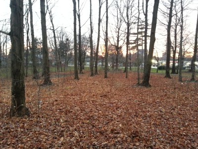
Hidden behind a strip mall at Pharmacy and Sheppard is Wishing Well Woods. Like Brimley Woods and Passmore Forest, this woodlot is what I like to call a colonial remnant or a rural leftover – a patch of 100 to 200 year old forest on a farming parcel which survived redevelopment after WWII. Of course, these remnants never seem to prevail fully in tact, especially in the case of Wishing Well Woods. Compared to Brimley and Passmore Woods, though, this collection of trees isn’t much of a woodlot. That said, green space is green space and losing it would be a loss.

Wishing Well Woods

Wishing Well Woods

The mentioned strip mall at Pharmacy and Sheppard looks like it has development in its future. Hopefully that doesn’t affect Wishing Well Woods.

3105-3133 Sheppard East development 1      3105-3133 Sheppard East development 2

The Pharmacy and Sheppard intersection is no stranger to redevelopment. North of Sheppard is the Bridlewood neighbourhood, which gets its name from the indoor racetrack once located at the northeast corner. It was built for Harry H. Hatch, a distiller with a hand in the Gooderham & Worts empire and a championship horse breeder. The racetrack was torn down in 1958 and the Bridlewood development was subsequently constructed.

Sheppard East & Pharmacy

South of Sheppard, Pharmacy Avenue takes on a narrower, sparser form than north of it. Historically, it ran through the area now occupied by Highway 401, but since the highway’s construction in the early t0 mid-1950s, it dead ends just north and south of the expressway. One supposes with its proximity to Victoria Park, a bridge at Pharmacy wasn’t needed.

Pharmarcy Avenue

Wishing Well Park occupies the foot of Pharmacy. Anyone traveling westbound on the 401 near Victoria Park is at least familiar with Wishing Well and its baseball diamonds.


Wishing Well Park 3
But today’s baseball fields is yesterday’s farmfield, specifically Thomas Mason’s barns. The post-Mason farm development to the north, constructed around 1955, is named Town & Country. Information about Mason himself and the root of this naming is scarce, but if I had to guess, it might be because of the duality of (sub)urban and rural at the time.

Further to the story, Wishing Well Park also once contained the headwaters to Taylor-Massey Creek, a slinking waterway that shows up in Warden Woods Park and the former Massey property in today’s Crescent Town. Today’s headwaters are located south of the highway after the original were buried and diverted to Highland Creek.

Town and Country, 1956
Town and Country, 1956. Source: City of Toronto Archives. Taylor Massey Creek cuts diagonally through Wishing Well Park, then still a farm.

As signs of its one time existence, one can pick out Taylor Massey Creek’s topographical imprint on the park. Moreover, streets like Meadowacres Drive pay tribute to it.

Wishing Well Park Taylor Massey Creek

Up on Victoria Park, Consumers Road and area is home to a large employment district in Toronto and a few company headquarters, including Universal Music and the street’s namesake company, Consumers Enbridge Gas.

Enbridge Consumers Road
Consumers Road
Like Sheppard East, the area is set for redevelopment with the ConsumersNext project. As a huge locale for jobs, Consumers Road Business Park is currently zoned as an employment area, but the environment isn’t very navigable sans an automobile. Among its goals, ConsumersNext will make the Business Park pedestrian- and transit-friendly.

Consumers Next Map
Consumers Next Map. Source: City of Toronto City Planning.

Within the ConsumersNext lands is the recently named Ann O’Reilly Road. The new street contains an interesting bit of local, hidden history. O’Reilly was an innkeeper who, in 1860, along with husband, Patrick O’Sullivan, opened a hotel on the northwest corner of Victoria Park and Sheppard (now Victoria Park Square).

Victoria Park & Sheppard East

The intersection and area became known as O’Sullivan’s Corners after Ann & Patrick’s son, Micheal O’Sullivan, opened a post office in the hotel in 1892. It’s a familiar origin story in Toronto: a post office (and/or hotel, in the case of O’Sullivan’s Corners) opens in an area and becomes a hub for the new community.

The inn/post office was torn down around 1954, and without its existence, O’Sullivan’s Corners seems to have fallen out of use. It’s a part of a long list of bygone neighbourhoods in Toronto. The grander community of Sullivan (sans the “O'”) seems to reference it, however.

O'Sullivan's Corners, 1955.
Metropolitan Map of Toronto, 1955. Source: University of Toronto Map and Data Library. Note the routing of Sheppard Avenue at the top of the map. It once ended at Victoria Park Avenue. A separate street named Lansing Road curled down from Woodbine Avenue and straightened at Victoria Park before continuing into Scarborough. Around 1955, the two streets were merged to make the modern Sheppard Avenue. The ‘orphaned’ section between Woodbine (which became the 404 in 1977) and Victoria Park became Old Sheppard Avenue.

Today, though, there’s another landmark at the intersection: the famed Johnny’s Hamburgers, a fixture since 1967 which seems like it’ll endure whatever comes next for its surroundings.

Johnny's Hamburgers
Useful Links

CBC – Birth of the Suburbs

City of Toronto City Planning – ConsumersNext

City of Toronto City Planning – Sheppard Avenue East Avenue Study

Ian Hadden’s Family Tree – City of Toronto Honours Ann O’Reilly

Inside Toronto – ‘Innkeeper Ann O’Reilly Gets Warm Welcome From Preservation Panel’

Toronto Star – Laura Stone – ‘Street Meet: 10 years post-subway, Sheppard Ave. E. is poised to look like an urban street’