
When does a place stop being a place? On the border of North York and Scarborough, there are two Sheppard Avenues. Old Sheppard Avenue runs east to west from Victoria Park Avenue to just shy of Highway 404. Sheppard Avenue East curves just south of the old street across the border of the two former municipalities.
These two streets — and triangular plot in between — hold quite the history and evolution of two lost junctions: O’Sullivan’s Corners and Muirhead’s Corners. Here is a brief account of their story.

On Old Sheppard Avenue, there is a house unlike the others around it. Now situated in the middle of a modern subdivision, it was the farmhouse of the Alex Muirhead and his family.
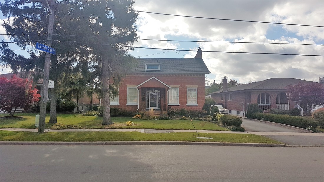
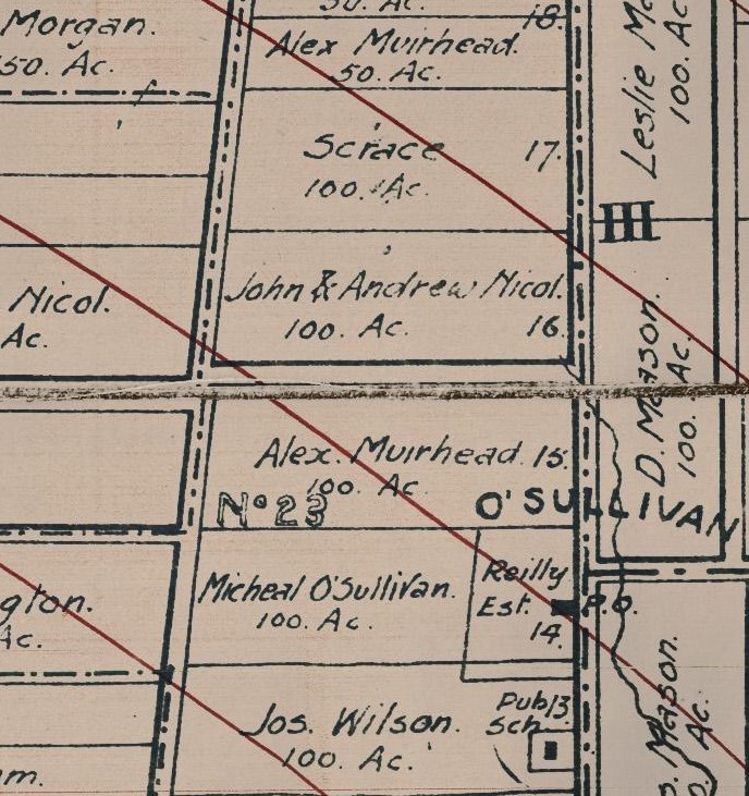
The Muirheads settled the 100-acre plot of land known as Concession IV Lot 15 in York Township in 1853. Alex Muirhead would build his farmhouse in the Ontario Vernacular style in that same year, situating it on the south side of what is now Old Sheppard Avenue. The Muirhead name was prominent in the area — so much so that the odd junction on the northwest corner of the lot was known as Muirhead’s Corners in the early 20th century.

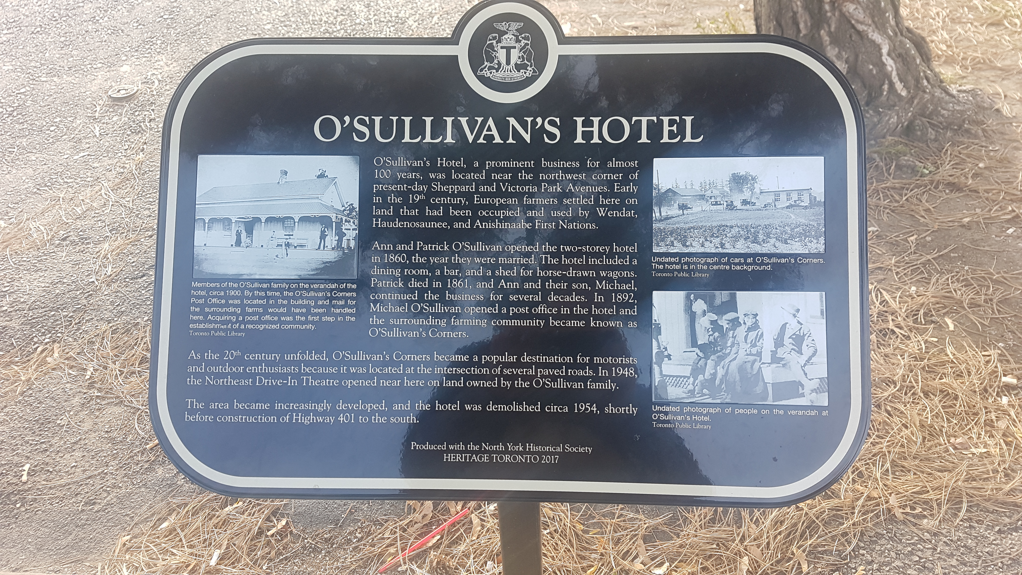
In 1860, Patrick O’Sullivan and Ann O’Reilly opened the O’Sullivan Hotel on the eastern part of Lot 14, directly south of the Muirhead property. The hotel featured ‘two bedrooms, dining room, and a bar’. The structure was situated on the west side of the York-Scarborough line across the Third concession on the Reilly farm.


The area grew from here. In 1873, part of the O’Reilly land was used to house a one-room public school. The school — named School Section #23, later Victoria Park School –roughly served the west side of townline from today’s Lawrence Avenue to Finch Avenue. In 1893, a Post Office opened at the O’Sullivan Hotel, cementing the area as a community with the moniker O’Sullivan’s Corners. The area, sometimes shortened to just O’Sullivan, rose to local landmark status in the early 20th century.

The rise of automobiles and highways in the early 20th century aided in the growth of O’Sullivan. Beginning in the 1910s, significant changes took place along the roadways of northern Scarborough and North York. Motorized vehicles were on the increase and, with them, convenient and leisurely long-distance travel through the suburbs of Toronto. One can imagine couples and families venturing through O’Sullivan’s Corners and stopping for a Sunday lunch.

The main east-west street through these parts was Lansing Sideroad (sometimes named Lansing Cut-Off), which — next to Kingston Road — was the main way from the centre of Toronto to Pickering and Oshawa. Named after the community it originated in, Lansing Sideroad extended east from Yonge Street, passing the community of Oriole at Leslie Street and Muirhead’s Corners at Don Mills Road (later Woodbine Avenue).It stitched together east-west routes connecting the Concession roads of North York: Bayview (2), Leslie (3), and Woodbine (4).

Lansing then jogged south at the townline near O’Sullivan before continuing into the Scarborough through Agincourt and Malvern following the old Third Concession Road. In 1911, Lansing Sideroad was paved to allow better navigation. It is unclear when it was named Lansing Road, but there is an early mention of improvements to the road in 1903.

As the 1920s rolled into the 1930s, more upgrades were made to Lansing Sideroad. The Department of Public Highways of Ontario, created in 1916, sought to include the road in a larger highway network to improve motor vehicle travel. And so, on August 25, 1931, Premier George S. Henry inaugurated a new motorway between Lansing and Malvern on the street.


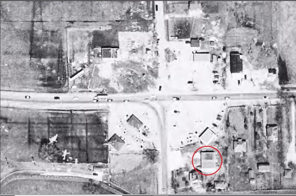
In another huge development, the two sections of the Lansing Sideroad in Scarborough and North York were aligned in 1934. The new curved section of roadway donated and purchased from several landowners in the area and eliminated multiple jogs between O’Sullivan’s Corners at Dawes Road and Muirhead’s Corners at Don Mills Road. Travellers now could travel more seamlessly between townships.


Along with the O’Sullivan Hotel, there were service centres, gas stations, and some shops to serve the local and commuting populations of O’Sullivan and Muirhead’s Corners in the early 20th century. The North-East Drive-In Theatre also opened between the communities on Lansing Road in 1947, further building on the virtues of car travel.

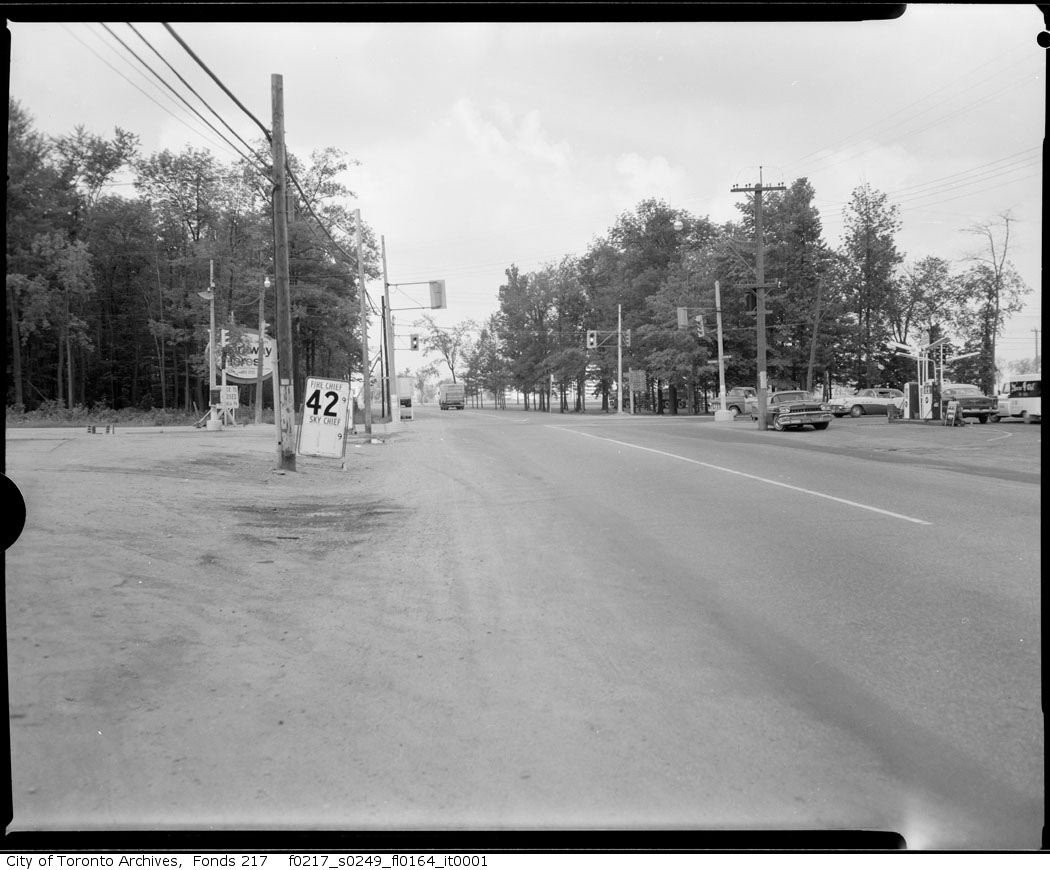

The second half of the 20th century proved to be a transitional period for the area and the beginning of the end many things recognizable at O’Sullivan’s Corners. For a start, the road network was significantly altered — even more than before. Perhaps as a result of the new Metropolitan Toronto’s efforts to harmonize transportation in the city, Dawes Road and Lansing Sideroad both were renamed to Victoria Park Avenue and Sheppard Avenue East in the 1950s.

The four-laned Toronto By-Pass — now Highway 401 — opened as the new east-west alternative to Kingston Road and Lansing Road in and out of the Toronto area in 1957. It included an exit at Victoria Park Avenue.

And in a final update to motorways, Highway 404 replaced Woodbine Avenue north of Highway 401 by 1967. The move spelt the end of Muirhead’s Corners, as the junction was physically eliminated to make way for the highway. It also meant Old Sheppard was now cut off at its west end, now looping into a new Muirhead Road (near a school also named for the pioneer of the street).

It is hard to pinpoint when O’Sullivan’s Corners stopped being O’Sullivan’s Corners, but the 1950s and ’60s is certainly a start. After nearly a century in operation, O’Sullivan’s Hotel was closed in 1954. The reasons? Perhaps interest had faded from patrons and management. Or the costs were too high. Its replacement was a gas station — a use the corner continues today. To its south, SS #23 was also lost in 1964 to accommodate more lanes for Highway 401. (Its belfry and bell was salvaged by Herbert and Rosa Clark and is now on display at the Guild Park in Scarborough along with our salvaged building fragments of the post-war era)

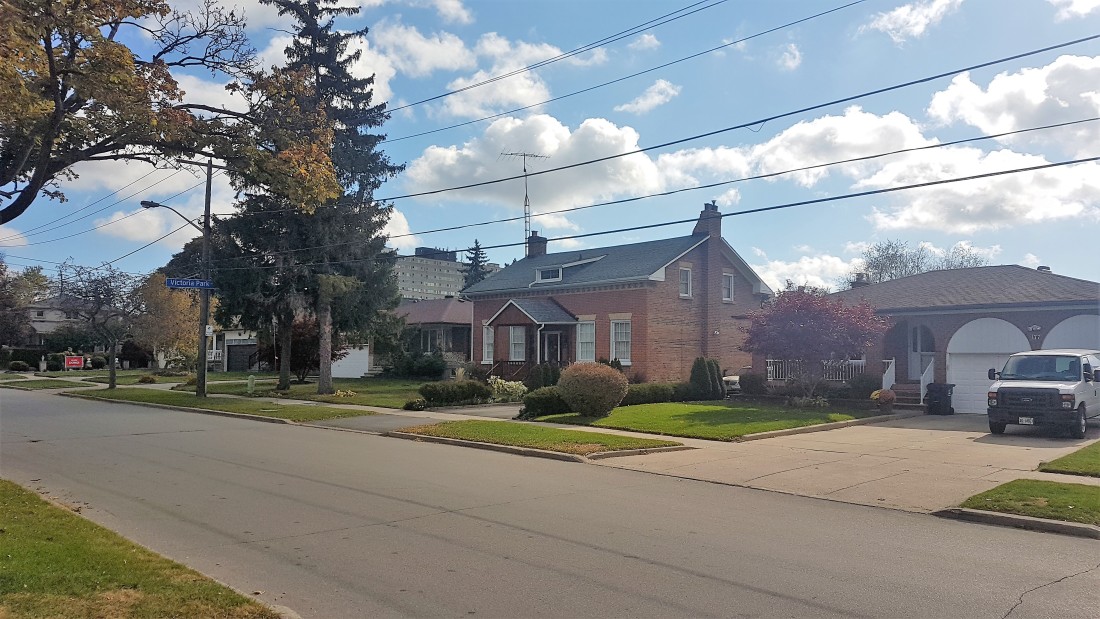
By at least 1950, the Muirhead farm was also divided up to host a new residential community. Brian Drive (originally Sandra Boulevard) and Patrick Boulevard both hosted houses with large lots. The old Muirhead farmhouse also received new neighbours on its street. Curiously though, Old Sheppard is unnamed in maps from the 1950s. (Perhaps the moniker came into existence when it was orphaned by the highway 404.)

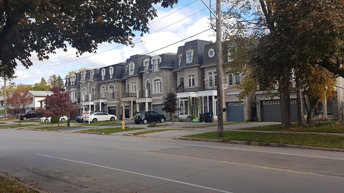
In the early 1970s, brand new houses went in north of Patrick Boulevard and east of Brian Drive, replacing most of the housing stock from twenty years prior. The Muirhead farmhouse was already situated close to the street, so when the new houses went in beside it, it was relatively integrated into its surroundings.
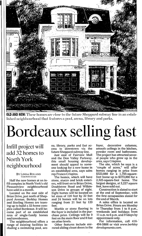
Around the corner on Brian Drive, a line of more modern residences in the middle of the street curiously deviates from neighbouring housing styles. The story: When this area bought up and sold by redevelopers in the 1970s, it seems one property held out on selling. Its deep lot stretched to Wilkinson Drive, leaving the new streets in between incomplete. The holdout looks like it lasted about 30 years until around 2001 when four rows of infill development went in. With that, Doubletree and Wilkinson were finally connected.


On Patrick Boulevard, a house from the same era as the Brian Drive holdout residence remains. It never had to sell, though. This house is noticeable because, although it is neighbours with houses it predates, it is set back considerably from the street with a long driveway.


On the west side of Brian Drive, apartment towers and townhouses went up steadily through the 1970s too. The ‘Crossroads’ buildings, in particular, are appropriately and geographically named.


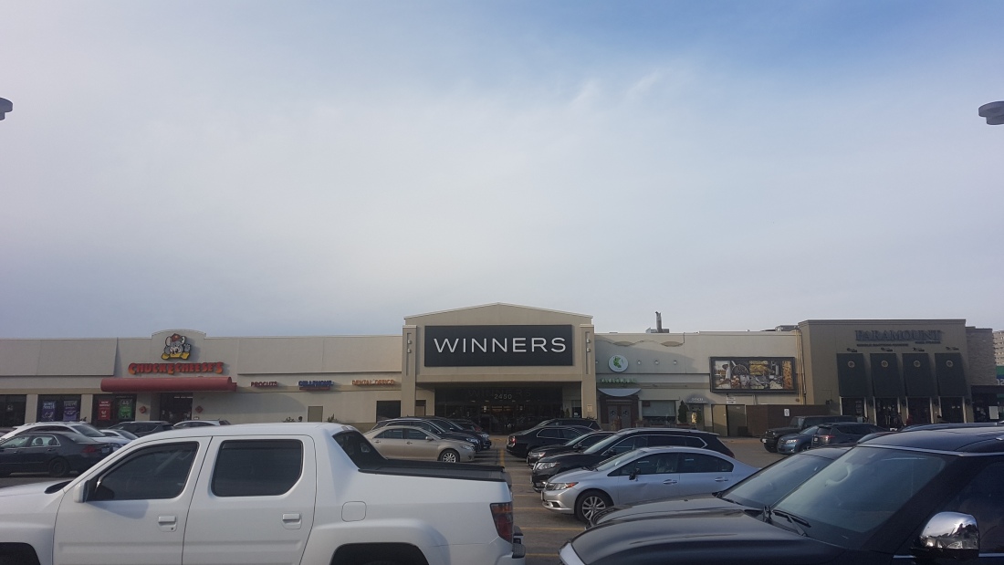
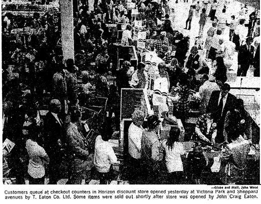
Victoria Park Square is the local mall for the area. It opened in 1972 on the former site of the O’Sullivan Hotel to serve the up-and-coming residences. It was known in those early days for hosting the first Horizon — Eaton’s chain of discount stores. A Heritage Toronto and North York Historical Society plaque today tells the story of O’Sullivan’s Hotel.
In 1988, a second plaza was built at the corner of Brian Drive and Sheppard Avenue. Named ‘The Shoppes of Brian Village’, the plaza resembles a village centre. It was significant enough to warrant an Urban Design award from the city in 1988. The site also gives the area another name: Brian Village (or perhaps vice versa).


Today, this community is part of the modern Pleasantview census tract – a total area which reaches up to Finch Avenue East. It is a mix of mostly English and Mandarin speakers, with some Italian and Greek households.


The name is not in use anymore, but how much of O’Sullivan’s Corners is left? O’Sullivan School certainly lives at the Guild as a physical remnant. More than that, the busy nexus of Victoria Park and Sheppard — where the hotel once stood — may have a clue. Today, the intersection hosts a gas station, a breakfast spot, a pizza place, and a drugstore. Next to that drug store is the famed Johnny’s Hamburgers. The building housing Johnny’s is from about 1956. The burger joint got its start about ten years later by a Greek immigrant.


Although it post-dates the era of the O’Sullivan Hotel, Johnny’s Hamburgers grew out of the car-centric circumstances that brought the area prominence. The simple, table-less interior also plays tribute to North-East Theatre as its one-time neighbour. Even if the place no longer exists, a visit to Johnny’s may a taste of the O’Sullivan community of old.
