The White Shield Plaza hugs the northwest corner of Kennedy Road and Lawrence Avenue. Without any disrespect to the mall (which hosts Flipper’s and other tenants) though, my eye goes to two restaurants just off the strip mall.
On first look, Harry’s Drive-In looks of another era. And that’s because it is. Immediately I think of Johnny’s Hamburgers at Victoria Park and Sheppard. It’s a small shack of a burger joint that slightly compensates for its lack of space inside with a tiny patio outside. Even the name is to the point. No gimmicks. My observation is pretty bang on, too: it’s been here since the 1960s.
Beside Harry’s, there’s Nova Ristorante – a sitdown Pizza Nova restaurant. The first Pizza Nova. Sam Prumicci and his brothers opened the shop here in Scarborough in 1963. One thinks of the pizza chain as a takeout/delivery place, but restaurants have been part of its past and present.
The Hellenic Home for the Aged sits on the southeast corner of the intersection. Before the home however, there was a hydro station here.
Kennedy & Lawrence Hydro Station, 1960. Source: City of Toronto Archives.
Mike Myers Drive, which was (re)named for the Scarborough comedian in 2002, slinks behind the seniors home. I believe a few power stations still remain.
Kennedy Road looking north to Lawrence Avenue, 1960. Source: City of Toronto Archives.Kennedy Lawrence Hydro Station aerial, 1965. Note the spur off the Canadian National Railway. Source: City of Toronto Archives.
The houses on this stretch of Kennedy Road south of Lawrence date from the 1950s.
Down in the hydro field, there is (or was, rather) some planting a’happenin’. This is Givendale Allotment Garden, and its concept is new to me. My sense is it’s an unknown idea in general – “secret gardens”, as I’ve read. It’s certainly a neat use for a hydro fiend – much more advisable than model airplane or kite-flying.
If my understanding is right, one can apply for a permit to use a garden plot in one of 13 designated allotment gardens in the city. Applications are accepted the first day of February and permits are issued the first day of May.
Finally, Jack Goodlad Park is a nicely sized park with basketball courts, a recreation centre, playground, and a couple of baseball fields. Jack Goodlad, its namesake, was a Scarborough alderman.
The Pan Am Path also passes through Jack Goodlad Park in its meandering route through Toronto. It’s one of the legacies of the 2015 Pan Am & Parapan Am Games.
Before it was a park and trail though, Jack Goodlad Park was the Scarboro Drive-In. The theatre opened in 1952 and closed around the late 1970s when drive-in movies in Toronto declined in popularity. It’s fascinating to learn about because it tells us a bit about what Toronto suburbia used to look and be like.
Scarborough Council purchased the Scarboro Drive-In property and redeveloped it into a municipal park beginning in 1980. Goodlad himself had a big hand in the end of the movie theatre, objecting to the seedier movies that were playing in the supposedly family-friendly venue.
Scarboro Drive-In, 1960. Source: City of Toronto Archives.Scarboro Drive-In aerial, 1965. Source: City of Toronto Archives.
Kennedy Road between Finch and Linwood Avenues is, at first glance, an inconsequential stretch of street. 1km of nothing. A bit of digging, however, and there’s a story. There’s always a story.
Beginning at the top, there’s the Hugh Clark House. A rural leftover nestled in behind a gas station. The Clark family once lined the north side of Finch with their farms. The first of the Clarks to plant his roots was Hugh‘s father, William, who settled two lots over at Birchmount Road in 1838. I wrote a little bit about the elder Clark while exploring his property at today’s L’Amoreaux Park.
Crossing the street, one comes to an innocent looking parkette. Today’s park, however, is yesterday’s street jog. Kennedy at one time jogged left at Finch, forcing a northbound traveler to turn left and then right before continuing north. At some point Kennedy was reconfigured to run seamlessly through the intersection. An orphaned section of the old route remained south of Finch, however. The old Kennedy bus used to turn around at the loop when the bus route terminated at Finch. The triangular jog was eliminated for good in 1979, leaving us Kennedy Road Parkette.
Next, Lynnwood Heights on Southlawn Drive has been around since 1956. The school’s TDSB webpage notes an original population of 400, a staggering far cry from the current enrollment of 160 pupils. The surrounding subdivision also dates from around 1956, making it one of the older post-war developments in northern Scarborough. One can imagine as the area continued to grow, more schools opened to relieve Lynnwood.
Huntingwood Drive is an east-west alternative to Sheppard and Finch (at least, between Victoria Park and McCowan), but its existence is a relatively recent thing – around 1967, more specifically. It’s odd in the way it snakes close to Sheppard in some parts and close in Finch in others.
Kennedy Road & Area, 1965. Source: City of Toronto Archives. The future Huntingwood Drive is pencilled in bottom left. Finch jog at top.
Bookending the kilometre stretch is another farmhouse, Elmridge. This was the Pat(t)erson family homestead. Or, at least, one of them. Like the Clarks, the Patersons were a pioneering Scarboro family who toiled the land on the east side of the street between Sheppard and Finch. Robert Bonis writes in A History of Scarboroughthat a Thomas Paterson arrived here in 1820 from Scotland, clearing the land with his son. His descendants continued his work at Elmridge, eventually making the Paterson name synonymous with Agincourt. This excellently researched WikiTree entry breaks down the life of Thomas Archibald Paterson, the great-grandson of the original Thomas Paterson.
Consider this a sequel. Or, maybe a prequel. Whatever the case, if Wishing Well Acres is the Sullivan in Tam O’Shanter-Sullivan, here’s the Tam O’Shanter part.
We begin at Agincourt Mall. The shopping centre dates back to 1966, likely making it the third enclosed mall in Scarborough after 1954’s Eglinton Square and Golden Mile (Cedarbrae Mall predates Agincourt by four years but didn’t get its ceiling until 1972). The mall’s anchors are Wal-Mart and No Frills, but I can recall a time – in 1994, specifically – when they were Woolco and Loblaws, respectively. Walmart bought Woolco that year. No Frills came in the 2000s.
As much as malls like Agincourt are seen as shabby and sad (Agincourt Mall as of 2016 has a number of empty tenants), I’ve found that they are still appreciated locales. A lot of nostalgia fills their walls. The comments in this BlogTO article about Agincourt Mall by Robyn Urback prove that. Everyone has a story, or a store they enjoyed frequently, or an odd memory about something that isn’t there anymore. Mine is the RadioShack that was there in 1990s and 00s, reminding me of lost Canadian retailers. There is a Source in the mall now, but not in the same space as its predecessor.
Agincourt Mall was built on the Kennedy farm, with the farmhouse once located just north of the mall and south of the West Highland Creek. A walk down the street named for the family leads to a trail that lines the creek.
The path is sandwiched between an apartment and townhouse complex on one side and the creek and Tam O’Shanter Golf Club on the other. A look down at the shallow waterway produces a shiny sheet of ice over the surface and the occasional group of ducks in the non-frozen bits. But there’s also something that doesn’t quite belong.
Several pillars jut out on either side of the creek – two on one side and two opposite them. I count three sets of these abutments along the way. Their meaning isn’t hard to figure out: 3 sets of abutments, 3 phantom bridges. There is one question, though: what’s the story?
The answer: In the 1930s to the 1970s, this was the site of the Tam O’Shanter Golf and Country Club, the precursor to Tam O’Shanter Golf Course.
In addition to golf, the Tam O’Shanter Country Club complex had swimming, ice hockey, and curling. In 1971, the club erupted in flames, destroying some of the complex. In researching the fire, I’ve read many stories about people seeing the flames from afar. Like Agincourt Mall, the country club meant something to many people.
In 1973, the Province of Ontario, Metro Toronto, and Scarborough jointly acquired Tam O’Shanter and converted it into a municipal golf course. In the coming years, the complex would be gradually demolished and a new clubhouse would be built around 1980. Today, a couple of apartment towers on Bonis Avenue stand in the club’s former location.
Tam O’Shanter & West Highland Creek, 1967, Source: City of Toronto Archives.
Back to the abandoned abutments, the creek was located just behind the clubhouse and its bridges led to and from the golf course. Shortly after the course’s acquisition, the bridges were removed, presumably because the course layout would be reorganized.
But the creek hasn’t always run the same course.
Tam O’Shanter & West Highland Creek, 1956, Source: City of Toronto Archives.
The West Highland at one time swung north up into the golf course before dropping back down and resuming in a northwest direction. Around 1967, the creek was straightened and bridges were installed. The orphan bend remained as a sort of oxbox for some time, but since has been mostly filled in. One can still see the imprint of the bend today, though, notably through the pond and the ‘etched’ curved outline north of it.
Tam O’Shanter & West Highland Creek, 2015. Source: Toronto Historic Maps.
There is one remaining bridge, however – a wider, sturdier construction. There is a gate in the fence on the other side, so one can guess that at least it might have been a vehicular corridor. As of 2015, though, both ends have been barricaded to prevent any sort of use.
As the West Highland continues into the golf course and beyond, the trail comes to Ron Watson Park, renamed from Tam O’Shanter Park in 2005 in recognition of the long-time Scarborough resident, trustee, and councillor. Watson was honoured with a star on Scarborough’s Walk of Fame in 2011. The park forms the field of Tam O’Shanter School, featuring a nice playground…and a stone turret.
This viney tower became an instant curiosity to me. It looked old and misplaced. No doors (although, perhaps a sealed opening), a couple of ‘windows’ near the top. What was/is it?
I had to do some digging. Google presented nothing, so I consulted some aerial photos to try and date it. It’s been around since at least 1947, the first year on record for aerials in the Toronto Archives.
Charles Watson Farm, 1965. Source: City of Toronto Archives.Ron Watson Park, 2015. Source: Toronto Historic Maps.
So, Horsey sold his farm to Watson, who likely built the silo. When Watson’s farm was subdivided, the tower was never torn down with it. My guess is the task proved too difficult. It doesn’t fully answer the ‘when?’ part, but mystery solved!
Leaving the park and silo, the two-in-one Stephen Leacock Collegiate/John Buchan Senior Public School has had a place on Birchmount Road since 1970. It is built in the Brutalist (or, Heroic) style that was indicative of Toronto architecture in the 1950s to 1970s. The schools’ namesakes were a Canadian author and humourist and Scottish author and historian, respectively.
And while I’m profiling, Tam O’Shanter is a Robbie Burns poem. Another Scottish connection. The Anglo-Saxon roots and references of the Tam O’Shanter community is interesting though, considering what it became. Today, it is one of the more diverse areas in the city of Toronto.
Next, a derelict structure stands across the school. I don’t know its full context, but it’s most definitely another rural leftover.
On Bonis Avenue, there’s Agincourt Library and another great turret. Although the building opened in 1991, the library itself dates back to 1918. Within that time it has moved locales a few times, including a stay in Agincourt Mall. The branh carries three copies of A History of Scaborough. Its editor is a Mr. Robert Bonis, who lends his name to the street.
Down at Birchmount and Sheppard, a strip mall has gone through a makeover in the last few years. It’s about to get a new tenant, too: Starbucks. The sight is initial shock for me, if only because it’s strange to see one in this neighbourhood. My mind shoots to the old idea that a Starbucks is tell tale sign of gentrification, but I question whether it applies here. We’ll have to see.
Foregoing a stroll down Sheppard, I backtrack to Bay Mills Boulevard. The curved street offers a sort of ‘backstage’ view of Tam O’Shanter, showing off the apartments, church, school, field, playground that all front Sheppard. The intersection of Bay Mills and Sheppard is the start of the Sheppard Avenue East Avenue Study zone. On one side there’s another strip mall; on the other, a car dealership. They’ll surely be part of the plans.
Warden Avenue is further down the way, but that adventure lies in the mentioned Wish Well exploration. For now, that’s a wrap on this one.
If you have memories of Agincourt Mall, Tam O’Shanter Country Club, Stephen Leacock School, or Tam-O’Shanter-Sullivan in general, I would like to hear about it. Leave a comment below or tweet me!
The area between Highway 401 and Sheppard Avenue East, Warden and Victoria Park Avenues has got a bit going on. A strip-mall and apartment lined main street, a winding neighbourhood of bungalows to its south — it’s unmistakably suburbia. The rise of its subdivisions following World War II, the effects on the natural and built environment, and its pending evolution make it an area of interest.
First, from its beginnings as the narrow, dirt covered Concession Road III to its wide, strip mall-lined incarnation after WWII, Sheppard is about to get another layer.
Sheppard East is an avenue, but it’s also an Avenue – at least, if you ask Toronto city planners.
Avenues are corridors which have been identified to help accommodate Toronto’s growth. Avenues like Sheppard have to be rezoned to handle more density and this is done through midrise construction. The result are livable, walkable, transit accessible, mixed use communities outside the downtown core. A Sheppard Avenue East Avenue Study sets out the upcoming changes.
As suburban arterials transform to become people-oriented places, cycling, walking and transit become real options. pic.twitter.com/x2rZCBy1PI
The centre of this transformation is the Sheppard and Warden intersection. On one corner, a car dealership sits empty – and has for a while, as far as I can remember – and awaits development. A muralled box by Katherine Laco colours the corner as well.
On another corner, the aptly named Warden-Sheppard Plaza looks like it might be razed as well. I remember this mall for its longtime archor, the Galati Brothers supermarket, now Food Depot Supermarket.
South of the Sheppard to the 401, the residential neighbourhood also sports some layers. It’s a bit of a name game to identify this neighbourhood. Tam O’Shanter-Sullivan (or simply Sullivan) marks the larger area in the Scarborough-Agincourt federal and provincial ridings. Just to narrow it down, though, I’ll elect to use the Wishing Well Acres moniker after one of the subdivisions.
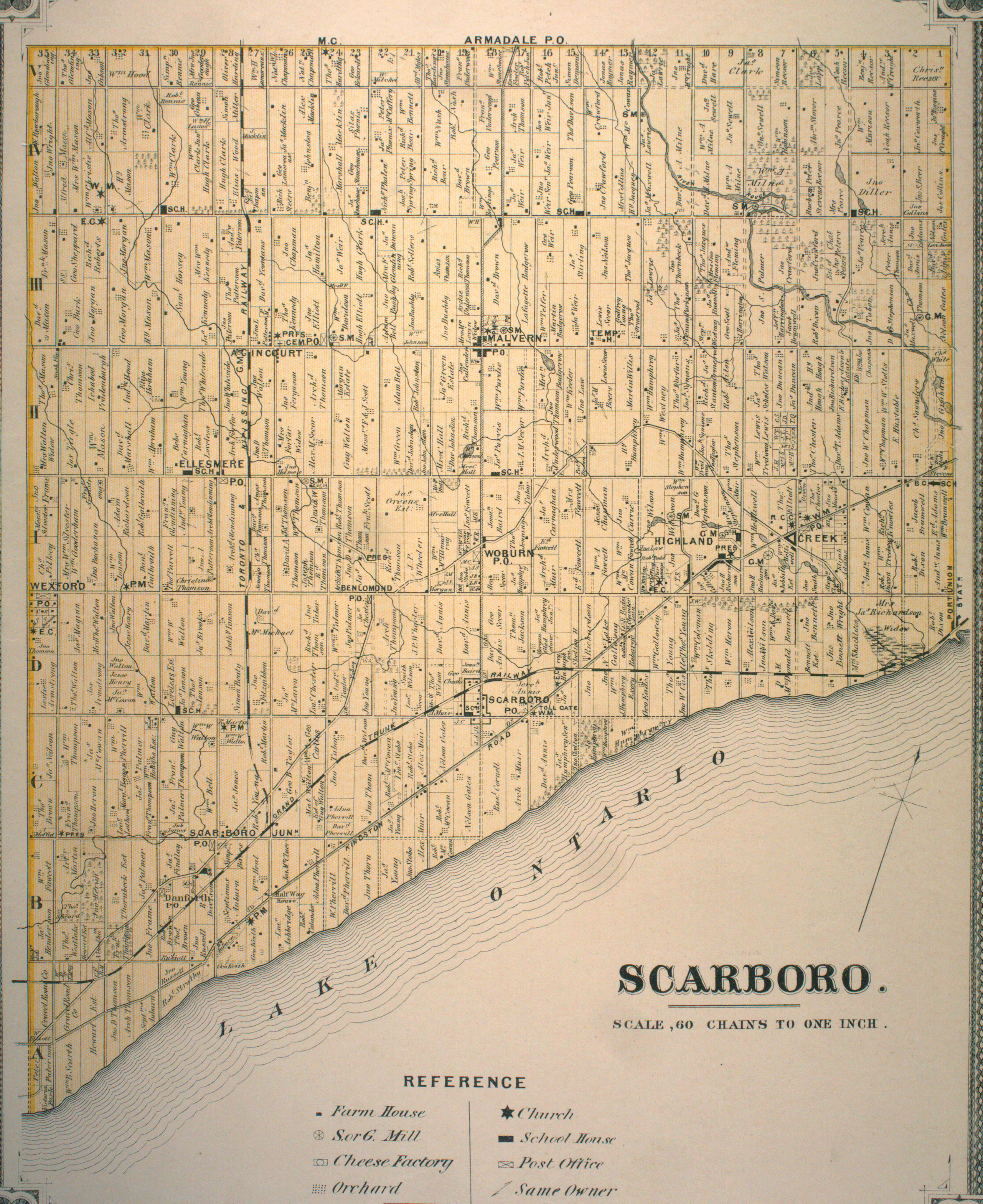
This area between Warden and Victoria Park Avenue historically consisted of three 19th century farms: one by Ichabod Vradenburgh at Concession II Lot 33, another by Christopher Thomson at Lot 34, and finally one by Thomas Mason at Lot 35.
Source: 1878 Illustrated Historical Atlas of the County of York.
Ichabod Vradenburgh was born in 1815, and emigrated from New York some time after. He married Jane Thompson, a Scarborough native, and had six children. The Vradenburgh name is pretty well represented in the new neighbourhood – sort of.
Vradenburgh development, 1965. Source: City of Toronto Archives. The northern half of the plot, consisting of Palmdale Drive (above picture) and Warden-Sheppard Plaza, is constructed by 1975.
Vradenburg Junior Public School was built in 1957, which was approximately year the community starts to take shape. By the looks of its large windows, it follows the Modernist design of John B. Parkin’s 1942 Sunnylea Junior Public School. Vradenberg Drive and Park also bear the family name, although with an inexplicably vowel swap and consonant removal.
Today’s Castleford Drive roughly marks the border between Vradenburgh’s property and Christopher Thomson’s Wishing Well Farm. Thomson was named after his Scottish father, who was one of the first settlers in Scarboro Township and who rose to a respected position locally. Christopher’s mother, Mary, was a native of York, Upper Canada. According to the Scarborough Historical Society, Thomson settled here in 1827 and the name of his farm derived from his hope to plant a well on his land. When he finally hit water, he called it Wishing Well Farm.
Wishing Well Acres, 1956. Source: City of Toronto Archives. North of Sheppard is Harry C. Hatch’s indoor racetrack. On the south side of Sheppard is Wishing Well Woods.I always feel like I’m taking a secret passageway anytime I encounter paths like this.
Wishing Well Acres, the subdivision that rose out of the farm in 1956, is notable for housing Canada’s Millionth Post-War House, a bungalow on Beacham Crescent also built in 1956, needless to say, marked a watershed moment in suburbia.
Hidden behind a strip mall at Pharmacy and Sheppard is Wishing Well Woods. Like Brimley Woods and Passmore Forest, this woodlot is what I like to call a colonial remnant or a rural leftover – a patch of 100 to 200 year old forest on a farming parcel which survived redevelopment after WWII. Of course, these remnants never seem to prevail fully in tact, especially in the case of Wishing Well Woods. Compared to Brimley and Passmore Woods, though, this collection of trees isn’t much of a woodlot. That said, green space is green space and losing it would be a loss.
The mentioned strip mall at Pharmacy and Sheppard looks like it has development in its future. Hopefully that doesn’t affect Wishing Well Woods.
The Pharmacy and Sheppard intersection is no stranger to redevelopment. North of Sheppard is the Bridlewood neighbourhood, which gets its name from the indoor racetrack once located at the northeast corner. It was built for Harry H. Hatch, a distiller with a hand in the Gooderham & Worts empire and a championship horse breeder. The racetrack was torn down in 1958 and the Bridlewood development was subsequently constructed.
South of Sheppard, Pharmacy Avenue takes on a narrower, sparser form than north of it. Historically, it ran through the area now occupied by Highway 401, but since the highway’s construction in the early t0 mid-1950s, it dead ends just north and south of the expressway. One supposes with its proximity to Victoria Park, a bridge at Pharmacy wasn’t needed.
Wishing Well Park occupies the foot of Pharmacy. Anyone traveling westbound on the 401 near Victoria Park is at least familiar with Wishing Well and its baseball diamonds.
But today’s baseball fields is yesterday’s farmfield, specifically Thomas Mason’s barns. The post-Mason farm development to the north, constructed around 1955, is named Town & Country. Information about Mason himself and the root of this naming is scarce, but if I had to guess, it might be because of the duality of (sub)urban and rural at the time.
Further to the story, Wishing Well Park also once contained the headwaters to Taylor-Massey Creek, a slinking waterway that shows up in Warden Woods Park and the former Massey property in today’s Crescent Town. Today’s headwaters are located south of the highway after the original were buried and diverted to Highland Creek.
Town and Country, 1956. Source: City of Toronto Archives. Taylor Massey Creek cuts diagonally through Wishing Well Park, then still a farm.
As signs of its one time existence, one can pick out Taylor Massey Creek’s topographical imprint on the park. Moreover, streets like Meadowacres Drive pay tribute to it.
Up on Victoria Park, Consumers Road and area is home to a large employment district in Toronto and a few company headquarters, including Universal Music and the street’s namesake company, Consumers Enbridge Gas.
Like Sheppard East, the area is set for redevelopment with the ConsumersNext project. As a huge locale for jobs, Consumers Road Business Park is currently zoned as an employment area, but the environment isn’t very navigable sans an automobile. Among its goals, ConsumersNext will make the Business Park pedestrian- and transit-friendly.
Consumers Next Map. Source: City of Toronto City Planning.
Within the ConsumersNext lands is the recently named Ann O’Reilly Road. The new street contains an interesting bit of local, hidden history. O’Reilly was an innkeeper who, in 1860, along with husband, Patrick O’Sullivan, opened a hotel on the northwest corner of Victoria Park and Sheppard (now Victoria Park Square).
The intersection and area became known as O’Sullivan’s Corners after Ann & Patrick’s son, Micheal O’Sullivan, opened a post office in the hotel in 1892. It’s a familiar origin story in Toronto: a post office (and/or hotel, in the case of O’Sullivan’s Corners) opens in an area and becomes a hub for the new community.
The inn/post office was torn down around 1954, and without its existence, O’Sullivan’s Corners seems to have fallen out of use. It’s a part of a long list of bygone neighbourhoods in Toronto. The grander community of Sullivan (sans the “O'”) seems to reference it, however.
Metropolitan Map of Toronto, 1955. Source: University of Toronto Map and Data Library. Note the routing of Sheppard Avenue at the top of the map. It once ended at Victoria Park Avenue. A separate street named Lansing Road curled down from Woodbine Avenue and straightened at Victoria Park before continuing into Scarborough. Around 1955, the two streets were merged to make the modern Sheppard Avenue. The ‘orphaned’ section between Woodbine (which became the 404 in 1977) and Victoria Park became Old Sheppard Avenue.
Today, though, there’s another landmark at the intersection: the famed Johnny’s Hamburgers, a fixture since 1967 which seems like it’ll endure whatever comes next for its surroundings.
As 2015 has come and gone, I think it’s an appropriate exercise to take stock of my year of exploring the city.
My adventures were concentrated once again within the borders of the Old City of Toronto, which was expected, because even in the context of the MegaCity, Toronto Proper still has many stories to discover and relay. A huge highlight was attempting to peel back of the layers of the Fort York area. For an area that has had two hundred years of history and is important in the grand story of Toronto, it’s development into a neighbourhood is only a recent development.
I took a similar approach in meandering through Yorkville, which has been a ‘village’ for more than a hundred years, but has layers of natural, industrial, cultural, and built heritage.
Towards the end of the year, however, I got outside of the downtown core and started to explore areas that were closer to home. This ultimately began with a guided Heritage Toronto tour through Etobicoke’s Sunnylea, but it really took off with a look into Passmore Forest and then shortly followed by Brimley Woods. The existence and evolution of these greenspaces and their environs in the context of Scarborough’s farming past and suburban present is fascinating. In the case of Passmore Forest, there’s even a pre-contact history with the Alexandra Site!
East York’s Crescent Town and North York’s Peanut and environs was a further investigation into suburbia, particularly in the history of tower building in Toronto. Although located in different parts of the city, both their constructions interestingly necessitated the extension of two main roads – Victoria Park Avenue for Crescent Town and Don Mills Road in The Peanut and area.
In regards to where I’ve been, in June I attempted to draw out Toronto from memory. In constructing this mental map, I identified the holes in my concept of the city. More than half a year later, the western reaches of the city still draw blanks. A resolution for 2016, perhaps?
Their stories are very similar: they both border on the Highland Creek (albeit, Passmore Forest on the West Highland and Brimley Woods on the East Highland) and they’re both the forested remnants of rural Scarborough. Oh, and they’re both gorgeous.
Access to the woods comes from a trail off Finch Avenue. This path is part of the North Scarborough Green Loop, which uses streets, ravines, and parks to create a walking, biking, and running corridor in Agincourt & L’Amoreaux.
As expected, a look down at the East Highland produces a waterway that’s seen the effects of human interference. But what catches my eye more is the massive and thick orange canopy across the way.
The bending path continues on towards the Finch Hydro Corridor, but a bridge over the creek leads the way to the woods.
The first thing I encounter in Brimley Woods is what I initially think is a jungle gym. It’s actually the first activity station in the Vita Course – a fitness ‘gauntlet’, as I think of it. My first thought was that it was installed by one of the local schools, but I suspect that it’s something separate.
The second thing I encounter: a leftover from Halloween.
With the tall tree tops above and the leaves blanketing the ground below, I get to exploring the park’s meandering paths. At 8.1 hectares, it’s big, sure, but not too big. It’s very easy to orientate oneself and very hard to get lost.
The woods were part of the farm of Marshall Macklin, an Irish pioneer who came to Upper Canada in 1828 and settled here in Scarborough. The trees themselves are 100 to 200 years old.
Lot 24 (and 23) Concession IV, 1878 Illustrated Historical Atlas of the County of York. Brimley Woods is shown as a wooded area in the southernmost part of the lot.
The Macklin name lives on today in Macklin Public School and Macklingate Court, which houses the 1851 Macklin family homestead, Forest Home.
Brimley Woods aerial, 1965. Forest Home is in the top left corner. Source: City of Toronto Archives.
Brimley Woods is considerably larger than Passmore Forest, and according to the Toronto & Region Conservation Authority, this is an advantage because allows for interior habitat for animals. Unfortunately, I don’t spot any on this day. There are people, though!
At one point I encounter a exit/entry point off Brimley Avenue, but instead opt to keep exploring. The entire time the same recurring thought keeps circulating in my head: “This place actually exists! In Scarborough! Why haven’t I heard of or been here before?”
When I do exit, it’s at the southeastern corner of the park. I follow the ravine back down to the Finch Avenue, passing some hillside planting.
Where the creek runs under the street, a marker dates the piece of infrastructure. 1972. Sounds about right. The beginning of the suburbia in Scarborough.
By 1975, the Macklin farm would be completely subdivided and transformed by development. Forest Home would be integrated into its new surroundings, taking its spot at end of a cul de sac. At least we still have it and Brimley Woods. Or, as I should say, Macklin’s Bush.
North Scarborough’s L’Amoreaux Park has everything one would want in a park. It’s big, it has trails, it has sports, it has nature, and it even has a kid’s water park. But what makes it so interesting is its hidden connections to the past.
A focal point is naturally L’Amoreaux Pond in the northern edge of the park. Its trail and its waters are often populated by Canada Geese and today is no exception.
The pond makes up the headwaters of the West Highland Creek – or, at least, the Bendale branch of it. But it seems like it wasn’t always here. Like a lot of waterways in Toronto, the creek has been altered, and, in this case, an entire new body of water has been added.
L’Amoreaux Park aerial, 2015.L’Amoreaux Park aerial, 1965. Source: City of Toronto Archives.
Also found on the path around L’Amoreaux Pond: a couple of Heritage Toronto plaques commemorating the Alexandra Site – a 14th-century Huron-Wendat village that was excavated just north of here in 2001.
The evidence of Aboriginal villages within the City of Toronto are few and far between. Many of them are destroyed before we ever learn about them. Thus, to know that there was a village here – and one tells us so much about lifestyle of these people – is very neat.
But in addition to the great information the plaques tell us about this Huron-Wendat settlement, it’s remarkable that up until 15 years ago, the Alexandra Site was still a farmer’s field! It speaks to the fact that even though Scarborough has changed a lot since World War II, pockets of its rural beginnings have still endured in recent years. Northeast Scarborough near the Markham line in particular still looks like the country in some parts. (And indeed, it is home to the Reesor farm – the last of its kind in the borough).
Lot 30 Concession IV, 1878 Illustrated Historical Atlas of the County of York. The site of L’Amoreaux Park was once owned and farmed by the Clarks. William Clark first settled here in 1838. Clarks Corners, the neighbourhood in the Finch Ave. & Birchmount Ave. area, is named for the family.
Rounding around the pond, one comes to Passmore Forest, a neat woodlot of looping paths and lots of great foliage. The survival of such a wooded area is remarkable if only because the legacy of colonialism is, well, a very destructive and disruptive one. Lands get cleared and farmed, invasive species are introduced, species disappear etc.
But looking at a map of the area even 50 years ago (see above), one can see the forest even existed in 1965.
Its naming is significant to Scarborough’s roots too, because F.F. Passmore surveyed the township in 1882. Passmore Avenue is named for him. Today, it exists as an inconsequential industrial road, but at one time ran the span of northern Scarborough (and was directly north of these woods before being obliterated for development). My theory is that Passmore became expendable as an east-west corridor because it was so close to Steeles Avenue. McNiccol Avenue further south eventually replaced it.
As the Toronto & Region Conservation Authority – the governing agency for the Highland Creek Watershed – tells us, the existence of this woodlot is a mixed thing. On the one hand, Passmore Forest is in good shape and does accommodate some flora and fauna. On the other hand, such isolated pockets of tree cover and the effects of urbanization and human use does not allow for greater species diversity.
Out of the forest and down the other side of the pond, I find myself under McNiccol with the expectedly shallow West Highland flowing next to me.
From there, L’Amoreaux Park opens up and two loafs rise high above the park. I follow the unofficial path up one and survey the scene. There are courts and fields here for tennis, baseball, soccer, cricket, and a dog park too. (Although, I best know the grounds for the Kidstown Water Park, a childhood hangout.)
From here the tree lined trail meanders around and over the creek, offering looks at the channelized waterway before concluding at Birchmount and Silver Springs. Throughout the pleasant walk is a mental reminder that it didn’t always look like this.
Down at Finch and Birchmount, there’s a final hidden reminder of a time long ago. The northeast corner was home to L’Amoreaux Public School (S.S. #1) from 1817-48, possibly rebuilt and replaced in the 20th century. Alexander Muir of Maple Leaf Forever fame taught at the log school. Although his name is perhaps more synonymous with Leslieville, Alexmuir School and Park carry his legacy in Scarborough.
L’Amoreaux School circa 1840, 1909. Source: Toronto Public Library.
According to the Scarborough Archives, S.S. #1 was demolished in the 1970s (around 1974, more specifically) as the Birchmount Road was realigned to eliminate the job across Finch Avenue.
Finch & Birchmount, 1973. Source: City of Toronto Archives.Finch & Birchmount, 1975. Source: City of Toronto Archives.
Near the heart of Scarborough, in a neighbourhood known as Midland Park, one can find Birkdale Ravine.
The entrance to Birkdale Ravine is marked with the expected Parks signage as well as one funded by Livegreen Toronto, but as I get into the park, there’s a wooden post also lovingly welcoming me. But sadly, it isn’t marking the start of the trail or personally wishing me well on my hike. No, the Birkdale Ravine must’ve held a race here some time.
Running through the ravine is the West Highland Creek. The Highland Creek as a whole snakes diagonally from its mouth in Port Union to L’Amoreaux. Its watershed and ecosystem encompasses the majority of Scarborough (the Rouge River making up a small portion).
The first thing I notice out the creek is that it’s depleted and not very fast flowing, but above all, it’s naturalized. The portions of the Highland I’m used to – the parts north and west of here – have all been channelized with the creek flowing on a bed of concrete.
The trail itself is serene and tranquil with the changing colours offering great scenery. It’s also well used as recreational space with a number of power walkers crossing my path.
Over by the stream, there’s some activity too. On one side of a bridge (the first of two here), there’s a pair of individuals wading in its waters. On the other side, a flock of Canada geese take their rest.
A great thing about Birkdale ravine is its physical connections to the surrounding community. There are five access points to the park (and the two main ones at Ellesmere and Brimley). Some neighbourhoods are defined by their parks (Trinity Bellwoods, Withrow Park), and, it’s amazing for the people of Midland Park to have this gem literally in their backyards.
But with everything gorgeous and amazing, I have to have a little chuckle at the shabby signage by the second bridge of the trail. Replacements, maybe?
The path ends at Brimley Road, where there’s a marker from the Scarborough Historical Society. The north bank of the ravine, where I just came from, was the site of a Wendat village excavated in 1956. The plaque also mentions a burial ground in a park east of here. There’s a great Historicist piece on that.
With that, it’s the end of my trek. Highland Creek continues south through Thomson Park, but that’s for another day. I make a plan to explore this waterway little by little.
Warden Woods is undoubtedly a gem. It’s a gem as a piece of natural heritage in Toronto, and it’s a gem along Taylor-Massey Creek. I’m here as a part of a Heritage Toronto tour, led by Andrew McCammon of the Taylor-Massey Project, a volunteer effort dedicated to preserving the Taylor-Massey watershed.
We gather at the corner of the Warden and St. Clair Avenues opposite Warden Subway Station and descend into the park.
A bit of background on the Taylor-Massey: it feeds into the River Don, flowing from the Forks and concluding at Terraview Park near Victoria Park & the 401 in Scarborough. Its real headwaters, though, are actually buried under the highway and just north of it. Also, like its name suggests, it consists of two branches named for prominent Toronto families.
The first thing that strikes me about the creek is how naturalized it looks. There’s actual flow to it! Whereas other creeks in the city (including parts of the Taylor-Massey) have been channelized and filled with concrete beds, there’s nothing of the sort with this ‘reach’ of the ravine.
We get our first look at the creek and see also a far off cliff – a mini-Scarborough Bluff, as I like to think of it. Both are glacial remnants of the last ice age.
As Andrew explains, the TMP is trying to make the watershed into a functioning, vibrant ecosystem. That has meant no washrooms in the park (although I don’t see why any would be needed) and no night lights. Curiously, there’s only one bench in the whole park, too. Warden Woods is home to many bird sanctuaries and serves as a stop over for migratory species.
But it doesn’t mean the creek isn’t without its challenges. That same great view shows that its banks have been fortified with armor-stone bricks to prevent erosion. Other parts lack the armor-stone, though.
The trail itself begins as a gravel path. Unlike other parks of its size and larger, it doesn’t branch off. To the right is the creek, to the left is thick forest. It is a serene stroll – if you don’t mind the rattle of nearby subway cars.
Warden Woods Park also faces issues of storm water and sewage water draining into the creek. Andrew brings us to a bridge over a tiny tributary and has us note the smell. Pungent stuff it is.
The problem with coordinating a plan of ‘attack’ to tackle these issues is that there are a couple of bodies – Toronto Parks, Toronto & Region Conservation Authority, as examples – that have some jurisdiction over Warden Woods and similar areas. Sadly, they don’t talk to each other as much as they should. With the City’s Ravine Strategy, perhaps a concentrated effort will be in place.
The other issue within Warden Woods – and in most natural settings in Toronto – is invasive species. Particular to both is the prevalence of garlic mustard, which impedes the ability for any other plant to grow in its vicinity.
We come to a large bridge, which Andrew says at one time had a plaque dedicated to the Thompson Brothers. Across it is a path that once led to a mini BMX course and today is a great spot for bird watching. Serendipitously, at that very moment a hawk (red tailed, maybe?) flies high above us.
Further past the bridge, the now paved path curves and meanders at about the spot where the shores of ancient Lake Iroquois once stood.
At the end of the trail, Warden Woods Trail curiously becomes a parking lot, which is unfortunate because if one where passing through on Pharmacy, he/she would have no clue that a great natural escape exists down the way.
It’s fun to think about what was happening in different parts of the city at the same time. You have communities with no formal connections to each other growing alongside each other. Communities that eventually form the modern City of Toronto.
Wikipedia’s page on the History of Toronto has articles on History of Neighbourhoods, Historic places, Oldest buildings and structures, and Timeline of Toronto History. It would interesting to combine these into a giant timeline of events in Toronto’s history. More than that, because this relies on displaying information tied to places, I’d like to see the information displayed on a map (because really, who doesn’t like looking at maps?). I imagine being able to look at map of a given year and clicking on different nodes placed on that map. Then, being able to explore the map from the following year.
I imagine being able to draw observations about how the city developed, what was settled when, what areas were industrializing/de-industrializing, when and how natural landforms were shaped (think the burial of creeks) etc..
In all, it would be another way to capture the story of Toronto. Just an idea.
Edmund Wyly Grier’s “A View of York (Toronto) Upper Canada, 1820” Credit: Toronto Public Library


