Note: Adventures as of last fall-ish. Here’s hoping we get some greenery soon!
My first impression of Graffiti Alley? It’s just as much in a hidden corridor and loading zone as it is a gallery. I enter from Augusta, although the path begins at Spadina in the east. The mighty needle rises above some cartoon caricatures dancing around some windows.
Nearby, there’s some more sophisticated aquatic renderings. The creative output in both drawings are impressive. It’s a grand exercise in place making, isn’t it? Here you have previously dead, in-between ‘spaces’ turning into destinations themselves through the creative efforts of some talented individuals.
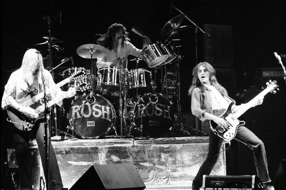
As a past adventure taught me, names hold meaning, and assigning a name to a space goes a long way into place making. Graffiti Alley is formally recognized as Rush Lane, and doesn’t refer to the trio from Willowdale, but a local who once owned many shops along Queen Street. Making meaning through commemoration. With that knowledge, I come out at Portland and head up to the street.
The Outer Layer hugs the corner of Queen and Portland. The rather unfortunately faded plaque can’t tell me this, but this was built as a Bank of Montreal branch in 1899. It was designed by Frederick Herbert, who, in my opinion, is the second most iconic architect of old Toronto (E.J. Lennox being the first.) Through observation throughout the city, it doesn’t seem too often that an old bank deviates from its original purpose. Of course, it does happen – the most formidable of Banks of Montreal is now the Hockey Hall of Fame.
I do slip inside the shop for a moment. I’m on a mission for some quirky Toronto-themed postcards to send overseas. I don’t find any here, but I do come away with a Lou Reed card and a TTC subway magnet I pick up at the register.
Across the way is the formidable looking Epicure Cafe building. I’ve eaten there a few times…very affordable prices for great food. Even further down (not pictured) is Tequila Bookwork, another great local eatery and drinkery.
I follow the way past Bathurst, where a backpacker greets me on the other side of the crossing. I’m not sure what kind of works he’s packing.
Outside the Dog’s Bullocks (possibly the greatest name for a bar), a group begins a chant that I don’t get but they find wildly amusing. A few doors down is Valhalla Cards, which houses a grand collection of postcards. Among my purchases are a 1910 look up Bay Street and a Captain Canuck cover from 1975.
Next, I take a swing onto Niagara Street, and another alley quickly greets me. Unlike Rush Lane, this one is unnamed – but this is expected. Of the 3000+ alleys in Toronto, only 200 are actually places. One such exists north of Gerrard between Coxwell and Greenwood.
Here I encounter a cyclist and the CN Tower again – albeit anthropomorphized. I love TO too, little needle.
I also get some two-word advice.
For an existential thought, I mentally tag on ‘Yourself’ to this one.
Back on Niagara, another sweet mural presents itself.
Whenever I used to see Niagara Street on a map, I’d always wondered why it curved. All the streets around it follow a grid; what is Niagara’s deal? Did the town planners have a fun day at the office that day?
Only recently did I come to the realization that’s all geography. The now buried Garrison Greek ran roughly parallel to the street. In fact the western side of Niagara used to have breweries and lumber yards, which lined the banks of the creek.
Boulton Atlas, 1858 – Niagara Street and area
Down the way I find Niagara Street Junior Public School, which celebrates its centennial this year. It’s actually the second incarnation of the school, the first built in 1874 and later demolished to make way for the new building.
Maybe it’s my suburban upbringing, but the yard is curiously small for a schoolyard to me. The grass is not actually grass either.
Further down past King Street I find the another institution, the Fu Sien Tong Buddhist Temple. It looks odd to me – not the building itself, because that’s beautiful and an unexpected discovery – but the way it’s set back from the street and not parallel to it.
Where Niagara meets Tecumseth is some more industrial history in the former National Casket Co. buildings. It’s a complex of three structures built between 1884 & 1887. The most easterly is the oldest. You can guess that they’re about to undergo development.
That’s not the extent of the industrial character of the street. At the very foot of Tecumseth is the Toronto Abattoir. Or was, anyway. This year marks the end of a 100+ year history of animal processing in the area. To think: an animal slaughterhouse and a coffin factory steps from each other…kind of dark, no?
Goads Map, 1924 – Toronto Abattoir & National Casket Co.
I can’t tell for sure, but I think there’s a remnant of the radial spur below me. I could be wrong.
Beyond the railway lands below is Fort York National Historic Site, although I can’t see it right now. With that, I turn back up the street, spotting the last bit of street art of the day.
The walk up Tecumseth is rather uneventful – not much happening other than the 1897 Ukrainian Baptist Church near Queen. I snap a picture and then continue on to catch a streetcar.
Before I can start my stroll, I note the taste for coffee developing in my buds. I opt not for Starbucks and not for Timmies, which hang beside each other in competition, but for the Toronto Reference Library. Yes, it may be closed on this Easter Monday, but Balzac’s isn’t. The customer in front of me in line tries to pronounce the name of the brew she’s ordering; the barista has to correct her. Me, I don’t bother with the given name of my amber roast; I grab it and am on my way. Now I can start.
Yorkville is about as quintessential a Toronto neighbourhood as you can get. It also has a deeply layered past and an ever evolving future, some of which I am already aware of and eager to see the evidence of. While its borders have expanded and contracted over its long history, it’s my thought that the part east of Yonge doesn’t get a lot of consideration.
And so, that’s what I intend to do to start things off.
I don’t get very far on Asquith before I see my first discovery. Although I’m hugging (not literally) the Bell building on the opposite side of the street, my eyes spot a pathway beyond the library across the way. The street sign reads ‘Sherlock Holmes Walk’. Literary giants next to one another! Having read Mr. Conan Doyle’s biography years ago, I imagine he would approve of the tribute – he loved Toronto and Canada (and hated the States).
At the end of the way is Church Street, whose curvy route between Bloor and Yonge Streets is the result of a project to relieve traffic congestion in the 1920s. Even without this knowledge, the odd meeting of Church, Collier, and Park streets and the island it forms in the middle just looks unnatural. I look towards Davenport, spotting the famed Masonic Temple, 1917, but opt to head in the opposite direction.
Yorkville, east of Yonge Street. Source: Goads Atlas, 1884.
My next stop, situated beside a singular Victorian house (no doubt once part of a row), is Asquith Green, which sadly is more muggy brown than green. Still though, I remind myself of the parkette’s potential in the summer and give it points for the animal cutouts and accenting structure in the middle. I don’t know the source of what I think is a quote, but subsequent Googling has produced ‘We Rise Again’, an Eastern Canadian music classic. Here’s a moving version with the great Maritme songstresses, Anne Murray and the late Rita MacNeil.
Following Park Road up, I come to Rosedale Valley Road. This quiet throughway marks the border between Yorkville and its upscale residential sister, Rosedale.
It is also built on top of the now completely buried Castle Frank Brook. It is particularly important in shaping the modern geography of Yorkville, but also to its history – particularly in its brewing and brick making past. Located southwest of me near Sherbourne Street, for example, was Joseph Bloore’s brewery. Bloor Street, of course, is his namesake. (Mr. Bloore also holds the distinction of having the freakiest portrait of any figure in Toronto’s history.) Parkland marks the intersection, and trudge through it to arrive at Severn Street.
Joseph Bloor Brewery, 1865. Source: Toronto Public Library.
The tiny dead end street is anything but inconsequential. For one, it’s named after John Severn, another 19th century brewer. His establishment stood at Yonge and Church. Moreover, Castle Frank Brook’s alternate name is Severn/Brewery Creek.
Severn’s Brewery, 1870s. Source: Toronto Public Library.Severn’s Brewery, 1912. Source: Toronto Public Library.
Perhaps even more notable to the street is that one can find the Studio Building. On the way here, I passed through Lawren Harris Park; Mr. Harris lived and worked in the Studio Building, 1914, along with other members of the Group of Seven.
The Studio Building holds double distinction as a National Historic Site and a Toronto heritage property. The Toronto Historical Board plaque in particular informs me that the Harris in Lawren Harris is of the Massey-Harris industrial empire. Learn something everyday. The Studio Building was designed to be a secluded quiet spot where artists can work their creative process. As I move around the building I hear the periodic screeching of the Yonge subway and somehow I think that doesn’t completely hold true today (although the surrounding parkland does help a bit).
I continue on my way, this time following Aylmer up. I stop for a moment to watch the trains roll in and out of Rosedale Station and then cross Yonge. The street becomes Belmont and I’m liking the streetscape on either side of me. Other than admiring the charm, however, I do have another purpose for being here.
Belmont House is a retirement home and long term care centre built in the 60s. More interesting to its story is that it is built on the site of an Aged Men’s Home, Aged Women’s Home, and Magdalen Asylum & Industrial House of Refuge.
The latter establishment is most fascinating. On first glance at the name, it doesn’t sound like a particularly good place – asylums generally don’t provoke the best connotations and the Biblical character it’s named for isn’t always portrayed in the best light either. The ever trustworthy Wikipedia tells that Magdalen Asylums are not just a Toronto thing. Its history, however, promotes it as a place of care for homeless women and I suppose I will take it as such.
This detour completed, I circle back to Yonge Street and walk north. I turn onto Ramsden Park, the former site of 19th century brickyards. Castle Frank Brook ran through here too, the riverbed making for rich clay deposits. The park’s uneven, dug-in landscape is the only remnant of its industrial past. (And here I’ll shamelessly plug my Industrial Heritage Map). There’s also a few stubborn remnants of winter in a file snow piles that refuse to acknowledge the existence of spring.
Yorkville Brickyards. Source: Goad’s Atlas, 1884.Yorkville Brickyards, 1880s. Source: Toronto Public Library.
Pears Street, which runs adjacent, is named for one of the brick makers. A cat lounges on the sidewalk and soaks up the sun. He has the right idea. I eventually hit Avenue Road. Across the way is 174 Avenue, otherwise known as the Village Corner in the 1960s Yorkville folk scene. The Village Corner gave the first break to Ian & Silvia and a young Gordon Lightfoot in 1962. For more on Gordon Lightfoot’s Toronto, look here please.
With a skip down the street and a turn onto Hazelton Avenue, I’m onto more familiar settings when it comes to the neighbourhood of Yorkville. Hazelton is considered part of the heart of the Village and is pretty much an architecture lover’s dream. Bay and Gable, Gothic, Worker’s Cottage…it’s hard not to dream while being here. Alas, I stop myself from getting too ‘in the clouds’.
The southern end of the street has a more commercial character. It features Heliconian Hall, the second National Historic Site of the day (and, like the Studio Building, also holds dual heritage recognition). The Hall is the counterpart to a place like the Arts & Letters Club on Elm Street in that it was originally a professional association for women when they were excluded from Arts & Letter Clubs. Today it is an event space.
Across the way are a line of boutiques and neat little street art. I lament at the sight of one characters wearing a Leaf jerseys. Somehow the ‘maybe next year’ saying isn’t appropriate. They are also the lead in to Hazelton Lanes, the premiere mall of the Village.
Yorkville Avenue marks the end of the street. At the corner is the Hazelton Hotel, which represents everything Yorkville is today – fashionable, luxurious, and expensive. The Hotel replaced a series of rowhouses after the heyday of the bohemian village, one of which housed the Riverboat Coffee House. This was the most famous of all coffee houses and another venue Mr. Lightfoot got his ‘chops.’
I follow the street east, passing the first Mount Sinai Hospital (1922) and the Sheriff’s House (1837) on either side of the street. I peek down Bellair and inwardly judge the patio-ers. I know it’s a sunny day and there’s a certain desperation for more welcoming climates, but it is still very chilly and not quite patio weather. Moving on, the wideness of Bay Street to me breaks apart the neat, quiet street vibe. It’s no wonder that, like Church Street, it didn’t always run through Yorkville. Bay was extended north to Davenport in 1922.
In any case, I cross it and pass the shiny and blue Four Seasons Hotel (which might be my favourite tall towers in the city) and its adjoining parkette. Beside is Fire Hall #10, 1890, which displays the Yorkville Coat of Arms. The emblem was once located a stone’s throw away at the now lost Yorkville Town Hall on Yonge Street. Decked on the coat of arms are symbols of early industrialists that built the Village, including our friend Severn the brewer.
Beside the fire station is Yorkville Library, 1907. This Beaux-Arts gem is one of the famed Carnegie Libraries. Adjoined to it is Town Hall Square Park, which, and I know parks come in different forms and sizes, but isn’t too park-ish too me. Maybe users of the park, like the woman promenading around with her dog, disagree.
I leave the area and head down a laneway to Cumberland. Cumberland Terrace is to my left. It’s a bit of an oddity within its surroundings. It might have fit in well in 1970s when Yorkville was beginning its gentrification, but now it’s a bit of a tacky sour thumb.
Village of Yorkville Park (doesn’t really roll off the tongue, does it?) is a bit of an oddball park too. It’s meant to represent the diversity of Canadian landscapes from coast to coast. I wouldn’t have known this if I had not read it. The highlight for most people is the giant rock which represents the Canadian Shield (and actually the hunk of rock really did come from the Canadian Shield!). I take a seat on some nearby rest points, and, as the subway rumbles under me, I recognize that park does it’s job. It’s well used and a meeting point for people. It’s excellent for people watching, for example the people lining the other side of the street and sitting in the patio of Hemingway’s (more internal judgement).
Down Bellair I go and I’m at Bloor Street. Needing to cross the street, I head towards Bay. The Manulife Centre, 1974, presides over the intersection and its ill-fated scramble crossing. From mynew location, I get a good view of the ‘Mink Mile’ that is Bloor. A noted spotting is the Pottery Barn, whose facade alludes to its prior incarnation as the University Theatre.
I take a little detour down St. Thomas and catch a look at the sophisticated Windsor Arms Hotel, 1927. It actually reminds me of a fortress. This area wasn’t part of the original Village of Yorkville, but as mentioned earlier, borders have expanded and contracted, and somehow the area south of Bloor is lumped into Yorkville. The Windsor Arms fits in well with the swankiness of the neighbourhood anyways. As I’m admiring and snapping pictures, a UPS driver buzzes the door of the adjacent University Apartment. He doesn’t find who he’s looking for.
I have to let out an internal weep at what I see at the construction site on the opposing corner. There are Victorian facades fronting an empty pit, and I realize we’re about to get a facadist (ie, cop out) approach to preserving the heritage elements to whatever development is on the way. Shame.
Back on Bloor, I make a mental cue for Pink Floyd because I’m off to Yonge to end things where they began. It’s actually a sad note, because, like the site of Sultan and St. Thomas Streets, I note with a frown at the ‘progress’ on the Stollery’s site and how poorly the demolition unfolded. Across the way, One Bloor inches closer to completion.
It’s fun to think about what was happening in different parts of the city at the same time. You have communities with no formal connections to each other growing alongside each other. Communities that eventually form the modern City of Toronto.
Wikipedia’s page on the History of Toronto has articles on History of Neighbourhoods, Historic places, Oldest buildings and structures, and Timeline of Toronto History. It would interesting to combine these into a giant timeline of events in Toronto’s history. More than that, because this relies on displaying information tied to places, I’d like to see the information displayed on a map (because really, who doesn’t like looking at maps?). I imagine being able to look at map of a given year and clicking on different nodes placed on that map. Then, being able to explore the map from the following year.
I imagine being able to draw observations about how the city developed, what was settled when, what areas were industrializing/de-industrializing, when and how natural landforms were shaped (think the burial of creeks) etc..
In all, it would be another way to capture the story of Toronto. Just an idea.
Edmund Wyly Grier’s “A View of York (Toronto) Upper Canada, 1820” Credit: Toronto Public Library
I begin at St. Lawrence Hall, the famed 1850s building that impressively mans the corner of King and Jarvis. It’s become a habit to stop and look up at things I pass, including the archways above doors. Much of the story, allure, and yes, even seduction lies in them. As a civic building, it appropriate contains Toronto’s former coat of arms, which deciphered alludes to the city’s colonial and aboriginal foundations. Above that is the stern visage of an Olympian-like caricature. Glory, mystique, and fear. That’s how I feel.
Shallow puddles provide distorted reflections of the towers above. It’s a drizzly one in Toronto, but that’s OK. Hopefully the falling rain will help eliminate the black half snow, half ice banks for good. I turn onto Market Lane heading to Front Street. With the exception of a portion of the Hall, the buildings lining the way are relatively new. But I’m reminded from a past heritage walk that the lane itself isn’t. A sign of that is the watering station – explained to me as a gas station of yore for horse-drawn travellers. There’s a fountain for people and one for non-human beings below it.
Across Front, the lane continues on as Market Street, recently made to be exclusive to pedestrian traffic. Beside that of course is St. Lawrence Market, itself a former city hall. Beyond the great assortment of tasty foods, it is also a house of culture. The Market Gallery on the upper floors stands where the old council chamber was located. Without a dedicated Toronto museum, the Market Gallery is a favourite place to indulge in the city’s past. Right now the space houses a Toronto Black History exhibition which I admittedly have not seen yet. The previous one, however, on Art Deco in Toronto was masterful.
The south side of Front is lined with a row of heritage buildings, all now food franchises. “New ideas meet old buildings”, to put a spin on Jane Jacobs. The street leads up to the most photographed landmark in the city, the Flat Iron Building. I have to think of an old photo of the intersection featuring the Coffin Block, the building’s predecessor. It’s a reminder how layered the city is – that even some of the oldest structures in the city were not the first on their respective sites. The quirkiness of the Front-Church-Wellington intersection which allows such a quirky building disspells the dominant fantasy that Toronto is a perfect grid.
The ‘nose’ of the Gooderham Building is the entrance to a Firkin pub chain, but the entrance to the structure itself is on the south side. Like the St. Lawrence Hall it is marked with a great arch and decorative ornaments. I wonder if it’s all original, but it nonetheless looks really well done.
Passing Pravda, next I come to Leader Lane. Although the naming of lanes is a curiosity, I don’t follow the lane (get it?). It’s a shame because through further research it is part of a relatively hidden network of narrow streets.
Outside the Vagabondo restaurant (great name) I see a sculpture featuring a bowl-like platform and a spherical thing. Although I have not idea what UV Ceti is or represents, the ball look like a celestial body of some sort. Turns out I was on the right track. A UV Ceti variable, also known as a flare star, is a dwarf star whose temperature and brightness drastically in a span of minutes. Pretty cool, eh? A thank you to Mr. Andrew Posa for his creation!
Over my time of studying streetscapes I’ve developed a theory: the greatest structures in terms of grandeur are, in order, churches, government buildings (city halls, parliaments etc), banks, and post offices. Considered under its original incarnation, the Irish Embassy Pub falls into the third category. With its arched windows and doorways and mansard roof, the design is spectacular. There is even ornamental faces – this time of lions! Looking up though, it’s apparent the wears of history and the elements have left their marks.
I cross Yonge and then Wellington to head southbound towards Front. Along the way I pass beautifully restored and coloured historic facades. My destination and terminus on this walk is a new building, Brookfield Place. The centre has been on my list of places to visit, so this was a treat. I enter into Sam Pollock Square, named for arguably the smartest man in hockey (at least, according to Don Cherry in an interview with Nardwuar the Human Serviette). The famed roofed is the main attraction with arches and criss-crossing wires.
I move into The Allen Lambert Galleria and am greeted by a photo exhibition: George Steinmetz’s Desert Air. It’s a fabulous little showing of unique natural landscapes running until April 17. No pictures from me, but it’s worth a look. Beside them is a restored heritage facade to a bank building. The appeal here is obvious – old with the new.
The main attraction, though, is the atrium. The tall atrium. Someone once described to me as a forest – a tall, symmetrical, sterile forest. I personally would not have seen it if not pointed to me, but I see where the comparison comes in. Steel trucks row by row, branches high above with little peeks of the sky between them. Just as I began the walk, I end by sticking around a while to just look up. Yes, definitely a habit.
Satisfied, I am tempted to take a tour through the Hockey Hall of Fame – it would be my first in 15 years. Alas, I nix the idea, reasoning it would be better under more social circumstances. I do hit the store briefly for some browsing. No whim purchases though – everything is nearly above what I’m willing to shell out. After that, I exit and walk up Yonge Street for lunch and coffee, courtesy of Dineen Coffee.
I have never stepped inside Sam the Record Man, and I shamefully admit my memories of walking by the famous neon signs at Yonge and Gould are vague at best. My experience is limited to exploring my father’s record collection which he purchased at the store in the 80s, and sifting through what would be become new favourites like Bowie’s Let’s Dance and the Saturday Night Fever soundtrack. With this said, personal memory and collective memory are separate yet connected ideas, and while my own past does not directly intersect with the life and times of Sam the Record Man, I feel part of a collective whose past indeed does – even if those memories aren’t mine.
The issue to me is not losing the store itself. Business is a tricky endeavour, and recent high-profile examples unfortunately show that even the most profitable and high profile enterprises can fold. There are many that would like to see it in existence, and I am not diminishing those sentiments. But since it is gone, we are faced with a ‘now what?’ situation.
Well, the ‘now what?’ is what do we do with the giant neon signs. The signs are the most tangible remnants of that store, along with perhaps the records purchased from the record shop that still exist in the collections of its former patrons and the auctioned memorabilia distributed in the store’s final days. The issue is commemorating, through the signs, the importance of Sam’s and its owner Sam Sniderman in the narrative of our music and cultural history.
Many assign Ryerson University – a rapidly expanding institution and the current owners of the former site of the store – as the villains in this saga. Many lament the loss of the Yonge Street Entertainment Strip (located between Queen and Gerrard Streets), of which Sam’s was a big part of, and dismiss its current incarnation as a soulless commercial and educational strip filled with an upcoming Ryerson student buildings and a mix of big and small name shopping destinations.
A&A, Steeles Tavern, & Sam The Record Man ca. 1971 City of Toronto Archives Series 1465, File 312, Item 51
For me, times change and there should be no qualms about new epochs coming into fashion. That’s fine. The fascinating thing about Toronto is its layered history. Different occupants, one after another (or sometimes at the same time), move into an area, set up their establishments, and in doing so they transform the character of their locale. This is perhaps no better manifested than in Kensington Market.
As these transformational processes take place and time, the altered urban landscapes have the power to reveal and conceal the layered history of their use. From the 1960s to about the 1990s, The Yonge Street Strip was for the most part a music and entertainment epicentre in Toronto. The sites which have contributed to this characterization have largely disappeared. Some buildings currently employ different uses (like Friars Taven at Dundas), others have been demolished completely (like the Colonial Tavern at 203 Yonge St). The loss of Sam’s and the Empress Hotel (which has quite the history itself) were the latest in this episode. The only visible reminder is Zanzibar’s, although even that has shifted identities from a music club to a purely adult entertainment establishment. Take this further and one hundred years ago the history of the Yonge Street Strip comes a bit full circle with how we might see it today. In 1912, for example, Sam’s was Curtis-Wilson Furniture Co. and Byers Albert Jefferies, Ltd., furries. 349 Yonge – Steeles Tavern, which Sam Sniderman eventually took over – was Hele’s Ceramic Art. Co. A&A at 351 Yonge was owned by Walker Frank, a man in the clothing business. In other words, this was a retail strip in its own right.
Today, the site of Sam is occupied and owned by Ryerson Univeraity – a booming educational institution that has seen tremendous growth since its days as a polytechnic. One has to guess that growing levels of enrollment within existing programs and the addition of new programs has necessitated its spatial growth, so as much as we might curse the ‘takeover’, perhaps we cannot fault that from occurring.
So the question remains: where do the signs end up? They are doing no favours to anyone stored in a North Toronto trailer.
The original plan was to have them mounted within the new student centre as a part of the deal struck by the Ryerson-Sniderman deal. Much fuss has been made about a broken promise on Ryerson’s president who has said that signs would clash with the modernist style of the new building.
Recently renewed talk has called for the need of a Toronto Museum. Whether we have the site and leadership to finally execute such a needed endeavour is another story. It does remain, however, that the neon signs would be ideal artefacts within such as a space. This would help in telling the musical and cultural narrative of Toronto as well as the role of Yonge Street.
Ideally, I’d like to see them back a part of the street, which also was the proposal put forward by Councillor Wong-Tam and supported by Mayor Rob Ford. The signs are best preserved and presented in context. Sam’s was an important part of a certain era of Yonge Street, and its signs should be displayed at its historic intersection. In doing so, in the end, we are putting them in a museum – albeit one that lacks physical plant and invites the components of the urban landscape to be the artifacts themselves.
Urban landscapes as museums are not a new idea. The Textile Museum’s mobile app TXTile City turns the city of Toronto into a museum whose artifacts are the sites – the built forms and their related oral histories — themselves. A recent TedTalk promoted the idea of the built and natural forms of Indianapolis – the city itself – as a science museum. A Toronto Star column has outlined the importance of Yonge Street. This is our Saint Laurent Boulevard of Montreal fame. Like The Main, Yonge Street, our spine, bisects the city, connects neighbourhoods, serves as cultural and commercial epicentre, and has a very layered past. In other words, it is important in the historical, geographic, cultural, natural, economic, sociological development of Toronto.
Fortunately, we already have something like what I’ve been proposing already underway. Youryongestreet is an online crowdsourcing initiative, launched by the Toronto Public Library, aimed at celebrating the history of Yonge Street. The potential age range of participants (and backgrounds in general) allows for exactly what I’ve been talking about: the presentation of the diversity of Yonge Street. The exhibits collection features a range of images, videos, audio accounts, and written tales about Yonge Street.
Youryongestreet and the urban landscape museum I have presented are two parts in an grander museum that showcases Yonge Street’s past. No doubt the Sam the Record sign should be an artefect in that museum, too.