Scenes From Tam O’Shanter

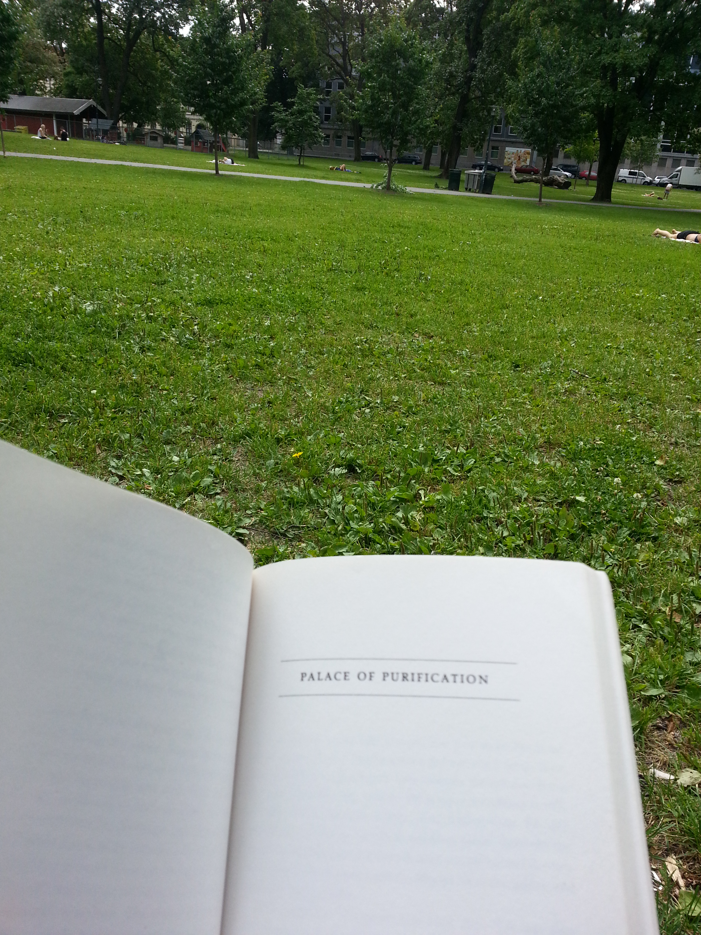
Consider this a sequel. Or, maybe a prequel. Whatever the case, if Wishing Well Acres is  the Sullivan in Tam O’Shanter-Sullivan, here’s the Tam O’Shanter part.

We begin at Agincourt Mall. The shopping centre dates back to 1966, likely making it the third enclosed mall in Scarborough after 1954’s Eglinton Square and Golden Mile (Cedarbrae Mall predates Agincourt by four years but didn’t get its ceiling until 1972). The mall’s anchors are Wal-Mart and No Frills, but I can recall a time – in 1994, specifically – when they were Woolco and Loblaws, respectively. Walmart bought Woolco that year. No Frills came in the 2000s.

Agincourt Mall outside

As much as malls like Agincourt are seen as shabby and sad (Agincourt Mall as of 2016 has a number of empty tenants), I’ve found that they are still appreciated locales. A lot of nostalgia fills their walls. The comments in this BlogTO article about Agincourt Mall by Robyn Urback  prove that. Everyone has a story, or a store they enjoyed frequently, or an odd memory about something that isn’t there anymore. Mine is the RadioShack that was there in 1990s and 00s, reminding me of lost Canadian retailers. There is a Source in the mall now, but not in the same space as its predecessor.

Agincourt Mall inside

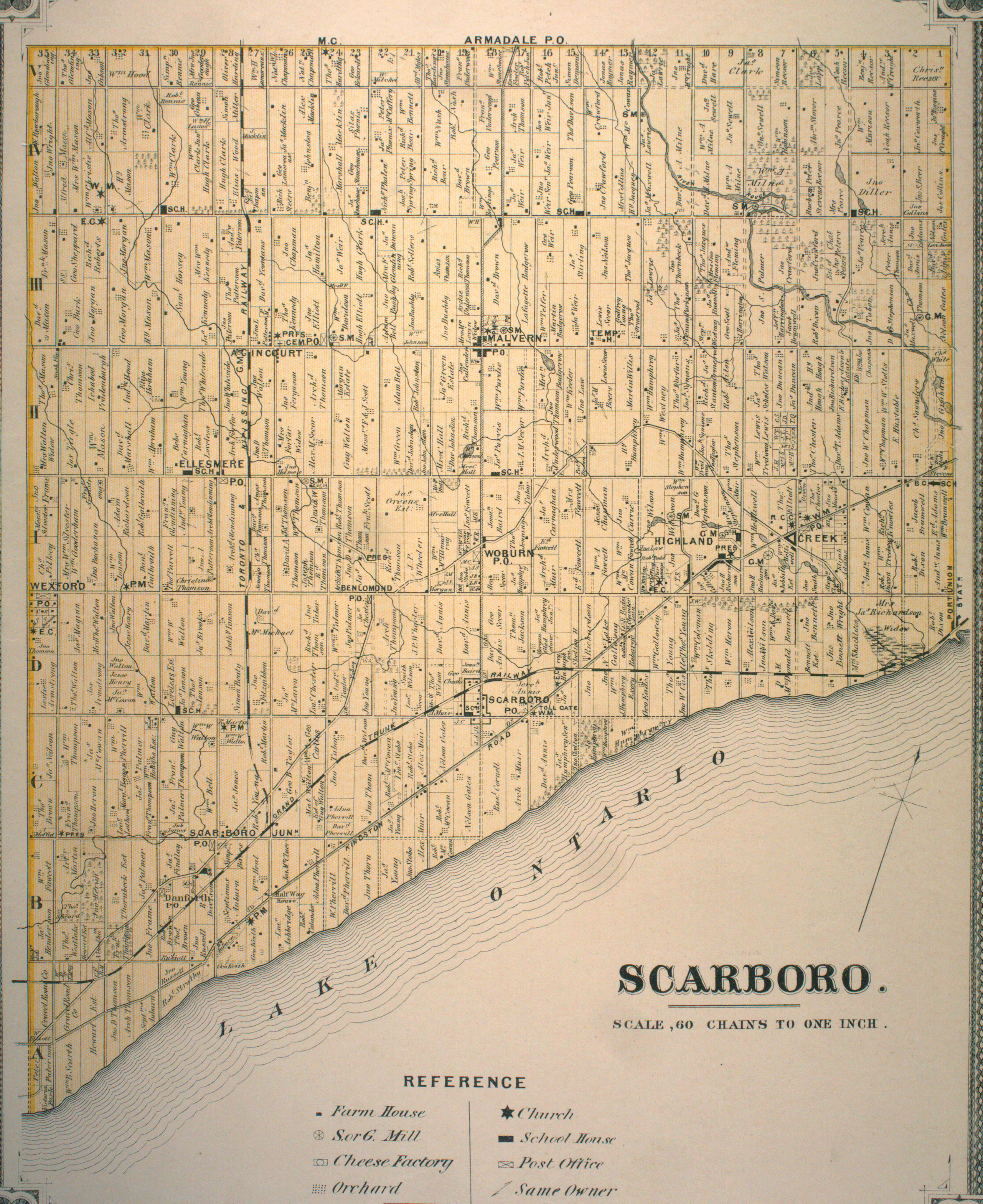
Agincourt Mall was built on the Kennedy farm, with the farmhouse once located just north of the mall and south of the West Highland Creek. A walk down the street named for the family leads to a trail that lines the creek.

West Highland Creek bridge
The path is sandwiched between an apartment and townhouse complex on one side and the creek and Tam O’Shanter Golf Club on the other. A look down at the shallow waterway produces a shiny sheet of ice over the surface and the occasional group of ducks in the non-frozen bits. But there’s also something that doesn’t quite belong.

West Highland Creek
Several pillars jut out on either side of the creek – two on one side and two opposite them. I count three sets of these abutments along the way. Their meaning isn’t hard to figure out: 3 sets of abutments, 3 phantom bridges. There is one question, though: what’s the story?

West Highland Creek bridge abutments

The answer: In the 1930s to the 1970s, this was the site of the Tam O’Shanter Golf and Country Club, the precursor to Tam O’Shanter Golf Course.

In addition to golf, the Tam O’Shanter Country Club complex had swimming, ice hockey, and curling. In 1971, the club erupted in flames, destroying some of the complex. In researching the fire, I’ve read many stories about people seeing the flames from afar. Like Agincourt Mall, the country club meant something to many people.

In 1973, the Province of Ontario, Metro Toronto, and Scarborough jointly acquired Tam O’Shanter and converted it into a municipal golf course. In the coming years, the complex would be gradually demolished and a new clubhouse would be built around 1980. Today, a couple of apartment towers on Bonis Avenue stand in the club’s former location.

West Highland Creek Bend 1967
Tam O’Shanter & West Highland Creek, 1967, Source: City of Toronto Archives.

Back to the abandoned abutments, the creek was located just behind the clubhouse and its bridges led to and from the golf course. Shortly after the course’s acquisition, the bridges were removed, presumably because the course layout would be reorganized.

West Highland Creek ducks

But the creek hasn’t always run the same course.

West Highland Creek Bend 1956
Tam O’Shanter & West Highland Creek, 1956, Source: City of Toronto Archives.

The West Highland at one time swung north up into the golf course before dropping back down and resuming in a northwest direction. Around 1967, the creek was straightened and bridges were installed. The orphan bend remained as a sort of oxbox for some time, but since has been mostly filled in. One can still see the imprint of the bend today, though, notably through the pond and the ‘etched’ curved outline north of it.

West Highland Creek Bend 2015
Tam O’Shanter & West Highland Creek, 2015. Source: Toronto Historic Maps.

Tam Shanter West Highland bend pond

There is one remaining bridge, however – a wider, sturdier construction. There is a gate in the fence on the other side, so one can guess that at least it might have been a vehicular corridor. As of 2015, though, both ends have been barricaded to prevent any sort of use.

West Highland Creek big bridge

As the West Highland continues into the golf course and beyond, the trail comes to Ron Watson Park, renamed from Tam O’Shanter Park in 2005 in recognition of the long-time Scarborough resident, trustee, and councillor. Watson was honoured with a star on Scarborough’s Walk of Fame in 2011. The park forms the field of Tam O’Shanter School, featuring a nice playground…and a stone turret.

Ron Watson Park

This viney tower became an instant curiosity to me. It looked old and misplaced. No doors (although, perhaps a sealed opening), a couple of ‘windows’ near the top. What was/is it?

Ron Watson Park tower

I had to do some digging. Google presented nothing, so I consulted some aerial photos to try and date it. It’s been around since at least 1947, the first year on record for aerials in the Toronto Archives.

Ron Watson Turret 1965
Charles Watson Farm, 1965. Source: City of Toronto Archives.
Ron Watson Turret 2015
Ron Watson Park, 2015. Source: Toronto Historic Maps.

Next, looking at the 1878 Map of Scarboro Township, Ron Watson Park was once part of the Samuel Horsey farm on Concession 3 Lot 30. Whether Horsey built the mystery tower is unknown. His house had a parlour, though!

Posting my findings and curiosities on Twitter, answers came in from the Scarborough Archives.

So, Horsey sold his farm to Watson, who likely built the silo. When Watson’s farm was subdivided, the tower was never torn down with it. My guess is the task proved too difficult. It doesn’t fully answer the ‘when?’ part, but mystery solved!

Ron Watson Park silo

Leaving the park and silo, the two-in-one Stephen Leacock  Collegiate/John Buchan Senior Public School has had a place on Birchmount Road since 1970. It is built in the Brutalist (or, Heroic) style that was indicative of Toronto architecture in the 1950s to 1970s. The schools’ namesakes were a Canadian author and humourist and Scottish author and historian, respectively.

Stephen Leacock School Brutalism

And while I’m profiling, Tam O’Shanter is a Robbie Burns poem. Another Scottish connection. The Anglo-Saxon roots and references of the Tam O’Shanter community is interesting though, considering what it became. Today, it is one of the more diverse areas in the city of Toronto.

Next, a derelict structure stands across the school. I don’t know its full context, but it’s most definitely another rural leftover.

Abandoned building Birchmount Avenue

On Bonis Avenue, there’s Agincourt Library and another great turret. Although the building opened in 1991, the library itself dates back to 1918. Within that time it has moved locales a few times, including a stay in Agincourt Mall. The branh carries three copies of A History of Scaborough. Its editor is a Mr. Robert Bonis, who lends his name to the street.

Agincourt Library

Down at Birchmount and Sheppard, a strip mall has gone through a makeover in the last few years. It’s about to get a new tenant, too: Starbucks. The sight is initial shock for me, if only because it’s strange to see one in this neighbourhood. My mind shoots to the old idea that a Starbucks is tell tale sign of gentrification, but I question whether it applies here. We’ll have to see.

Starbucks Birchmount and Sheppard

Foregoing a stroll down Sheppard,  I backtrack to Bay Mills Boulevard. The curved street offers a sort of ‘backstage’ view of Tam O’Shanter, showing off the apartments, church, school, field, playground that all front Sheppard. The intersection of Bay Mills and Sheppard is the start of the Sheppard Avenue East Avenue Study zone. On one side there’s another strip mall; on the other, a car dealership. They’ll surely be part of the plans.

Bay Mills Boulevard

Warden Avenue is further down the way, but that adventure lies in the mentioned Wish Well exploration. For now, that’s a wrap on this one.

Sheppard and Bay Mills

If you have memories of Agincourt Mall, Tam O’Shanter Country Club, Stephen Leacock School, or Tam-O’Shanter-Sullivan in general, I would like to hear about it. Leave a comment below or tweet me!

Scenes From Grünerløkka, Oslo

I’m going to be venturing outside of Toronto and even Canada for this post. Two weeks ago, I had the opportunity to travel to Oslo, Norway to visit a friend. Even before I got there, I had a list of what I wanted to do and see: taking in the nature the city had to offer as well as the typical tourist-y, sightseeing, museum-y stuff.

But I also wanted to explore. More specifically, pick a neighbourhood, run around, and see what it’s all about. I do that in Toronto already, so why not bring that overseas?

My choice of where to go wasn’t completely random. One of the running themes I love to explore in Toronto is former industrial neighbourhoods and the layers of history within them. Gentrification, transformation, adaptive reuse…it’s all very compelling stuff. I wondered if there was something like that in Olso.

Enter Grünerløkka.

Grunerlokka Map

Grünerløkka is a former-manufacturing district located for the most part to the east of Akerselva (river Akers), considered the boundary between East and West Oslo. Are there parallels to Toronto? Definitely. Grünerløkka is basically Oslo’s bohemian, hip(ster) neighbourhood. It’s a cross between Leslieville and West Queen West with a little bit of Yorkville, Liberty Village, Kensington Market, and the Distillery District sprinkled in there.

To get to Grünerløkka, I take the 11 trikk from where I’m staying in Majorstuen and get off at Thorvald Meyers gate at Olaf Ryes plass (square). As I’ve written about before, place names are often important ‘ins’ into understanding the makeup and history of a locale. ‘Grünerløkka’, for instance, refers to Friedrich Grüner, an early property owner in the area. Grüners gate (street), the northern boundary of Olaf Ryes plass, also is an homage to him.  Thorvald Meyer was a businessman who bought  substantial property in Grünerløkka in 1860. Grunerlokka became part of Oslo in 1858, suggesting there was a distinct identity to the district even before it was absorbed into the city – much like the many annexed communities that would eventually become the city of Toronto.

Exiting the streetcar, I immediately browse my surroundings. Thorvald Myers is one the  main commercial throughways in the neighbourhood and is thus quite lively. Across the street, there is the plass; behind me is a building with large words above the door. I don’t know the significance, but imagine there could be a story there. Doing some research after the fact, ‘Paulus Menighetshus’ translates to St. Paul’s Parish, and according to this Digital Museum entry (have to love online museums) has been around since 1965.

1. Paulus Menighetshus

I do a quick walk through the square, passing a table of fresh strawberries on the way to the park’s centrepiece – the fountain. All the benches are full. And why not? It’s a gorgeous day to sit around. I head to Grüners gate, noting the row of restaurants with giant patios.

2. Olaf Ryes plass

3. Villa Paradiso, 1892

4. Grüners gate

One of my goals in coming to Grünerløkka was to find some of the remaining industrial architecture, and through a pretty educated guess, I figure that there might be some by the river. At the western terminus of Grüners, there’s a nearby grain silo which has been converted into residential space for students. Of the many examples of adaptive reuse I’ve come across, this is one of the most crafty and ingenuous. I wonder about the logistics of such a conversion, though.

In the other direction, there’s a path leading down to some parkland. Sunbathers rest on grassy hills, and I can see dog and their owners meandering below. Getting close to Akerselva, I note how shallow it is. I think fair to suggest that this is the end-product of vigorous industrialization. This is Oslo’s Don River – the heart of early industry in the city. Like the Don, it has taken a beating over the years, and only recently has there been real attention put toward its value. This article by the City of Oslo tells me of the rejuvenation of the Akers. After years of pollution, a beautifying initiative has sprung up to make the river and the surrounding infrastructure a gorgeous hub for new ecosystems and human activity. Further up I can see a group of people standing in the middle of the ankle-deep waters. It reminds me of parts of the Mimico Creek in Etobicoke. I pass a bridge and a man convening with some pigeons (not quite at a Home Alone II level, though).

5. Akerselva river

6. Birdman Akerselva

7. Akerselva bridge

Then, I gladly come across a complex of brick buildings, unmistakably industrial in design. The one nearest to me has what I interpret to be a historical plaque (the old years hint toward it). I think about getting a dog-walker to translate for me, but I settle for Google’s help after the fact.

9. Factories Grünerløkka

10. Akers Mek. Verksted plaque
Akers Mek. Workshop. Founded here in 1841. Delivered equipment and services to businesses along the Aker River. Moved in 1854 to the islet in the bay. Was the city’s biggest shipyard pioneer in oil industry. Closed in 1982

I pass another bridge – this one with charming love locks (not quite Paris worthy, though). Up the Akers is a waterfall, one of a few along the river’s course. I head back to the buildings and ascend the stairs. At the top, I find out their adapted purpose (a fine arts school campus) and then a little further down along the cobblestone path a clue on their historic use. Christiana Seildugsfabrik. Christiana was Oslo’s name between 1624 and 1924. Fabrik might refer to clothes. After some research, I’m partially right. Seildugsfabrik was a hefty operation which made textiles for ships. Our friend Thorvald Meyer even had a hand in it.

13. Lock Bridge Grünerløkka

14. Seildugsfabrik Factory Grünerløkka

12. Seildugsfabrik Factory Grünerløkka       15. Seildugsfabrik Factory Grünerløkka

16. Oslo National Academy For the Arts
Known as Khio, for short

17. Seildugsfabrik Factory Grünerløkka

19. Seildugsfabrik Grünerløkka This Is It
Is This It?
20. Seildugsfabrik Factory Grünerløkka
The collection of buildings under this former entreprise give it a Distillery District feel. Especially with the brick flooring between them.

21. Seildugsfabrik Grünerløkka

 I find my way to the road network at Seilduksgata. I arbitrarily turn north on the next street I come across (someone’s had fun with the street sign). Walking a bit, to my right I see the back of a church tower. To my left is a school, rich in great masonry and the use of arches.

23. Steenstrups (Patrick Is Gay) Gat
Erm…

24. Paulus Kirke back               25. Foss Skole

Heading up to and across Sannergata, there’s a different vibe to the district than what I experienced near Olaf Ryes plass. For one thing, the streets are for the most part barren. But the most striking characteristic is the prevailing graffiti. Grünerløkka might be a renewed working class district, but elements of its seedy past still linger on. It reminds me a bit of Toronto’s Leslieville, a neighbourhood in transition. Even with gentrification, hints of the days of yore remain. Travelling south on Toftes gate, a tattoo parlour and an animated mural.

26. Factory in the distance Sannergata
Former factory(?) in the distance at Sannergata

27. Grafitti Grünerløkka

28. Tattoo place Toftes Gate Grünerløkka

30. Toftes Gate Mural

Then I come to Birkelunden, the third park of the day. Grünerløkka is coloured with them. Birkelunden has its own tint. I enter from the side that houses the formidable looking Grünerløkka skole. My sights move across the park to get my second look at Paulus Kirke today, this time from the front. The creation and planning of public parks is a fascinating topic. It looks like Birkelunden was always intended to be a park from the start, but I wonder about the planning that goes into the surrounding environment. More specifically, I wonder if it was deliberate to pit a school and church across from each other with a park in the middle, but something about it works. There’s a religious institution, an educational institution, and then this public forum at the centre.

31. Grünerløkka skole school

32. Birkelunden fountain

33. Birkelunden Paulus Kirke

Then, I unexpectedly come across a market. This is the park’s Sunday bric-a-brac. I meander around the tables, looking for anything eye-catching and useless. I take the time to look for a wallet, but see nothing that suits me. I do come across CDs and used vinyl, though. I find  a copy of Queen’s ‘A Day at the Races’. With my takeaway for the day, I exit via the familiar Seilduksgata. I take a moment to examine what looks like an upcoming development. Even the signs and gate are littered with spray paint.

34. Birkelunden Bric-a-Brac

35. Lou Reed Bric-a-Brac     36. Birkelunden Abba

38. Seilduksgata development

39. Seilduksgata development

40. Seilduksgata development

Heading south, I come across Sofienbergparken – park #4 of the day. It’s the biggest of them all thus far. I spoke about the planning of parks earlier. Well, this one has an interesting story – turns out it was once a cemetery. Following a cholera outbreak in the city in 1853, the block that contained Sofienberg, then outside Oslo’s borders, was chosen as a resting place for the victims. Over time it seems people opined it was a bad and unhygienic idea to have a cemetery in the middle of a growing, dense neighbourhood, so it was gradually made into a park.

There’s a Toronto connection, too! St. James Park was also once a graveyard. In 1844, the overcrowded cemetery was moved to its present location on Parliament Street. But before that, Toronto suffered cholera epidemics in 1832 and again in 1834. The story is a portion of St. James Cathedral still holds the unmarked graves of cholera victims. More than that, there was idea that a cemetery in the centre of town (metres away from the financial core no less) was not the best scenario.

44. Sofienbergparken

42. Grünerløkka_map_1917
Grünerløkka, 1917. Source: Wikimedia

Oblivious to this bit of hidden history, I join the masses in reading and relaxing on the grass. I pull out some Toronto fiction, the classic In The Skin of a Lion, which I keep with me to remind me of home, and then I move on.

45. Sofienbergparken

46. Sofienbergparken

I admittedly get lost after this. I’m trying to find my way back to Olaf Ryes plass. Just when I think I’ve found it, I realise it’s not the right place. This is Schous Plass and, in addition to being park #5, has a nice old library. I have to consult a map, which shamefully tells me I’m actually not to far from where I need to go.

47. Streetscape Grünerløkka     48. Deichmanske bibliotek

A short walk up Thorvald Meyers and I find the park! Before jumping on the tram, I make the executive decision to grab some lunch. I pass by a number of establishments including a famed watering hole in the area, Grünerløkka Brygghus (Brewhouse), and Valouria Vintage (because vintage shops are a must in hipster neighbourhoods – just as Queen Street West) before settling on a sandwich from Something Hotel. It’s an investment I immediately regret for its taste and price point, but it’ll have to do. I eat while I wait for the tram that got me here. I have just as many minutes wait as the number trikk I need. When it does come, it swoops me back to Majorstuen.

50. Velouria Vintage

This marked the end of my venture on this particular day, but I would return with company to Grünerløkka two more times in the coming days. We would head to the western part of the district on the other side of the Akers. Here one finds the grand Mathallen Food Hall (which was sadly closed when we tried to go) and little alleyways that lead to riverside entreprises. Ingens Gate (which comically translates to Nobody’s Street) in particular is a fun little nook with entertaining street art.

51. Ingens Gate Street Art

On another occasion, we fuel up at the two microbreweries: the already mentioned Brygghus, and at Schouskjelleren Mikrobryggeria, which is just south of Schous plass. It’s a dimly lit basement bar (really, ‘kjelleren’ means ‘basement’). No music, no trinkets on the wall, no nothing. There is a a sweet fireplace, though! And it’s fittingly located on the grounds of the former Schous Bryggeri (brewery). Christian Schou, a brewer, is another name synonymous with the local history of Grünerløkka that lives on in the neighbourhood.

52. Schouskjelleren Mikrobryggeria

53. Schouskjelleren Mikrobryggeria

Actually, the growth of amazing drinking establishments that has (in part) made Grünerløkka the “to go and be” district in Oslo might be attributed to the growth of the craft beer industry in Norway. The beer industry as a whole has been re-animated because of microbrews. It’s interesting because there have been breweries in Oslo for a long time (look at the above 1917 map and look for anything with Bryggeri in the title – I can count 3 of them), but the industry went stagnant. With Oslo and Norway playing catchup, the bar scene in the city – something that Toronto has been doing very well at in recent years – is better than ever.

54. Schouskjelleren Mikrobryggeria

I’d say that’s a good reason to say “Skål” to Grünerløkka.

Related links

Google Maps – My Route through Grünerløkka
Oslobilder – “Grünerløkka”
Industrimuseum – “Seildugsfabrik Christiania”
SkyscraperCity Forums – Never fulfilled urban renewal/developments plans for Oslo, Norway (Includes early plans for Grünerløkka)