“The Ward: Representations and Realities, 1890-1950” at Campbell House Museum

I was first introduced to The Ward several years ago through a compelling archival photograph. It was of an impoverished child standing in the debris-filled lane of what looked like a ‘slum’. In the background were the unmistakable Romanesque Revival towers of Old City Hall. The disparity between the two places – the majestic civic heart of the city and the desperate ‘ghetto’ literally at its doorstep – struck me at the time. And it still does. Even more striking is that photo was taken in what is now the southern end of Nathan Phillips Square.

Rear of 21 Elizabeth Street 1913
Rear of 21 Elizabeth Street, The Ward, 1913. Source: City of Toronto Archives.

The story of St. John’s Ward is very much one of lost geographies (like in the photo), lost narratives, and how and why we remember or don’t remember. The Ward’s former borders were from Yonge to University and College to Queen. Those streets still exist of course, but the built form between them largely hasn’t survived. For a long time, the stories associated with those landmarks and their Chinese, Italian, Jewish, and Black communities also went underground.

The 2015 release of The Ward: The Life And Loss of Toronto’s First Immigrant Neighbourhood was an excellent step in revealing those narratives. The book was co-edited by John Lorinc, Ellen Scheinberg, Michael McClellan, and Tatum Taylor, and features the great contributions of many talented writers. It is easily one of my favourite titles in the Toronto History genre. Today, “The Ward: Representations and Realities, 1890 – 1950” continues that work.

The Ward Toronto

Part of the Myseum of Toronto’s 2015 “Intersections” festival,  “The Ward” exhibition is housed in Campbell House Museum, the 1822 residence of Sir William Campbell, a former Chief Justice of Upper Canada. In 1972, the Georgian-style house famously moved from its original location on Adelaide Street to Queen and University.

Cambell House Museum Toronto

It’s a fitting locale given the museum’s placement near the historic area of The Ward (and indeed, above the mantle of the ballroom is an aerial photograph of the neighbourhood taken from the location of the museum.)

Cambell House Museum The Ward 2

The challenge of interpreting and showcasing The Ward’s histories is the lack of contemporary borders attached to those stories. Thus, from a museological perspective, it affects the kinds of artefacts one has access to. Photos of The Ward are abundant, so the curators –  Paul Bishop, Daniel Panneton & Marisa Strom – had no issues there. Photographer Arthur Goss, at the instruction of the health department of the day, did a remarkable job of documenting the troubling conditions of the enclave.

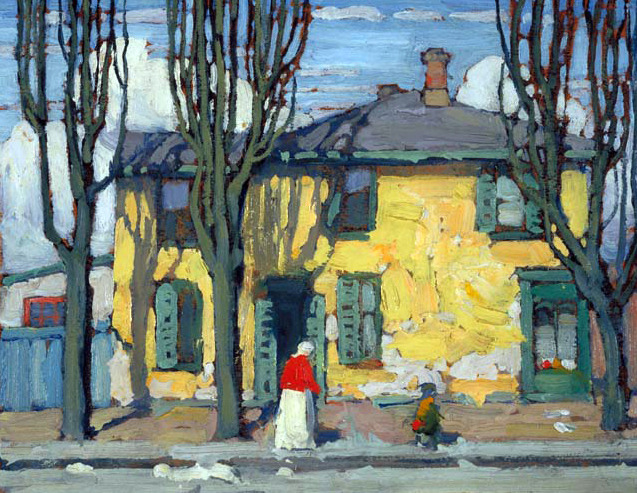
The show is organized thematically with well-displayed panels and pictures about The Ward’s politics, labour strife, Lawren Harris’ artistic take on the area, and other realities. New to me was Albert Lane was one of Toronto’s notorious laneways.

Cambell House Museum The Ward 3         Cambell House Museum The Ward 5

Cambell House Museum The Ward 4
A nice collection of loaned artefacts offer some physical connections to The Ward. They include a labour union banner, restaurant items and Eaton’s pins, and a copy of the (in)famous 1911 Hastings Report in which Toronto’s medical officer of health, Dr. Charles Hastings, observed and critiqued the overcrowded, ‘diseased’ conditions of the enclave. Slums were not a good look for Toronto, according to the high-ranking civil servant. The report came to be the official representation of The Ward.

Cambell House Museum The Ward 7

Cambell House Museum The Ward 8

The neatest addition for me, though, was the collection of oral histories from surviving members of the neighbourhood. “The Voices of The Ward” offer different realities than the Hastings Report — one that emphasizes its deep community. Stories include the ethnically diverse clientele of its shops, being an Italian during the War, and how Eaton’s would not hire Italians.

The interviews provide an audible, human element to The Ward in a way that faces in pictures or names in old news articles cannot. Archival images and words are certainly great resources, but they can put history at a distance. The recordings are a very important reminder that there are living connections to St. John’s Ward today. After all, 1950 wasn’t that long ago in the grand scheme of history. Residents of The Ward and their descendants still live in Toronto.

Cambell House Museum The Ward 9
“The Ward: Representations and Realities, 1890-1950” is on until April 23, 2016 at Campbell House Museum at 160 Queen Street West. Admission is free, although donation is always appreciated.

Cambell House Museum The Ward 1

Scenes From Open Streets TO 2015 – Yonge Street

On Sunday August 16, 2015, Open Streets TO ran the first of its car-free street initiatives this year which aim to promote healthy-living and vibrant cities and reimagine public space.

Yonge Street Open Streets
Beyond supporting the awesome event and its cause, I wanted to take advantage of the time and open streets to stroke my historical and urban curiosities, particularly in regards to Yonge Street and the T. Eaton Co.

I’ve embarked on a project to map the history of Eaton’s transformative influence on Toronto. Much of it relates to the Yonge Street we see today. Check it out here.

The streets were open on Bloor from Spadina to Parliament and Yonge from Bloor to Queen, but I elect to walk southwards from College. The intersection’s landmark is, of course, College Park, opened as the ambitious Eaton’s College Street in 1930.

College Park (2)
It was to be the T. Eaton Co.’s headquarters, moving from its flagship store about a 1km to the south. It was also supposed to have a 36-storey tower, but the penny-pinching of the Great Depression scaled it back. Luckily its ornate Art Deco-ness as it exists today hasn’t changed since the 30s.

College Park 1930s
Source: Archives of Ontario. 1930s.

Yonge Street won’t get any emptier than this at noon.

Yonge Street
The College department store was built with many entrances, one of which leads up to the Carlu. The store closed in February 1977 along with seventh floor restaurant and event space, The Round Room and Eaton Auditorium (which opened in 1931). It was locked until 2003, when it was rebranded as the Carlu, after the space’s architect, John Carlu. In 1983, the Round Room and Eaton Auditorium were designated a National Historic Site to prevent demolition.

College Park Carlu

College Park (3)
I had to take a peek inside.

College Park
Passing the store completely, I can’t resist a look back, if only to compare with an dingy looking shot from the 1970s.

College Park 1970s
Source: City of Toronto Archives. 1970s.

College Park Yonge Street
The Downtown Yonge Street strip is next with RyersonU’s towers looming above it all.

Yonge near Gerrard Open Streets
Beyond that, the Eaton Centre, another ambitious Eaton endeavour, is continuing on its perennial makeover of its oldest part from 1977. Nordstrom’s is set to become its third anchoring tenant after the recently closed Sears and the namesake store before it.

Eaton Centre
There are many making use of the free street – walkers, runners, cyclists, skateboarders, rollerbladers – but it’s a wonder seemingly a bigger majority still are using the sidewalk. It’s intuitive behaviour in any normal circumstance, but so counter-intuitive to the whole purpose of Open Streets.

The Toronto Eaton Centre also redefined the street grid around Yonge. Where Baton Rouge is now, one would’ve been able to turn on Albert Street.

EatonsFactories1919
Source: Archives of Ontario. 1919.

Eaton Centre (2)
Beside the 1905 E.J. Lennox designed Bank of Toronto building is the Massey Tower pit. Fun fact: Heritage Toronto’s former logo is based on the bank. I didn’t know that.

Massey Tower Construction
I wonder if the people manning the table in front of Danier know they’re in front of the site of Timothy Eaton’s  first store at 190-196 Yonge Street, opened in 1883.

Eaton Centre Open Streets

Eatons1884catalogue
Source: Wikimedia Commons. Inaugural Eaton’s catalogue, 1884.

The walk ends at Queen Street with a gaze at the 1896 Robert Simpson Co. building, which housed Eaton’s historic competitor. The irony is the Chicago-style structure occupies the site of T. Eaton’s first dry goods store he opened in 1869.

Simpson Building Queen StreetFinally, turning back up to face Yonge, I ponder another historical bookend. I wonder what our 19th century brethren in the pre-automobile age might have thought about Open Streets.

Open Streets Yonge at Queen

Yonge_Street_north_of_Queen_Street_by_Micklethwaite
Source: Wikimedia Commons. 1890s. The T. Eaton Co. flag flies high above the main store.

Sam The Record Man Sign Belongs in a Yonge Street Museum

Sam the Record Man Sign
Credit: Shane S. Flickr stream

I have never stepped inside Sam the Record Man, and I shamefully admit my memories of walking by the famous neon signs at Yonge and Gould are vague at best. My experience is limited to exploring my father’s record collection which he purchased at the store in the 80s, and sifting through what would be become new favourites like Bowie’s Let’s Dance and the Saturday Night Fever soundtrack. With this said, personal memory and collective memory are separate yet connected ideas, and while my own past does not directly intersect with the life and times of Sam the Record Man, I feel part of a collective whose past indeed does – even if those memories aren’t mine.

The issue to me is not losing the store itself. Business is a tricky endeavour, and recent high-profile examples unfortunately show that even the most profitable and high profile enterprises can fold. There are many that would like to see it in existence, and I am not diminishing those sentiments. But since it is gone, we are faced with a ‘now what?’ situation.

Well, the ‘now what?’ is what do we do with the giant neon signs. The signs are the most tangible remnants of that store, along with perhaps the records purchased from the record shop that still exist in the collections of its former patrons and the auctioned memorabilia distributed in the store’s final days. The issue is commemorating, through the signs, the importance of Sam’s and its owner Sam Sniderman in the narrative of our music and cultural history.

Many assign Ryerson University – a rapidly expanding institution and the current owners of the former site of the store – as the villains in this saga. Many lament the loss of the Yonge Street Entertainment Strip (located between Queen and Gerrard Streets), of which Sam’s was a big part of, and dismiss its current incarnation as a soulless commercial and educational strip filled with an upcoming Ryerson student buildings and a mix of big and small name shopping destinations.

Sam The Record Man, Steeles Tavern, A&A
A&A, Steeles Tavern, & Sam The Record Man ca. 1971
         City of Toronto Archives           Series 1465, File 312, Item 51

For me, times change and there should be no qualms about new epochs coming into fashion. That’s fine. The fascinating thing about Toronto is its layered history. Different occupants, one after another (or sometimes at the same time), move into an area, set up their establishments, and in doing so they transform the character of their locale. This is perhaps no better manifested than in Kensington Market.

As these transformational processes take place and time, the altered urban landscapes have the power to reveal and conceal the layered history of their use. From the 1960s to about the 1990s, The Yonge Street Strip was for the most part a music and entertainment epicentre in Toronto. The sites which have contributed to this characterization have largely disappeared. Some buildings currently employ different uses (like Friars Taven at Dundas), others have been demolished completely (like the Colonial Tavern at 203 Yonge St). The loss of Sam’s and the Empress Hotel (which has quite the history itself) were the latest in this episode. The only visible reminder is Zanzibar’s, although even that has shifted identities from a music club to a purely adult entertainment establishment. Take this further and one hundred years ago the history of the Yonge Street Strip comes a bit full circle with how we might see it today. In 1912, for example, Sam’s was Curtis-Wilson Furniture Co. and Byers Albert Jefferies, Ltd., furries. 349 Yonge – Steeles Tavern, which Sam Sniderman eventually took over – was Hele’s Ceramic Art. Co. A&A at 351 Yonge was owned by Walker Frank, a man in the clothing business. In other words, this was a retail strip in its own right.

SamsDirectory1912

Today, the site of Sam is occupied and owned by Ryerson Univeraity – a booming educational institution that has seen tremendous growth since its days as a polytechnic. One has to guess that growing levels of enrollment within existing programs and the addition of new programs has necessitated its spatial growth, so as much as we might curse the ‘takeover’, perhaps we cannot fault that from occurring.

So the question remains: where do the signs end up? They are doing no favours to anyone stored in a North Toronto trailer.

The original plan was to have them mounted within the new student centre as a part of the deal struck by the Ryerson-Sniderman deal. Much fuss has been made about a broken promise on Ryerson’s president who has said that signs would clash with the modernist style of the new building.

Recently renewed talk has called for the need of a Toronto Museum. Whether we have the site and leadership to finally execute such a needed endeavour is another story. It does remain, however, that the neon signs would be ideal artefacts within such as a space. This would help in telling the musical and cultural narrative of Toronto as well as the role of Yonge Street.

Ideally, I’d like to see them back a part of the street, which also was the proposal put forward by Councillor Wong-Tam and supported by Mayor Rob Ford. The signs are best preserved and presented in context. Sam’s was an important part of a certain era of Yonge Street, and its signs should be displayed at its historic intersection. In doing so, in the end, we are putting them in a museum – albeit one that lacks physical plant and invites the components of the urban landscape to be the artifacts themselves.

Urban landscapes as museums are not a new idea. The Textile Museum’s mobile app TXTile City turns the city of Toronto into a museum whose artifacts are the sites – the built forms and their related oral histories — themselves. A recent TedTalk promoted the idea of the built and natural forms of Indianapolis – the city itself – as a science museum. A Toronto Star column has outlined the importance of Yonge Street. This is our Saint Laurent Boulevard of Montreal fame. Like The Main, Yonge Street, our spine, bisects the city, connects neighbourhoods, serves as cultural and commercial epicentre, and has a very layered past. In other words, it is important in the historical, geographic, cultural, natural, economic, sociological development of Toronto.

Fortunately, we already have something like what I’ve been proposing already underway. Youryongestreet is an online crowdsourcing initiative, launched by the Toronto Public Library, aimed at celebrating the history of Yonge Street. The potential age range of participants (and backgrounds in general) allows for exactly what I’ve been talking about: the presentation of the diversity of Yonge Street. The exhibits collection features a range of images, videos, audio accounts, and written tales about Yonge Street.

Youryongestreet and the urban landscape museum I have presented are two parts in an grander museum that showcases Yonge Street’s past. No doubt the Sam the Record sign should be an artefect in that museum, too.